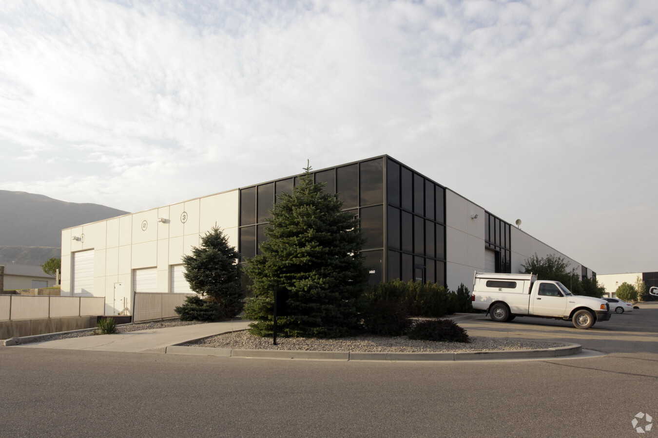
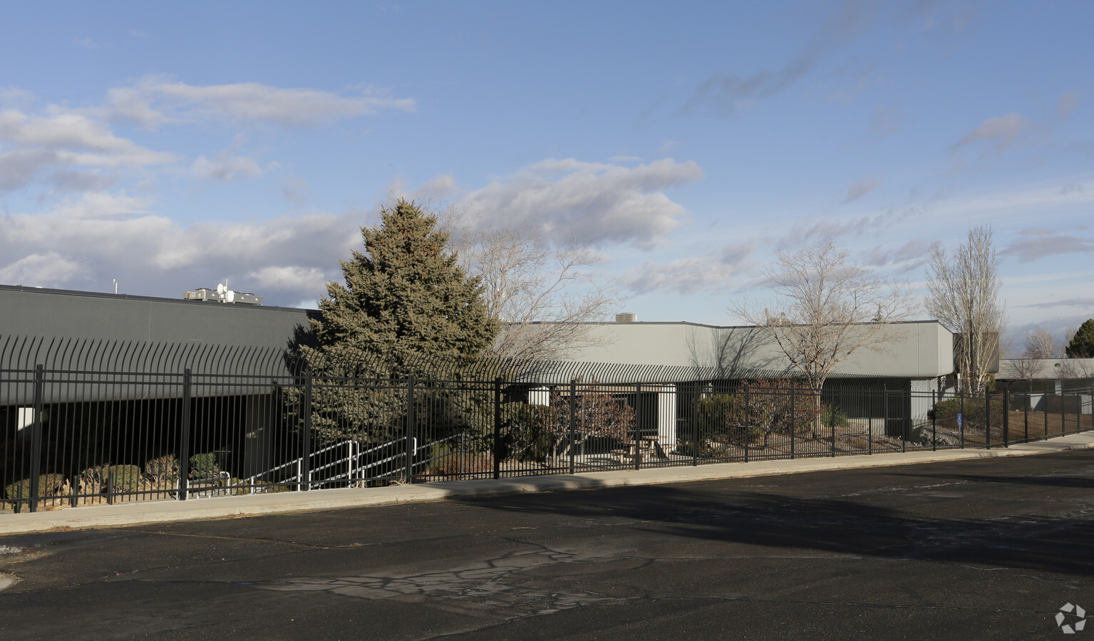
Property Record
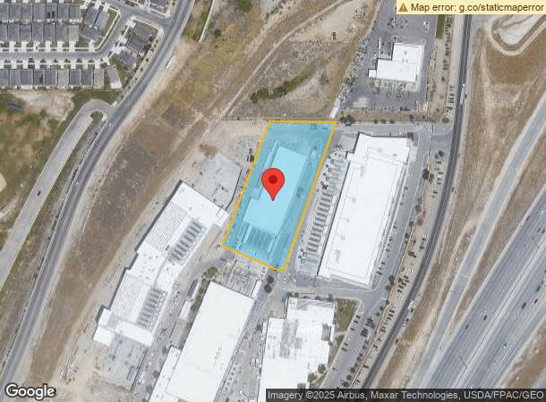
14860 S Pony Express Rd, Bluffdale, UT 84065

NEARBY LISTINGS FOR SALE OR LEASE
Property Detail
14860 S Pony Express Rd
33-12-300-041-0000
BEG S 89^3955 E 1263.33 FT ALG SEC LINE & N 22^1321 E 677.31 FT FR SW COR SEC 12, T 4S, R 1W, SLM; N 67^4639 W 188.85 FT; N 20^5325 E 445.37 FT; S 89^3955 E 219.31 FT;S 19^2230 W 526.14 FT; N 70^3730 W 30.47 FT TO BEG. 2.38AC M OR L. 8071-1557 8321-1
Commercialnec
Salt Lake
X
Utah
49035C0600G
2.38 AC
2023
Riverton
2023
Salt Lake City
113017
Salt Lake City, UT
29,640 SF
DEMOGRAPHICS near 14860 S Pony Express Rd
1 Mile
3 Mile
5 Mile
2024 Total Population
7,110
56,033
164,766
2029 Population
7,456
58,981
175,363
Pop Growth 2024-2029
+ 4.87%
+ 5.26%
+ 6.43%
Average Age
29
33
33
2024 Total Households
2,236
16,189
48,199
HH Growth 2024-2029
+ 4.87%
+ 5.44%
+ 6.33%
Median Household Inc
$103,216
$111,264
$114,795
Avg Household Size
3.20
3.30
3.30
2024 Avg HH Vehicles
2.00
2.00
2.00
Median Home Value
$601,305
$662,147
$623,433
Median Year Built
2010
2009
2006
Nearby Places
- Restaurants
- Banks
- Shops
- Fitness
- Groceries
PUBLIC TRANSPORTATION
COMMUTER RAIL
Draper Station (FrontRunner - Utah Transit Authority (UTA))
DRIVE
WALK
Distance
Draper Station (FrontRunner - Utah Transit Authority (UTA))
8 min
3.7 mi
Lehi Station (FrontRunner - Utah Transit Authority (UTA))
DRIVE
WALK
Distance
Lehi Station (FrontRunner - Utah Transit Authority (UTA))
10 min
5.7 mi
AIRPORT
Salt Lake City International
DRIVE
WALK
Distance
Salt Lake City International
31 min
25.4 mi
Provo Municipal
DRIVE
WALK
Distance
Provo Municipal
36 min
26.4 mi
Freight Ports
Port of Stockton
DRIVE
WALK
Distance
Port of Stockton
731 min
715.8 mi
Nearby Properties
Address
Land Use
TOTAL SIZE
Lot Size
Zoning
Address
Land Use
TOTAL SIZE
Lot Size
Zoning
49,058 SF
624.79 AC
M-1
Address
Land Use
TOTAL SIZE
Lot Size
Zoning
249.04 AC
M-U
Address
Land Use
TOTAL SIZE
Lot Size
Zoning
40,495 SF
33.28 AC
RM-1
Address
Land Use
TOTAL SIZE
Lot Size
Zoning
213,757 SF
19.51 AC
1122
Address
Land Use
TOTAL SIZE
Lot Size
Zoning
766,331 SF
87.50 AC
M-1
Address
Land Use
TOTAL SIZE
Lot Size
Zoning
210,421 SF
6.87 AC
CR
Address
Land Use
TOTAL SIZE
Lot Size
Zoning
423,208 SF
8.07 AC
CSD-H
Address
Land Use
TOTAL SIZE
Lot Size
Zoning
359,628 SF
4.53 AC
TSD
Address
Land Use
TOTAL SIZE
Lot Size
Zoning
416,562 SF
7.48 AC
CSDDPM
Address
Land Use
TOTAL SIZE
Lot Size
Zoning
81,925 SF
10.13 AC
MU
Address
Land Use
TOTAL SIZE
Lot Size
Zoning
115,637 SF
36.38 AC
TSD
Address
Land Use
TOTAL SIZE
Lot Size
Zoning
374,367 SF
6.87 AC
CSDDPM
Address
Land Use
TOTAL SIZE
Lot Size
Zoning
391,078 SF
5.78 AC
IC
Address
Land Use
TOTAL SIZE
Lot Size
Zoning
65,664 SF
16.47 AC
RM2
Address
Land Use
TOTAL SIZE
Lot Size
Zoning
132,024 SF
16.13 AC
RM 1
Address
Land Use
TOTAL SIZE
Lot Size
Zoning
70,379 SF
2.81 AC
RM2
Address
Land Use
TOTAL SIZE
Lot Size
Zoning
76,420 SF
14.22 AC
RM-2
Address
Land Use
TOTAL SIZE
Lot Size
Zoning
204,760 SF
17.91 AC
CSDDRC
Address
Land Use
TOTAL SIZE
Lot Size
Zoning
186,398 SF
8.57 AC
CSD
Address
Land Use
TOTAL SIZE
Lot Size
Zoning
255,928 SF
14.90 AC
M-1
Address
Land Use
TOTAL SIZE
Lot Size
Zoning
408,208 SF
5.20 AC
DC
Address
Land Use
TOTAL SIZE
Lot Size
Zoning
25,484 SF
8.08 AC
CSDDPM
Address
Land Use
TOTAL SIZE
Lot Size
Zoning
24,320 SF
7.83 AC
CBP
Address
Land Use
TOTAL SIZE
Lot Size
Zoning
179,860 SF
11.50 AC
M-1
Address
Land Use
TOTAL SIZE
Lot Size
Zoning
207,041 SF
0.85 AC
DC
Address
Land Use
TOTAL SIZE
Lot Size
Zoning
38,303 SF
2.68 AC
TSD
Address
Land Use
TOTAL SIZE
Lot Size
Zoning
166,494 SF
8.45 AC
CO
Address
Land Use
TOTAL SIZE
Lot Size
Zoning
33,674 SF
5.59 AC
TSD
Address
Land Use
TOTAL SIZE
Lot Size
Zoning
77,905 SF
7.15 AC
CO2
Address
Land Use
TOTAL SIZE
Lot Size
Zoning
353,500 SF
29.38 AC
2000
The World's #1 Commercial Real Estate Marketplace
Connect with us
© 2025 CoStar Group
The information above has been obtained from sources believed reliable. While we do not doubt its accuracy we have not verified it and make no guarantee, warranty or representation about it. It is your responsibility to independently confirm its accuracy and completeness. Any projections, opinions, assumptions, or estimates used are for example only and do not represent the current or future performance of the property. The value of this transaction to you depends on tax and other factors which should be evaluated by your tax, financial, and legal advisors. You and your advisors should conduct a careful, independent investigation of the property to determine to your satisfaction the suitability of the property for your needs.