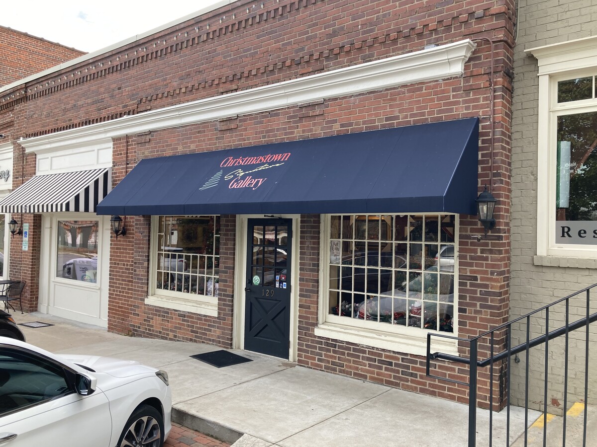
Property Record
149 Main St, Mc Adenville, NC 28101
NEARBY LISTINGS FOR SALE OR LEASE
-
-
-
-
-
-
No Photo
-
View all Mc Adenville listings for lease on LoopNet.com
Property Detail
149 Main St
Charlotte-Concord-Gastonia, NC-SC
BUSINESS DISTRICT & DWGS 09 004 001 00 000
305301
Gaston
Commercialofficeresidentialmixeduse
North Carolina
2024
39.77 AC
2024
Gaston County
032201
Charlotte
1,827 SF
DEMOGRAPHICS near 149 Main St
1 Mile
3 Mile
5 Mile
2024 Total Population
3,588
37,554
94,678
2029 Population
3,893
40,332
101,365
Pop Growth 2024-2029
+ 8.50%
+ 7.40%
+ 7.06%
Average Age
40
40
40
2024 Total Households
1,660
15,529
38,563
HH Growth 2024-2029
+ 9.10%
+ 7.65%
+ 7.27%
Median Household Inc
$59,963
$60,872
$63,494
Avg Household Size
2.20
2.30
2.40
2024 Avg HH Vehicles
2.00
2.00
2.00
Median Home Value
$205,184
$231,159
$238,367
Median Year Built
1990
1983
1985
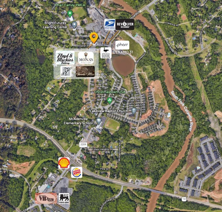
Nearby Places
- Restaurants
- Banks
- Shops
- Fitness
- Groceries
PUBLIC TRANSPORTATION
COMMUTER RAIL
Gastonia Amtrak Station (Crescent - Amtrak)
DRIVE
WALK
Distance
Gastonia Amtrak Station (Crescent - Amtrak)
10 min
6.0 mi
AIRPORT
Charlotte/Douglas International
DRIVE
WALK
Distance
Charlotte/Douglas International
23 min
11.1 mi
Concord-Padgett Regional
DRIVE
WALK
Distance
Concord-Padgett Regional
37 min
27.4 mi
Freight Ports
North Charleston Terminal
DRIVE
WALK
Distance
North Charleston Terminal
237 min
206.5 mi
SALE & LEASE HISTORY
LISTING DATE
SALE/LEASE

Nov 03, 2022
For Lease
Nearby Properties
Address
Land Use
TOTAL SIZE
Lot Size
Zoning
Address
Land Use
TOTAL SIZE
Lot Size
Zoning
104.72 AC
Address
Land Use
TOTAL SIZE
Lot Size
Zoning
1,886 SF
39.26 AC
Address
Land Use
TOTAL SIZE
Lot Size
Zoning
25,137 SF
34.81 AC
Address
Land Use
TOTAL SIZE
Lot Size
Zoning
41,508 SF
29.70 AC
Address
Land Use
TOTAL SIZE
Lot Size
Zoning
142,022 SF
6.01 AC
INDS1
Address
Land Use
TOTAL SIZE
Lot Size
Zoning
47,625 SF
39.10 AC
SHOP2
Address
Land Use
TOTAL SIZE
Lot Size
Zoning
30,906 SF
14.19 AC
Address
Land Use
TOTAL SIZE
Lot Size
Zoning
43.38 AC
Address
Land Use
TOTAL SIZE
Lot Size
Zoning
23,899 SF
14.57 AC
HC
Address
Land Use
TOTAL SIZE
Lot Size
Zoning
98.12 AC
Address
Land Use
TOTAL SIZE
Lot Size
Zoning
28.04 AC
Address
Land Use
TOTAL SIZE
Lot Size
Zoning
30,000 SF
18.87 AC
SHOP2
Address
Land Use
TOTAL SIZE
Lot Size
Zoning
5,200 SF
22.98 AC
OFF01
Address
Land Use
TOTAL SIZE
Lot Size
Zoning
4,552 SF
9.22 AC
R1
Address
Land Use
TOTAL SIZE
Lot Size
Zoning
20.41 AC
Address
Land Use
TOTAL SIZE
Lot Size
Zoning
358,450 SF
23.50 AC
STOR2
Address
Land Use
TOTAL SIZE
Lot Size
Zoning
190,498 SF
20.10 AC
RET05
Address
Land Use
TOTAL SIZE
Lot Size
Zoning
13,800 SF
58.55 AC
PUB01
Address
Land Use
TOTAL SIZE
Lot Size
Zoning
46,998 SF
30.74 AC
HCAR1
Address
Land Use
TOTAL SIZE
Lot Size
Zoning
198,897 SF
10.89 AC
RET05
Address
Land Use
TOTAL SIZE
Lot Size
Zoning
44,718 SF
26.53 AC
OFF10
Address
Land Use
TOTAL SIZE
Lot Size
Zoning
140,740 SF
17.45 AC
RET05
Address
Land Use
TOTAL SIZE
Lot Size
Zoning
1,596 SF
5.73 AC
OFF01
Address
Land Use
TOTAL SIZE
Lot Size
Zoning
65,513 SF
3.07 AC
Address
Land Use
TOTAL SIZE
Lot Size
Zoning
139,155 SF
15.13 AC
RET05
Address
Land Use
TOTAL SIZE
Lot Size
Zoning
99.28 AC
BCD
Address
Land Use
TOTAL SIZE
Lot Size
Zoning
119,008 SF
11.29 AC
RET05
Address
Land Use
TOTAL SIZE
Lot Size
Zoning
118,896 SF
3.98 AC
Address
Land Use
TOTAL SIZE
Lot Size
Zoning
21.61 AC
Address
Land Use
TOTAL SIZE
Lot Size
Zoning
102,915 SF
39.29 AC
PUB01
The World's #1 Commercial Real Estate Marketplace
Connect with us
© 2025 CoStar Group
The information above has been obtained from sources believed reliable. While we do not doubt its accuracy we have not verified it and make no guarantee, warranty or representation about it. It is your responsibility to independently confirm its accuracy and completeness. Any projections, opinions, assumptions, or estimates used are for example only and do not represent the current or future performance of the property. The value of this transaction to you depends on tax and other factors which should be evaluated by your tax, financial, and legal advisors. You and your advisors should conduct a careful, independent investigation of the property to determine to your satisfaction the suitability of the property for your needs.