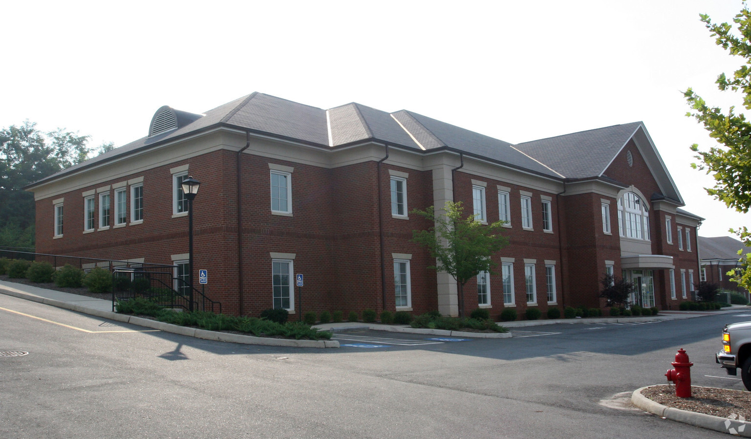
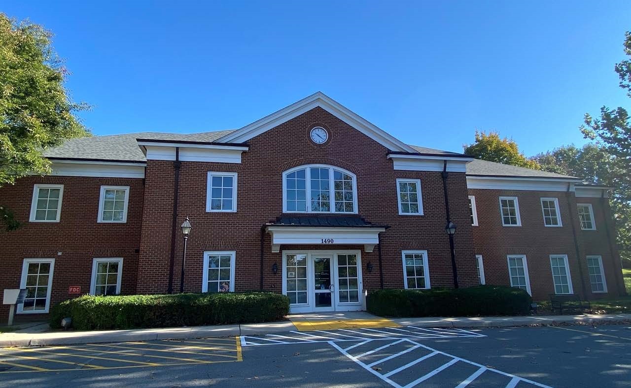
Property Record
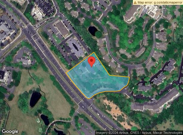
1490 Pantops Mountain Pl, Charlottesville, VA 22911
NEARBY LISTINGS FOR SALE OR LEASE
Property Detail
1490 Pantops Mountain Pl
07800-00-00-055A0
Plat Showing Subdivision Of Tmp 78-55A M
Medicalbuilding
ACREAGE 3
X
Albemarle
51003C0289D
Virginia
0
2.97 AC
2024
Charlottesville
010502
Other Market Areas
7,662 SF
Charlottesville, VA
DEMOGRAPHICS near 1490 Pantops Mountain Pl
1 Mile
3 Mile
5 Mile
2024 Total Population
5,138
28,956
97,195
2029 Population
5,351
28,819
98,150
Pop Growth 2024-2029
+ 4.15%
(0.47%)
+ 0.98%
Average Age
44
41
37
2024 Total Households
2,496
13,623
39,657
HH Growth 2024-2029
+ 4.53%
(0.30%)
+ 1.12%
Median Household Inc
$102,426
$86,097
$73,915
Avg Household Size
2.00
2.10
2.20
2024 Avg HH Vehicles
2.00
2.00
2.00
Median Home Value
$450,306
$420,375
$403,459
Median Year Built
2001
1985
1984
Nearby Places
- Restaurants
- Banks
- Shops
- Fitness
- Groceries
PUBLIC TRANSPORTATION
COMMUTER RAIL
Charlottesville (Cardinal - Amtrak, Crescent - Amtrak, Northeast Regional - Amtrak)
Drive
Walk
Distance
Charlottesville (Cardinal - Amtrak, Crescent - Amtrak, Northeast Regional - Amtrak)
9 min
3.5 mi
AIRPORT
Charlottesville-Albemarle
Drive
Walk
Distance
Charlottesville-Albemarle
23 min
11.2 mi
Freight Ports
Virginia Port Authority - Richmond
Drive
Walk
Distance
Virginia Port Authority - Richmond
89 min
74.4 mi
SALE & LEASE HISTORY
LISTING DATE
SALE/LEASE

Nov 17, 2022
For Lease
Nearby Properties
Address
Land Use
TOTAL SIZE
Lot Size
Zoning
Address
Land Use
TOTAL SIZE
Lot Size
Zoning
429500
38.49 AC
PDMC
Address
Land Use
TOTAL SIZE
Lot Size
Zoning
160621
55.78 AC
PLANNED RE
Address
Land Use
TOTAL SIZE
Lot Size
Zoning
3465
145.17 AC
CV
Address
Land Use
TOTAL SIZE
Lot Size
Zoning
43616
2.24 AC
CX-8
Address
Land Use
TOTAL SIZE
Lot Size
Zoning
30896
0.97 AC
DX
Address
Land Use
TOTAL SIZE
Lot Size
Zoning
240936
1.26 AC
NX-10
Address
Land Use
TOTAL SIZE
Lot Size
Zoning
336000
20.20 AC
R15 RESIDE
Address
Land Use
TOTAL SIZE
Lot Size
Zoning
20.42 AC
Address
Land Use
TOTAL SIZE
Lot Size
Zoning
14000
6.45 AC
CX-5
Address
Land Use
TOTAL SIZE
Lot Size
Zoning
222253
0.73 AC
NX-10
Address
Land Use
TOTAL SIZE
Lot Size
Zoning
41184
16.27 AC
R10 RESIDE
Address
Land Use
TOTAL SIZE
Lot Size
Zoning
1.38 AC
CX-3
Address
Land Use
TOTAL SIZE
Lot Size
Zoning
82308
97.43 AC
R1 RESIDEN
Address
Land Use
TOTAL SIZE
Lot Size
Zoning
249740
42.40 AC
CM
Address
Land Use
TOTAL SIZE
Lot Size
Zoning
328429
35 AC
COMMERCIAL
Address
Land Use
TOTAL SIZE
Lot Size
Zoning
173868
4.38 AC
DX
Address
Land Use
TOTAL SIZE
Lot Size
Zoning
42336
0.90 AC
CV
Address
Land Use
TOTAL SIZE
Lot Size
Zoning
25650
11.16 AC
R15 RESIDE
Address
Land Use
TOTAL SIZE
Lot Size
Zoning
12495
4.50 AC
NX-10
Address
Land Use
TOTAL SIZE
Lot Size
Zoning
100
51.71 AC
LIGHT INDU
Address
Land Use
TOTAL SIZE
Lot Size
Zoning
73068
13.38 AC
PLANNED DE
Address
Land Use
TOTAL SIZE
Lot Size
Zoning
117270
14.62 AC
CV
Address
Land Use
TOTAL SIZE
Lot Size
Zoning
3803
266.70 AC
CV
Address
Land Use
TOTAL SIZE
Lot Size
Zoning
1195052
1.05 AC
DX
Address
Land Use
TOTAL SIZE
Lot Size
Zoning
75760
1.15 AC
CV
Address
Land Use
TOTAL SIZE
Lot Size
Zoning
1200
14.92 AC
LIGHT INDU
Address
Land Use
TOTAL SIZE
Lot Size
Zoning
69624
17.66 AC
CM
Address
Land Use
TOTAL SIZE
Lot Size
Zoning
85000
3.49 AC
NX-10
Address
Land Use
TOTAL SIZE
Lot Size
Zoning
81569
0.63 AC
DX
Address
Land Use
TOTAL SIZE
Lot Size
Zoning
4.82 AC
UNASSIGNED
Start a new search to find other properties for sale or lease
Connect with us
© 2024 CoStar Group
The information above has been obtained from sources believed reliable. While we do not doubt its accuracy we have not verified it and make no guarantee, warranty or representation about it. It is your responsibility to independently confirm its accuracy and completeness. Any projections, opinions, assumptions, or estimates used are for example only and do not represent the current or future performance of the property. The value of this transaction to you depends on tax and other factors which should be evaluated by your tax, financial, and legal advisors. You and your advisors should conduct a careful, independent investigation of the property to determine to your satisfaction the suitability of the property for your needs.