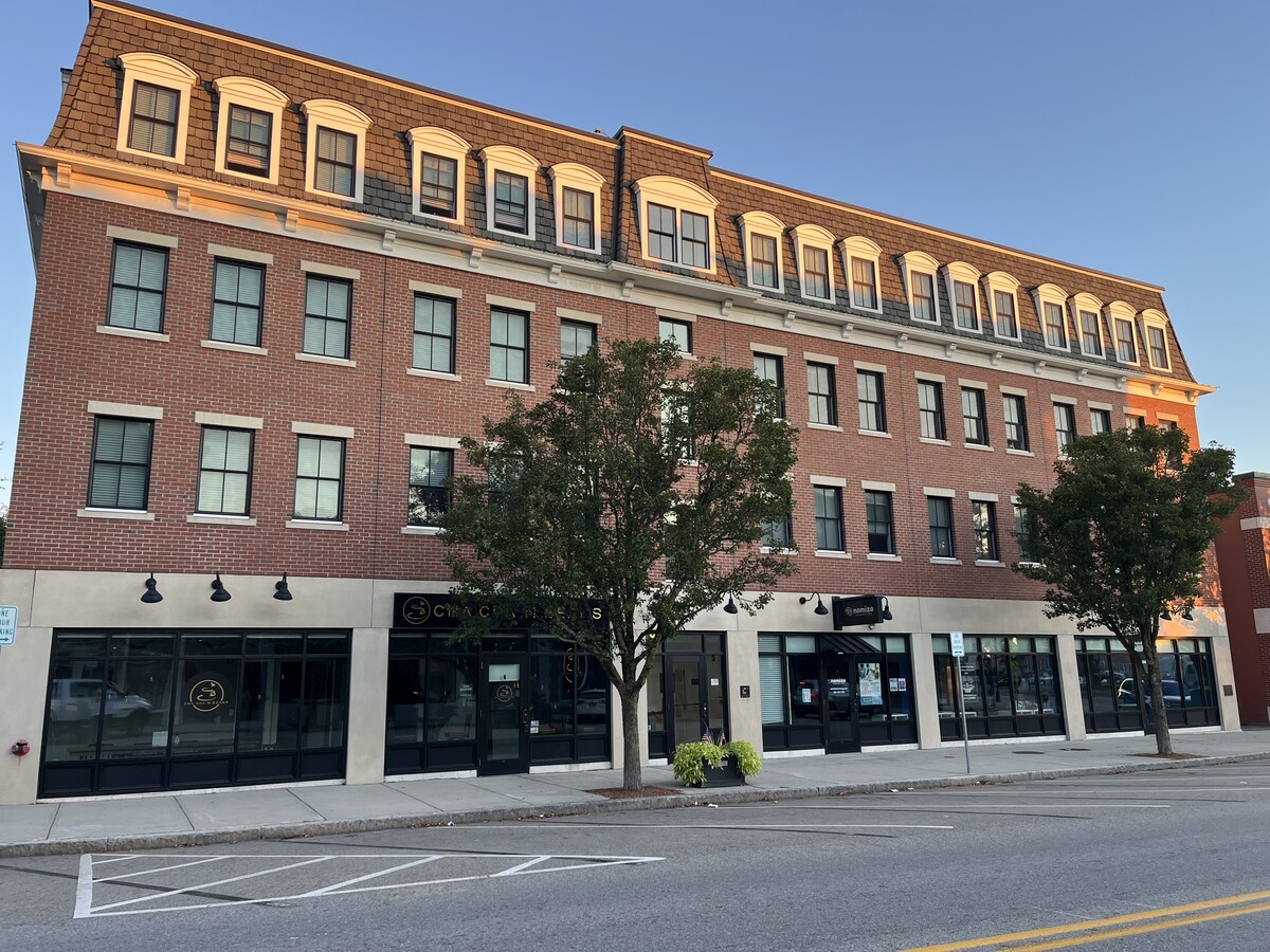
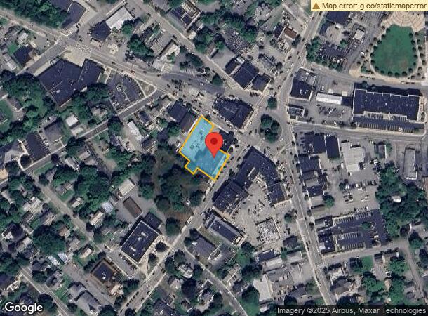
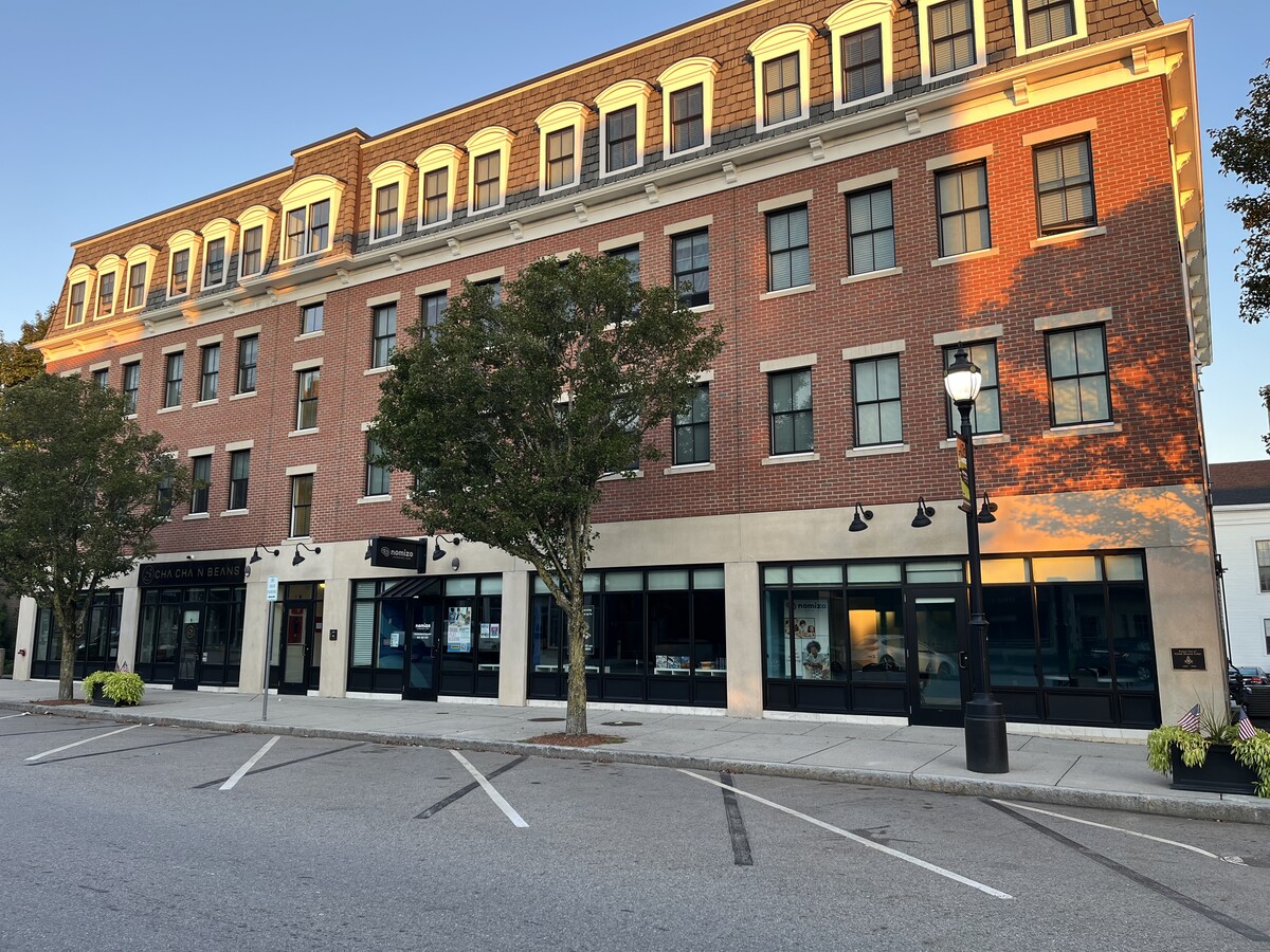
Property Record
25 W Main St, Westborough, MA 01581
NEARBY LISTINGS FOR SALE OR LEASE
Property Detail
25 W Main St
Commercialofficeresidentialmixeduse
Worcester
X
Massachusetts
25027C0663F
0.53 AC
2024
The Boroughs
2024
Boston
742300
Worcester, MA-CT
29,424 SF
WBOR-000020-000312
DEMOGRAPHICS near 25 W Main St
1 Mile
3 Mile
5 Mile
2024 Total Population
5,625
26,633
67,163
2029 Population
5,609
26,631
67,221
Pop Growth 2024-2029
(0.28%)
(0.01%)
+ 0.09%
Average Age
43
40
40
2024 Total Households
2,368
9,660
24,429
HH Growth 2024-2029
(0.21%)
(0.01%)
+ 0.12%
Median Household Inc
$102,090
$132,411
$138,263
Avg Household Size
2.20
2.70
2.70
2024 Avg HH Vehicles
2.00
2.00
2.00
Median Home Value
$455,109
$563,050
$603,038
Median Year Built
1954
1978
1983
Nearby Places
- Restaurants
- Banks
- Shops
- Fitness
- Groceries
PUBLIC TRANSPORTATION
COMMUTER RAIL
Westborough (Framingham/Worcester Line - Massachusetts Bay Transportation Authority Commuter Rail (Purple Line))
DRIVE
WALK
Distance
Westborough (Framingham/Worcester Line - Massachusetts Bay Transportation Authority Commuter Rail (Purple Line))
6 min
2.2 mi
Grafton (Framingham/Worcester Line - Massachusetts Bay Transportation Authority Commuter Rail (Purple Line))
DRIVE
WALK
Distance
Grafton (Framingham/Worcester Line - Massachusetts Bay Transportation Authority Commuter Rail (Purple Line))
9 min
4.4 mi
AIRPORT
Worcester Regional
DRIVE
WALK
Distance
Worcester Regional
29 min
15.7 mi
Freight Ports
Port of Boston
DRIVE
WALK
Distance
Port of Boston
49 min
33.4 mi
SALE & LEASE HISTORY
LISTING DATE
SALE/LEASE

Sep 06, 2024
For Lease
Nearby Properties
Address
Land Use
TOTAL SIZE
Lot Size
Zoning
Address
Land Use
TOTAL SIZE
Lot Size
Zoning
274,000 SF
32 AC
M-1
Address
Land Use
TOTAL SIZE
Lot Size
Zoning
67.29 AC
IB
Address
Land Use
TOTAL SIZE
Lot Size
Zoning
19.69 AC
BA
Address
Land Use
TOTAL SIZE
Lot Size
Zoning
237,337 SF
16.65 AC
IB
Address
Land Use
TOTAL SIZE
Lot Size
Zoning
320,540 SF
20.02 AC
BA
Address
Land Use
TOTAL SIZE
Lot Size
Zoning
677,238 SF
92.81 AC
IB
Address
Land Use
TOTAL SIZE
Lot Size
Zoning
578,873 SF
94.26 AC
IB
Address
Land Use
TOTAL SIZE
Lot Size
Zoning
205,712 SF
3.95 AC
BA
Address
Land Use
TOTAL SIZE
Lot Size
Zoning
325,390 SF
28.81 AC
I
Address
Land Use
TOTAL SIZE
Lot Size
Zoning
107,308 SF
45.40 AC
M-1
Address
Land Use
TOTAL SIZE
Lot Size
Zoning
201,818 SF
5.55 AC
BA
Address
Land Use
TOTAL SIZE
Lot Size
Zoning
205,712 SF
5.76 AC
BA
Address
Land Use
TOTAL SIZE
Lot Size
Zoning
15.20 AC
BA
Address
Land Use
TOTAL SIZE
Lot Size
Zoning
43.90 AC
M-1
Address
Land Use
TOTAL SIZE
Lot Size
Zoning
10.28 AC
R
Address
Land Use
TOTAL SIZE
Lot Size
Zoning
32.51 AC
IB
Address
Land Use
TOTAL SIZE
Lot Size
Zoning
296,330 SF
24.88 AC
IB
Address
Land Use
TOTAL SIZE
Lot Size
Zoning
108,038 SF
19.68 AC
M-1
Address
Land Use
TOTAL SIZE
Lot Size
Zoning
216,518 SF
6.64 AC
R
Address
Land Use
TOTAL SIZE
Lot Size
Zoning
184,960 SF
23.58 AC
IB
Address
Land Use
TOTAL SIZE
Lot Size
Zoning
97,171 SF
27.77 AC
M-1
Address
Land Use
TOTAL SIZE
Lot Size
Zoning
184,523 SF
34.34 AC
BA
Address
Land Use
TOTAL SIZE
Lot Size
Zoning
50.07 AC
BB
Address
Land Use
TOTAL SIZE
Lot Size
Zoning
48,048 SF
14.50 AC
M-1
Address
Land Use
TOTAL SIZE
Lot Size
Zoning
7,387 SF
109.70 AC
M-1
Address
Land Use
TOTAL SIZE
Lot Size
Zoning
170,000 SF
27.66 AC
BA
Address
Land Use
TOTAL SIZE
Lot Size
Zoning
177,201 SF
18.33 AC
HB
Address
Land Use
TOTAL SIZE
Lot Size
Zoning
112,981 SF
10.50 AC
R
Address
Land Use
TOTAL SIZE
Lot Size
Zoning
11.83 AC
MUD
Address
Land Use
TOTAL SIZE
Lot Size
Zoning
18.50 AC
BA
The World's #1 Commercial Real Estate Marketplace
Connect with us
© 2025 CoStar Group
The information above has been obtained from sources believed reliable. While we do not doubt its accuracy we have not verified it and make no guarantee, warranty or representation about it. It is your responsibility to independently confirm its accuracy and completeness. Any projections, opinions, assumptions, or estimates used are for example only and do not represent the current or future performance of the property. The value of this transaction to you depends on tax and other factors which should be evaluated by your tax, financial, and legal advisors. You and your advisors should conduct a careful, independent investigation of the property to determine to your satisfaction the suitability of the property for your needs.