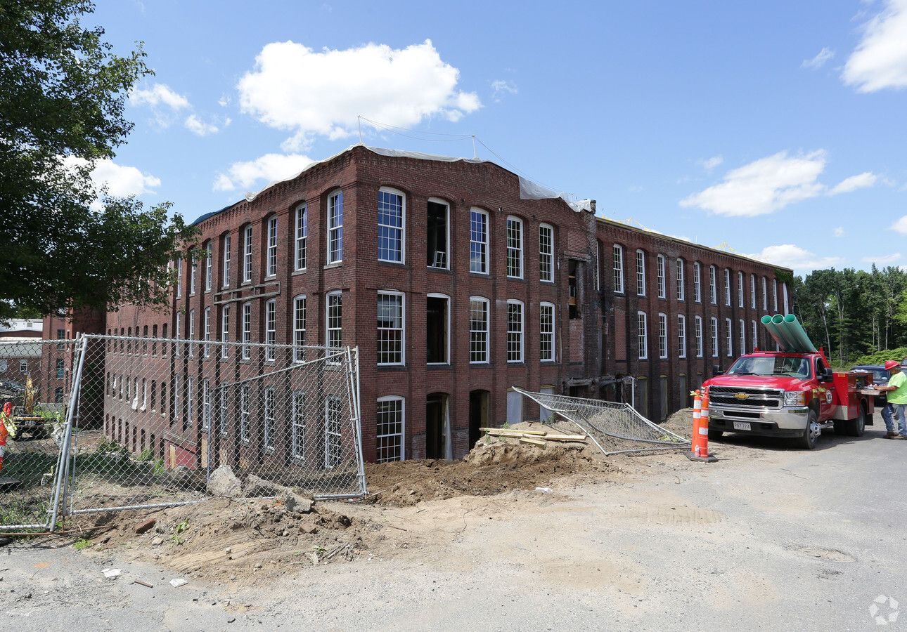
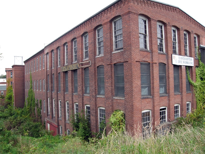
Property Record
15 Cottage St, Easthampton, MA 01027
NEARBY LISTINGS FOR SALE OR LEASE
Property Detail
15 Cottage St
Hartford
Hampshire
Springfield, MA
Massachusetts
EHAM-000054-000001
4.34 AC
Apartment
Hampshire County
101,406 SF
DEMOGRAPHICS near 15 Cottage St
1 Mile
3 Mile
5 Mile
2024 Total Population
7,237
17,993
67,704
2029 Population
5,628
14,204
57,724
Pop Growth 2024-2029
(22.23%)
(21.06%)
(14.74%)
Average Age
43
45
43
2024 Total Households
3,602
8,144
29,173
HH Growth 2024-2029
(22.18%)
(21.45%)
(15.99%)
Median Household Inc
$61,141
$70,739
$68,934
Avg Household Size
1.90
2.20
2.20
2024 Avg HH Vehicles
1.00
2.00
2.00
Median Home Value
$302,621
$332,737
$334,809
Median Year Built
1950
1964
1956
Nearby Places
- Restaurants
- Banks
- Shops
- Fitness
- Groceries
PUBLIC TRANSPORTATION
COMMUTER RAIL
Northampton (Valley Flyer - Amtrak, Vermonter - Amtrak)
DRIVE
WALK
Distance
Northampton (Valley Flyer - Amtrak, Vermonter - Amtrak)
10 min
5.2 mi
Holyoke Amtrak (Valley Flyer - Amtrak, Vermonter - Amtrak)
DRIVE
WALK
Distance
Holyoke Amtrak (Valley Flyer - Amtrak, Vermonter - Amtrak)
13 min
6.3 mi
AIRPORT
Bradley International
DRIVE
WALK
Distance
Bradley International
51 min
25.7 mi
Freight Ports
Albany, NY Port
DRIVE
WALK
Distance
Albany, NY Port
107 min
84.9 mi
Nearby Properties
Address
Land Use
TOTAL SIZE
Lot Size
Zoning
Address
Land Use
TOTAL SIZE
Lot Size
Zoning
29.13 AC
RR
Address
Land Use
TOTAL SIZE
Lot Size
Zoning
42,416 SF
17.58 AC
R10
Address
Land Use
TOTAL SIZE
Lot Size
Zoning
126,515 SF
183.24 AC
R40
Address
Land Use
TOTAL SIZE
Lot Size
Zoning
5,272 SF
16.12 AC
R10
Address
Land Use
TOTAL SIZE
Lot Size
Zoning
4,114 SF
125.44 AC
R35
Address
Land Use
TOTAL SIZE
Lot Size
Zoning
84,509 SF
7.53 AC
R10
Address
Land Use
TOTAL SIZE
Lot Size
Zoning
48,626 SF
4.25 AC
DB
Address
Land Use
TOTAL SIZE
Lot Size
Zoning
32,187 SF
3.16 AC
HB
Address
Land Use
TOTAL SIZE
Lot Size
Zoning
8.13 AC
BP
Address
Land Use
TOTAL SIZE
Lot Size
Zoning
16,720 SF
5.74 AC
HB
Address
Land Use
TOTAL SIZE
Lot Size
Zoning
29,946 SF
6.36 AC
HB
Address
Land Use
TOTAL SIZE
Lot Size
Zoning
30,210 SF
1.58 AC
HB
Address
Land Use
TOTAL SIZE
Lot Size
Zoning
211,382 SF
17.15 AC
I
Address
Land Use
TOTAL SIZE
Lot Size
Zoning
480,770 SF
7.61 AC
MI
Address
Land Use
TOTAL SIZE
Lot Size
Zoning
3,792 SF
7.27 AC
R15
Address
Land Use
TOTAL SIZE
Lot Size
Zoning
1,280.42 AC
RA
Address
Land Use
TOTAL SIZE
Lot Size
Zoning
14.80 AC
Address
Land Use
TOTAL SIZE
Lot Size
Zoning
27,040 SF
14.60 AC
I
Address
Land Use
TOTAL SIZE
Lot Size
Zoning
43,286 SF
0.71 AC
R5
Address
Land Use
TOTAL SIZE
Lot Size
Zoning
22,264 SF
9.72 AC
I
Address
Land Use
TOTAL SIZE
Lot Size
Zoning
20.40 AC
RM20
Address
Land Use
TOTAL SIZE
Lot Size
Zoning
177,512 SF
44.36 AC
GI
Address
Land Use
TOTAL SIZE
Lot Size
Zoning
15,674 SF
3.77 AC
R10
Address
Land Use
TOTAL SIZE
Lot Size
Zoning
106,823 SF
5.31 AC
MI
Address
Land Use
TOTAL SIZE
Lot Size
Zoning
33,275 SF
0.71 AC
DB
Address
Land Use
TOTAL SIZE
Lot Size
Zoning
39,728 SF
13.38 AC
I
Address
Land Use
TOTAL SIZE
Lot Size
Zoning
24,268 SF
1.20 AC
I
Address
Land Use
TOTAL SIZE
Lot Size
Zoning
29,142 SF
2.78 AC
R15
Address
Land Use
TOTAL SIZE
Lot Size
Zoning
98,189 SF
1.65 AC
MI
Address
Land Use
TOTAL SIZE
Lot Size
Zoning
11,400 SF
6.93 AC
R15
The World's #1 Commercial Real Estate Marketplace
Connect with us
© 2025 CoStar Group
The information above has been obtained from sources believed reliable. While we do not doubt its accuracy we have not verified it and make no guarantee, warranty or representation about it. It is your responsibility to independently confirm its accuracy and completeness. Any projections, opinions, assumptions, or estimates used are for example only and do not represent the current or future performance of the property. The value of this transaction to you depends on tax and other factors which should be evaluated by your tax, financial, and legal advisors. You and your advisors should conduct a careful, independent investigation of the property to determine to your satisfaction the suitability of the property for your needs.