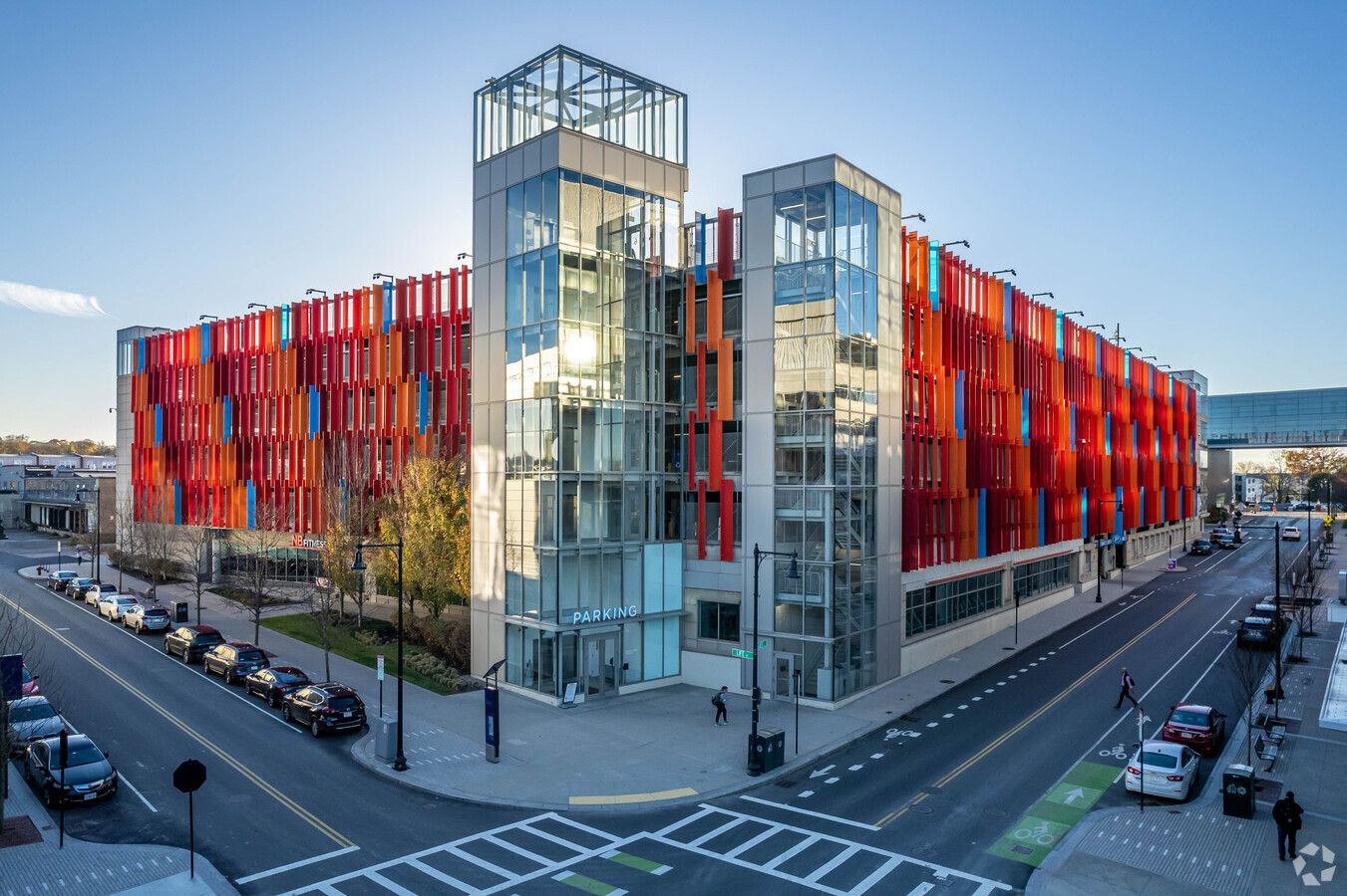
Property Record
15 Guest St, Brighton, MA 02135


NEARBY LISTINGS FOR SALE OR LEASE
Property Detail
15 Guest St
Taxexempt
Suffolk
X
Massachusetts
25021C0032E
3.14 AC
0
Allston/Brighton
2024
Boston
000601
Boston-Cambridge-Newton, MA-NH
133,162 SF
BRIG-000000-000022-001907
DEMOGRAPHICS near 15 Guest St
1 Mile
3 Mile
5 Mile
2024 Total Population
47,198
358,907
873,719
2029 Population
45,329
350,372
849,985
Pop Growth 2024-2029
(3.96%)
(2.38%)
(2.72%)
Average Age
35
36
38
2024 Total Households
20,778
149,275
366,911
HH Growth 2024-2029
(4.25%)
(2.58%)
(2.95%)
Median Household Inc
$76,961
$103,742
$104,233
Avg Household Size
2.20
2.10
2.10
2024 Avg HH Vehicles
1.00
1.00
1.00
Median Home Value
$642,911
$931,666
$872,638
Median Year Built
1960
1948
1949
Nearby Places
- Restaurants
- Banks
- Shops
- Fitness
- Groceries
PUBLIC TRANSPORTATION
TRANSIT/SUBWAY
Warren Street Station (Green Line - B - Massachusetts Bay Transportation Authority Subway (The T))
DRIVE
WALK
Distance
Warren Street Station (Green Line - B - Massachusetts Bay Transportation Authority Subway (The T))
4 min
16 min
0.8 mi
Allston Street Station (Green Line - B - Massachusetts Bay Transportation Authority Subway (The T))
DRIVE
WALK
Distance
Allston Street Station (Green Line - B - Massachusetts Bay Transportation Authority Subway (The T))
3 min
18 min
0.9 mi
Griggs Street/Long Avenue Station (Green Line - B - Massachusetts Bay Transportation Authority Subway (The T))
DRIVE
WALK
Distance
Griggs Street/Long Avenue Station (Green Line - B - Massachusetts Bay Transportation Authority Subway (The T))
4 min
20 min
1.0 mi
Griggs Street Station (Green Line - B - Massachusetts Bay Transportation Authority Subway (The T))
DRIVE
WALK
Distance
Griggs Street Station (Green Line - B - Massachusetts Bay Transportation Authority Subway (The T))
4 min
20 min
1.0 mi
COMMUTER RAIL
Yawkey (Framingham/Worcester Line - Massachusetts Bay Transportation Authority Commuter Rail (Purple Line))
DRIVE
WALK
Distance
Yawkey (Framingham/Worcester Line - Massachusetts Bay Transportation Authority Commuter Rail (Purple Line))
6 min
2.9 mi
Porter Square (Fitchburg/South Acton Line - Massachusetts Bay Transportation Authority Commuter Rail (Purple Line))
DRIVE
WALK
Distance
Porter Square (Fitchburg/South Acton Line - Massachusetts Bay Transportation Authority Commuter Rail (Purple Line))
9 min
3.3 mi
AIRPORT
Logan International
DRIVE
WALK
Distance
Logan International
16 min
8.3 mi
Freight Ports
Port of Boston
DRIVE
WALK
Distance
Port of Boston
15 min
7.1 mi
SALE & LEASE HISTORY
LISTING DATE
SALE/LEASE

Sep 25, 2016
For Lease
Feb 03, 2020
For Lease
Apr 05, 2022
For Lease
Nearby Properties
Address
Land Use
TOTAL SIZE
Lot Size
Zoning
Address
Land Use
TOTAL SIZE
Lot Size
Zoning
2.79 AC
Address
Land Use
TOTAL SIZE
Lot Size
Zoning
469,670 SF
7.60 AC
C
Address
Land Use
TOTAL SIZE
Lot Size
Zoning
142,458 SF
1.67 AC
C-3
Address
Land Use
TOTAL SIZE
Lot Size
Zoning
304,349 SF
1.72 AC
Address
Land Use
TOTAL SIZE
Lot Size
Zoning
150,192 SF
10.27 AC
E
Address
Land Use
TOTAL SIZE
Lot Size
Zoning
530,200 SF
62.08 AC
E
Address
Land Use
TOTAL SIZE
Lot Size
Zoning
239,377 SF
0.71 AC
MXD
Address
Land Use
TOTAL SIZE
Lot Size
Zoning
324,346 SF
1.83 AC
Address
Land Use
TOTAL SIZE
Lot Size
Zoning
2.87 AC
O-2A
Address
Land Use
TOTAL SIZE
Lot Size
Zoning
4,355 SF
13.12 AC
E
Address
Land Use
TOTAL SIZE
Lot Size
Zoning
2.81 AC
O-2
Address
Land Use
TOTAL SIZE
Lot Size
Zoning
387,083 SF
1.92 AC
RC
Address
Land Use
TOTAL SIZE
Lot Size
Zoning
2.25 AC
SD-12
Address
Land Use
TOTAL SIZE
Lot Size
Zoning
54,500 SF
4.01 AC
O-2A
Address
Land Use
TOTAL SIZE
Lot Size
Zoning
419,722 SF
2.02 AC
RC
Address
Land Use
TOTAL SIZE
Lot Size
Zoning
237,928 SF
1.27 AC
C-3
Address
Land Use
TOTAL SIZE
Lot Size
Zoning
155,818 SF
5.33 AC
OS
Address
Land Use
TOTAL SIZE
Lot Size
Zoning
283,554 SF
2.76 AC
O-2A
Address
Land Use
TOTAL SIZE
Lot Size
Zoning
214,398 SF
0.63 AC
BB-CSQ
Address
Land Use
TOTAL SIZE
Lot Size
Zoning
3.52 AC
C-3
Address
Land Use
TOTAL SIZE
Lot Size
Zoning
136,025 SF
6.91 AC
C3
Address
Land Use
TOTAL SIZE
Lot Size
Zoning
336,518 SF
6.14 AC
I-3
Address
Land Use
TOTAL SIZE
Lot Size
Zoning
254,208 SF
3.83 AC
E
Address
Land Use
TOTAL SIZE
Lot Size
Zoning
506,534 SF
2.75 AC
C
Address
Land Use
TOTAL SIZE
Lot Size
Zoning
220,671 SF
2.52 AC
I-2
Address
Land Use
TOTAL SIZE
Lot Size
Zoning
174,764 SF
1.83 AC
C-3
Address
Land Use
TOTAL SIZE
Lot Size
Zoning
17,788 SF
8.32 AC
C-1
Address
Land Use
TOTAL SIZE
Lot Size
Zoning
416,359 SF
1.97 AC
C
Address
Land Use
TOTAL SIZE
Lot Size
Zoning
176,625 SF
5.76 AC
I-3
Address
Land Use
TOTAL SIZE
Lot Size
Zoning
244,008 SF
4 AC
SD-4A
The World's #1 Commercial Real Estate Marketplace
Connect with us
© 2025 CoStar Group
The information above has been obtained from sources believed reliable. While we do not doubt its accuracy we have not verified it and make no guarantee, warranty or representation about it. It is your responsibility to independently confirm its accuracy and completeness. Any projections, opinions, assumptions, or estimates used are for example only and do not represent the current or future performance of the property. The value of this transaction to you depends on tax and other factors which should be evaluated by your tax, financial, and legal advisors. You and your advisors should conduct a careful, independent investigation of the property to determine to your satisfaction the suitability of the property for your needs.