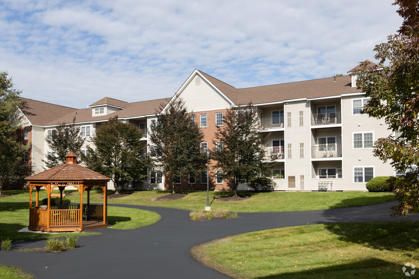
Property Record
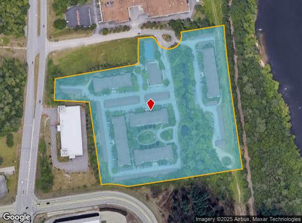
15 Iron Horse Dr, Bedford, NH 03110
NEARBY LISTINGS FOR SALE OR LEASE
-
-
View all Bedford listings for sale on LoopNet.com
Property Detail
15 Iron Horse Dr
BEDD-000036-000001-000001
Hillsborough
Commercialbuilding
New Hampshire
X
1
33011C0387D
15.58 AC
2023
River Corridor
2023
Boston
002901
Manchester-Nashua, NH
42,228 SF
DEMOGRAPHICS near 15 Iron Horse Dr
1 Mile
3 Mile
5 Mile
2024 Total Population
2,755
24,737
104,030
2029 Population
2,823
25,400
106,227
Pop Growth 2024-2029
+ 2.47%
+ 2.68%
+ 2.11%
Average Age
43
42
40
2024 Total Households
1,182
9,703
40,811
HH Growth 2024-2029
+ 2.71%
+ 2.73%
+ 2.08%
Median Household Inc
$84,163
$97,411
$86,521
Avg Household Size
2.20
2.50
2.50
2024 Avg HH Vehicles
2.00
2.00
2.00
Median Home Value
$287,045
$356,971
$348,961
Median Year Built
1992
1983
1976
Nearby Places
- Restaurants
- Banks
- Shops
- Fitness
- Groceries
PUBLIC TRANSPORTATION
AIRPORT
Manchester Boston Regional
DRIVE
WALK
Distance
Manchester Boston Regional
9 min
3.3 mi
Freight Ports
Port of Boston
DRIVE
WALK
Distance
Port of Boston
84 min
62.4 mi
Nearby Properties
Address
Land Use
TOTAL SIZE
Lot Size
Zoning
Address
Land Use
TOTAL SIZE
Lot Size
Zoning
768,020 SF
74.47 AC
I-II
Address
Land Use
TOTAL SIZE
Lot Size
Zoning
56,997 SF
31.28 AC
INDUST
Address
Land Use
TOTAL SIZE
Lot Size
Zoning
603,357 SF
45.12 AC
GB
Address
Land Use
TOTAL SIZE
Lot Size
Zoning
8,064 SF
34.29 AC
Address
Land Use
TOTAL SIZE
Lot Size
Zoning
46,906 SF
552.35 AC
Address
Land Use
TOTAL SIZE
Lot Size
Zoning
3,748 SF
14.69 AC
Address
Land Use
TOTAL SIZE
Lot Size
Zoning
29,803 SF
31.46 AC
PZ
Address
Land Use
TOTAL SIZE
Lot Size
Zoning
50.47 AC
GB
Address
Land Use
TOTAL SIZE
Lot Size
Zoning
22,101 SF
8.33 AC
Address
Land Use
TOTAL SIZE
Lot Size
Zoning
723,875 SF
38.08 AC
Address
Land Use
TOTAL SIZE
Lot Size
Zoning
180,474 SF
18.60 AC
Address
Land Use
TOTAL SIZE
Lot Size
Zoning
201,831 SF
18.46 AC
IND-II
Address
Land Use
TOTAL SIZE
Lot Size
Zoning
151,002 SF
6.95 AC
PZ
Address
Land Use
TOTAL SIZE
Lot Size
Zoning
139,616 SF
18.47 AC
PZ
Address
Land Use
TOTAL SIZE
Lot Size
Zoning
142,318 SF
26.12 AC
GB
Address
Land Use
TOTAL SIZE
Lot Size
Zoning
227,589 SF
GB
Address
Land Use
TOTAL SIZE
Lot Size
Zoning
244,637 SF
27.28 AC
IND-II
Address
Land Use
TOTAL SIZE
Lot Size
Zoning
304,312 SF
29.62 AC
IND-II
Address
Land Use
TOTAL SIZE
Lot Size
Zoning
171,811 SF
44.42 AC
Address
Land Use
TOTAL SIZE
Lot Size
Zoning
2,034 SF
8.16 AC
PZ
Address
Land Use
TOTAL SIZE
Lot Size
Zoning
6,110 SF
12.98 AC
Address
Land Use
TOTAL SIZE
Lot Size
Zoning
116.34 AC
IND-II
Address
Land Use
TOTAL SIZE
Lot Size
Zoning
162,272 SF
9.69 AC
Address
Land Use
TOTAL SIZE
Lot Size
Zoning
192,520 SF
34.20 AC
Address
Land Use
TOTAL SIZE
Lot Size
Zoning
187,046 SF
17.40 AC
PZ
Address
Land Use
TOTAL SIZE
Lot Size
Zoning
24.20 AC
GB
Address
Land Use
TOTAL SIZE
Lot Size
Zoning
112,851 SF
10.93 AC
Address
Land Use
TOTAL SIZE
Lot Size
Zoning
134,586 SF
14.84 AC
Address
Land Use
TOTAL SIZE
Lot Size
Zoning
124,836 SF
28.60 AC
The World's #1 Commercial Real Estate Marketplace
Connect with us
© 2025 CoStar Group
The information above has been obtained from sources believed reliable. While we do not doubt its accuracy we have not verified it and make no guarantee, warranty or representation about it. It is your responsibility to independently confirm its accuracy and completeness. Any projections, opinions, assumptions, or estimates used are for example only and do not represent the current or future performance of the property. The value of this transaction to you depends on tax and other factors which should be evaluated by your tax, financial, and legal advisors. You and your advisors should conduct a careful, independent investigation of the property to determine to your satisfaction the suitability of the property for your needs.