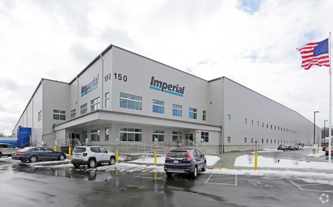
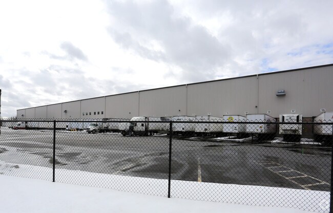
Property Record
150 Blackstone River Rd, Worcester, MA 01607

NEARBY LISTINGS FOR SALE OR LEASE
Property Detail
150 Blackstone River Rd
WORC-000031-000022-000003
Worcester
Warehouse
Massachusetts
AE
3
25027C0806E
33.04 AC
2025
Worcester Metro
2025
Boston
732901
Worcester, MA-CT
591,515 SF
DEMOGRAPHICS near 150 Blackstone River Rd
1 Mile
3 Mile
5 Mile
2024 Total Population
7,705
107,064
211,604
2029 Population
7,668
105,246
208,667
Pop Growth 2024-2029
(0.48%)
(1.70%)
(1.39%)
Average Age
39
38
39
2024 Total Households
3,265
43,137
83,967
HH Growth 2024-2029
(0.49%)
(1.59%)
(1.32%)
Median Household Inc
$65,612
$56,409
$67,509
Avg Household Size
2.30
2.40
2.40
2024 Avg HH Vehicles
2.00
1.00
2.00
Median Home Value
$285,137
$307,839
$338,152
Median Year Built
1957
1949
1953
Nearby Places
Map Layers
Map Styles
 Street
 Aerial
- Restaurants
- Banks
- Shops
- Fitness
- Groceries
PUBLIC TRANSPORTATION
COMMUTER RAIL
Worcester Union Station (Lake Shore Limited - Amtrak)
DRIVE
WALK
Distance
Worcester Union Station (Lake Shore Limited - Amtrak)
7 min
3.0 mi
Worcester (Framingham/Worcester Line - Massachusetts Bay Transportation Authority Commuter Rail (Purple Line))
DRIVE
WALK
Distance
Worcester (Framingham/Worcester Line - Massachusetts Bay Transportation Authority Commuter Rail (Purple Line))
7 min
3.1 mi
AIRPORT
Worcester Regional
DRIVE
WALK
Distance
Worcester Regional
17 min
8.4 mi
Freight Ports
Port of Boston
DRIVE
WALK
Distance
Port of Boston
60 min
44.9 mi
SALE & LEASE HISTORY
LISTING DATE
SALE/LEASE

Sep 25, 2016
For Lease
Sep 25, 2016
For Lease
Sep 05, 2017
For Lease
Nov 09, 2017
For Lease
May 12, 2017
For Lease
Feb 24, 2020
For Lease
Nearby Properties
Address
Land Use
TOTAL SIZE
Lot Size
Zoning
Address
Land Use
TOTAL SIZE
Lot Size
Zoning
669,637 SF
17.46 AC
BG-6
Address
Land Use
TOTAL SIZE
Lot Size
Zoning
381,440 SF
2.74 AC
BG-6
Address
Land Use
TOTAL SIZE
Lot Size
Zoning
612,538 SF
3.98 AC
BG-6
Address
Land Use
TOTAL SIZE
Lot Size
Zoning
142.98 AC
Address
Land Use
TOTAL SIZE
Lot Size
Zoning
25,000 SF
99.10 AC
MG-.5
Address
Land Use
TOTAL SIZE
Lot Size
Zoning
311,604 SF
2.37 AC
MG-2
Address
Land Use
TOTAL SIZE
Lot Size
Zoning
1,760 SF
105.54 AC
ML10
Address
Land Use
TOTAL SIZE
Lot Size
Zoning
157,385 SF
3.45 AC
BG-6
Address
Land Use
TOTAL SIZE
Lot Size
Zoning
164,378 SF
21.40 AC
Address
Land Use
TOTAL SIZE
Lot Size
Zoning
19,319 SF
10.67 AC
RG-5
Address
Land Use
TOTAL SIZE
Lot Size
Zoning
176,316 SF
19.57 AC
RL-7
Address
Land Use
TOTAL SIZE
Lot Size
Zoning
70,514 SF
31.64 AC
RL-7
Address
Land Use
TOTAL SIZE
Lot Size
Zoning
3.55 AC
RG-5
Address
Land Use
TOTAL SIZE
Lot Size
Zoning
210,168 SF
45.75 AC
RL-7
Address
Land Use
TOTAL SIZE
Lot Size
Zoning
69.46 AC
RS-7
Address
Land Use
TOTAL SIZE
Lot Size
Zoning
159,355 SF
207.62 AC
RL-7
Address
Land Use
TOTAL SIZE
Lot Size
Zoning
68.34 AC
ML10
Address
Land Use
TOTAL SIZE
Lot Size
Zoning
3.43 AC
ML10
Address
Land Use
TOTAL SIZE
Lot Size
Zoning
37,093 SF
5.41 AC
RG-5
Address
Land Use
TOTAL SIZE
Lot Size
Zoning
27.89 AC
RL-7
Address
Land Use
TOTAL SIZE
Lot Size
Zoning
181,408 SF
1.50 AC
BG-6
Address
Land Use
TOTAL SIZE
Lot Size
Zoning
64.46 AC
RS-7
Address
Land Use
TOTAL SIZE
Lot Size
Zoning
78.19 AC
RL-7
Address
Land Use
TOTAL SIZE
Lot Size
Zoning
7,700 SF
80.72 AC
ML-.5
Address
Land Use
TOTAL SIZE
Lot Size
Zoning
175,200 SF
2.26 AC
BL-1
Address
Land Use
TOTAL SIZE
Lot Size
Zoning
36.67 AC
Address
Land Use
TOTAL SIZE
Lot Size
Zoning
53.52 AC
RL-7
Address
Land Use
TOTAL SIZE
Lot Size
Zoning
2.78 AC
MG-2
Address
Land Use
TOTAL SIZE
Lot Size
Zoning
222,474 SF
22.75 AC
MG-1
The World's #1 Commercial Real Estate Marketplace
Connect with us
© 2025 CoStar Group
The information above has been obtained from sources believed reliable. While we do not doubt its accuracy we have not verified it and make no guarantee, warranty or representation about it. It is your responsibility to independently confirm its accuracy and completeness. Any projections, opinions, assumptions, or estimates used are for example only and do not represent the current or future performance of the property. The value of this transaction to you depends on tax and other factors which should be evaluated by your tax, financial, and legal advisors. You and your advisors should conduct a careful, independent investigation of the property to determine to your satisfaction the suitability of the property for your needs.