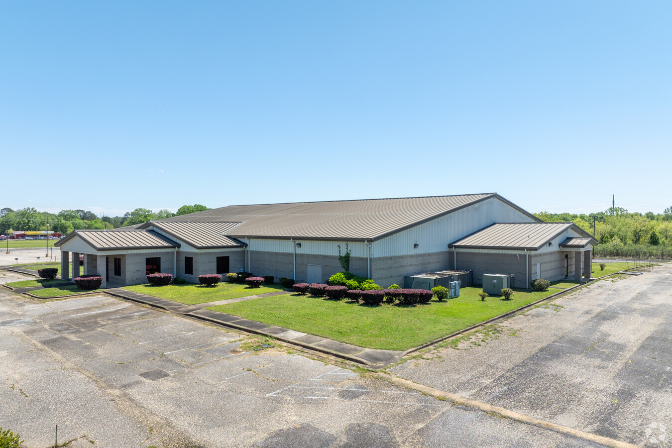
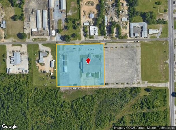
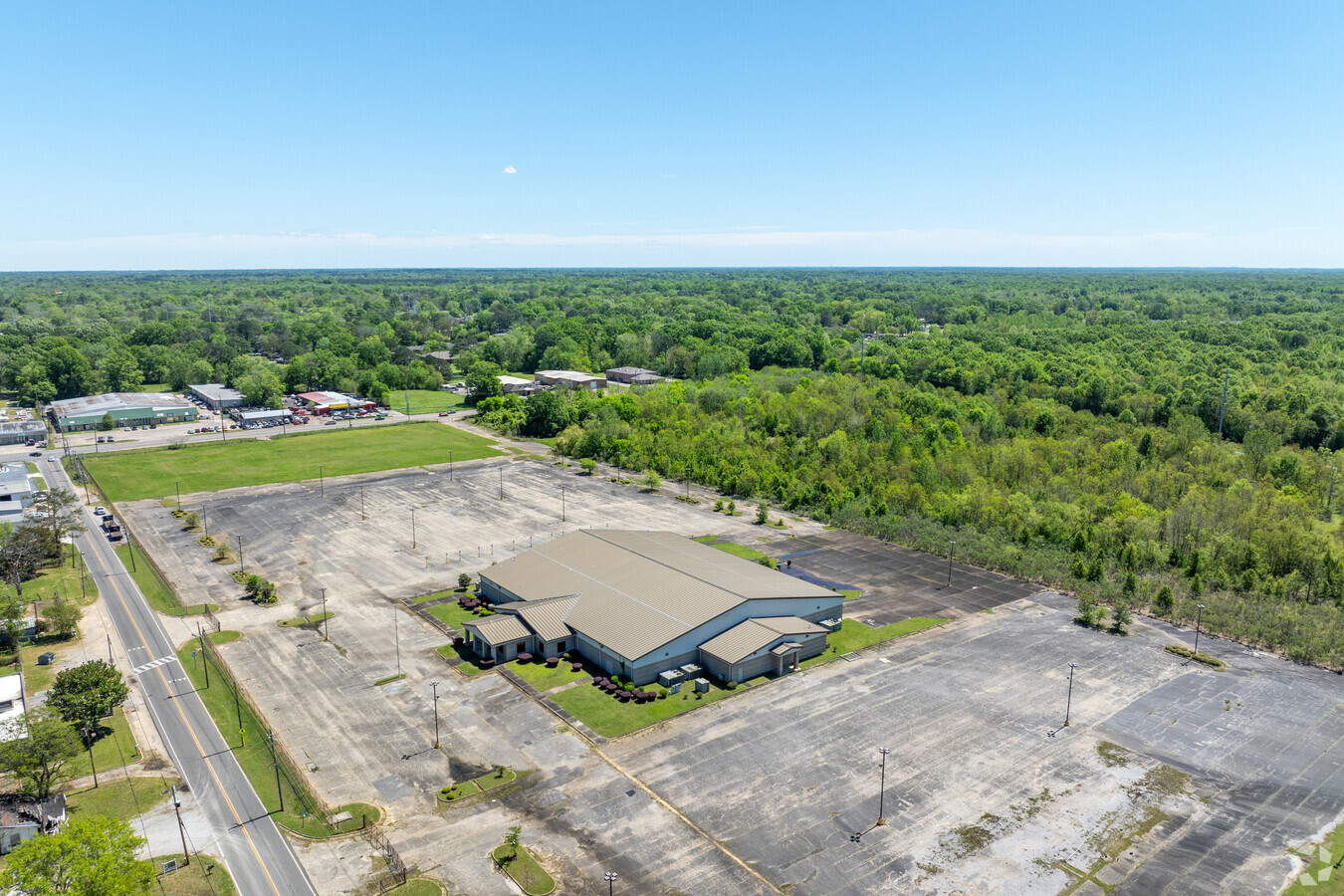
Property Record
150 E Fleming Rd, Montgomery, AL 36105
This Property Is For Sale
NEARBY LISTINGS FOR SALE OR LEASE
Property Detail
150 E Fleming Rd
10-09-31-3-001-001.003
COM SE INT FLEMING RD & ENDOVER DR TH E 742.3 TO POB TH E 544.5 TH S 480 TH W 544.5 TH N 480 TO POB 1009313001001003
Theater
Montgomery
X
Alabama
01101C0208J
6 AC
0
South Montgomery
2024
Montgomery
002202
Montgomery, AL
34,846 SF
DEMOGRAPHICS near 150 E Fleming Rd
1 Mile
3 Mile
5 Mile
2024 Total Population
6,416
46,171
106,985
2029 Population
6,308
45,774
105,696
Pop Growth 2024-2029
(1.68%)
(0.86%)
(1.20%)
Average Age
39
40
38
2024 Total Households
2,560
18,888
43,348
HH Growth 2024-2029
(1.68%)
(0.77%)
(1.10%)
Median Household Inc
$35,496
$39,147
$36,417
Avg Household Size
2.40
2.30
2.30
2024 Avg HH Vehicles
2.00
2.00
2.00
Median Home Value
$61,746
$100,125
$107,076
Median Year Built
1962
1963
1970
Nearby Places
- Restaurants
- Banks
- Shops
- Fitness
- Groceries
PUBLIC TRANSPORTATION
AIRPORT
Montgomery Regional (Dannelly Field)
DRIVE
WALK
Distance
Montgomery Regional (Dannelly Field)
10 min
7.0 mi
Freight Ports
Port of Panama City
DRIVE
WALK
Distance
Port of Panama City
234 min
185.8 mi
Nearby Properties
Address
Land Use
TOTAL SIZE
Lot Size
Zoning
Address
Land Use
TOTAL SIZE
Lot Size
Zoning
260,402 SF
17 AC
O-2
Address
Land Use
TOTAL SIZE
Lot Size
Zoning
126,745 SF
239.11 AC
Address
Land Use
TOTAL SIZE
Lot Size
Zoning
40,829 SF
50.49 AC
SD
Address
Land Use
TOTAL SIZE
Lot Size
Zoning
9,060 SF
524.11 AC
Address
Land Use
TOTAL SIZE
Lot Size
Zoning
164,528 SF
5.28 AC
B-3
Address
Land Use
TOTAL SIZE
Lot Size
Zoning
32,902 SF
14 AC
R-75-M
Address
Land Use
TOTAL SIZE
Lot Size
Zoning
341,170 SF
O-2
Address
Land Use
TOTAL SIZE
Lot Size
Zoning
14,733 SF
19 AC
O-2
Address
Land Use
TOTAL SIZE
Lot Size
Zoning
135,573 SF
35 AC
O-2
Address
Land Use
TOTAL SIZE
Lot Size
Zoning
249,231 SF
20 AC
INST
Address
Land Use
TOTAL SIZE
Lot Size
Zoning
61,137 SF
59 AC
INST
Address
Land Use
TOTAL SIZE
Lot Size
Zoning
57,565 SF
1.50 AC
T4-R
Address
Land Use
TOTAL SIZE
Lot Size
Zoning
95,886 SF
3.19 AC
B-4
Address
Land Use
TOTAL SIZE
Lot Size
Zoning
8,652 SF
5.28 AC
R-75-D
Address
Land Use
TOTAL SIZE
Lot Size
Zoning
54,384 SF
0.65 AC
Address
Land Use
TOTAL SIZE
Lot Size
Zoning
154,202 SF
14.90 AC
B-4
Address
Land Use
TOTAL SIZE
Lot Size
Zoning
65,357 SF
4.29 AC
R-65-M
Address
Land Use
TOTAL SIZE
Lot Size
Zoning
91,241 SF
9.10 AC
R-65-S
Address
Land Use
TOTAL SIZE
Lot Size
Zoning
88,234 SF
O-1
Address
Land Use
TOTAL SIZE
Lot Size
Zoning
4.69 AC
R-75-S
Address
Land Use
TOTAL SIZE
Lot Size
Zoning
3,078 SF
11 AC
R-60-S
Address
Land Use
TOTAL SIZE
Lot Size
Zoning
2,380 SF
9.80 AC
R-65-M
Address
Land Use
TOTAL SIZE
Lot Size
Zoning
1,693 SF
3.29 AC
B-1-A-Q
Address
Land Use
TOTAL SIZE
Lot Size
Zoning
176,106 SF
19.22 AC
M-3
Address
Land Use
TOTAL SIZE
Lot Size
Zoning
87,441 SF
9.90 AC
INST
Address
Land Use
TOTAL SIZE
Lot Size
Zoning
40,554 SF
3.20 AC
INST
Address
Land Use
TOTAL SIZE
Lot Size
Zoning
46,760 SF
4.38 AC
R-65-D
Address
Land Use
TOTAL SIZE
Lot Size
Zoning
44,263 SF
3.42 AC
B-4
Address
Land Use
TOTAL SIZE
Lot Size
Zoning
88,994 SF
5.16 AC
INST
Address
Land Use
TOTAL SIZE
Lot Size
Zoning
34,520 SF
4.55 AC
R-75-S
The World's #1 Commercial Real Estate Marketplace
Connect with us
© 2025 CoStar Group
The information above has been obtained from sources believed reliable. While we do not doubt its accuracy we have not verified it and make no guarantee, warranty or representation about it. It is your responsibility to independently confirm its accuracy and completeness. Any projections, opinions, assumptions, or estimates used are for example only and do not represent the current or future performance of the property. The value of this transaction to you depends on tax and other factors which should be evaluated by your tax, financial, and legal advisors. You and your advisors should conduct a careful, independent investigation of the property to determine to your satisfaction the suitability of the property for your needs.