Property Record
150 Fm 1959 Rd, Houston, TX 77034
NEARBY LISTINGS FOR SALE OR LEASE
Property Detail
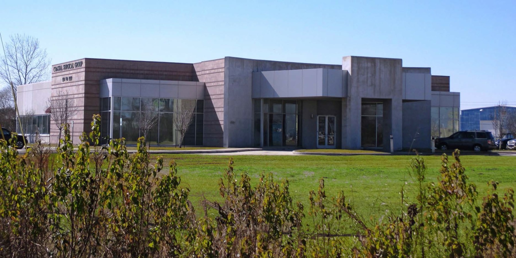
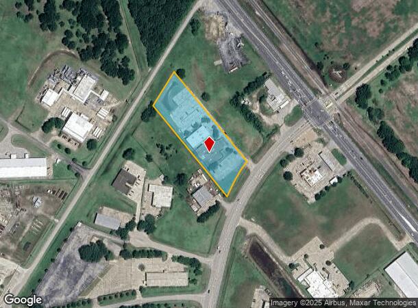
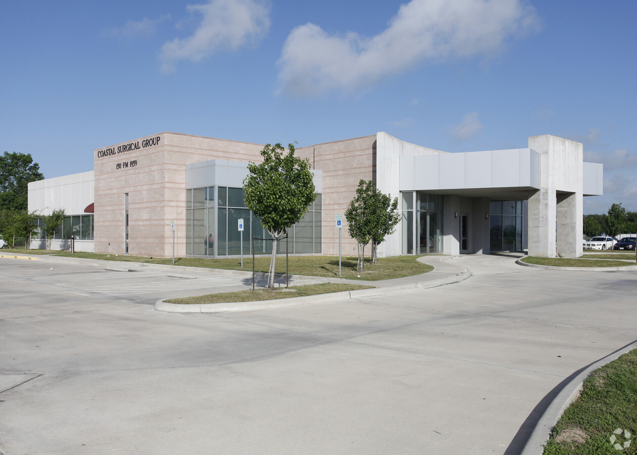
150 Fm 1959 Rd
1290660010001
Coastal Surgical Group Center
Outdoorrecreationbeachmountaindesert
RES A BLK 1 COASTAL SURGICAL GROUP CENTER
X
Harris
48167C0010G
Texas
2023
2.50 AC
2023
NASA/Clear Lake
340102
Houston
19,126 SF
Houston-The Woodlands-Sugar Land, TX
DEMOGRAPHICS near 150 Fm 1959 Rd
1 Mile
3 Mile
5 Mile
2024 Total Population
4,099
63,709
257,539
2029 Population
4,210
64,676
262,650
Pop Growth 2024-2029
+ 2.71%
+ 1.52%
+ 1.98%
Average Age
35
36
37
2024 Total Households
1,584
22,287
91,468
HH Growth 2024-2029
+ 3.03%
+ 1.56%
+ 1.99%
Median Household Inc
$68,458
$71,569
$72,709
Avg Household Size
2.50
2.80
2.80
2024 Avg HH Vehicles
2.00
2.00
2.00
Median Home Value
$205,350
$213,511
$229,906
Median Year Built
1988
1987
1984
Nearby Places
- Restaurants
- Banks
- Shops
- Fitness
- Groceries
PUBLIC TRANSPORTATION
AIRPORT
William P Hobby
DRIVE
WALK
Distance
William P Hobby
19 min
8.7 mi
George Bush Intcntl/Houston
DRIVE
WALK
Distance
George Bush Intcntl/Houston
47 min
36.5 mi
Freight Ports
Port of Houston
DRIVE
WALK
Distance
Port of Houston
24 min
15.4 mi
SALE & LEASE HISTORY
LISTING DATE
SALE/LEASE

Sep 25, 2016
For Lease
Sep 23, 2016
For Sale
Nearby Properties
Address
Land Use
TOTAL SIZE
Lot Size
Zoning
Address
Land Use
TOTAL SIZE
Lot Size
Zoning
6,478,017 SF
135.61 AC
Address
Land Use
TOTAL SIZE
Lot Size
Zoning
541,172 SF
25.61 AC
Address
Land Use
TOTAL SIZE
Lot Size
Zoning
309,779 SF
19.57 AC
Address
Land Use
TOTAL SIZE
Lot Size
Zoning
511,000 SF
31.20 AC
Address
Land Use
TOTAL SIZE
Lot Size
Zoning
135.61 AC
Address
Land Use
TOTAL SIZE
Lot Size
Zoning
331,734 SF
15.82 AC
Address
Land Use
TOTAL SIZE
Lot Size
Zoning
334,780 SF
13.48 AC
Address
Land Use
TOTAL SIZE
Lot Size
Zoning
226,250 SF
13.69 AC
Address
Land Use
TOTAL SIZE
Lot Size
Zoning
131,584 SF
25.37 AC
Address
Land Use
TOTAL SIZE
Lot Size
Zoning
311,591 SF
13.87 AC
Address
Land Use
TOTAL SIZE
Lot Size
Zoning
279,627 SF
15.98 AC
Address
Land Use
TOTAL SIZE
Lot Size
Zoning
276,029 SF
14.44 AC
Address
Land Use
TOTAL SIZE
Lot Size
Zoning
277,465 SF
11.80 AC
Address
Land Use
TOTAL SIZE
Lot Size
Zoning
800,000 SF
135.61 AC
Address
Land Use
TOTAL SIZE
Lot Size
Zoning
262,774 SF
10.87 AC
Address
Land Use
TOTAL SIZE
Lot Size
Zoning
245,028 SF
12.44 AC
Address
Land Use
TOTAL SIZE
Lot Size
Zoning
203,158 SF
10 AC
Address
Land Use
TOTAL SIZE
Lot Size
Zoning
219,424 SF
7.25 AC
Address
Land Use
TOTAL SIZE
Lot Size
Zoning
102,056 SF
5.59 AC
Address
Land Use
TOTAL SIZE
Lot Size
Zoning
241,245 SF
9 AC
Address
Land Use
TOTAL SIZE
Lot Size
Zoning
158,602 SF
7.90 AC
Address
Land Use
TOTAL SIZE
Lot Size
Zoning
242,528 SF
9.61 AC
Address
Land Use
TOTAL SIZE
Lot Size
Zoning
125,028 SF
5.59 AC
Address
Land Use
TOTAL SIZE
Lot Size
Zoning
242,732 SF
12.25 AC
Address
Land Use
TOTAL SIZE
Lot Size
Zoning
152,047 SF
7.02 AC
Address
Land Use
TOTAL SIZE
Lot Size
Zoning
163,325 SF
10 AC
Address
Land Use
TOTAL SIZE
Lot Size
Zoning
233,622 SF
8.60 AC
Address
Land Use
TOTAL SIZE
Lot Size
Zoning
74,952 SF
13.46 AC
Address
Land Use
TOTAL SIZE
Lot Size
Zoning
75,007 SF
4.26 AC
Address
Land Use
TOTAL SIZE
Lot Size
Zoning
173,718 SF
7.74 AC
The World's #1 Commercial Real Estate Marketplace
Connect with us
© 2025 CoStar Group
The information above has been obtained from sources believed reliable. While we do not doubt its accuracy we have not verified it and make no guarantee, warranty or representation about it. It is your responsibility to independently confirm its accuracy and completeness. Any projections, opinions, assumptions, or estimates used are for example only and do not represent the current or future performance of the property. The value of this transaction to you depends on tax and other factors which should be evaluated by your tax, financial, and legal advisors. You and your advisors should conduct a careful, independent investigation of the property to determine to your satisfaction the suitability of the property for your needs.