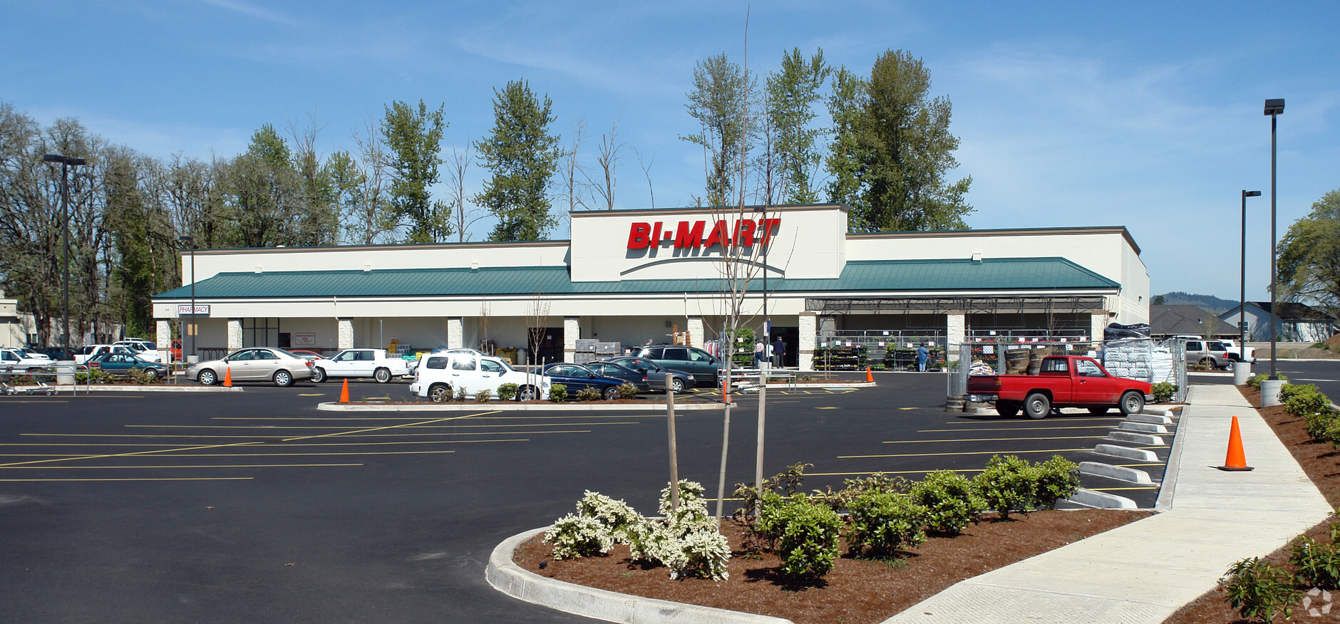
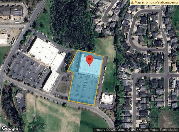
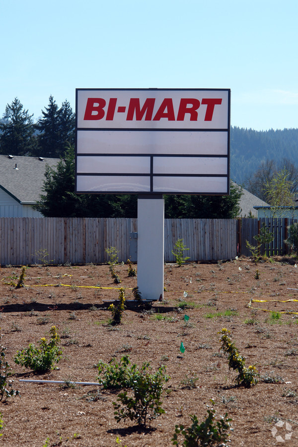
Property Record
150 Melton Rd, Creswell, OR 97426
NEARBY LISTINGS FOR SALE OR LEASE
-
-
View all Creswell listings for sale on LoopNet.com
Property Detail
150 Melton Rd
Eugene, OR
Pond View Subdivision
1837986
SUBDIVISION PLAT POND VIEW SUBDIVISION LOT 1 TL 08200
Commercialbuilding
Lane
AE
Oregon
41039C1642F
1
2023
3.02 AC
2023
Lane County
001101
Portland
DEMOGRAPHICS near 150 Melton Rd
1 Mile
3 Mile
5 Mile
2024 Total Population
3,461
8,494
11,170
2029 Population
3,464
8,460
11,105
Pop Growth 2024-2029
+ 0.09%
(0.40%)
(0.58%)
Average Age
42
41
42
2024 Total Households
1,323
3,171
4,181
HH Growth 2024-2029
0.00%
(0.44%)
(0.62%)
Median Household Inc
$83,229
$80,719
$83,805
Avg Household Size
2.60
2.60
2.60
2024 Avg HH Vehicles
2.00
2.00
2.00
Median Home Value
$364,780
$373,786
$403,512
Median Year Built
2000
1992
1989
Nearby Places
- Restaurants
- Banks
- Shops
- Fitness
- Groceries
PUBLIC TRANSPORTATION
AIRPORT
Mahlon Sweet Field
DRIVE
WALK
Distance
Mahlon Sweet Field
35 min
23.1 mi
Freight Ports
Port of Coos Bay, OR
DRIVE
WALK
Distance
Port of Coos Bay, OR
152 min
104.5 mi
Nearby Properties
Address
Land Use
TOTAL SIZE
Lot Size
Zoning
Address
Land Use
TOTAL SIZE
Lot Size
Zoning
9.35 AC
P
Address
Land Use
TOTAL SIZE
Lot Size
Zoning
2.26 AC
RPF
Address
Land Use
TOTAL SIZE
Lot Size
Zoning
27.48 AC
AGT5
Address
Land Use
TOTAL SIZE
Lot Size
Zoning
16.37 AC
E25
Address
Land Use
TOTAL SIZE
Lot Size
Zoning
75.99 AC
E25
Address
Land Use
TOTAL SIZE
Lot Size
Zoning
4.72 AC
C
Address
Land Use
TOTAL SIZE
Lot Size
Zoning
13.13 AC
P
Address
Land Use
TOTAL SIZE
Lot Size
Zoning
3.28 AC
C
Address
Land Use
TOTAL SIZE
Lot Size
Zoning
130.63 AC
C
Address
Land Use
TOTAL SIZE
Lot Size
Zoning
2.68 AC
R
Address
Land Use
TOTAL SIZE
Lot Size
Zoning
1.16 AC
C
Address
Land Use
TOTAL SIZE
Lot Size
Zoning
2.96 AC
RPF
Address
Land Use
TOTAL SIZE
Lot Size
Zoning
2.22 AC
C
Address
Land Use
TOTAL SIZE
Lot Size
Zoning
672 SF
4.14 AC
RC
Address
Land Use
TOTAL SIZE
Lot Size
Zoning
0.57 AC
C
Address
Land Use
TOTAL SIZE
Lot Size
Zoning
0.96 AC
C
Address
Land Use
TOTAL SIZE
Lot Size
Zoning
1.66 AC
C
Address
Land Use
TOTAL SIZE
Lot Size
Zoning
1.49 AC
C
Address
Land Use
TOTAL SIZE
Lot Size
Zoning
2.14 AC
C
Address
Land Use
TOTAL SIZE
Lot Size
Zoning
1.73 AC
C
Address
Land Use
TOTAL SIZE
Lot Size
Zoning
4.37 AC
C
Address
Land Use
TOTAL SIZE
Lot Size
Zoning
1.87 AC
P
Address
Land Use
TOTAL SIZE
Lot Size
Zoning
5.73 AC
C
Address
Land Use
TOTAL SIZE
Lot Size
Zoning
4.70 AC
E25
Address
Land Use
TOTAL SIZE
Lot Size
Zoning
1.84 AC
C
Address
Land Use
TOTAL SIZE
Lot Size
Zoning
300 SF
5.10 AC
E25
Address
Land Use
TOTAL SIZE
Lot Size
Zoning
20.35 AC
E25
Address
Land Use
TOTAL SIZE
Lot Size
Zoning
1.02 AC
R
Address
Land Use
TOTAL SIZE
Lot Size
Zoning
1.56 AC
C
The World's #1 Commercial Real Estate Marketplace
Connect with us
© 2025 CoStar Group
The information above has been obtained from sources believed reliable. While we do not doubt its accuracy we have not verified it and make no guarantee, warranty or representation about it. It is your responsibility to independently confirm its accuracy and completeness. Any projections, opinions, assumptions, or estimates used are for example only and do not represent the current or future performance of the property. The value of this transaction to you depends on tax and other factors which should be evaluated by your tax, financial, and legal advisors. You and your advisors should conduct a careful, independent investigation of the property to determine to your satisfaction the suitability of the property for your needs.