Property Record
1500 Beatties Ford Rd, Charlotte, NC 28216


NEARBY LISTINGS FOR SALE OR LEASE
Property Detail
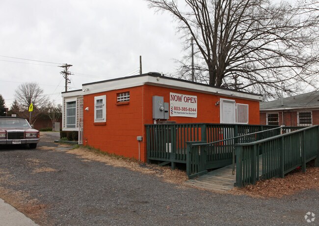
1500 Beatties Ford Rd
075-059-07
L1 BB M967-357
Officebuilding
Mecklenburg
X
North Carolina
3710454500K
1
2024
0.15 AC
2025
Northwest
004800
Charlotte
644 SF
Charlotte-Concord-Gastonia, NC-SC
DEMOGRAPHICS near 1500 Beatties Ford Rd
1 Mile
3 Mile
5 Mile
2024 Total Population
10,803
95,894
251,621
2029 Population
11,477
103,207
268,591
Pop Growth 2024-2029
+ 6.24%
+ 7.63%
+ 6.74%
Average Age
39
36
36
2024 Total Households
4,205
45,462
110,801
HH Growth 2024-2029
+ 6.33%
+ 7.96%
+ 6.98%
Median Household Inc
$35,906
$62,758
$62,684
Avg Household Size
2.40
2.00
2.20
2024 Avg HH Vehicles
1.00
1.00
2.00
Median Home Value
$215,438
$288,678
$294,026
Median Year Built
1969
2001
1994
Nearby Places
Map Layers
Map Styles
 Street
 Aerial
- Restaurants
- Banks
- Shops
- Fitness
- Groceries
PUBLIC TRANSPORTATION
COMMUTER RAIL
DRIVE
WALK
Distance
6 min
2.8 mi
AIRPORT
Charlotte/Douglas International
DRIVE
WALK
Distance
Charlotte/Douglas International
17 min
8.6 mi
Concord-Padgett Regional
DRIVE
WALK
Distance
Concord-Padgett Regional
23 min
14.9 mi
Nearby Properties
Address
Land Use
TOTAL SIZE
Lot Size
Zoning
Address
Land Use
TOTAL SIZE
Lot Size
Zoning
1,652,470 SF
10.96 AC
UMUD
Address
Land Use
TOTAL SIZE
Lot Size
Zoning
780,000 SF
7.69 AC
UMUD-O
Address
Land Use
TOTAL SIZE
Lot Size
Zoning
1,097,257 SF
2.34 AC
UMUD-O
Address
Land Use
TOTAL SIZE
Lot Size
Zoning
1,498,190 SF
2.09 AC
UMUD
Address
Land Use
TOTAL SIZE
Lot Size
Zoning
955,273 SF
1.83 AC
Address
Land Use
TOTAL SIZE
Lot Size
Zoning
1,483,634 SF
1.49 AC
Address
Land Use
TOTAL SIZE
Lot Size
Zoning
1,097,857 SF
2.40 AC
UMUDO
Address
Land Use
TOTAL SIZE
Lot Size
Zoning
1,052,203 SF
2.17 AC
Address
Land Use
TOTAL SIZE
Lot Size
Zoning
1,752,744 SF
3.20 AC
UMUDO
Address
Land Use
TOTAL SIZE
Lot Size
Zoning
1,266,700 SF
2.98 AC
Address
Land Use
TOTAL SIZE
Lot Size
Zoning
1,325,933 SF
34.09 AC
Address
Land Use
TOTAL SIZE
Lot Size
Zoning
925,808 SF
1.84 AC
UMUD-O
Address
Land Use
TOTAL SIZE
Lot Size
Zoning
1,435,616 SF
33.78 AC
UMUD
Address
Land Use
TOTAL SIZE
Lot Size
Zoning
1,250,926 SF
4.89 AC
I2
Address
Land Use
TOTAL SIZE
Lot Size
Zoning
1,053,936 SF
2.47 AC
UMUD
Address
Land Use
TOTAL SIZE
Lot Size
Zoning
865,160 SF
2.80 AC
UMUD
Address
Land Use
TOTAL SIZE
Lot Size
Zoning
839,976 SF
1.62 AC
UMUD
Address
Land Use
TOTAL SIZE
Lot Size
Zoning
894,108 SF
4.52 AC
UMUDO
Address
Land Use
TOTAL SIZE
Lot Size
Zoning
696,527 SF
1.96 AC
UMUDO
Address
Land Use
TOTAL SIZE
Lot Size
Zoning
1,025,674 SF
3.43 AC
UMUD
Address
Land Use
TOTAL SIZE
Lot Size
Zoning
916,725 SF
2.35 AC
UMUD
Address
Land Use
TOTAL SIZE
Lot Size
Zoning
626,053 SF
2.77 AC
I2
Address
Land Use
TOTAL SIZE
Lot Size
Zoning
944,863 SF
3.58 AC
UMUD
Address
Land Use
TOTAL SIZE
Lot Size
Zoning
416,225 SF
0.64 AC
Address
Land Use
TOTAL SIZE
Lot Size
Zoning
1,039,198 SF
5.62 AC
UMUD
Address
Land Use
TOTAL SIZE
Lot Size
Zoning
645,212 SF
3.76 AC
UMUD
Address
Land Use
TOTAL SIZE
Lot Size
Zoning
588,300 SF
1.45 AC
Address
Land Use
TOTAL SIZE
Lot Size
Zoning
680,348 SF
0.94 AC
Address
Land Use
TOTAL SIZE
Lot Size
Zoning
768,780 SF
6.84 AC
UMUDO
Address
Land Use
TOTAL SIZE
Lot Size
Zoning
471,602 SF
1.82 AC
UMUD
The World's #1 Commercial Real Estate Marketplace
Connect with us
© 2025 CoStar Group
The information above has been obtained from sources believed reliable. While we do not doubt its accuracy we have not verified it and make no guarantee, warranty or representation about it. It is your responsibility to independently confirm its accuracy and completeness. Any projections, opinions, assumptions, or estimates used are for example only and do not represent the current or future performance of the property. The value of this transaction to you depends on tax and other factors which should be evaluated by your tax, financial, and legal advisors. You and your advisors should conduct a careful, independent investigation of the property to determine to your satisfaction the suitability of the property for your needs.