Property Record
1500 N State Route 50, Bourbonnais, IL 60914


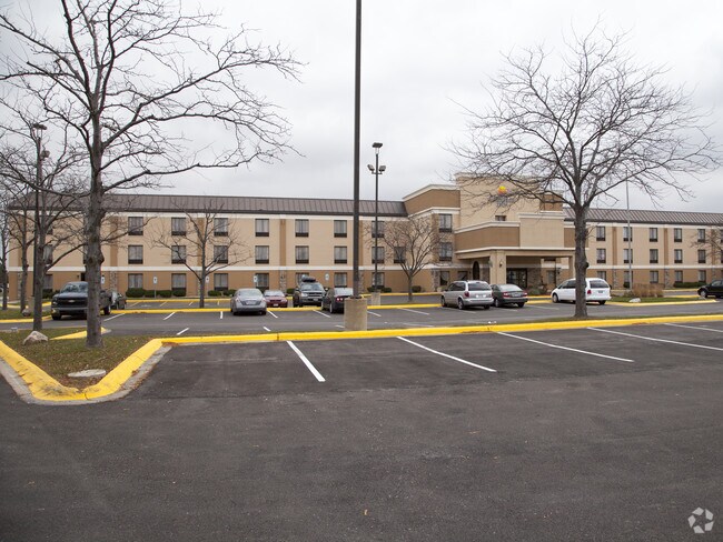
Property Detail
1500 N State Route 50
Kankakee, IL
NORTHFIELD SQUARE RESUB SW COR LOT 13 BAL 2.80AC 16-31-12E LEES INN
17-09-16-101-016
KANKAKEE
Commercialnec
Illinois
B and X Area of moderate flood hazard, usually the area between the limits of the 100-year and 500-year floods.
13
2024
2.80 AC
2025
Illinois North Area
010701
Other Market Areas
NEARBY LISTINGS FOR SALE OR LEASE
DEMOGRAPHICS near 1500 N State Route 50
1 mile
3 mile
5 mile
2025 Total Population
4,873
37,024
68,230
2030 Population
4,817
36,789
68,171
Pop Growth 2025-2030
(1.15%)
(0.63%)
(0.09%)
Average Age
39
38
39
2025 Total Households
2,000
13,745
25,600
HH Growth 2025-2030
(1.25%)
(0.76%)
(0.14%)
Median Household Inc
$81,769
$72,558
$64,628
Avg Household Size
2.40
2.50
2.50
2025 Avg HH Vehicles
2.00
2.00
2.00
Median Home Value
$207,063
$193,289
$179,759
Median Year Built
1991
1978
1971
Nearby Places
Map Layers
Map Styles
 Street
 Aerial
Layers
 Traffic
 Biking
Places
Listings with unknown addresses are not visible on the map
- Restaurants
- Banks
- Shops
- Fitness
- Groceries
PUBLIC TRANSPORTATION
COMMUTER RAIL
Kankakee (City of New Orleans - Amtrak, Illini - Amtrak, Saluki - Amtrak)
Drive
Walk
Distance
Kankakee (City of New Orleans - Amtrak, Illini - Amtrak, Saluki - Amtrak)
10 min
4.9 mi
Freight Ports
Port Milwaukee
Drive
Walk
Distance
Port Milwaukee
171 min
140.4 mi
Nearby Properties
Address
Land Use
TOTAL SIZE
Lot Size
Zoning
Address
Land Use
TOTAL SIZE
Lot Size
Zoning
Address
Land Use
TOTAL SIZE
Lot Size
Zoning
43.69 AC
Address
Land Use
TOTAL SIZE
Lot Size
Zoning
52.73 AC
I2
Address
Land Use
TOTAL SIZE
Lot Size
Zoning
Address
Land Use
TOTAL SIZE
Lot Size
Zoning
Address
Land Use
TOTAL SIZE
Lot Size
Zoning
21.07 AC
Address
Land Use
TOTAL SIZE
Lot Size
Zoning
13.96 AC
Address
Land Use
TOTAL SIZE
Lot Size
Zoning
75.44 AC
A1
Address
Land Use
TOTAL SIZE
Lot Size
Zoning
35.35 AC
C2
Address
Land Use
TOTAL SIZE
Lot Size
Zoning
18.69 AC
Address
Land Use
TOTAL SIZE
Lot Size
Zoning
44.50 AC
A1
Address
Land Use
TOTAL SIZE
Lot Size
Zoning
Address
Land Use
TOTAL SIZE
Lot Size
Zoning
Address
Land Use
TOTAL SIZE
Lot Size
Zoning
Address
Land Use
TOTAL SIZE
Lot Size
Zoning
Address
Land Use
TOTAL SIZE
Lot Size
Zoning
Address
Land Use
TOTAL SIZE
Lot Size
Zoning
Address
Land Use
TOTAL SIZE
Lot Size
Zoning
37.25 AC
A1
Address
Land Use
TOTAL SIZE
Lot Size
Zoning
27.09 AC
Address
Land Use
TOTAL SIZE
Lot Size
Zoning
13.50 AC
Address
Land Use
TOTAL SIZE
Lot Size
Zoning
Address
Land Use
TOTAL SIZE
Lot Size
Zoning
Address
Land Use
TOTAL SIZE
Lot Size
Zoning
0.92 AC
Address
Land Use
TOTAL SIZE
Lot Size
Zoning
Address
Land Use
TOTAL SIZE
Lot Size
Zoning
Address
Land Use
TOTAL SIZE
Lot Size
Zoning
23.74 AC
Address
Land Use
TOTAL SIZE
Lot Size
Zoning
Address
Land Use
TOTAL SIZE
Lot Size
Zoning
4.79 AC
Address
Land Use
TOTAL SIZE
Lot Size
Zoning
Address
Land Use
TOTAL SIZE
Lot Size
Zoning
The World's #1 Commercial Real Estate Marketplace
Connect with us
© 2026 CoStar Group
The information above has been obtained from sources believed reliable. While we do not doubt its accuracy we have not verified it and make no guarantee, warranty or representation about it. It is your responsibility to independently confirm its accuracy and completeness. Any projections, opinions, assumptions, or estimates used are for example only and do not represent the current or future performance of the property. The value of this transaction to you depends on tax and other factors which should be evaluated by your tax, financial, and legal advisors. You and your advisors should conduct a careful, independent investigation of the property to determine to your satisfaction the suitability of the property for your needs.