Property Record
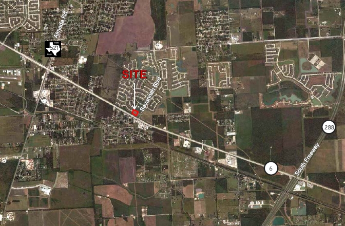
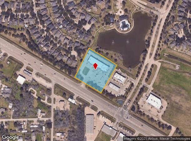
15003 Highway 6, Rosharon, TX 77583
NEARBY LISTINGS FOR SALE OR LEASE
Property Detail
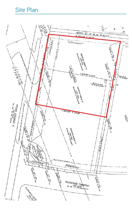
15003 Highway 6
Houston-The Woodlands-Sugar Land, TX
Ma And Sons (A0403 & A0280)
6357-0001-000
MA AND SONS (A0403 & A0280) BLK 1 LOT RESERVE A (UNRESTRICTED) ACRES 2.672
Commercialnec
Brazoria
X
Texas
48039C0105K
a
2023
2.67 AC
2023
South
6606021143
Houston
16,800 SF
DEMOGRAPHICS near 15003 Highway 6
1 Mile
3 Mile
5 Mile
2024 Total Population
6,729
45,356
132,256
2029 Population
7,675
53,814
154,774
Pop Growth 2024-2029
+ 14.06%
+ 18.65%
+ 17.03%
Average Age
34
33
35
2024 Total Households
2,021
13,654
41,025
HH Growth 2024-2029
+ 14.05%
+ 18.96%
+ 17.29%
Median Household Inc
$117,580
$79,768
$103,631
Avg Household Size
3.20
3.30
3.20
2024 Avg HH Vehicles
2.00
2.00
2.00
Median Home Value
$271,488
$240,832
$305,998
Median Year Built
2009
2010
2010
Nearby Places
- Restaurants
- Banks
- Shops
- Fitness
- Groceries
PUBLIC TRANSPORTATION
AIRPORT
William P. Hobby
DRIVE
WALK
Distance
William P. Hobby
32 min
20.5 mi
Houston George Bush Intercontinental
DRIVE
WALK
Distance
Houston George Bush Intercontinental
47 min
41.1 mi
Nearby Properties
Address
Land Use
TOTAL SIZE
Lot Size
Zoning
Address
Land Use
TOTAL SIZE
Lot Size
Zoning
70,000 SF
64.91 AC
Address
Land Use
TOTAL SIZE
Lot Size
Zoning
15.28 AC
0015
Address
Land Use
TOTAL SIZE
Lot Size
Zoning
105,790 SF
12.82 AC
X
Address
Land Use
TOTAL SIZE
Lot Size
Zoning
13.85 AC
Address
Land Use
TOTAL SIZE
Lot Size
Zoning
67,748 SF
9.28 AC
Address
Land Use
TOTAL SIZE
Lot Size
Zoning
82,400 SF
10.85 AC
I
Address
Land Use
TOTAL SIZE
Lot Size
Zoning
2,000 SF
24.84 AC
Address
Land Use
TOTAL SIZE
Lot Size
Zoning
28,633 SF
9.36 AC
Address
Land Use
TOTAL SIZE
Lot Size
Zoning
44,735 SF
120.87 AC
0010
Address
Land Use
TOTAL SIZE
Lot Size
Zoning
214,827 SF
15.70 AC
0033
Address
Land Use
TOTAL SIZE
Lot Size
Zoning
94,094 SF
5.86 AC
Address
Land Use
TOTAL SIZE
Lot Size
Zoning
127,500 SF
7.60 AC
Address
Land Use
TOTAL SIZE
Lot Size
Zoning
98,957 SF
10.70 AC
Address
Land Use
TOTAL SIZE
Lot Size
Zoning
103,673 SF
20.13 AC
0007
Address
Land Use
TOTAL SIZE
Lot Size
Zoning
75,548 SF
12.30 AC
Address
Land Use
TOTAL SIZE
Lot Size
Zoning
37,000 SF
6.06 AC
0218
Address
Land Use
TOTAL SIZE
Lot Size
Zoning
17,481 SF
12.54 AC
Address
Land Use
TOTAL SIZE
Lot Size
Zoning
Address
Land Use
TOTAL SIZE
Lot Size
Zoning
9,940 SF
2.08 AC
Address
Land Use
TOTAL SIZE
Lot Size
Zoning
29,625 SF
2.01 AC
Address
Land Use
TOTAL SIZE
Lot Size
Zoning
14,575 SF
2.13 AC
Address
Land Use
TOTAL SIZE
Lot Size
Zoning
2.92 AC
Address
Land Use
TOTAL SIZE
Lot Size
Zoning
14,543 SF
2.22 AC
Address
Land Use
TOTAL SIZE
Lot Size
Zoning
13,328 SF
5.33 AC
Address
Land Use
TOTAL SIZE
Lot Size
Zoning
9,298 SF
3.22 AC
Address
Land Use
TOTAL SIZE
Lot Size
Zoning
6,538 SF
9.85 AC
0039
Address
Land Use
TOTAL SIZE
Lot Size
Zoning
6,538 SF
4.42 AC
Address
Land Use
TOTAL SIZE
Lot Size
Zoning
25,613 SF
10.11 AC
0034
Address
Land Use
TOTAL SIZE
Lot Size
Zoning
20,770 SF
2.92 AC
XY
Address
Land Use
TOTAL SIZE
Lot Size
Zoning
67,064 SF
5 AC
0034
The World's #1 Commercial Real Estate Marketplace
Connect with us
© 2025 CoStar Group
The information above has been obtained from sources believed reliable. While we do not doubt its accuracy we have not verified it and make no guarantee, warranty or representation about it. It is your responsibility to independently confirm its accuracy and completeness. Any projections, opinions, assumptions, or estimates used are for example only and do not represent the current or future performance of the property. The value of this transaction to you depends on tax and other factors which should be evaluated by your tax, financial, and legal advisors. You and your advisors should conduct a careful, independent investigation of the property to determine to your satisfaction the suitability of the property for your needs.