Property Record
1419 Hershberger Rd Nw, Roanoke, VA 24012

NEARBY LISTINGS FOR SALE OR LEASE
Property Detail
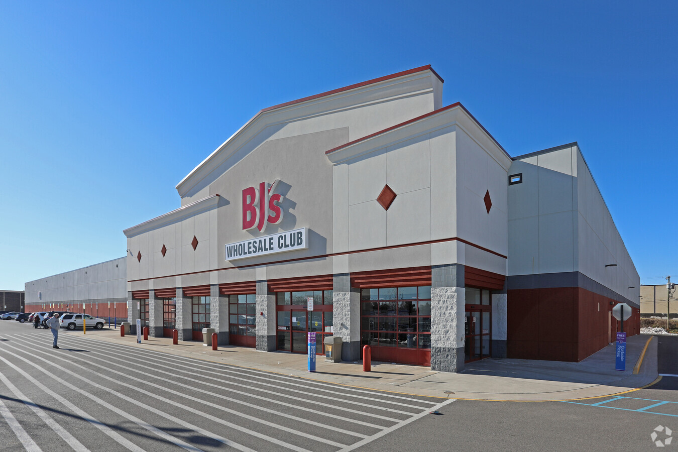
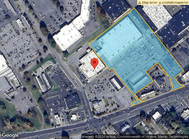
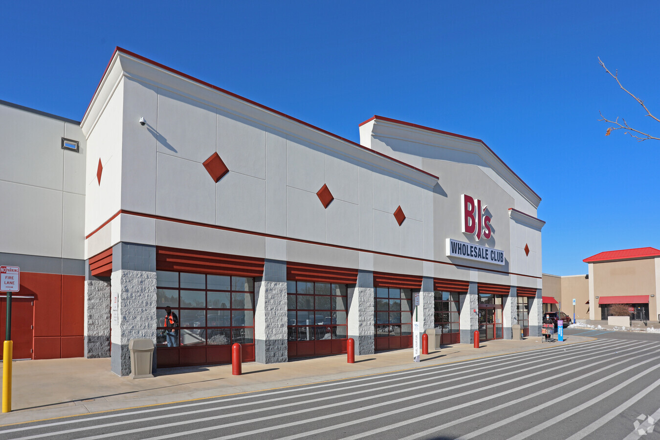
1419 Hershberger Rd Nw
666-0105
Crossroads Consumer Mall
Multipleuses
PARCEL 6A1 GREENDALE FARMS MAP
X
Roanoke City
51023C0455C
Virginia
2024
9.27 AC
2024
Northeast Roanoke
000300
Roanoke
112,165 SF
Roanoke, VA
DEMOGRAPHICS near 1419 Hershberger Rd Nw
1 Mile
3 Mile
5 Mile
2024 Total Population
6,874
58,759
127,487
2029 Population
6,712
57,860
125,941
Pop Growth 2024-2029
(2.36%)
(1.53%)
(1.21%)
Average Age
40
40
40
2024 Total Households
2,902
24,330
55,018
HH Growth 2024-2029
(2.38%)
(1.53%)
(1.25%)
Median Household Inc
$54,396
$48,689
$52,875
Avg Household Size
2.20
2.30
2.20
2024 Avg HH Vehicles
2.00
2.00
2.00
Median Home Value
$150,294
$162,638
$177,349
Median Year Built
1959
1967
1964
Nearby Places
- Restaurants
- Banks
- Shops
- Fitness
- Groceries
PUBLIC TRANSPORTATION
COMMUTER RAIL
Roanoke (Northeast Regional - Amtrak)
DRIVE
WALK
Distance
Roanoke (Northeast Regional - Amtrak)
8 min
4.5 mi
AIRPORT
Roanoke/Blacksburg Regional (Woodrum Field)
DRIVE
WALK
Distance
Roanoke/Blacksburg Regional (Woodrum Field)
5 min
1.6 mi
Freight Ports
Virginia Port Authority - Richmond
DRIVE
WALK
Distance
Virginia Port Authority - Richmond
216 min
189.1 mi
SALE & LEASE HISTORY
LISTING DATE
SALE/LEASE

Jun 17, 2020
For Sale
Jun 12, 2019
For Sale
Feb 20, 2019
For Sale
Nearby Properties
Address
Land Use
TOTAL SIZE
Lot Size
Zoning
Address
Land Use
TOTAL SIZE
Lot Size
Zoning
8,930 SF
604.76 AC
AD
Address
Land Use
TOTAL SIZE
Lot Size
Zoning
3,850 SF
60.20 AC
INPUD
Address
Land Use
TOTAL SIZE
Lot Size
Zoning
437,578 SF
14.74 AC
CLS
Address
Land Use
TOTAL SIZE
Lot Size
Zoning
96,620 SF
26.84 AC
D
Address
Land Use
TOTAL SIZE
Lot Size
Zoning
219,494 SF
12.01 AC
CLS
Address
Land Use
TOTAL SIZE
Lot Size
Zoning
49,887 SF
2.28 AC
C1
Address
Land Use
TOTAL SIZE
Lot Size
Zoning
67,486 SF
3.99 AC
RMF
Address
Land Use
TOTAL SIZE
Lot Size
Zoning
67,903 SF
11.96 AC
I2
Address
Land Use
TOTAL SIZE
Lot Size
Zoning
206,978 SF
19.45 AC
CLS
Address
Land Use
TOTAL SIZE
Lot Size
Zoning
609,211 SF
41.01 AC
I1C
Address
Land Use
TOTAL SIZE
Lot Size
Zoning
10,704 SF
12.76 AC
D
Address
Land Use
TOTAL SIZE
Lot Size
Zoning
207,812 SF
22.62 AC
CLS
Address
Land Use
TOTAL SIZE
Lot Size
Zoning
123,651 SF
29.38 AC
R2S
Address
Land Use
TOTAL SIZE
Lot Size
Zoning
164,753 SF
5.45 AC
INPUD
Address
Land Use
TOTAL SIZE
Lot Size
Zoning
10,878 SF
10.34 AC
RMF
Address
Land Use
TOTAL SIZE
Lot Size
Zoning
71,238 SF
3.62 AC
CLS
Address
Land Use
TOTAL SIZE
Lot Size
Zoning
71,590 SF
2.49 AC
CLS
Address
Land Use
TOTAL SIZE
Lot Size
Zoning
124,725 SF
6.53 AC
I1
Address
Land Use
TOTAL SIZE
Lot Size
Zoning
48,935 SF
9.15 AC
RMF
Address
Land Use
TOTAL SIZE
Lot Size
Zoning
32,080 SF
16 AC
INPUD
Address
Land Use
TOTAL SIZE
Lot Size
Zoning
2,688 SF
21.40 AC
RMF
Address
Land Use
TOTAL SIZE
Lot Size
Zoning
139,654 SF
4.77 AC
C2S
Address
Land Use
TOTAL SIZE
Lot Size
Zoning
13,128 SF
8.77 AC
RMF
Address
Land Use
TOTAL SIZE
Lot Size
Zoning
1.86 AC
CLS
Address
Land Use
TOTAL SIZE
Lot Size
Zoning
7,590 SF
14.18 AC
RMF
Address
Land Use
TOTAL SIZE
Lot Size
Zoning
198,089 SF
46.65 AC
AD
Address
Land Use
TOTAL SIZE
Lot Size
Zoning
22,950 SF
9.50 AC
R3
Address
Land Use
TOTAL SIZE
Lot Size
Zoning
162,236 SF
13.71 AC
CLS
Address
Land Use
TOTAL SIZE
Lot Size
Zoning
31,950 SF
27.34 AC
I-1
Address
Land Use
TOTAL SIZE
Lot Size
Zoning
12,018 SF
8.78 AC
RMF
The World's #1 Commercial Real Estate Marketplace
Connect with us
© 2025 CoStar Group
The information above has been obtained from sources believed reliable. While we do not doubt its accuracy we have not verified it and make no guarantee, warranty or representation about it. It is your responsibility to independently confirm its accuracy and completeness. Any projections, opinions, assumptions, or estimates used are for example only and do not represent the current or future performance of the property. The value of this transaction to you depends on tax and other factors which should be evaluated by your tax, financial, and legal advisors. You and your advisors should conduct a careful, independent investigation of the property to determine to your satisfaction the suitability of the property for your needs.