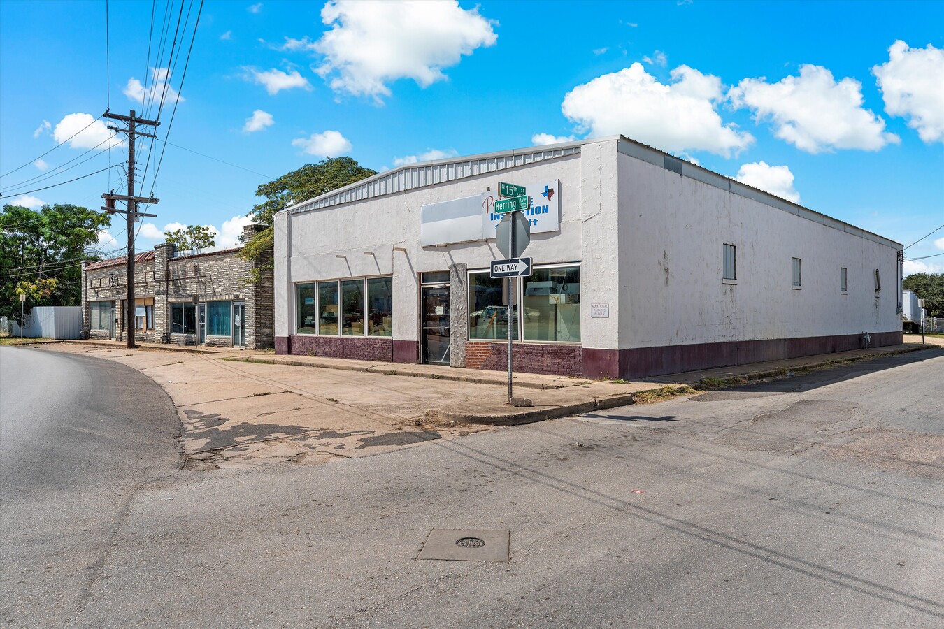
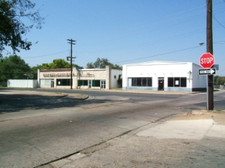
Property Record
1509 Herring Ave, Waco, TX 76708
NEARBY LISTINGS FOR SALE OR LEASE
Property Detail
1509 Herring Ave
Waco, TX
Farwell Hts
48-017600-095800-6
FARWELL HTS LOT 6 BLOCK 94 ACRES .1894
Commercialnec
Mclennan
X
Texas
48309C0360D
6
2024
0.19 AC
2024
Downtown Waco
001300
Other Market Areas
4,500 SF
DEMOGRAPHICS near 1509 Herring Ave
1 Mile
3 Mile
5 Mile
2024 Total Population
11,983
74,050
136,441
2029 Population
12,755
78,743
145,385
Pop Growth 2024-2029
+ 6.44%
+ 6.34%
+ 6.56%
Average Age
34
35
35
2024 Total Households
3,976
27,041
51,484
HH Growth 2024-2029
+ 6.61%
+ 6.87%
+ 6.90%
Median Household Inc
$37,724
$40,038
$42,251
Avg Household Size
2.80
2.50
2.40
2024 Avg HH Vehicles
2.00
2.00
2.00
Median Home Value
$77,528
$136,525
$141,516
Median Year Built
1956
1967
1972
Nearby Places
- Restaurants
- Banks
- Shops
- Fitness
- Groceries
PUBLIC TRANSPORTATION
AIRPORT
Waco Regional
DRIVE
WALK
Distance
Waco Regional
15 min
6.5 mi
Freight Ports
Port of Houston
DRIVE
WALK
Distance
Port of Houston
218 min
187.9 mi
Nearby Properties
Address
Land Use
TOTAL SIZE
Lot Size
Zoning
Address
Land Use
TOTAL SIZE
Lot Size
Zoning
93.17 AC
2007 TIF
Address
Land Use
TOTAL SIZE
Lot Size
Zoning
489,214 SF
34.05 AC
O2
Address
Land Use
TOTAL SIZE
Lot Size
Zoning
120,623 SF
55.15 AC
2007 TIF
Address
Land Use
TOTAL SIZE
Lot Size
Zoning
576,501 SF
4.21 AC
Address
Land Use
TOTAL SIZE
Lot Size
Zoning
452,498 SF
39.43 AC
C-2
Address
Land Use
TOTAL SIZE
Lot Size
Zoning
394,674 SF
21.31 AC
O2
Address
Land Use
TOTAL SIZE
Lot Size
Zoning
560,620 SF
3.70 AC
O2
Address
Land Use
TOTAL SIZE
Lot Size
Zoning
27.28 AC
C
Address
Land Use
TOTAL SIZE
Lot Size
Zoning
399,747 SF
2.86 AC
C-3,C
Address
Land Use
TOTAL SIZE
Lot Size
Zoning
9.84 AC
2007 TIF
Address
Land Use
TOTAL SIZE
Lot Size
Zoning
24.75 AC
O2
Address
Land Use
TOTAL SIZE
Lot Size
Zoning
69,809 SF
8.12 AC
2007 TIF
Address
Land Use
TOTAL SIZE
Lot Size
Zoning
188,465 SF
5.85 AC
2007 TIF
Address
Land Use
TOTAL SIZE
Lot Size
Zoning
238,580 SF
12.25 AC
R-3E
Address
Land Use
TOTAL SIZE
Lot Size
Zoning
189,545 SF
13.98 AC
O2
Address
Land Use
TOTAL SIZE
Lot Size
Zoning
213,814 SF
4.10 AC
2007 TIF
Address
Land Use
TOTAL SIZE
Lot Size
Zoning
16.78 AC
2007 TIF
Address
Land Use
TOTAL SIZE
Lot Size
Zoning
214,351 SF
19.37 AC
R3B
Address
Land Use
TOTAL SIZE
Lot Size
Zoning
53,500 SF
0.46 AC
2007 TIF
Address
Land Use
TOTAL SIZE
Lot Size
Zoning
155,900 SF
2.85 AC
O2
Address
Land Use
TOTAL SIZE
Lot Size
Zoning
7.33 AC
2007TIF
Address
Land Use
TOTAL SIZE
Lot Size
Zoning
77,089 SF
5.09 AC
O2
Address
Land Use
TOTAL SIZE
Lot Size
Zoning
167,206 SF
11.22 AC
R-3C
Address
Land Use
TOTAL SIZE
Lot Size
Zoning
84,139 SF
2.81 AC
2007 TIF
Address
Land Use
TOTAL SIZE
Lot Size
Zoning
126,592 SF
5.05 AC
2007 TIF
Address
Land Use
TOTAL SIZE
Lot Size
Zoning
124,525 SF
4.17 AC
O2
Address
Land Use
TOTAL SIZE
Lot Size
Zoning
124,874 SF
3.88 AC
2007 TIF
Address
Land Use
TOTAL SIZE
Lot Size
Zoning
221,433 SF
3.97 AC
O2
Address
Land Use
TOTAL SIZE
Lot Size
Zoning
51,175 SF
9.48 AC
2007 TIF
Address
Land Use
TOTAL SIZE
Lot Size
Zoning
4.15 AC
2007 TIF
The World's #1 Commercial Real Estate Marketplace
Connect with us
© 2025 CoStar Group
The information above has been obtained from sources believed reliable. While we do not doubt its accuracy we have not verified it and make no guarantee, warranty or representation about it. It is your responsibility to independently confirm its accuracy and completeness. Any projections, opinions, assumptions, or estimates used are for example only and do not represent the current or future performance of the property. The value of this transaction to you depends on tax and other factors which should be evaluated by your tax, financial, and legal advisors. You and your advisors should conduct a careful, independent investigation of the property to determine to your satisfaction the suitability of the property for your needs.