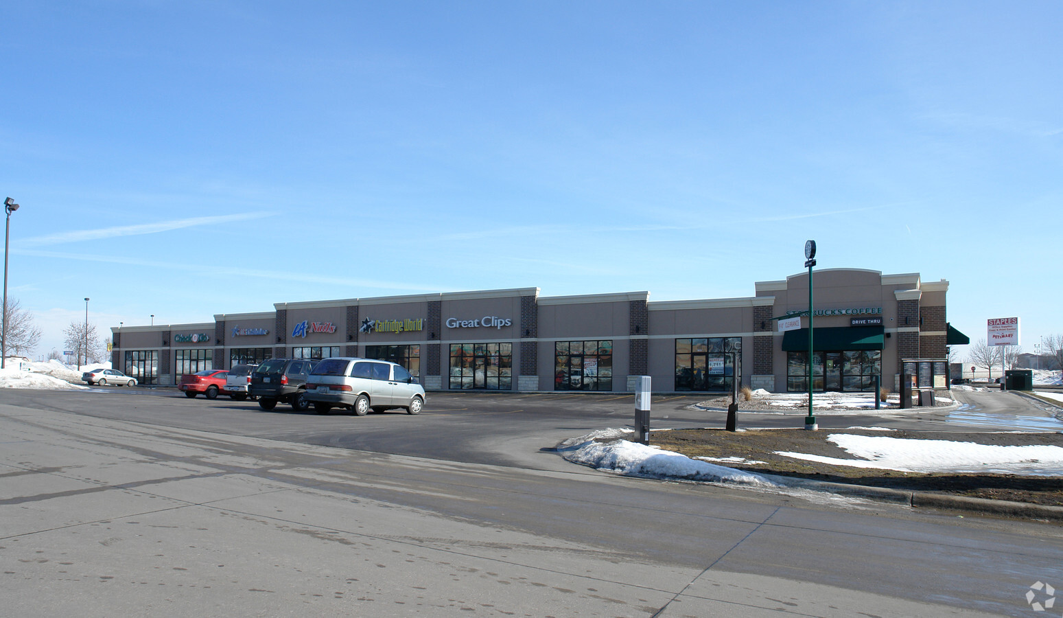
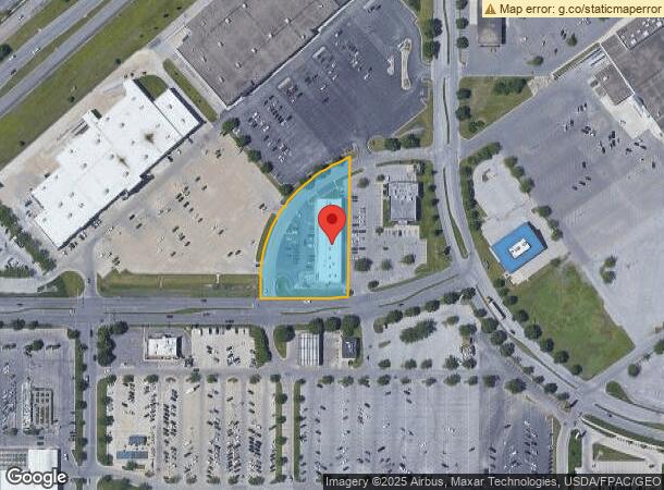
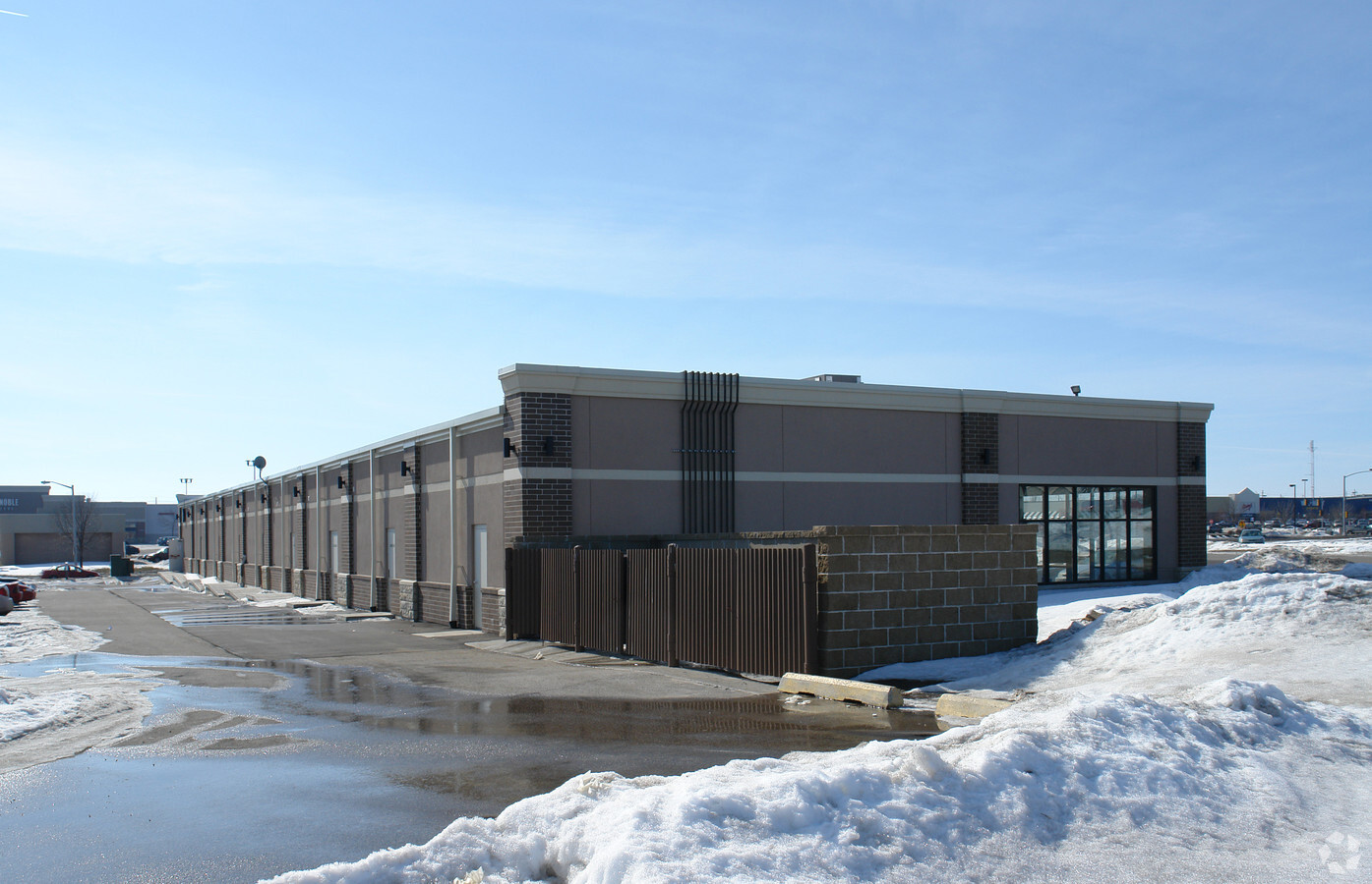
Property Record
1513 Flammang Dr, Waterloo, IA 50702
NEARBY LISTINGS FOR SALE OR LEASE
Property Detail
1513 Flammang Dr
Waterloo-Cedar Falls, IA
Crossroads Plat No 2
8813-02-376-018
CROSSROADS PLAT NO 2 LOT 3 EXC THAT PART DESC AS FOL: COM AT NE COR SAID LOT 3 TH S ALONG A CURVE CONCAVE ELY HAVING A RADIUS
Stripcommercialcenter
Black Hawk
X
Iowa
19013C0304G
3
2024
1.53 AC
2024
Iowa City/Waterloo
000900
Other Market Areas
14,370 SF
DEMOGRAPHICS near 1513 Flammang Dr
1 Mile
3 Mile
5 Mile
2024 Total Population
5,334
46,883
71,911
2029 Population
5,281
46,667
71,478
Pop Growth 2024-2029
(0.99%)
(0.46%)
(0.60%)
Average Age
39
39
39
2024 Total Households
2,455
20,214
31,001
HH Growth 2024-2029
(0.98%)
(0.41%)
(0.59%)
Median Household Inc
$51,713
$51,963
$52,265
Avg Household Size
2.10
2.20
2.20
2024 Avg HH Vehicles
2.00
2.00
2.00
Median Home Value
$154,440
$140,804
$140,688
Median Year Built
1970
1961
1962
Nearby Places
- Restaurants
- Banks
- Shops
- Fitness
- Groceries
SALE & LEASE HISTORY
LISTING DATE
SALE/LEASE

Dec 11, 2017
For Lease
Nearby Properties
Address
Land Use
TOTAL SIZE
Lot Size
Zoning
Address
Land Use
TOTAL SIZE
Lot Size
Zoning
156,098 SF
52.58 AC
Address
Land Use
TOTAL SIZE
Lot Size
Zoning
108,671 SF
3.72 AC
Address
Land Use
TOTAL SIZE
Lot Size
Zoning
185,014 SF
10.89 AC
Address
Land Use
TOTAL SIZE
Lot Size
Zoning
622 SF
106.81 AC
Address
Land Use
TOTAL SIZE
Lot Size
Zoning
172,479 SF
9.39 AC
Address
Land Use
TOTAL SIZE
Lot Size
Zoning
197,968 SF
6.10 AC
Address
Land Use
TOTAL SIZE
Lot Size
Zoning
341 SF
1.82 AC
Address
Land Use
TOTAL SIZE
Lot Size
Zoning
101,633 SF
7 AC
Address
Land Use
TOTAL SIZE
Lot Size
Zoning
202,974 SF
19.11 AC
Address
Land Use
TOTAL SIZE
Lot Size
Zoning
129,863 SF
11.40 AC
Address
Land Use
TOTAL SIZE
Lot Size
Zoning
174,244 SF
34.27 AC
Address
Land Use
TOTAL SIZE
Lot Size
Zoning
2,735 SF
158.87 AC
Address
Land Use
TOTAL SIZE
Lot Size
Zoning
59,565 SF
0.28 AC
Address
Land Use
TOTAL SIZE
Lot Size
Zoning
115,819 SF
2.07 AC
Address
Land Use
TOTAL SIZE
Lot Size
Zoning
125,340 SF
0.80 AC
Address
Land Use
TOTAL SIZE
Lot Size
Zoning
205,163 SF
15 AC
Address
Land Use
TOTAL SIZE
Lot Size
Zoning
60,496 SF
4.96 AC
Address
Land Use
TOTAL SIZE
Lot Size
Zoning
157,119 SF
15.78 AC
Address
Land Use
TOTAL SIZE
Lot Size
Zoning
77,366 SF
38.51 AC
Address
Land Use
TOTAL SIZE
Lot Size
Zoning
86,363 SF
21.46 AC
Address
Land Use
TOTAL SIZE
Lot Size
Zoning
82,449 SF
10.62 AC
Address
Land Use
TOTAL SIZE
Lot Size
Zoning
70,933 SF
27.58 AC
Address
Land Use
TOTAL SIZE
Lot Size
Zoning
102,131 SF
9.16 AC
Address
Land Use
TOTAL SIZE
Lot Size
Zoning
84,388 SF
7.79 AC
Address
Land Use
TOTAL SIZE
Lot Size
Zoning
71,035 SF
8.27 AC
Address
Land Use
TOTAL SIZE
Lot Size
Zoning
145,720 SF
17.98 AC
Address
Land Use
TOTAL SIZE
Lot Size
Zoning
Address
Land Use
TOTAL SIZE
Lot Size
Zoning
118,073 SF
15.81 AC
Address
Land Use
TOTAL SIZE
Lot Size
Zoning
385,709 SF
38.30 AC
Address
Land Use
TOTAL SIZE
Lot Size
Zoning
39,700 SF
2.98 AC
The World's #1 Commercial Real Estate Marketplace
Connect with us
© 2025 CoStar Group
The information above has been obtained from sources believed reliable. While we do not doubt its accuracy we have not verified it and make no guarantee, warranty or representation about it. It is your responsibility to independently confirm its accuracy and completeness. Any projections, opinions, assumptions, or estimates used are for example only and do not represent the current or future performance of the property. The value of this transaction to you depends on tax and other factors which should be evaluated by your tax, financial, and legal advisors. You and your advisors should conduct a careful, independent investigation of the property to determine to your satisfaction the suitability of the property for your needs.