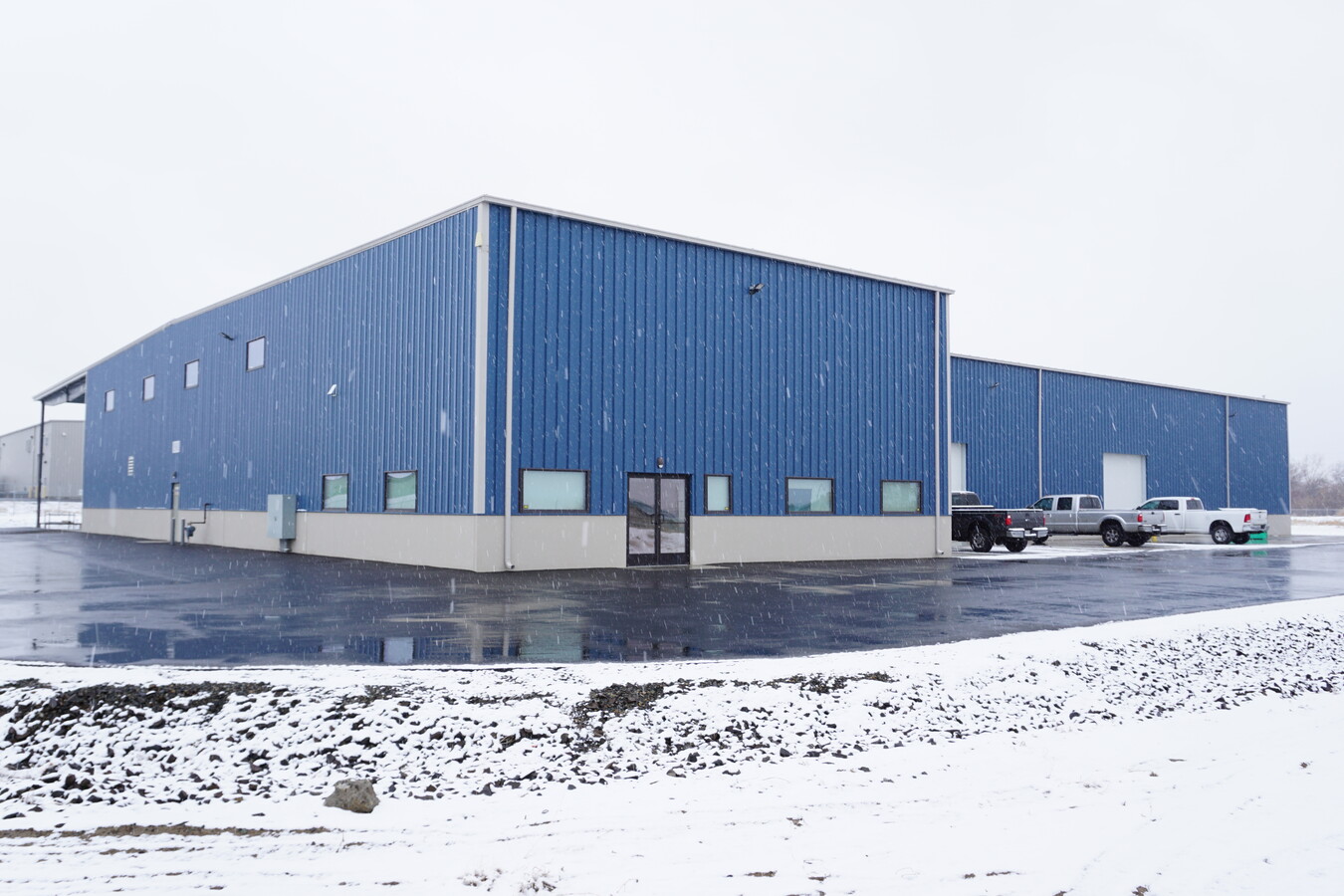
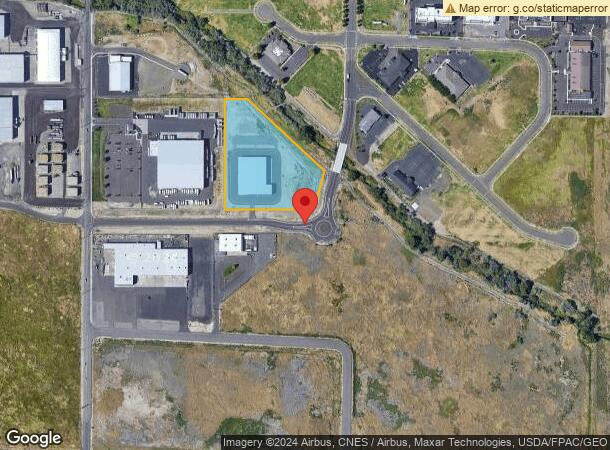
Property Record
1501 W Rose St, Yakima, WA 98903
NEARBY LISTINGS FOR SALE OR LEASE
Property Detail
1501 W Rose St
Yakima, WA
Short Plat Af 7914608
191206-33415
SECTION 06 TOWNSHIP 12 RANGE 19 QUARTER SW: SHORT PLAT AF 7914608 LOT 1
Industrialgeneral
Yakima
AE
Washington
53077C1061F
1
2024
5.41 AC
2023
Union Gap
001300
Yakima
21,500 SF
DEMOGRAPHICS near 1501 W Rose St
1 Mile
3 Mile
5 Mile
2024 Total Population
2,438
36,263
98,351
2029 Population
2,451
36,288
98,813
Pop Growth 2024-2029
+ 0.53%
+ 0.07%
+ 0.47%
Average Age
37
34
36
2024 Total Households
856
11,700
35,318
HH Growth 2024-2029
+ 0.47%
(0.03%)
+ 0.49%
Median Household Inc
$47,934
$47,857
$51,019
Avg Household Size
2.80
3.00
2.70
2024 Avg HH Vehicles
2.00
2.00
2.00
Median Home Value
$169,166
$171,654
$230,238
Median Year Built
1972
1965
1970
Nearby Places
- Restaurants
- Banks
- Shops
- Fitness
- Groceries
PUBLIC TRANSPORTATION
AIRPORT
Yakima Air Trml/McAllister Field
DRIVE
WALK
Distance
Yakima Air Trml/McAllister Field
7 min
3.2 mi
Freight Ports
Port of Tacoma
DRIVE
WALK
Distance
Port of Tacoma
189 min
160.1 mi
SALE & LEASE HISTORY
LISTING DATE
SALE/LEASE

Jan 04, 2022
For Sale
Apr 01, 2022
For Lease
Nearby Properties
Address
Land Use
TOTAL SIZE
Lot Size
Zoning
Address
Land Use
TOTAL SIZE
Lot Size
Zoning
326,323 SF
30.05 AC
R2
Address
Land Use
TOTAL SIZE
Lot Size
Zoning
347,665 SF
37.77 AC
M1
Address
Land Use
TOTAL SIZE
Lot Size
Zoning
345,698 SF
3.52 AC
COM
Address
Land Use
TOTAL SIZE
Lot Size
Zoning
208,322 SF
3.69 AC
PBD
Address
Land Use
TOTAL SIZE
Lot Size
Zoning
106,878 SF
3.46 AC
RD
Address
Land Use
TOTAL SIZE
Lot Size
Zoning
91,856 SF
92.29 AC
RD
Address
Land Use
TOTAL SIZE
Lot Size
Zoning
135,634 SF
9.84 AC
COM
Address
Land Use
TOTAL SIZE
Lot Size
Zoning
82,436 SF
11 AC
RD
Address
Land Use
TOTAL SIZE
Lot Size
Zoning
100,992 SF
9.15 AC
RD
Address
Land Use
TOTAL SIZE
Lot Size
Zoning
162,216 SF
11 AC
M1
Address
Land Use
TOTAL SIZE
Lot Size
Zoning
57,009 SF
212.58 AC
AS
Address
Land Use
TOTAL SIZE
Lot Size
Zoning
69.53 AC
SR
Address
Land Use
TOTAL SIZE
Lot Size
Zoning
128,789 SF
6.65 AC
R3
Address
Land Use
TOTAL SIZE
Lot Size
Zoning
151,831 SF
21.08 AC
CBD
Address
Land Use
TOTAL SIZE
Lot Size
Zoning
325,959 SF
11.95 AC
M2
Address
Land Use
TOTAL SIZE
Lot Size
Zoning
97,976 SF
3.98 AC
SCC
Address
Land Use
TOTAL SIZE
Lot Size
Zoning
58,008 SF
48.08 AC
PBD
Address
Land Use
TOTAL SIZE
Lot Size
Zoning
71,728 SF
2.96 AC
LCC
Address
Land Use
TOTAL SIZE
Lot Size
Zoning
126,780 SF
13.84 AC
M1
Address
Land Use
TOTAL SIZE
Lot Size
Zoning
82,422 SF
4.58 AC
COM
Address
Land Use
TOTAL SIZE
Lot Size
Zoning
80,374 SF
8.99 AC
COM
Address
Land Use
TOTAL SIZE
Lot Size
Zoning
204,600 SF
12.54 AC
W/W
Address
Land Use
TOTAL SIZE
Lot Size
Zoning
43,687 SF
3.33 AC
C2
Address
Land Use
TOTAL SIZE
Lot Size
Zoning
110,526 SF
9.70 AC
GC
Address
Land Use
TOTAL SIZE
Lot Size
Zoning
123,690 SF
12.02 AC
M1
Address
Land Use
TOTAL SIZE
Lot Size
Zoning
65,602 SF
10 AC
AS
Address
Land Use
TOTAL SIZE
Lot Size
Zoning
195,753 SF
11.66 AC
M2
Address
Land Use
TOTAL SIZE
Lot Size
Zoning
125,789 SF
7.15 AC
COM
Address
Land Use
TOTAL SIZE
Lot Size
Zoning
117,973 SF
12.70 AC
GC
Address
Land Use
TOTAL SIZE
Lot Size
Zoning
135,750 SF
10.20 AC
M2
The World's #1 Commercial Real Estate Marketplace
Connect with us
© 2025 CoStar Group
The information above has been obtained from sources believed reliable. While we do not doubt its accuracy we have not verified it and make no guarantee, warranty or representation about it. It is your responsibility to independently confirm its accuracy and completeness. Any projections, opinions, assumptions, or estimates used are for example only and do not represent the current or future performance of the property. The value of this transaction to you depends on tax and other factors which should be evaluated by your tax, financial, and legal advisors. You and your advisors should conduct a careful, independent investigation of the property to determine to your satisfaction the suitability of the property for your needs.