Property Record
1501 W Route 230 Utah 2 Pike, Middletown, PA 17057


NEARBY LISTINGS FOR SALE OR LEASE
Property Detail
1501 W Route 230 Utah 2 Pike
36-023-014
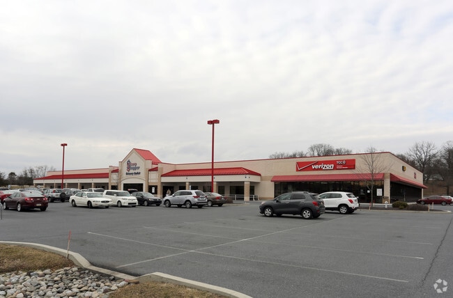
Linden Centre
Storebuilding
Dauphin
X
Pennsylvania
42133C0059F
10.64 AC
2025
Harrisburg Area East
2025
Philadelphia
023900
Harrisburg-Carlisle, PA
30,140 SF
DEMOGRAPHICS near 1501 W Route 230 Utah 2 Pike
1 Mile
3 Mile
5 Mile
2024 Total Population
2,320
25,429
72,977
2029 Population
2,310
25,837
74,313
Pop Growth 2024-2029
(0.43%)
+ 1.60%
+ 1.83%
Average Age
32
40
40
2024 Total Households
645
10,366
28,948
HH Growth 2024-2029
(1.71%)
+ 1.64%
+ 1.89%
Median Household Inc
$53,522
$64,616
$74,038
Avg Household Size
2.50
2.30
2.40
2024 Avg HH Vehicles
2.00
2.00
2.00
Median Home Value
$124,803
$160,609
$186,336
Median Year Built
1975
1970
1975
Nearby Places
Map Layers
Map Styles
 Street
 Aerial
- Restaurants
- Banks
- Shops
- Fitness
- Groceries
PUBLIC TRANSPORTATION
COMMUTER RAIL
Middletown (Keystone Service - Amtrak)
DRIVE
WALK
Distance
Middletown (Keystone Service - Amtrak)
4 min
1.5 mi
AIRPORT
Harrisburg International
DRIVE
WALK
Distance
Harrisburg International
4 min
1.3 mi
Freight Ports
Port of Baltimore
DRIVE
WALK
Distance
Port of Baltimore
119 min
85.3 mi
SALE & LEASE HISTORY
LISTING DATE
SALE/LEASE

Sep 25, 2016
For Lease
Jan 17, 2017
For Lease
Nearby Properties
Address
Land Use
TOTAL SIZE
Lot Size
Zoning
Address
Land Use
TOTAL SIZE
Lot Size
Zoning
5,737 SF
592.08 AC
Address
Land Use
TOTAL SIZE
Lot Size
Zoning
185,784 SF
173.81 AC
Address
Land Use
TOTAL SIZE
Lot Size
Zoning
72,186 SF
117.61 AC
Address
Land Use
TOTAL SIZE
Lot Size
Zoning
240,000 SF
68.73 AC
Address
Land Use
TOTAL SIZE
Lot Size
Zoning
29,440 SF
82.92 AC
Address
Land Use
TOTAL SIZE
Lot Size
Zoning
3,029 SF
54.26 AC
Address
Land Use
TOTAL SIZE
Lot Size
Zoning
142,010 SF
53.46 AC
Address
Land Use
TOTAL SIZE
Lot Size
Zoning
50,963 SF
46.61 AC
Address
Land Use
TOTAL SIZE
Lot Size
Zoning
5,396 SF
49.35 AC
Address
Land Use
TOTAL SIZE
Lot Size
Zoning
651,250 SF
47.13 AC
Address
Land Use
TOTAL SIZE
Lot Size
Zoning
40,000 SF
48.30 AC
Address
Land Use
TOTAL SIZE
Lot Size
Zoning
1,196 SF
50.34 AC
Address
Land Use
TOTAL SIZE
Lot Size
Zoning
507,000 SF
32.82 AC
Address
Land Use
TOTAL SIZE
Lot Size
Zoning
2,068 SF
19.26 AC
Address
Land Use
TOTAL SIZE
Lot Size
Zoning
348,615 SF
38.98 AC
Address
Land Use
TOTAL SIZE
Lot Size
Zoning
Address
Land Use
TOTAL SIZE
Lot Size
Zoning
165,549 SF
65.10 AC
Address
Land Use
TOTAL SIZE
Lot Size
Zoning
2,400 SF
9.11 AC
Address
Land Use
TOTAL SIZE
Lot Size
Zoning
320,000 SF
16.71 AC
Address
Land Use
TOTAL SIZE
Lot Size
Zoning
83,505 SF
11.50 AC
Address
Land Use
TOTAL SIZE
Lot Size
Zoning
18.43 AC
Address
Land Use
TOTAL SIZE
Lot Size
Zoning
249,112 SF
24.01 AC
Address
Land Use
TOTAL SIZE
Lot Size
Zoning
132,588 SF
18.49 AC
Address
Land Use
TOTAL SIZE
Lot Size
Zoning
59,760 SF
61.67 AC
Address
Land Use
TOTAL SIZE
Lot Size
Zoning
137,640 SF
12.87 AC
Address
Land Use
TOTAL SIZE
Lot Size
Zoning
3,698 SF
250.35 AC
Address
Land Use
TOTAL SIZE
Lot Size
Zoning
56.58 AC
Address
Land Use
TOTAL SIZE
Lot Size
Zoning
186,000 SF
10.58 AC
Address
Land Use
TOTAL SIZE
Lot Size
Zoning
37,224 SF
12.57 AC
Address
Land Use
TOTAL SIZE
Lot Size
Zoning
214,400 SF
14.74 AC
The World's #1 Commercial Real Estate Marketplace
Connect with us
© 2026 CoStar Group
The information above has been obtained from sources believed reliable. While we do not doubt its accuracy we have not verified it and make no guarantee, warranty or representation about it. It is your responsibility to independently confirm its accuracy and completeness. Any projections, opinions, assumptions, or estimates used are for example only and do not represent the current or future performance of the property. The value of this transaction to you depends on tax and other factors which should be evaluated by your tax, financial, and legal advisors. You and your advisors should conduct a careful, independent investigation of the property to determine to your satisfaction the suitability of the property for your needs.