Property Record
1502 S Post Rd, Shelby, NC 28152
NEARBY LISTINGS FOR SALE OR LEASE
Property Detail
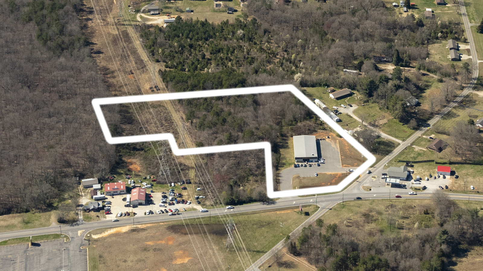
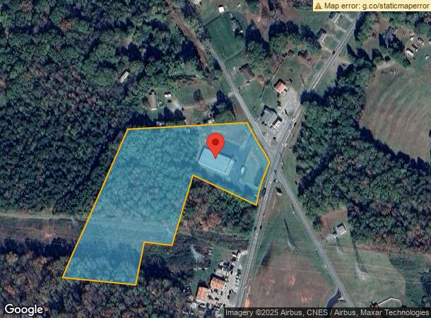
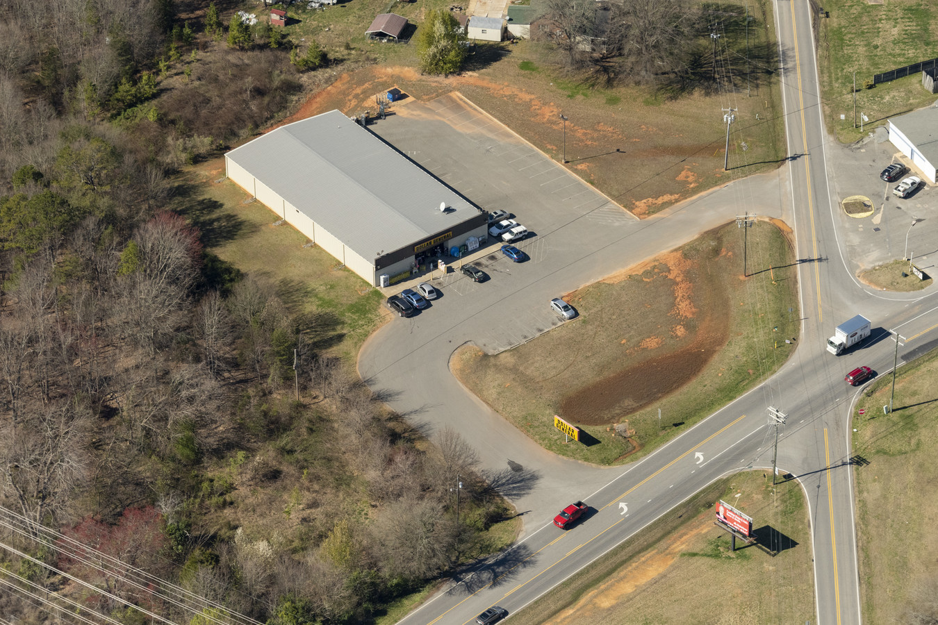
1502 S Post Rd
3127
7.92 AC HWY 226 & 180
Storebuilding
Cleveland
X
North Carolina
45021C0075D
8
2024
7.92 AC
2024
Cleveland County
951602
Charlotte
9,030 SF
Shelby, NC
DEMOGRAPHICS near 1502 S Post Rd
1 Mile
3 Mile
5 Mile
2024 Total Population
1,290
12,926
37,489
2029 Population
1,359
13,510
39,215
Pop Growth 2024-2029
+ 5.35%
+ 4.52%
+ 4.60%
Average Age
42
40
41
2024 Total Households
551
5,407
15,472
HH Growth 2024-2029
+ 5.26%
+ 4.49%
+ 4.61%
Median Household Inc
$43,958
$41,684
$43,327
Avg Household Size
2.30
2.30
2.30
2024 Avg HH Vehicles
2.00
2.00
2.00
Median Home Value
$80,750
$99,767
$133,690
Median Year Built
1976
1978
1976
Nearby Places
- Restaurants
- Banks
- Shops
- Fitness
- Groceries
SALE & LEASE HISTORY
LISTING DATE
SALE/LEASE

May 31, 2022
For Sale
Aug 18, 2019
For Sale
Nearby Properties
Address
Land Use
TOTAL SIZE
Lot Size
Zoning
Address
Land Use
TOTAL SIZE
Lot Size
Zoning
92,278 SF
41.38 AC
R10
Address
Land Use
TOTAL SIZE
Lot Size
Zoning
12.80 AC
R10
Address
Land Use
TOTAL SIZE
Lot Size
Zoning
9.55 AC
RO
Address
Land Use
TOTAL SIZE
Lot Size
Zoning
58.71 AC
R20
Address
Land Use
TOTAL SIZE
Lot Size
Zoning
8,712 SF
13.95 AC
R6
Address
Land Use
TOTAL SIZE
Lot Size
Zoning
66,184 SF
56.38 AC
ROCU
Address
Land Use
TOTAL SIZE
Lot Size
Zoning
20.38 AC
RO
Address
Land Use
TOTAL SIZE
Lot Size
Zoning
17,634 SF
20.09 AC
GB
Address
Land Use
TOTAL SIZE
Lot Size
Zoning
62.33 AC
R8
Address
Land Use
TOTAL SIZE
Lot Size
Zoning
224,162 SF
29.82 AC
GBCU
Address
Land Use
TOTAL SIZE
Lot Size
Zoning
71,644 SF
7.67 AC
GB
Address
Land Use
TOTAL SIZE
Lot Size
Zoning
8,880 SF
8.28 AC
CPD
Address
Land Use
TOTAL SIZE
Lot Size
Zoning
78,165 SF
7.41 AC
GB
Address
Land Use
TOTAL SIZE
Lot Size
Zoning
21,040 SF
22.83 AC
GB
Address
Land Use
TOTAL SIZE
Lot Size
Zoning
24,255 SF
8.28 AC
GB2
Address
Land Use
TOTAL SIZE
Lot Size
Zoning
253,504 SF
30.63 AC
LI
Address
Land Use
TOTAL SIZE
Lot Size
Zoning
91,986 SF
29.44 AC
R15
Address
Land Use
TOTAL SIZE
Lot Size
Zoning
46,948 SF
0.02 AC
GB
Address
Land Use
TOTAL SIZE
Lot Size
Zoning
134,978 SF
17.23 AC
GB2CU
Address
Land Use
TOTAL SIZE
Lot Size
Zoning
50,771 SF
2.40 AC
GB
Address
Land Use
TOTAL SIZE
Lot Size
Zoning
36,511 SF
11.16 AC
GB2
Address
Land Use
TOTAL SIZE
Lot Size
Zoning
10,406 SF
1.68 AC
GB
Address
Land Use
TOTAL SIZE
Lot Size
Zoning
37,580 SF
2 AC
GB
Address
Land Use
TOTAL SIZE
Lot Size
Zoning
7.90 AC
R10
Address
Land Use
TOTAL SIZE
Lot Size
Zoning
34,448 SF
1.65 AC
GB
Address
Land Use
TOTAL SIZE
Lot Size
Zoning
946 SF
8.49 AC
R6
Address
Land Use
TOTAL SIZE
Lot Size
Zoning
53,684 SF
20.06 AC
GB
Address
Land Use
TOTAL SIZE
Lot Size
Zoning
159,172 SF
30.75 AC
GB
Address
Land Use
TOTAL SIZE
Lot Size
Zoning
27,014 SF
9.93 AC
GB
Address
Land Use
TOTAL SIZE
Lot Size
Zoning
21,208 SF
5.65 AC
GB
The World's #1 Commercial Real Estate Marketplace
Connect with us
© 2025 CoStar Group
The information above has been obtained from sources believed reliable. While we do not doubt its accuracy we have not verified it and make no guarantee, warranty or representation about it. It is your responsibility to independently confirm its accuracy and completeness. Any projections, opinions, assumptions, or estimates used are for example only and do not represent the current or future performance of the property. The value of this transaction to you depends on tax and other factors which should be evaluated by your tax, financial, and legal advisors. You and your advisors should conduct a careful, independent investigation of the property to determine to your satisfaction the suitability of the property for your needs.