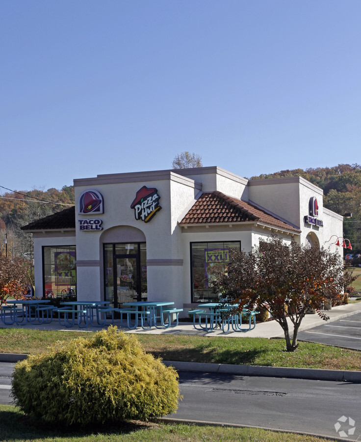
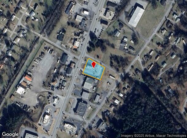
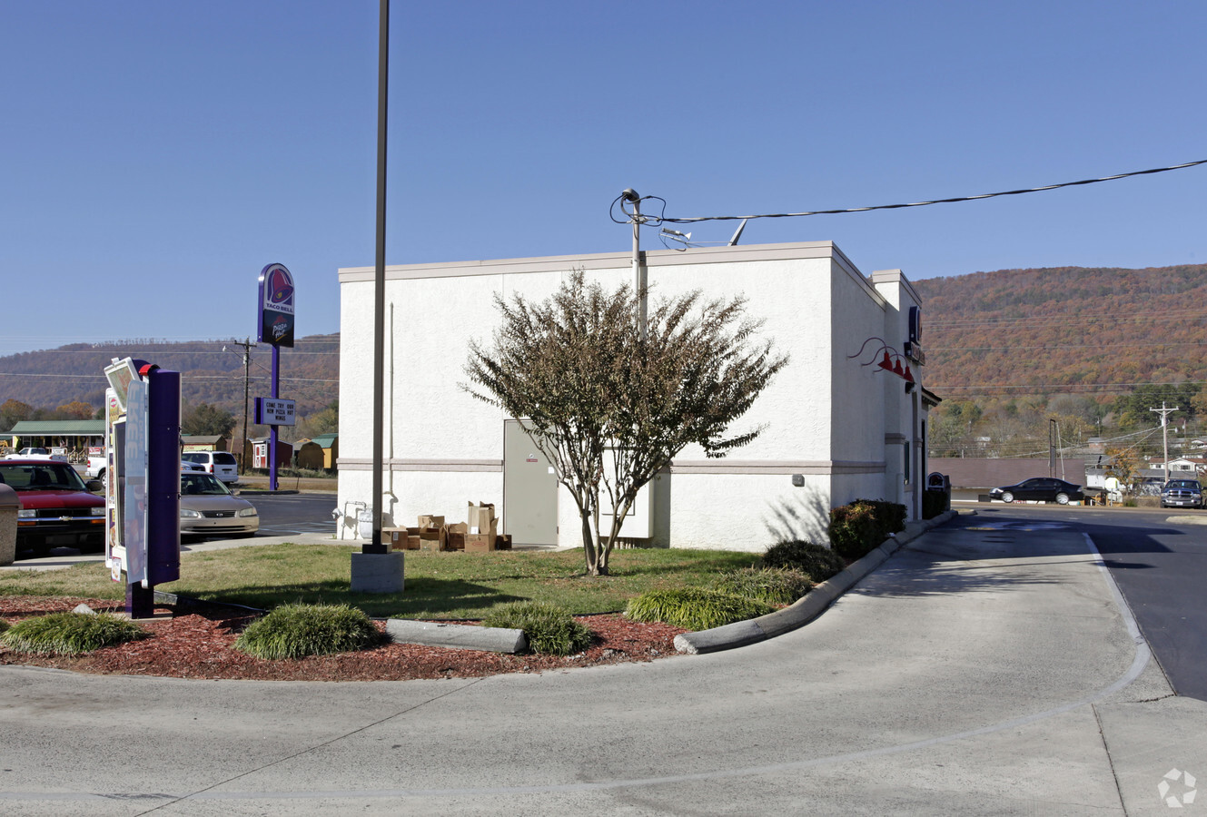
Property Record
15070 Rankin Ave, Dunlap, TN 37327
NEARBY LISTINGS FOR SALE OR LEASE
-
-
View all Dunlap listings for sale on LoopNet.com
Property Detail
15070 Rankin Ave
Chattanooga, TN-GA
South Dunlap V
048M-D-001.04
DISTRICT: 4; SUBDIVISION: SOUTH DUNLAP V
Restaurantdrivein
Sequatchie
X
Tennessee
47153C0157C
10
2023
0.73 AC
2023
Sequatchie County
060104
Chattanooga
1,619 SF
DEMOGRAPHICS near 15070 Rankin Ave
1 Mile
3 Mile
5 Mile
2024 Total Population
2,552
7,030
10,115
2029 Population
2,931
8,066
11,614
Pop Growth 2024-2029
+ 14.85%
+ 14.74%
+ 14.82%
Average Age
41
42
42
2024 Total Households
954
2,680
3,903
HH Growth 2024-2029
+ 14.68%
+ 14.51%
+ 14.55%
Median Household Inc
$43,921
$44,230
$46,006
Avg Household Size
2.50
2.50
2.50
2024 Avg HH Vehicles
2.00
2.00
2.00
Median Home Value
$156,451
$164,546
$172,936
Median Year Built
1992
1993
1994
Nearby Places
- Restaurants
- Banks
- Shops
- Fitness
- Groceries
PUBLIC TRANSPORTATION
AIRPORT
Lovell Field
DRIVE
WALK
Distance
Lovell Field
59 min
44.7 mi
Freight Ports
Georgia Ports - Savannah
DRIVE
WALK
Distance
Georgia Ports - Savannah
452 min
394.2 mi
Nearby Properties
Address
Land Use
TOTAL SIZE
Lot Size
Zoning
Address
Land Use
TOTAL SIZE
Lot Size
Zoning
109,700 SF
11.27 AC
Address
Land Use
TOTAL SIZE
Lot Size
Zoning
11,968 SF
8.60 AC
Address
Land Use
TOTAL SIZE
Lot Size
Zoning
13,161 SF
2 AC
FLOOD
Address
Land Use
TOTAL SIZE
Lot Size
Zoning
182,578 SF
35 AC
FLOOD
Address
Land Use
TOTAL SIZE
Lot Size
Zoning
18,182 SF
7.10 AC
FLOOD
Address
Land Use
TOTAL SIZE
Lot Size
Zoning
24,597 SF
5.20 AC
Address
Land Use
TOTAL SIZE
Lot Size
Zoning
225,200 SF
24.31 AC
FLOOD
Address
Land Use
TOTAL SIZE
Lot Size
Zoning
13.10 AC
Address
Land Use
TOTAL SIZE
Lot Size
Zoning
2,920.20 AC
FLOOD
Address
Land Use
TOTAL SIZE
Lot Size
Zoning
14,000 SF
3.08 AC
Address
Land Use
TOTAL SIZE
Lot Size
Zoning
41,100 SF
2.85 AC
FLOOD
Address
Land Use
TOTAL SIZE
Lot Size
Zoning
37.80 AC
Address
Land Use
TOTAL SIZE
Lot Size
Zoning
2,879.50 AC
FLOOD
Address
Land Use
TOTAL SIZE
Lot Size
Zoning
9,960 SF
1.38 AC
FLOOD
Address
Land Use
TOTAL SIZE
Lot Size
Zoning
20,332 SF
10.90 AC
FLOOD
Address
Land Use
TOTAL SIZE
Lot Size
Zoning
6,267 SF
10 AC
FLOOD
Address
Land Use
TOTAL SIZE
Lot Size
Zoning
34,320 SF
3 AC
Address
Land Use
TOTAL SIZE
Lot Size
Zoning
15,180 SF
2.76 AC
Address
Land Use
TOTAL SIZE
Lot Size
Zoning
2,077.40 AC
FLOOD
Address
Land Use
TOTAL SIZE
Lot Size
Zoning
3,614 SF
5.35 AC
Address
Land Use
TOTAL SIZE
Lot Size
Zoning
1,430 AC
FLOOD
Address
Land Use
TOTAL SIZE
Lot Size
Zoning
12,872 SF
1.97 AC
Address
Land Use
TOTAL SIZE
Lot Size
Zoning
65,754 SF
6.60 AC
FLOOD
Address
Land Use
TOTAL SIZE
Lot Size
Zoning
2,464 SF
26.15 AC
FLOOD
Address
Land Use
TOTAL SIZE
Lot Size
Zoning
12,033 SF
0.30 AC
FLOOD
Address
Land Use
TOTAL SIZE
Lot Size
Zoning
3,696 SF
1.10 AC
FLOOD
Address
Land Use
TOTAL SIZE
Lot Size
Zoning
10,220 SF
0.39 AC
FLOOD
Address
Land Use
TOTAL SIZE
Lot Size
Zoning
1,592 AC
Address
Land Use
TOTAL SIZE
Lot Size
Zoning
31.60 AC
FLOOD
Address
Land Use
TOTAL SIZE
Lot Size
Zoning
14,698 SF
1.47 AC
FLOOD
The World's #1 Commercial Real Estate Marketplace
Connect with us
© 2025 CoStar Group
The information above has been obtained from sources believed reliable. While we do not doubt its accuracy we have not verified it and make no guarantee, warranty or representation about it. It is your responsibility to independently confirm its accuracy and completeness. Any projections, opinions, assumptions, or estimates used are for example only and do not represent the current or future performance of the property. The value of this transaction to you depends on tax and other factors which should be evaluated by your tax, financial, and legal advisors. You and your advisors should conduct a careful, independent investigation of the property to determine to your satisfaction the suitability of the property for your needs.