Property Record
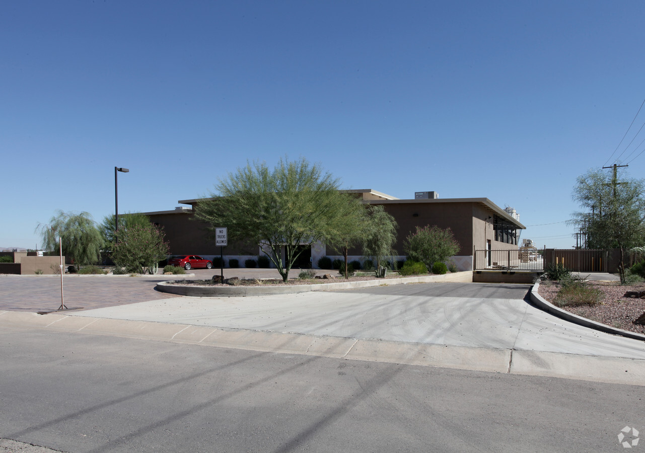
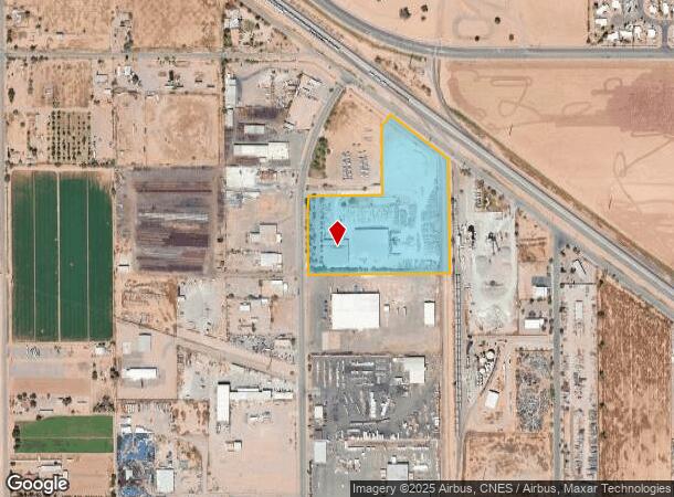
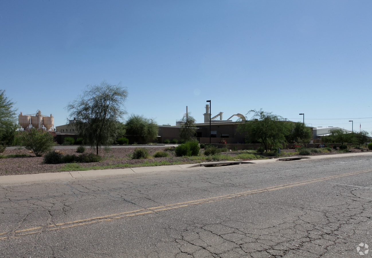
1508 N Vip Blvd, Casa Grande, AZ 85122

NEARBY LISTINGS FOR SALE OR LEASE
Property Detail
1508 N Vip Blvd
503-46-042B
COM @ N4 SEC 24-6S-5E TH S-S565.15 TO POB TH CONT S-712.94 TH W-8 39.94 TH N-325.21 TO NON-TANG CURVE W/ RAD 1263.39 A DIST 167.32 TH E-431.43 TH N-406.57 TH N 36D E-87.17 TH S 53D E
Lightindustrial
Pinal
X
Arizona
04021C1170E
12.47 AC
2024
Pinal County
2025
Phoenix
001306
Phoenix-Mesa-Scottsdale, AZ
57,568 SF
DEMOGRAPHICS near 1508 N Vip Blvd
1 Mile
3 Mile
5 Mile
2024 Total Population
873
25,652
58,903
2029 Population
1,097
32,408
74,650
Pop Growth 2024-2029
+ 25.66%
+ 26.34%
+ 26.73%
Average Age
48
39
39
2024 Total Households
355
9,322
21,157
HH Growth 2024-2029
+ 23.66%
+ 25.83%
+ 26.23%
Median Household Inc
$47,904
$53,411
$61,439
Avg Household Size
2.50
2.70
2.70
2024 Avg HH Vehicles
2.00
2.00
2.00
Median Home Value
$75,806
$180,327
$228,841
Median Year Built
1977
1990
2000
Nearby Places
- Restaurants
- Banks
- Shops
- Fitness
- Groceries
PUBLIC TRANSPORTATION
AIRPORT
Phoenix-Mesa Gateway
DRIVE
WALK
Distance
Phoenix-Mesa Gateway
66 min
42.6 mi
Freight Ports
Port of San Diego
DRIVE
WALK
Distance
Port of San Diego
377 min
343.9 mi
Nearby Properties
Address
Land Use
TOTAL SIZE
Lot Size
Zoning
Address
Land Use
TOTAL SIZE
Lot Size
Zoning
3,431,931 SF
47.73 AC
Address
Land Use
TOTAL SIZE
Lot Size
Zoning
615,446 SF
88.25 AC
Address
Land Use
TOTAL SIZE
Lot Size
Zoning
877,742 SF
125.20 AC
UNDESIGNAT
Address
Land Use
TOTAL SIZE
Lot Size
Zoning
525,773 SF
27.24 AC
UNDESIGNAT
Address
Land Use
TOTAL SIZE
Lot Size
Zoning
223,443 SF
176.81 AC
Address
Land Use
TOTAL SIZE
Lot Size
Zoning
380,964 SF
36.62 AC
UNDESIGNAT
Address
Land Use
TOTAL SIZE
Lot Size
Zoning
286,759 SF
37.76 AC
UNDESIGNAT
Address
Land Use
TOTAL SIZE
Lot Size
Zoning
123,963 SF
15.43 AC
UNDESIGNAT
Address
Land Use
TOTAL SIZE
Lot Size
Zoning
172,746 SF
14.70 AC
UNDESIGNAT
Address
Land Use
TOTAL SIZE
Lot Size
Zoning
264,993 SF
26.48 AC
Address
Land Use
TOTAL SIZE
Lot Size
Zoning
93,477 SF
4.22 AC
UNDESIGNAT
Address
Land Use
TOTAL SIZE
Lot Size
Zoning
111,066 SF
5.04 AC
UNDESIGNAT
Address
Land Use
TOTAL SIZE
Lot Size
Zoning
100,149 SF
10.59 AC
Address
Land Use
TOTAL SIZE
Lot Size
Zoning
395,597 SF
13.81 AC
Address
Land Use
TOTAL SIZE
Lot Size
Zoning
0.12 AC
Address
Land Use
TOTAL SIZE
Lot Size
Zoning
33.70 AC
Address
Land Use
TOTAL SIZE
Lot Size
Zoning
67,163 SF
24.27 AC
UNDESIGNAT
Address
Land Use
TOTAL SIZE
Lot Size
Zoning
32 AC
UNDESIGNAT
Address
Land Use
TOTAL SIZE
Lot Size
Zoning
840 SF
80 AC
Address
Land Use
TOTAL SIZE
Lot Size
Zoning
51,866 SF
5.88 AC
UNDESIGNAT
Address
Land Use
TOTAL SIZE
Lot Size
Zoning
48,543 SF
3.04 AC
UNDESIGNAT
Address
Land Use
TOTAL SIZE
Lot Size
Zoning
15,122 SF
114.70 AC
UNDESIGNAT
Address
Land Use
TOTAL SIZE
Lot Size
Zoning
711 SF
67.24 AC
UNDESIGNAT
Address
Land Use
TOTAL SIZE
Lot Size
Zoning
53,952 SF
10 AC
Address
Land Use
TOTAL SIZE
Lot Size
Zoning
127,626 SF
19.13 AC
UNDESIGNAT
Address
Land Use
TOTAL SIZE
Lot Size
Zoning
Address
Land Use
TOTAL SIZE
Lot Size
Zoning
151 AC
UNDESIGNAT
Address
Land Use
TOTAL SIZE
Lot Size
Zoning
303,129 SF
4.03 AC
UNDESIGNAT
The World's #1 Commercial Real Estate Marketplace
Connect with us
© 2025 CoStar Group
The information above has been obtained from sources believed reliable. While we do not doubt its accuracy we have not verified it and make no guarantee, warranty or representation about it. It is your responsibility to independently confirm its accuracy and completeness. Any projections, opinions, assumptions, or estimates used are for example only and do not represent the current or future performance of the property. The value of this transaction to you depends on tax and other factors which should be evaluated by your tax, financial, and legal advisors. You and your advisors should conduct a careful, independent investigation of the property to determine to your satisfaction the suitability of the property for your needs.