Property Record
1509 Cupples Rd, San Antonio, TX 78226


NEARBY LISTINGS FOR SALE OR LEASE
-
-
View all San Antonio listings for sale on LoopNet.com
Property Detail
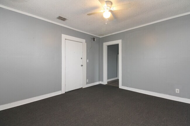
1509 Cupples Rd
San Antonio-New Braunfels, TX
Conv A/S Code
11312-008-0101
NCB 11312 BLK 8 LOT W IRR 134.82 FT OF 10
Multifamilydwelling
Bexar
X
Texas
48029C0395G
101
2024
0.14 AC
2025
Thompson
160702
San Antonio
5,520 SF
DEMOGRAPHICS near 1509 Cupples Rd
1 Mile
3 Mile
5 Mile
2024 Total Population
11,306
110,256
316,754
2029 Population
12,009
116,741
336,015
Pop Growth 2024-2029
+ 6.22%
+ 5.88%
+ 6.08%
Average Age
38
37
37
2024 Total Households
3,922
36,212
104,716
HH Growth 2024-2029
+ 6.53%
+ 6.07%
+ 6.55%
Median Household Inc
$32,822
$35,583
$38,492
Avg Household Size
2.80
2.90
2.80
2024 Avg HH Vehicles
2.00
2.00
2.00
Median Home Value
$97,821
$83,342
$112,148
Median Year Built
1963
1957
1961
Nearby Places
Map Layers
Map Styles
 Street
 Aerial
- Restaurants
- Banks
- Shops
- Fitness
- Groceries
PUBLIC TRANSPORTATION
COMMUTER RAIL
San Antonio Amtrak Station (Sunset Limited - Amtrak, Texas Eagle - Amtrak)
DRIVE
WALK
Distance
San Antonio Amtrak Station (Sunset Limited - Amtrak, Texas Eagle - Amtrak)
11 min
7.1 mi
AIRPORT
San Antonio International
DRIVE
WALK
Distance
San Antonio International
20 min
13.4 mi
Freight Ports
Calhoun Port
DRIVE
WALK
Distance
Calhoun Port
184 min
150.0 mi
SALE & LEASE HISTORY
LISTING DATE
SALE/LEASE

Mar 08, 2023
For Sale
Nearby Properties
Address
Land Use
TOTAL SIZE
Lot Size
Zoning
Address
Land Use
TOTAL SIZE
Lot Size
Zoning
180,980 SF
1,373.90 AC
Address
Land Use
TOTAL SIZE
Lot Size
Zoning
548,048 SF
27.53 AC
Address
Land Use
TOTAL SIZE
Lot Size
Zoning
176,336 SF
18.74 AC
Address
Land Use
TOTAL SIZE
Lot Size
Zoning
442,263 SF
37.97 AC
Address
Land Use
TOTAL SIZE
Lot Size
Zoning
352,890 SF
19.97 AC
Address
Land Use
TOTAL SIZE
Lot Size
Zoning
245,371 SF
20.50 AC
Address
Land Use
TOTAL SIZE
Lot Size
Zoning
306,922 SF
32.07 AC
Address
Land Use
TOTAL SIZE
Lot Size
Zoning
223,148 SF
19.15 AC
Address
Land Use
TOTAL SIZE
Lot Size
Zoning
102,456 SF
7.35 AC
Address
Land Use
TOTAL SIZE
Lot Size
Zoning
218,003 SF
12.33 AC
Address
Land Use
TOTAL SIZE
Lot Size
Zoning
Address
Land Use
TOTAL SIZE
Lot Size
Zoning
251,400 SF
10.62 AC
Address
Land Use
TOTAL SIZE
Lot Size
Zoning
247.88 AC
Address
Land Use
TOTAL SIZE
Lot Size
Zoning
231,592 SF
47.96 AC
Address
Land Use
TOTAL SIZE
Lot Size
Zoning
143,067 SF
11.69 AC
Address
Land Use
TOTAL SIZE
Lot Size
Zoning
166,270 SF
13.95 AC
Address
Land Use
TOTAL SIZE
Lot Size
Zoning
141,606 SF
13.74 AC
Address
Land Use
TOTAL SIZE
Lot Size
Zoning
360,000 SF
0.01 AC
Address
Land Use
TOTAL SIZE
Lot Size
Zoning
109,591 SF
5.65 AC
Address
Land Use
TOTAL SIZE
Lot Size
Zoning
197,650 SF
20.69 AC
Address
Land Use
TOTAL SIZE
Lot Size
Zoning
47.74 AC
Address
Land Use
TOTAL SIZE
Lot Size
Zoning
48,688 SF
7.77 AC
Address
Land Use
TOTAL SIZE
Lot Size
Zoning
196,328 SF
7.83 AC
Address
Land Use
TOTAL SIZE
Lot Size
Zoning
258,170 SF
17.89 AC
Address
Land Use
TOTAL SIZE
Lot Size
Zoning
275,840 SF
10.06 AC
Address
Land Use
TOTAL SIZE
Lot Size
Zoning
206,832 SF
31.78 AC
Address
Land Use
TOTAL SIZE
Lot Size
Zoning
86,352 SF
5.05 AC
Address
Land Use
TOTAL SIZE
Lot Size
Zoning
82,465 SF
1.19 AC
Address
Land Use
TOTAL SIZE
Lot Size
Zoning
115,316 SF
10.94 AC
Address
Land Use
TOTAL SIZE
Lot Size
Zoning
197,298 SF
18.64 AC
The World's #1 Commercial Real Estate Marketplace
Connect with us
© 2025 CoStar Group
The information above has been obtained from sources believed reliable. While we do not doubt its accuracy we have not verified it and make no guarantee, warranty or representation about it. It is your responsibility to independently confirm its accuracy and completeness. Any projections, opinions, assumptions, or estimates used are for example only and do not represent the current or future performance of the property. The value of this transaction to you depends on tax and other factors which should be evaluated by your tax, financial, and legal advisors. You and your advisors should conduct a careful, independent investigation of the property to determine to your satisfaction the suitability of the property for your needs.