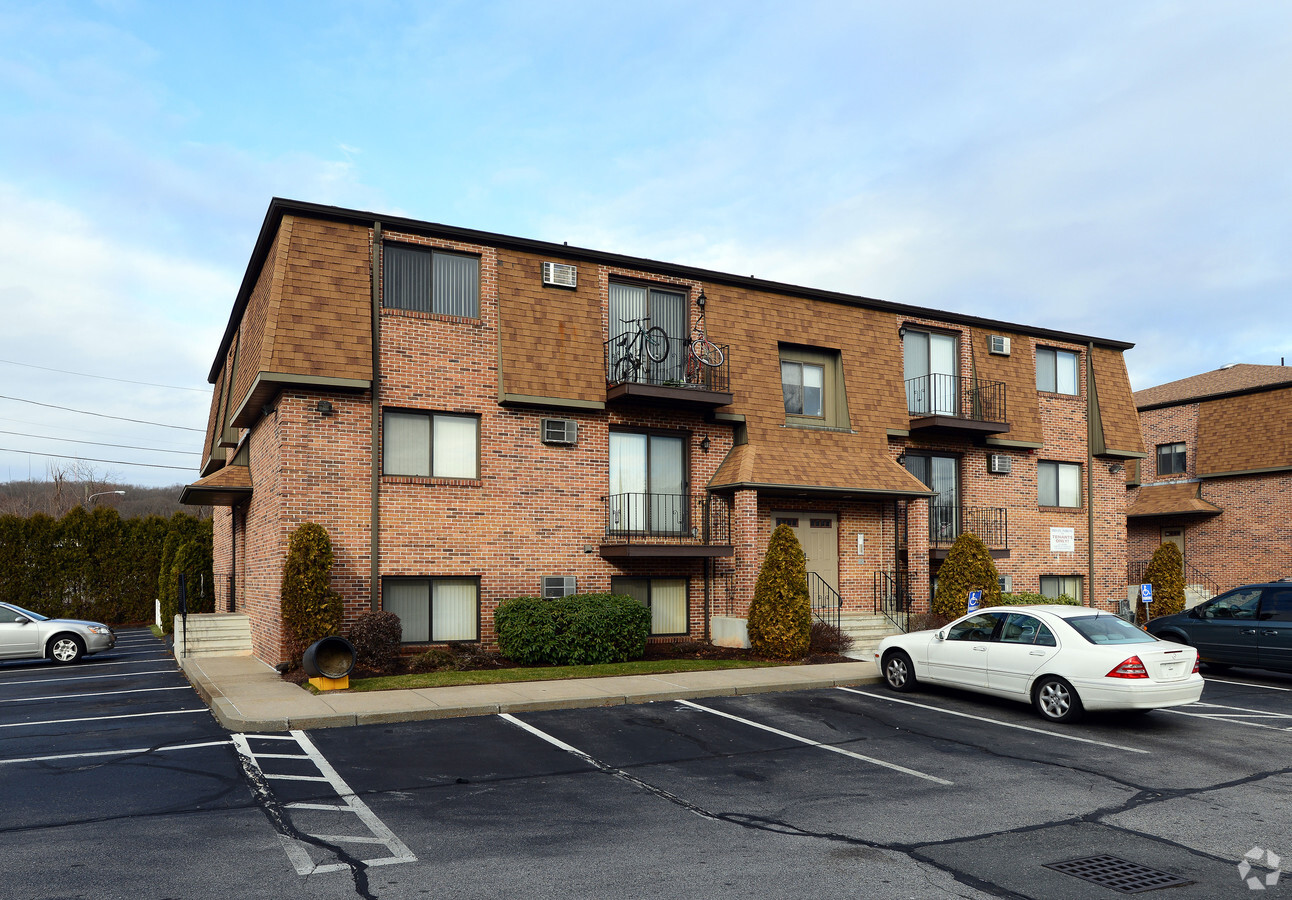
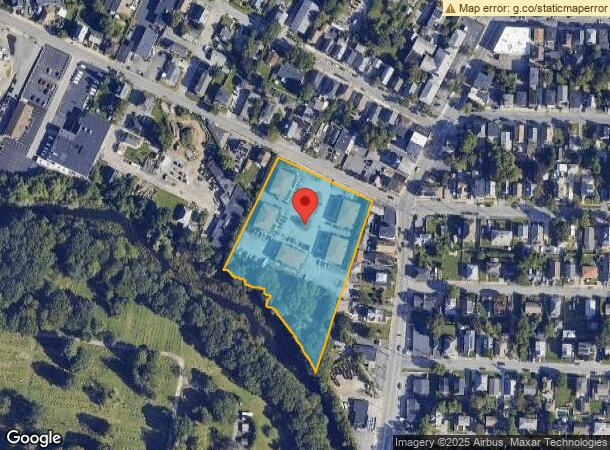
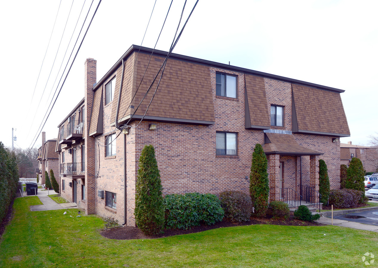
Property Record
151 Farmington Ave, Cranston, RI 02920
NEARBY LISTINGS FOR SALE OR LEASE
Property Detail
151 Farmington Ave
CRAN-000008-000004-000014
Providence
Apartment
Rhode Island
AE
14
44007C0312H
2.98 AC
2024
Outer Southeastern Providence County
2024
Providence
014700
Providence-Warwick, RI-MA
DEMOGRAPHICS near 151 Farmington Ave
1 Mile
3 Mile
5 Mile
2024 Total Population
26,761
185,667
355,600
2029 Population
26,086
183,389
352,813
Pop Growth 2024-2029
(2.52%)
(1.23%)
(0.78%)
Average Age
36
38
39
2024 Total Households
9,035
71,695
139,875
HH Growth 2024-2029
(2.55%)
(1.10%)
(0.71%)
Median Household Inc
$54,695
$59,667
$65,944
Avg Household Size
2.80
2.40
2.40
2024 Avg HH Vehicles
2.00
1.00
2.00
Median Home Value
$264,870
$277,240
$297,810
Median Year Built
1948
1950
1953
Nearby Places
- Restaurants
- Banks
- Shops
- Fitness
- Groceries
PUBLIC TRANSPORTATION
COMMUTER RAIL
Providence (Providence/Stoughton Line - Massachusetts Bay Transportation Authority Commuter Rail (Purple Line))
DRIVE
WALK
Distance
Providence (Providence/Stoughton Line - Massachusetts Bay Transportation Authority Commuter Rail (Purple Line))
6 min
3.6 mi
Tf Green Airport (Providence/Stoughton Line - MBTA)
DRIVE
WALK
Distance
Tf Green Airport (Providence/Stoughton Line - MBTA)
14 min
7.4 mi
AIRPORT
Rhode Island Tf Green International
DRIVE
WALK
Distance
Rhode Island Tf Green International
18 min
8.6 mi
Freight Ports
Port of Davisville, RI
DRIVE
WALK
Distance
Port of Davisville, RI
32 min
19.5 mi
Nearby Properties
Address
Land Use
TOTAL SIZE
Lot Size
Zoning
Address
Land Use
TOTAL SIZE
Lot Size
Zoning
15.88 AC
D-1-75
Address
Land Use
TOTAL SIZE
Lot Size
Zoning
21.60 AC
I-1-20
Address
Land Use
TOTAL SIZE
Lot Size
Zoning
37.67 AC
R-3
Address
Land Use
TOTAL SIZE
Lot Size
Zoning
162,816 SF
16.52 AC
D-1-10
Address
Land Use
TOTAL SIZE
Lot Size
Zoning
4.14 AC
D-1-30
Address
Land Use
TOTAL SIZE
Lot Size
Zoning
212.38 AC
R1
Address
Land Use
TOTAL SIZE
Lot Size
Zoning
32.48 AC
I-2
Address
Land Use
TOTAL SIZE
Lot Size
Zoning
12.41 AC
D-1-10
Address
Land Use
TOTAL SIZE
Lot Size
Zoning
20.04 AC
I-2
Address
Land Use
TOTAL SIZE
Lot Size
Zoning
8.93 AC
OS
Address
Land Use
TOTAL SIZE
Lot Size
Zoning
233,468 SF
1.55 AC
I-1-20
Address
Land Use
TOTAL SIZE
Lot Size
Zoning
268,679 SF
8.64 AC
I-1-75
Address
Land Use
TOTAL SIZE
Lot Size
Zoning
20.05 AC
I-2
Address
Land Use
TOTAL SIZE
Lot Size
Zoning
314,273 SF
D-1-20
Address
Land Use
TOTAL SIZE
Lot Size
Zoning
26.08 AC
PS
Address
Land Use
TOTAL SIZE
Lot Size
Zoning
Address
Land Use
TOTAL SIZE
Lot Size
Zoning
28.92 AC
PS
Address
Land Use
TOTAL SIZE
Lot Size
Zoning
9.06 AC
PS
Address
Land Use
TOTAL SIZE
Lot Size
Zoning
202,461 SF
1.64 AC
D-1-10
Address
Land Use
TOTAL SIZE
Lot Size
Zoning
244,872 SF
1.25 AC
D-1-12
Address
Land Use
TOTAL SIZE
Lot Size
Zoning
93.51 AC
PUD
Address
Land Use
TOTAL SIZE
Lot Size
Zoning
3.44 AC
D-1-20
Address
Land Use
TOTAL SIZE
Lot Size
Zoning
394,538 SF
0.94 AC
D-1-30
Address
Land Use
TOTAL SIZE
Lot Size
Zoning
396,000 SF
0.12 AC
D-1-30
Address
Land Use
TOTAL SIZE
Lot Size
Zoning
293,736 SF
1.24 AC
D-1-75
Address
Land Use
TOTAL SIZE
Lot Size
Zoning
367,374 SF
0.55 AC
D-1-30
Address
Land Use
TOTAL SIZE
Lot Size
Zoning
29,603 SF
1.28 AC
I-2
Address
Land Use
TOTAL SIZE
Lot Size
Zoning
301,035 SF
21.69 AC
15
Address
Land Use
TOTAL SIZE
Lot Size
Zoning
97,097 SF
0.99 AC
D-1-20
Address
Land Use
TOTAL SIZE
Lot Size
Zoning
4,954 SF
11.22 AC
C5
The World's #1 Commercial Real Estate Marketplace
Connect with us
© 2025 CoStar Group
The information above has been obtained from sources believed reliable. While we do not doubt its accuracy we have not verified it and make no guarantee, warranty or representation about it. It is your responsibility to independently confirm its accuracy and completeness. Any projections, opinions, assumptions, or estimates used are for example only and do not represent the current or future performance of the property. The value of this transaction to you depends on tax and other factors which should be evaluated by your tax, financial, and legal advisors. You and your advisors should conduct a careful, independent investigation of the property to determine to your satisfaction the suitability of the property for your needs.