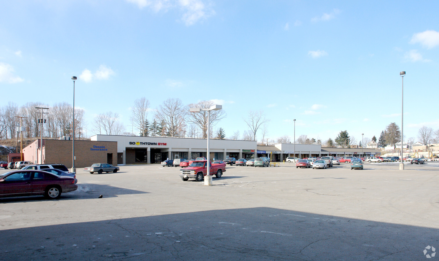
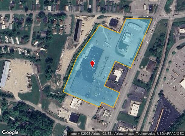
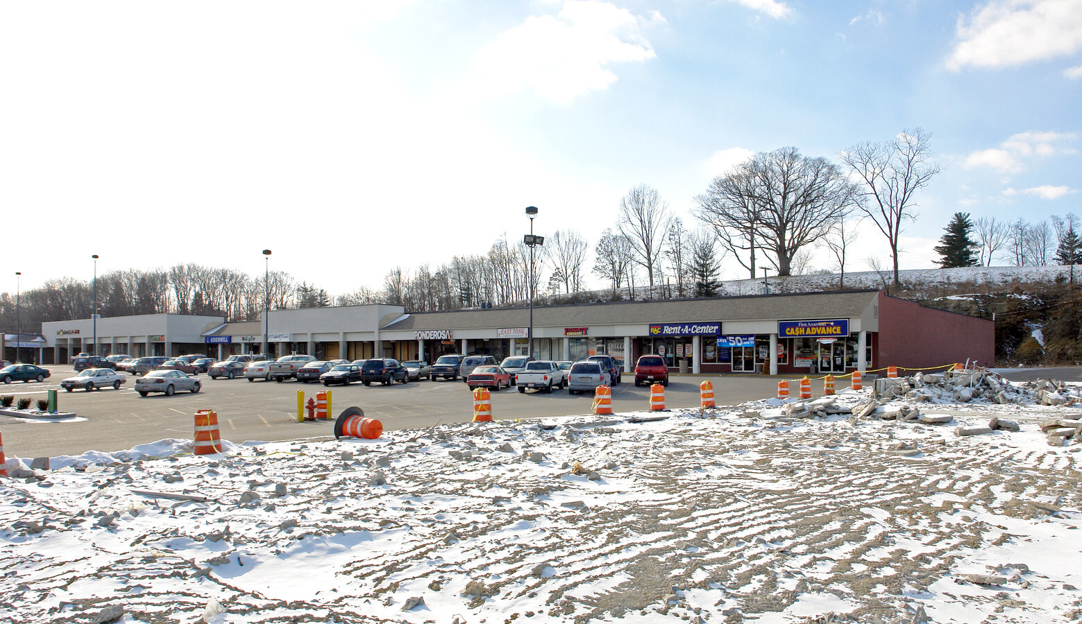
Property Record
151 N Maysville Ave, Zanesville, OH 43701
NEARBY LISTINGS FOR SALE OR LEASE
Property Detail
151 N Maysville Ave
63-09-04-05-000
Northpointe Professional Campus Condomin
Communitycenter
R 14 TP 16 SEC 13 7.31A
X
Muskingum
39119C0292G
Ohio
2023
7.31 AC
2023
Ohio South Area
912300
Other Market Areas
71,070 SF
Zanesville, OH
DEMOGRAPHICS near 151 N Maysville Ave
1 Mile
3 Mile
5 Mile
2024 Total Population
5,719
24,563
41,284
2029 Population
5,749
24,827
41,570
Pop Growth 2024-2029
+ 0.52%
+ 1.07%
+ 0.69%
Average Age
41
39
40
2024 Total Households
2,447
9,982
17,056
HH Growth 2024-2029
+ 0.45%
+ 1.03%
+ 0.67%
Median Household Inc
$43,291
$36,331
$43,165
Avg Household Size
2.30
2.40
2.30
2024 Avg HH Vehicles
2.00
2.00
2.00
Median Home Value
$79,035
$89,807
$114,114
Median Year Built
1956
1953
1957
Nearby Places
- Restaurants
- Banks
- Shops
- Fitness
- Groceries
SALE & LEASE HISTORY
LISTING DATE
SALE/LEASE

Aug 15, 2017
For Lease
Nearby Properties
Address
Land Use
TOTAL SIZE
Lot Size
Zoning
Address
Land Use
TOTAL SIZE
Lot Size
Zoning
12,480 SF
43.22 AC
Address
Land Use
TOTAL SIZE
Lot Size
Zoning
74,956 SF
10.45 AC
RS5
Address
Land Use
TOTAL SIZE
Lot Size
Zoning
150,499 SF
29.64 AC
Address
Land Use
TOTAL SIZE
Lot Size
Zoning
6,344 SF
19.56 AC
Address
Land Use
TOTAL SIZE
Lot Size
Zoning
83,031 SF
7.30 AC
RS4
Address
Land Use
TOTAL SIZE
Lot Size
Zoning
184,623 SF
21.08 AC
Address
Land Use
TOTAL SIZE
Lot Size
Zoning
2,772 SF
4.72 AC
RM1
Address
Land Use
TOTAL SIZE
Lot Size
Zoning
17,723 SF
0.94 AC
C4
Address
Land Use
TOTAL SIZE
Lot Size
Zoning
52,564 SF
0.80 AC
C3
Address
Land Use
TOTAL SIZE
Lot Size
Zoning
56,454 SF
1.50 AC
O2
Address
Land Use
TOTAL SIZE
Lot Size
Zoning
61,732 SF
18.46 AC
Address
Land Use
TOTAL SIZE
Lot Size
Zoning
6,662 SF
13.02 AC
I1
Address
Land Use
TOTAL SIZE
Lot Size
Zoning
23,857 SF
0.14 AC
C4
Address
Land Use
TOTAL SIZE
Lot Size
Zoning
49,516 SF
3.72 AC
C4
Address
Land Use
TOTAL SIZE
Lot Size
Zoning
3.37 AC
I1
Address
Land Use
TOTAL SIZE
Lot Size
Zoning
19,574 SF
2.88 AC
C4
Address
Land Use
TOTAL SIZE
Lot Size
Zoning
54,300 SF
7.47 AC
Address
Land Use
TOTAL SIZE
Lot Size
Zoning
51,702 SF
1.69 AC
O2
Address
Land Use
TOTAL SIZE
Lot Size
Zoning
132,528 SF
2.27 AC
I1
Address
Land Use
TOTAL SIZE
Lot Size
Zoning
98.11 AC
Address
Land Use
TOTAL SIZE
Lot Size
Zoning
5,404 SF
15.25 AC
RM1
Address
Land Use
TOTAL SIZE
Lot Size
Zoning
12,720 SF
5.24 AC
Address
Land Use
TOTAL SIZE
Lot Size
Zoning
30,836 SF
0.12 AC
C4
Address
Land Use
TOTAL SIZE
Lot Size
Zoning
42,400 SF
3.08 AC
C4
Address
Land Use
TOTAL SIZE
Lot Size
Zoning
51,740 SF
2.76 AC
I1
Address
Land Use
TOTAL SIZE
Lot Size
Zoning
16,109 SF
3.75 AC
Address
Land Use
TOTAL SIZE
Lot Size
Zoning
3,400 SF
0.82 AC
C4
Address
Land Use
TOTAL SIZE
Lot Size
Zoning
36,208 SF
0.22 AC
C3
Address
Land Use
TOTAL SIZE
Lot Size
Zoning
96,273 SF
6.41 AC
Address
Land Use
TOTAL SIZE
Lot Size
Zoning
960 SF
20.25 AC
I1
The World's #1 Commercial Real Estate Marketplace
Connect with us
© 2025 CoStar Group
The information above has been obtained from sources believed reliable. While we do not doubt its accuracy we have not verified it and make no guarantee, warranty or representation about it. It is your responsibility to independently confirm its accuracy and completeness. Any projections, opinions, assumptions, or estimates used are for example only and do not represent the current or future performance of the property. The value of this transaction to you depends on tax and other factors which should be evaluated by your tax, financial, and legal advisors. You and your advisors should conduct a careful, independent investigation of the property to determine to your satisfaction the suitability of the property for your needs.