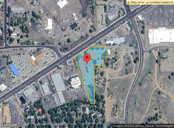
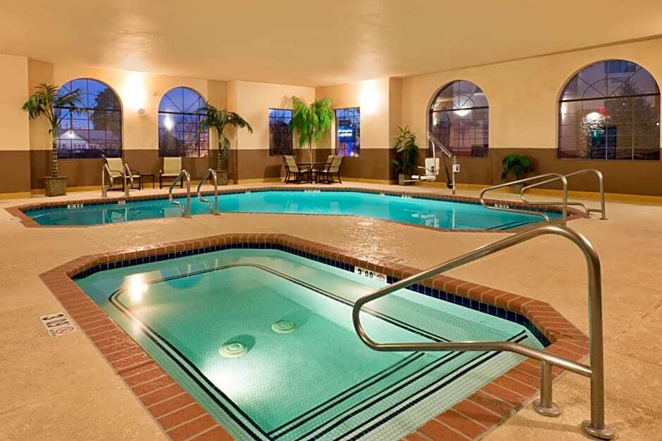
Property Record
151 W Deuce Of Clubs, Show Low, AZ 85901
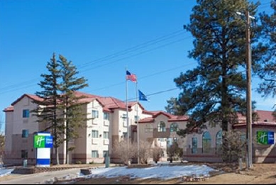

This Property Is For Sale
NEARBY LISTINGS FOR SALE OR LEASE
-
-
View all Show Low listings for sale on LoopNet.com
Property Detail
151 W Deuce Of Clubs
210-10-071A
Westwood Addition
Motel
SECTION 19,T10N,R22E:BEG E4 COR; TH N88DG24W 292.54 TO S R/W HW Y 260; TH S56DG5642 W 41.84 TPOB; TH S0DG2903 E 20.61; TH S88 DG24E 41.84; TH S0DG2440 E 108.70; TH S88DG24E 60.80; TH S0 DG5840 E 100.25; TH N88DG3102 W 100.21; TH N61DG2940 W 53.78 ; T
X
Navajo
04017C4706E
Arizona
2023
2.51 AC
2025
Arizona Northeast & Holbrook Area
961701
Other Market Areas
46,700 SF
Show Low, AZ
DEMOGRAPHICS near 151 W Deuce Of Clubs
1 Mile
3 Mile
5 Mile
2024 Total Population
6,061
16,347
21,794
2029 Population
6,445
17,875
23,813
Pop Growth 2024-2029
+ 6.34%
+ 9.35%
+ 9.26%
Average Age
39
43
44
2024 Total Households
2,343
6,696
8,883
HH Growth 2024-2029
+ 6.27%
+ 9.35%
+ 9.25%
Median Household Inc
$58,357
$58,405
$56,929
Avg Household Size
2.50
2.40
2.40
2024 Avg HH Vehicles
2.00
2.00
2.00
Median Home Value
$220,883
$237,644
$238,248
Median Year Built
1993
1998
1998
Nearby Places
- Restaurants
- Banks
- Shops
- Fitness
- Groceries
Nearby Properties
Address
Land Use
TOTAL SIZE
Lot Size
Zoning
Address
Land Use
TOTAL SIZE
Lot Size
Zoning
147,745 SF
12.70 AC
MUNICIPAL
Address
Land Use
TOTAL SIZE
Lot Size
Zoning
74,338 SF
2.29 AC
Address
Land Use
TOTAL SIZE
Lot Size
Zoning
86,443 SF
6.85 AC
MUNICIPAL
Address
Land Use
TOTAL SIZE
Lot Size
Zoning
55,237 SF
6.03 AC
MUNICIPAL
Address
Land Use
TOTAL SIZE
Lot Size
Zoning
32,308 SF
10.46 AC
MUNICIPAL
Address
Land Use
TOTAL SIZE
Lot Size
Zoning
30,952 SF
5.72 AC
MUNICIPAL
Address
Land Use
TOTAL SIZE
Lot Size
Zoning
81,647 SF
4.47 AC
MUNICIPAL
Address
Land Use
TOTAL SIZE
Lot Size
Zoning
30,942 SF
3.21 AC
MUNICIPAL
Address
Land Use
TOTAL SIZE
Lot Size
Zoning
56,032 SF
4.60 AC
MUNICIPAL
Address
Land Use
TOTAL SIZE
Lot Size
Zoning
29,707 SF
3 AC
MUNICIPAL
Address
Land Use
TOTAL SIZE
Lot Size
Zoning
76,060 SF
4.69 AC
MUNICIPAL
Address
Land Use
TOTAL SIZE
Lot Size
Zoning
47,586 SF
3.50 AC
MUNICIPAL
Address
Land Use
TOTAL SIZE
Lot Size
Zoning
24,000 SF
4.09 AC
MUNICIPAL
Address
Land Use
TOTAL SIZE
Lot Size
Zoning
16,349 SF
3.68 AC
MUNICIPAL
Address
Land Use
TOTAL SIZE
Lot Size
Zoning
26,513 SF
9.76 AC
MUNICIPAL
Address
Land Use
TOTAL SIZE
Lot Size
Zoning
17,948 SF
3.31 AC
MUNICIPAL
Address
Land Use
TOTAL SIZE
Lot Size
Zoning
22,705 SF
3.74 AC
MUNICIPAL
Address
Land Use
TOTAL SIZE
Lot Size
Zoning
31,443 SF
1.96 AC
MUNICIPAL
Address
Land Use
TOTAL SIZE
Lot Size
Zoning
90,509 SF
5.78 AC
Address
Land Use
TOTAL SIZE
Lot Size
Zoning
39,242 SF
4.91 AC
MUNICIPAL
Address
Land Use
TOTAL SIZE
Lot Size
Zoning
48,000 SF
1.15 AC
MUNICIPAL
Address
Land Use
TOTAL SIZE
Lot Size
Zoning
39,250 SF
2.27 AC
MUNICIPAL
Address
Land Use
TOTAL SIZE
Lot Size
Zoning
25,015 SF
1.89 AC
MUNICIPAL
Address
Land Use
TOTAL SIZE
Lot Size
Zoning
18,467 SF
1.49 AC
MUNICIPAL
Address
Land Use
TOTAL SIZE
Lot Size
Zoning
32,762 SF
1.95 AC
MUNICIPAL
Address
Land Use
TOTAL SIZE
Lot Size
Zoning
14,868 SF
1.57 AC
MUNICIPAL
Address
Land Use
TOTAL SIZE
Lot Size
Zoning
10,880 SF
1.36 AC
MUNICIPAL
Address
Land Use
TOTAL SIZE
Lot Size
Zoning
233.54 AC
SD
Address
Land Use
TOTAL SIZE
Lot Size
Zoning
7,604 SF
1.45 AC
The World's #1 Commercial Real Estate Marketplace
Connect with us
© 2025 CoStar Group
The information above has been obtained from sources believed reliable. While we do not doubt its accuracy we have not verified it and make no guarantee, warranty or representation about it. It is your responsibility to independently confirm its accuracy and completeness. Any projections, opinions, assumptions, or estimates used are for example only and do not represent the current or future performance of the property. The value of this transaction to you depends on tax and other factors which should be evaluated by your tax, financial, and legal advisors. You and your advisors should conduct a careful, independent investigation of the property to determine to your satisfaction the suitability of the property for your needs.