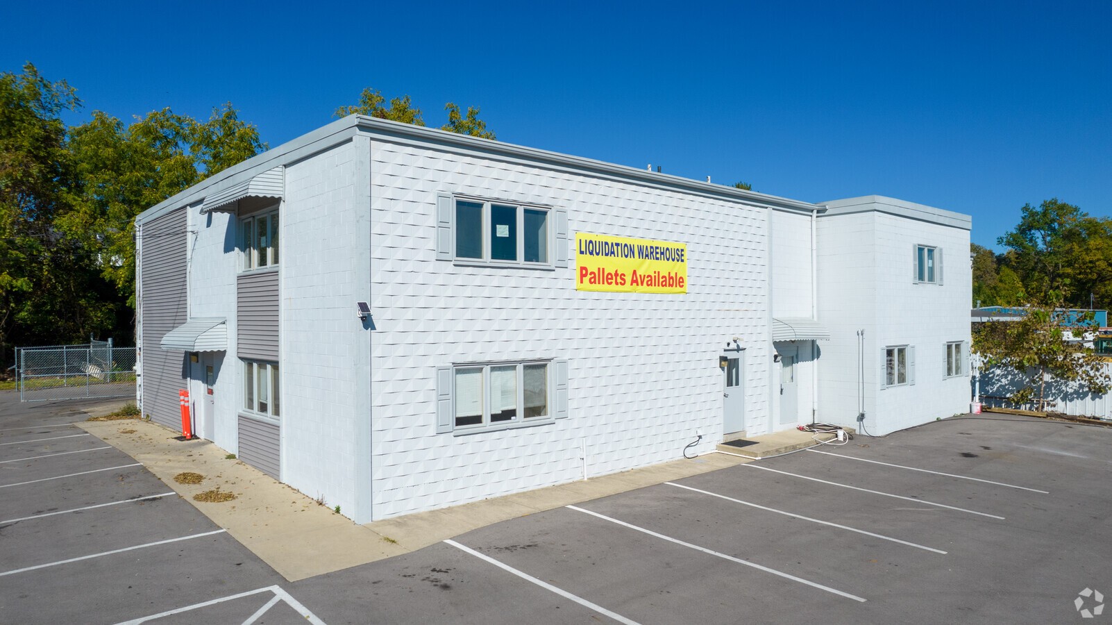
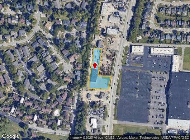
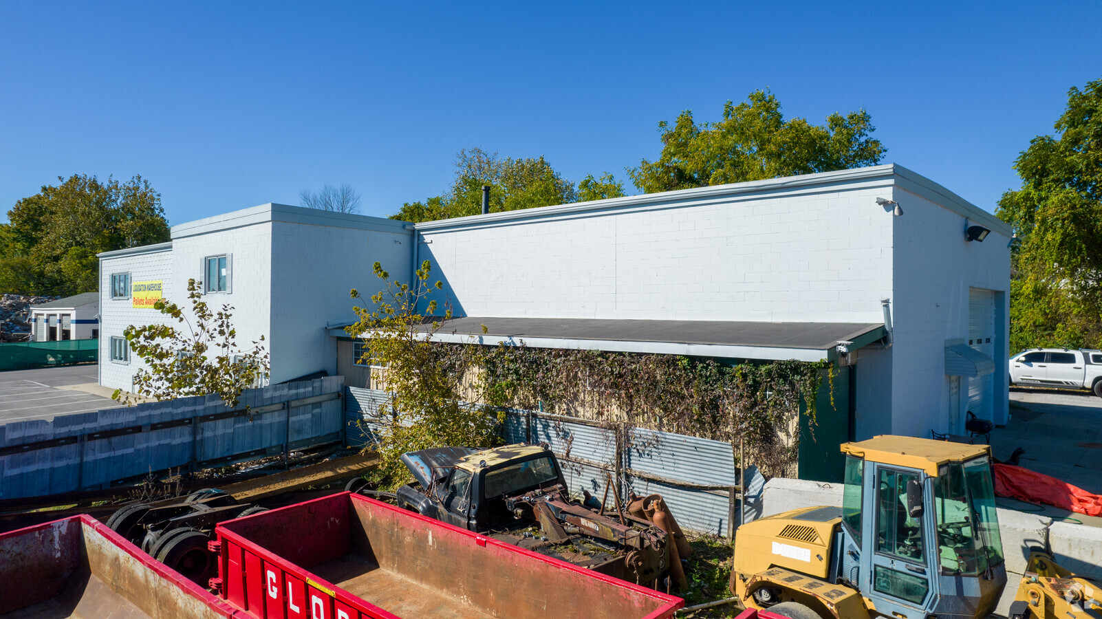
Property Record
5441 Westerville Rd, Westerville, OH 43081
NEARBY LISTINGS FOR SALE OR LEASE
Property Detail
5441 Westerville Rd
110-000366
United States Military Lands
Storebuilding
5441 COLS WOOSTER RD R17 T2 1/4T3 1.044 ACRES
X
Franklin
39049C0183K
Ohio
2023
1.04 AC
2023
Westerville
007120
Columbus
27,624 SF
Columbus, OH
DEMOGRAPHICS near 5441 Westerville Rd
1 Mile
3 Mile
5 Mile
2024 Total Population
16,832
117,191
289,812
2029 Population
16,757
116,777
291,372
Pop Growth 2024-2029
(0.45%)
(0.35%)
+ 0.54%
Average Age
36
37
38
2024 Total Households
6,565
45,473
118,091
HH Growth 2024-2029
(0.30%)
(0.34%)
+ 0.58%
Median Household Inc
$65,007
$60,582
$68,453
Avg Household Size
2.50
2.50
2.40
2024 Avg HH Vehicles
2.00
2.00
2.00
Median Home Value
$198,824
$215,974
$242,410
Median Year Built
1976
1976
1979
Nearby Places
- Restaurants
- Banks
- Shops
- Fitness
- Groceries
PUBLIC TRANSPORTATION
AIRPORT
John Glenn Columbus International
DRIVE
WALK
Distance
John Glenn Columbus International
15 min
9.1 mi
Rickenbacker International
DRIVE
WALK
Distance
Rickenbacker International
34 min
24.3 mi
Freight Ports
Port of Toledo
DRIVE
WALK
Distance
Port of Toledo
176 min
139.5 mi
SALE & LEASE HISTORY
LISTING DATE
SALE/LEASE

Mar 03, 2022
For Sale
Mar 01, 2021
For Lease
Dec 02, 2021
For Lease
Dec 02, 2021
For Lease
Nearby Properties
Address
Land Use
TOTAL SIZE
Lot Size
Zoning
Address
Land Use
TOTAL SIZE
Lot Size
Zoning
6,890,718 SF
60.76 AC
Address
Land Use
TOTAL SIZE
Lot Size
Zoning
440,828 SF
13.72 AC
Address
Land Use
TOTAL SIZE
Lot Size
Zoning
5,805,519 SF
202.04 AC
Address
Land Use
TOTAL SIZE
Lot Size
Zoning
1,587,105 SF
37.56 AC
Address
Land Use
TOTAL SIZE
Lot Size
Zoning
1,348,482 SF
9.75 AC
Address
Land Use
TOTAL SIZE
Lot Size
Zoning
426,653 SF
19.43 AC
Address
Land Use
TOTAL SIZE
Lot Size
Zoning
949,644 SF
145.20 AC
Address
Land Use
TOTAL SIZE
Lot Size
Zoning
1,549,455 SF
50.03 AC
Address
Land Use
TOTAL SIZE
Lot Size
Zoning
696,374 SF
40.91 AC
Address
Land Use
TOTAL SIZE
Lot Size
Zoning
159,315 SF
13.25 AC
Address
Land Use
TOTAL SIZE
Lot Size
Zoning
2,004,627 SF
61.10 AC
Address
Land Use
TOTAL SIZE
Lot Size
Zoning
165,944 SF
14.21 AC
Address
Land Use
TOTAL SIZE
Lot Size
Zoning
994,374 SF
15.36 AC
Address
Land Use
TOTAL SIZE
Lot Size
Zoning
603,216 SF
22.28 AC
Address
Land Use
TOTAL SIZE
Lot Size
Zoning
877,131 SF
36.29 AC
Address
Land Use
TOTAL SIZE
Lot Size
Zoning
150,718 SF
4.35 AC
Address
Land Use
TOTAL SIZE
Lot Size
Zoning
1,501,128 SF
3 AC
Address
Land Use
TOTAL SIZE
Lot Size
Zoning
455,676 SF
8.63 AC
Address
Land Use
TOTAL SIZE
Lot Size
Zoning
584,250 SF
13.53 AC
Address
Land Use
TOTAL SIZE
Lot Size
Zoning
844,215 SF
32.82 AC
Address
Land Use
TOTAL SIZE
Lot Size
Zoning
236,681 SF
7.83 AC
Address
Land Use
TOTAL SIZE
Lot Size
Zoning
142,998 SF
30.25 AC
Address
Land Use
TOTAL SIZE
Lot Size
Zoning
96,086 SF
12.23 AC
Address
Land Use
TOTAL SIZE
Lot Size
Zoning
710,031 SF
22.31 AC
Address
Land Use
TOTAL SIZE
Lot Size
Zoning
554,268 SF
23.53 AC
Address
Land Use
TOTAL SIZE
Lot Size
Zoning
89,544 SF
4.82 AC
Address
Land Use
TOTAL SIZE
Lot Size
Zoning
85,854 SF
1.13 AC
Address
Land Use
TOTAL SIZE
Lot Size
Zoning
1,074,792 SF
10.88 AC
Address
Land Use
TOTAL SIZE
Lot Size
Zoning
122,920 SF
20.30 AC
Address
Land Use
TOTAL SIZE
Lot Size
Zoning
1,086,042 SF
37.08 AC
The World's #1 Commercial Real Estate Marketplace
Connect with us
© 2025 CoStar Group
The information above has been obtained from sources believed reliable. While we do not doubt its accuracy we have not verified it and make no guarantee, warranty or representation about it. It is your responsibility to independently confirm its accuracy and completeness. Any projections, opinions, assumptions, or estimates used are for example only and do not represent the current or future performance of the property. The value of this transaction to you depends on tax and other factors which should be evaluated by your tax, financial, and legal advisors. You and your advisors should conduct a careful, independent investigation of the property to determine to your satisfaction the suitability of the property for your needs.