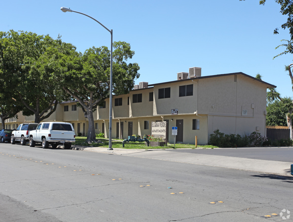
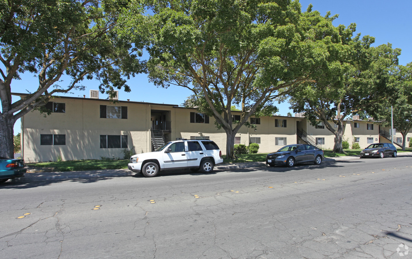
Property Record
1513 Robertson Rd, Modesto, CA 95351

NEARBY LISTINGS FOR SALE OR LEASE
Property Detail
1513 Robertson Rd
037-16-03
Town And Country Terrace No. 2
Multifamilydwelling
Stanislaus
X
California
06099C0532F
1
2024
7.87 AC
2024
Southwest Modesto
001604
Stockton/Modesto
83,904 SF
Modesto, CA
DEMOGRAPHICS near 1513 Robertson Rd
1 Mile
3 Mile
5 Mile
2024 Total Population
23,583
89,128
206,982
2029 Population
23,587
89,129
206,999
Pop Growth 2024-2029
+ 0.02%
0.00%
+ 0.01%
Average Age
33
35
36
2024 Total Households
5,866
25,184
64,141
HH Growth 2024-2029
+ 0.02%
(0.02%)
0.00%
Median Household Inc
$54,113
$58,817
$64,916
Avg Household Size
3.80
3.40
3.10
2024 Avg HH Vehicles
2.00
2.00
2.00
Median Home Value
$274,447
$326,107
$350,679
Median Year Built
1975
1973
1972
Nearby Places
- Restaurants
- Banks
- Shops
- Fitness
- Groceries
PUBLIC TRANSPORTATION
COMMUTER RAIL
Modesto (San Joaquins - Amtrak)
DRIVE
WALK
Distance
Modesto (San Joaquins - Amtrak)
17 min
8.2 mi
AIRPORT
Stockton Metro
DRIVE
WALK
Distance
Stockton Metro
37 min
27.0 mi
Freight Ports
Port of Stockton
DRIVE
WALK
Distance
Port of Stockton
46 min
35.4 mi
Nearby Properties
Address
Land Use
TOTAL SIZE
Lot Size
Zoning
Address
Land Use
TOTAL SIZE
Lot Size
Zoning
817,526 SF
17.31 AC
Address
Land Use
TOTAL SIZE
Lot Size
Zoning
373,574 SF
23 AC
Address
Land Use
TOTAL SIZE
Lot Size
Zoning
308,903 SF
13.21 AC
Address
Land Use
TOTAL SIZE
Lot Size
Zoning
39.18 AC
Address
Land Use
TOTAL SIZE
Lot Size
Zoning
153,937 SF
7.87 AC
Address
Land Use
TOTAL SIZE
Lot Size
Zoning
681,038 SF
92.04 AC
M2
Address
Land Use
TOTAL SIZE
Lot Size
Zoning
151,288 SF
6.50 AC
Address
Land Use
TOTAL SIZE
Lot Size
Zoning
877,788 SF
103.22 AC
MI
Address
Land Use
TOTAL SIZE
Lot Size
Zoning
50,688 SF
2.60 AC
Address
Land Use
TOTAL SIZE
Lot Size
Zoning
697,000 SF
37.82 AC
MODM2
Address
Land Use
TOTAL SIZE
Lot Size
Zoning
266,975 SF
1.90 AC
Address
Land Use
TOTAL SIZE
Lot Size
Zoning
726,299 SF
38.86 AC
M2
Address
Land Use
TOTAL SIZE
Lot Size
Zoning
17.34 AC
Address
Land Use
TOTAL SIZE
Lot Size
Zoning
26,416 SF
18.92 AC
MODPD
Address
Land Use
TOTAL SIZE
Lot Size
Zoning
142,521 SF
6.94 AC
Address
Land Use
TOTAL SIZE
Lot Size
Zoning
14.92 AC
MODM2
Address
Land Use
TOTAL SIZE
Lot Size
Zoning
207,550 SF
17.49 AC
Address
Land Use
TOTAL SIZE
Lot Size
Zoning
204,801 SF
12.99 AC
M2
Address
Land Use
TOTAL SIZE
Lot Size
Zoning
341,504 SF
19.43 AC
Address
Land Use
TOTAL SIZE
Lot Size
Zoning
85,968 SF
2.26 AC
MODCD
Address
Land Use
TOTAL SIZE
Lot Size
Zoning
73,290 SF
6 AC
MODPD
Address
Land Use
TOTAL SIZE
Lot Size
Zoning
266,250 SF
8.88 AC
Address
Land Use
TOTAL SIZE
Lot Size
Zoning
171,965 SF
11.92 AC
M2
Address
Land Use
TOTAL SIZE
Lot Size
Zoning
75,755 SF
1.28 AC
Address
Land Use
TOTAL SIZE
Lot Size
Zoning
76,978 SF
5.18 AC
Address
Land Use
TOTAL SIZE
Lot Size
Zoning
325,000 SF
14.26 AC
Address
Land Use
TOTAL SIZE
Lot Size
Zoning
102,489 SF
10.27 AC
C2
Address
Land Use
TOTAL SIZE
Lot Size
Zoning
328,890 SF
21.49 AC
Address
Land Use
TOTAL SIZE
Lot Size
Zoning
44,280 SF
3.74 AC
Address
Land Use
TOTAL SIZE
Lot Size
Zoning
60,145 SF
21.84 AC
MODR1
The World's #1 Commercial Real Estate Marketplace
Connect with us
© 2025 CoStar Group
The information above has been obtained from sources believed reliable. While we do not doubt its accuracy we have not verified it and make no guarantee, warranty or representation about it. It is your responsibility to independently confirm its accuracy and completeness. Any projections, opinions, assumptions, or estimates used are for example only and do not represent the current or future performance of the property. The value of this transaction to you depends on tax and other factors which should be evaluated by your tax, financial, and legal advisors. You and your advisors should conduct a careful, independent investigation of the property to determine to your satisfaction the suitability of the property for your needs.