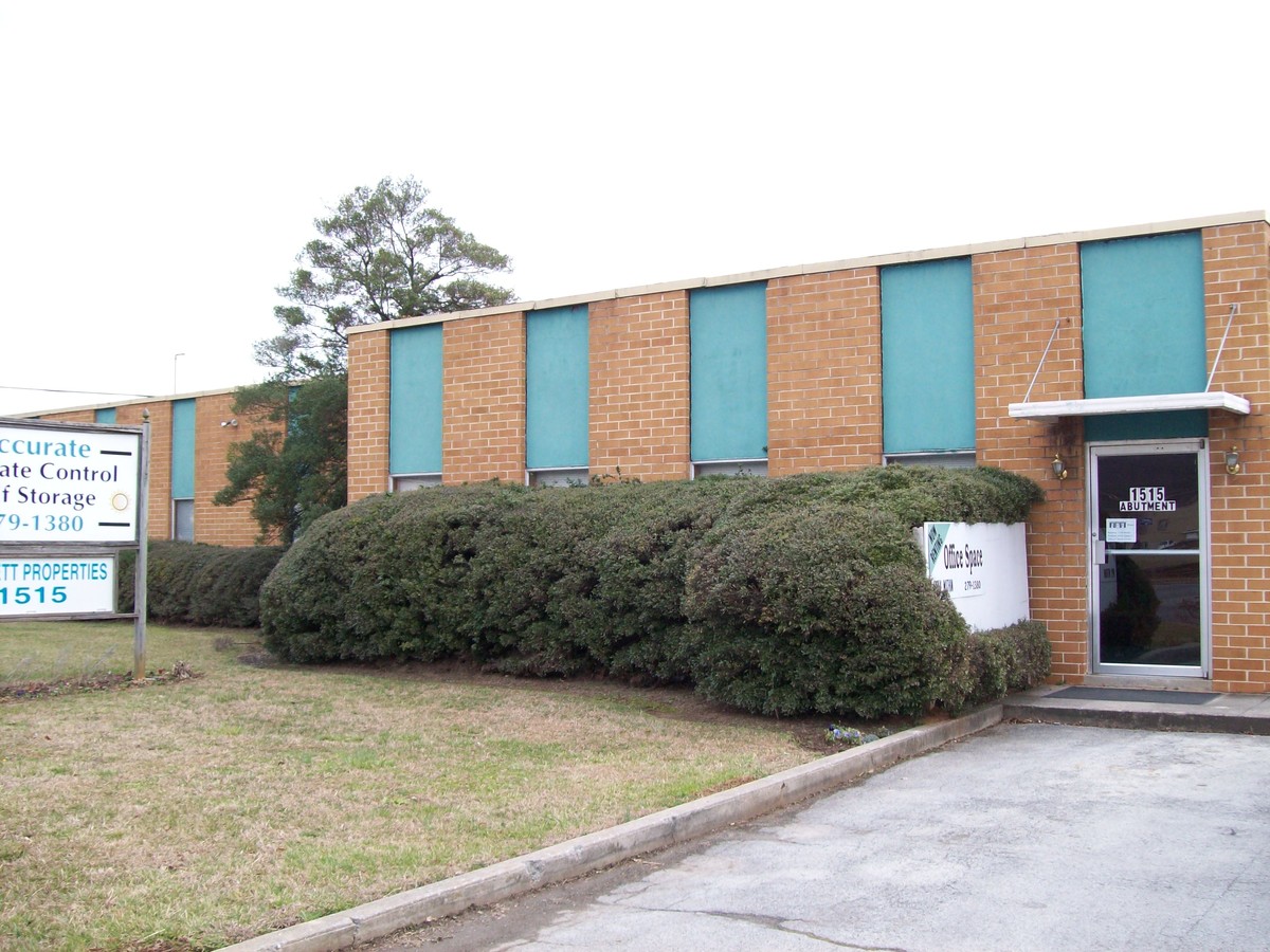
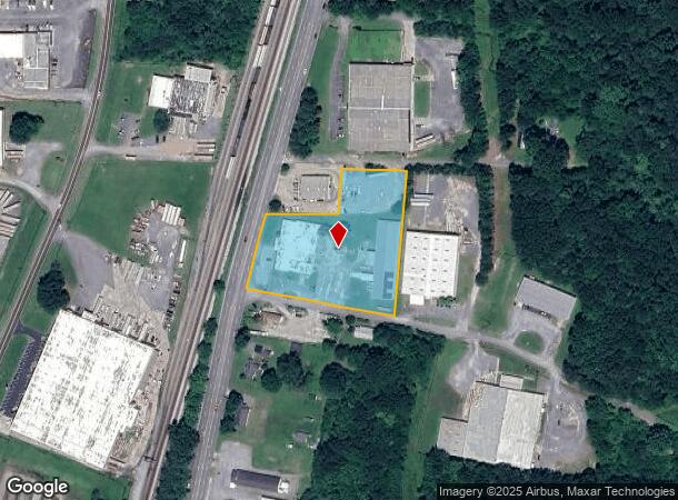
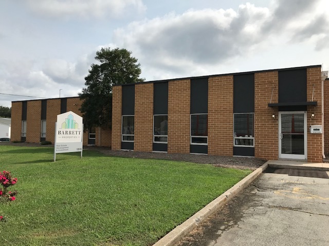
Property Record
1515 Abutment Rd, Dalton, GA 30721
Current Lease Availabilities
NEARBY LISTINGS FOR SALE OR LEASE
Property Detail
1515 Abutment Rd
12-315-01-030
Comm Lnd 20000 Ac
Warehouse
PL26T29 ETAL G C MURDOCK
X
Whitfield
13213C0200D
Georgia
2023
1.72 AC
2023
Georgia Northwest
001200
Other Market Areas
16,000 SF
Dalton, GA
DEMOGRAPHICS near 1515 Abutment Rd
1 Mile
3 Mile
5 Mile
2024 Total Population
2,520
36,476
56,574
2029 Population
2,565
36,595
56,738
Pop Growth 2024-2029
+ 1.79%
+ 0.33%
+ 0.29%
Average Age
35
36
37
2024 Total Households
796
12,250
19,535
HH Growth 2024-2029
+ 1.76%
+ 0.32%
+ 0.30%
Median Household Inc
$36,938
$48,539
$48,930
Avg Household Size
3.20
2.90
2.80
2024 Avg HH Vehicles
2.00
2.00
2.00
Median Home Value
$135,751
$165,789
$166,070
Median Year Built
1987
1981
1983
Nearby Places
- Restaurants
- Banks
- Shops
- Fitness
- Groceries
PUBLIC TRANSPORTATION
AIRPORT
Lovell Field
DRIVE
WALK
Distance
Lovell Field
42 min
31.0 mi
Freight Ports
Georgia Ports - Savannah
DRIVE
WALK
Distance
Georgia Ports - Savannah
376 min
335.1 mi
Nearby Properties
Address
Land Use
TOTAL SIZE
Lot Size
Zoning
Address
Land Use
TOTAL SIZE
Lot Size
Zoning
500,075 SF
11.48 AC
Address
Land Use
TOTAL SIZE
Lot Size
Zoning
123,430 SF
51.17 AC
Address
Land Use
TOTAL SIZE
Lot Size
Zoning
662,926 SF
67.28 AC
Address
Land Use
TOTAL SIZE
Lot Size
Zoning
433,597 SF
36.86 AC
Address
Land Use
TOTAL SIZE
Lot Size
Zoning
1,183,067 SF
48.97 AC
Address
Land Use
TOTAL SIZE
Lot Size
Zoning
100,084 SF
1.47 AC
Address
Land Use
TOTAL SIZE
Lot Size
Zoning
125,756 SF
7 AC
Address
Land Use
TOTAL SIZE
Lot Size
Zoning
193,716 SF
29.23 AC
Address
Land Use
TOTAL SIZE
Lot Size
Zoning
174,347 SF
87.57 AC
Address
Land Use
TOTAL SIZE
Lot Size
Zoning
38,016 SF
18 AC
Address
Land Use
TOTAL SIZE
Lot Size
Zoning
150,771 SF
12.66 AC
Address
Land Use
TOTAL SIZE
Lot Size
Zoning
747,587 SF
24.63 AC
Address
Land Use
TOTAL SIZE
Lot Size
Zoning
115,979 SF
10.60 AC
Address
Land Use
TOTAL SIZE
Lot Size
Zoning
1,125,548 SF
24.22 AC
Address
Land Use
TOTAL SIZE
Lot Size
Zoning
243,100 SF
27.04 AC
Address
Land Use
TOTAL SIZE
Lot Size
Zoning
261,000 SF
9.88 AC
Address
Land Use
TOTAL SIZE
Lot Size
Zoning
31,376 SF
9.64 AC
Address
Land Use
TOTAL SIZE
Lot Size
Zoning
471,045 SF
45.93 AC
Address
Land Use
TOTAL SIZE
Lot Size
Zoning
450,292 SF
23.87 AC
Address
Land Use
TOTAL SIZE
Lot Size
Zoning
55,584 SF
21.34 AC
Address
Land Use
TOTAL SIZE
Lot Size
Zoning
250,000 SF
12.50 AC
Address
Land Use
TOTAL SIZE
Lot Size
Zoning
541,013 SF
21.88 AC
Address
Land Use
TOTAL SIZE
Lot Size
Zoning
337,431 SF
14.51 AC
Address
Land Use
TOTAL SIZE
Lot Size
Zoning
200,586 SF
18.37 AC
C2
Address
Land Use
TOTAL SIZE
Lot Size
Zoning
184,000 SF
29.32 AC
Address
Land Use
TOTAL SIZE
Lot Size
Zoning
234,696 SF
41.91 AC
Address
Land Use
TOTAL SIZE
Lot Size
Zoning
299,446 SF
10.50 AC
Address
Land Use
TOTAL SIZE
Lot Size
Zoning
72,430 SF
7.88 AC
Address
Land Use
TOTAL SIZE
Lot Size
Zoning
18,016 SF
27.65 AC
Address
Land Use
TOTAL SIZE
Lot Size
Zoning
355,274 SF
17.41 AC
The World's #1 Commercial Real Estate Marketplace
Connect with us
© 2025 CoStar Group
The information above has been obtained from sources believed reliable. While we do not doubt its accuracy we have not verified it and make no guarantee, warranty or representation about it. It is your responsibility to independently confirm its accuracy and completeness. Any projections, opinions, assumptions, or estimates used are for example only and do not represent the current or future performance of the property. The value of this transaction to you depends on tax and other factors which should be evaluated by your tax, financial, and legal advisors. You and your advisors should conduct a careful, independent investigation of the property to determine to your satisfaction the suitability of the property for your needs.