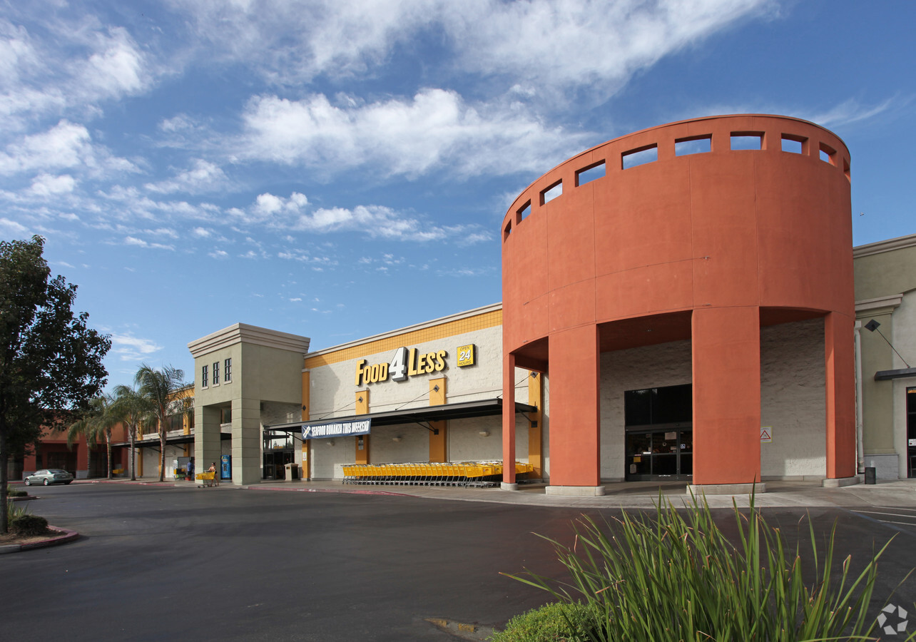
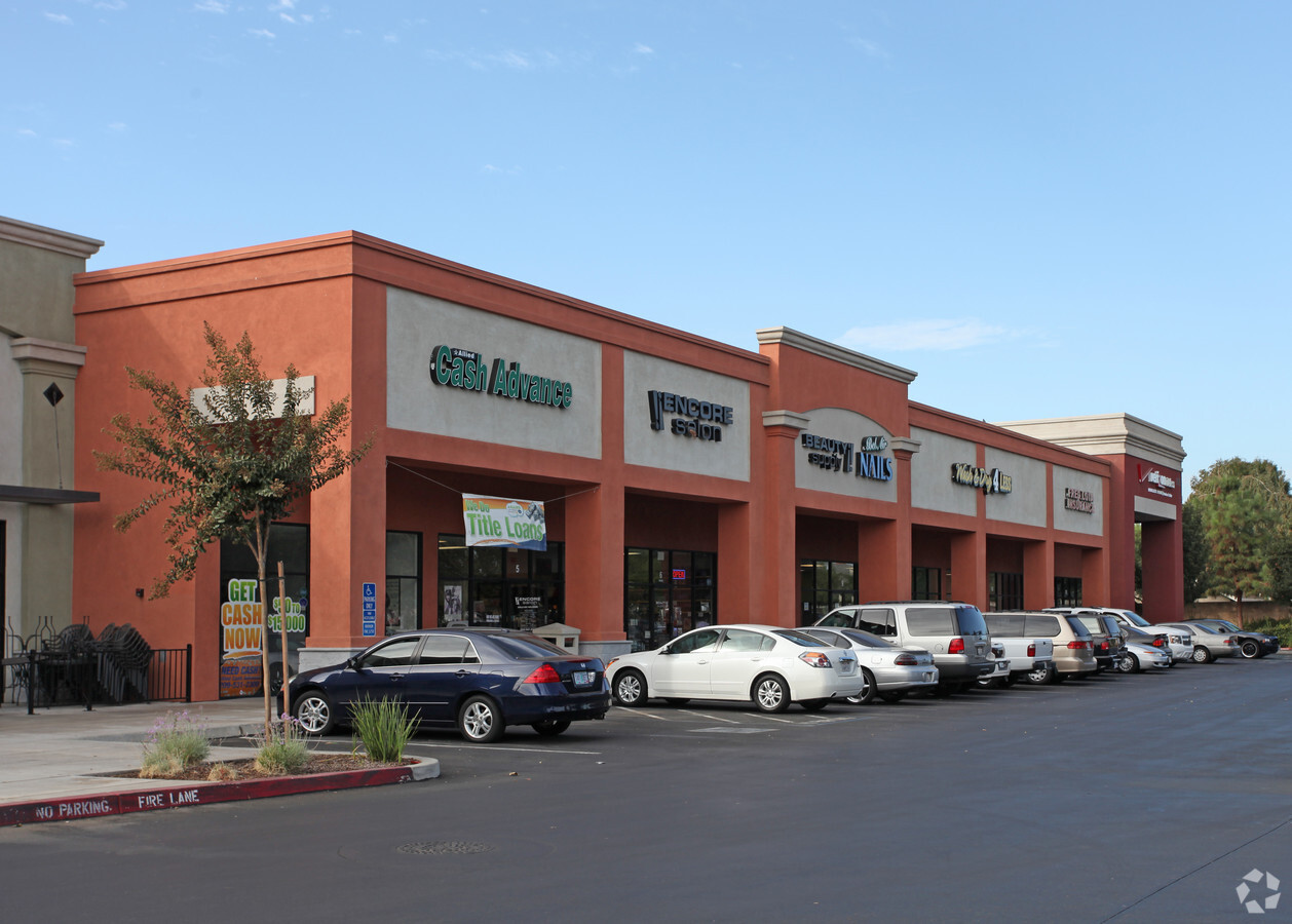
Property Record
1515 Mitchell Rd, Ceres, CA 95307
Current Lease Availabilities
NEARBY LISTINGS FOR SALE OR LEASE
Property Detail
1515 Mitchell Rd
040-92-45
Stanislaus
Regionalshoppingcenterormallwithanchorstore
California
X
1
06099C0552F
2.31 AC
2024
Modesto
2024
Stockton/Modesto
002605
Modesto, CA
57,840 SF
DEMOGRAPHICS near 1515 Mitchell Rd
1 Mile
3 Mile
5 Mile
2024 Total Population
17,680
87,110
212,226
2029 Population
17,654
86,999
211,940
Pop Growth 2024-2029
(0.15%)
(0.13%)
(0.13%)
Average Age
36
35
36
2024 Total Households
5,020
24,957
65,467
HH Growth 2024-2029
(0.16%)
(0.15%)
(0.14%)
Median Household Inc
$73,605
$65,653
$68,148
Avg Household Size
3.50
3.40
3.10
2024 Avg HH Vehicles
2.00
2.00
2.00
Median Home Value
$371,990
$349,321
$372,604
Median Year Built
1979
1979
1977
Nearby Places
- Restaurants
- Banks
- Shops
- Fitness
- Groceries
PUBLIC TRANSPORTATION
COMMUTER RAIL
Modesto (San Joaquins - Amtrak)
DRIVE
WALK
Distance
Modesto (San Joaquins - Amtrak)
13 min
7.1 mi
AIRPORT
Stockton Metro
DRIVE
WALK
Distance
Stockton Metro
39 min
29.4 mi
Freight Ports
Port of Stockton
DRIVE
WALK
Distance
Port of Stockton
48 min
37.9 mi
Nearby Properties
Address
Land Use
TOTAL SIZE
Lot Size
Zoning
Address
Land Use
TOTAL SIZE
Lot Size
Zoning
322,629 SF
71.35 AC
Address
Land Use
TOTAL SIZE
Lot Size
Zoning
817,526 SF
17.31 AC
Address
Land Use
TOTAL SIZE
Lot Size
Zoning
373,574 SF
23 AC
Address
Land Use
TOTAL SIZE
Lot Size
Zoning
448,549 SF
58.48 AC
Address
Land Use
TOTAL SIZE
Lot Size
Zoning
39.18 AC
Address
Land Use
TOTAL SIZE
Lot Size
Zoning
681,038 SF
92.04 AC
M2
Address
Land Use
TOTAL SIZE
Lot Size
Zoning
50,688 SF
2.60 AC
Address
Land Use
TOTAL SIZE
Lot Size
Zoning
697,000 SF
37.82 AC
MODM2
Address
Land Use
TOTAL SIZE
Lot Size
Zoning
854,100 SF
67.24 AC
MI
Address
Land Use
TOTAL SIZE
Lot Size
Zoning
182,100 SF
21 AC
Address
Land Use
TOTAL SIZE
Lot Size
Zoning
726,299 SF
38.86 AC
M2
Address
Land Use
TOTAL SIZE
Lot Size
Zoning
17.34 AC
Address
Land Use
TOTAL SIZE
Lot Size
Zoning
775,280 SF
30.42 AC
COUM
Address
Land Use
TOTAL SIZE
Lot Size
Zoning
327,227 SF
13.52 AC
Address
Land Use
TOTAL SIZE
Lot Size
Zoning
476,580 SF
44.60 AC
Address
Land Use
TOTAL SIZE
Lot Size
Zoning
186,058 SF
14.35 AC
Address
Land Use
TOTAL SIZE
Lot Size
Zoning
102,200 SF
9.85 AC
Address
Land Use
TOTAL SIZE
Lot Size
Zoning
256,014 SF
19.38 AC
Address
Land Use
TOTAL SIZE
Lot Size
Zoning
165,196 SF
15.57 AC
Address
Land Use
TOTAL SIZE
Lot Size
Zoning
207,550 SF
17.49 AC
Address
Land Use
TOTAL SIZE
Lot Size
Zoning
447,488 SF
22.67 AC
Address
Land Use
TOTAL SIZE
Lot Size
Zoning
192,858 SF
10.44 AC
Address
Land Use
TOTAL SIZE
Lot Size
Zoning
23,743 SF
77.55 AC
Address
Land Use
TOTAL SIZE
Lot Size
Zoning
341,504 SF
19.43 AC
Address
Land Use
TOTAL SIZE
Lot Size
Zoning
219,220 SF
36.39 AC
COUM
Address
Land Use
TOTAL SIZE
Lot Size
Zoning
366,400 SF
23.90 AC
Address
Land Use
TOTAL SIZE
Lot Size
Zoning
174,524 SF
11.61 AC
M
Address
Land Use
TOTAL SIZE
Lot Size
Zoning
9.68 AC
Address
Land Use
TOTAL SIZE
Lot Size
Zoning
392,796 SF
25.89 AC
COUM
Address
Land Use
TOTAL SIZE
Lot Size
Zoning
156,414 SF
6.57 AC
The World's #1 Commercial Real Estate Marketplace
Connect with us
© 2025 CoStar Group
The information above has been obtained from sources believed reliable. While we do not doubt its accuracy we have not verified it and make no guarantee, warranty or representation about it. It is your responsibility to independently confirm its accuracy and completeness. Any projections, opinions, assumptions, or estimates used are for example only and do not represent the current or future performance of the property. The value of this transaction to you depends on tax and other factors which should be evaluated by your tax, financial, and legal advisors. You and your advisors should conduct a careful, independent investigation of the property to determine to your satisfaction the suitability of the property for your needs.