Property Record
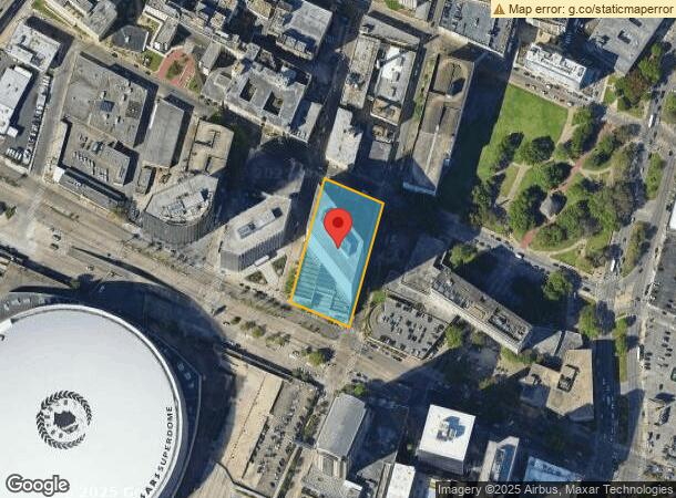
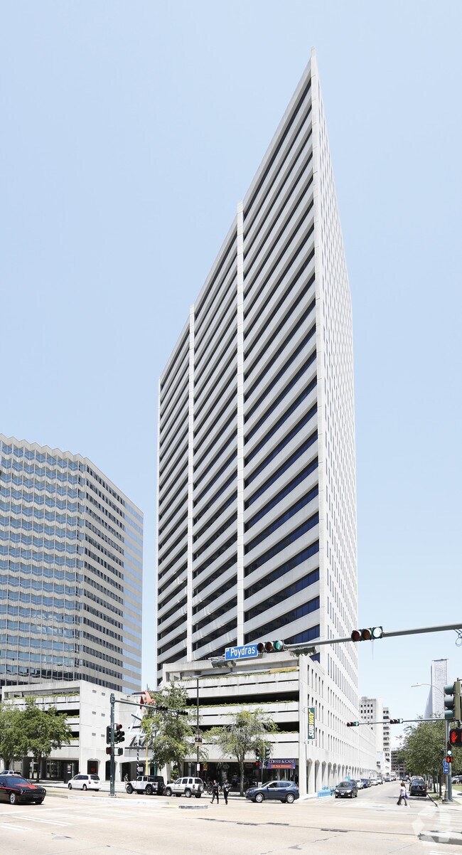
1515 Poydras St, New Orleans, LA 70112

NEARBY LISTINGS FOR SALE OR LEASE
Property Detail
1515 Poydras St
1-04-1-034-03
SQ 365 ENTIRE SQ 393X197 PTS SQUARE 1 LA SALLE 193 11 FR ERET 275 10 PERDIDO 197 5 M/A CHANGE 3/3/05 SEE E REC
Officebuilding
Orleans
X
Louisiana
22051C0225F
1.79 AC
2025
New Orleans CBD
2025
New Orleans/Metairie/Kenner
013400
New Orleans-Metairie, LA
1,062,870 SF
DEMOGRAPHICS near 1515 Poydras St
1 Mile
3 Mile
5 Mile
2024 Total Population
22,516
182,386
360,285
2029 Population
22,586
177,061
347,782
Pop Growth 2024-2029
+ 0.31%
(2.92%)
(3.47%)
Average Age
41
41
41
2024 Total Households
12,544
87,027
160,357
HH Growth 2024-2029
+ 0.96%
(2.87%)
(3.50%)
Median Household Inc
$34,058
$50,892
$50,366
Avg Household Size
1.70
1.90
2.10
2024 Avg HH Vehicles
1.00
1.00
1.00
Median Home Value
$400,951
$373,134
$301,216
Median Year Built
1949
1947
1954
Nearby Places
Map Layers
Map Styles
 Street
 Aerial
- Restaurants
- Banks
- Shops
- Fitness
- Groceries
PUBLIC TRANSPORTATION
TRANSIT/SUBWAY
Poydras Street Station (N) (UPT-Riverfront - NORTA)
DRIVE
WALK
Distance
Poydras Street Station (N) (UPT-Riverfront - NORTA)
0 min
4 min
0.2 mi
Tulane Station (O) (Rampart-Loyola Streetcar - NORTA, UPT-Riverfront - NORTA)
DRIVE
WALK
Distance
Tulane Station (O) (Rampart-Loyola Streetcar - NORTA, UPT-Riverfront - NORTA)
1 min
6 min
0.3 mi
Hyatt Regency Hotel (In) (UPT-Riverfront - NORTA)
DRIVE
WALK
Distance
Hyatt Regency Hotel (In) (UPT-Riverfront - NORTA)
0 min
6 min
0.4 mi
Canal And Marais/Lasalle (Canal Streetcar - Cemeteries - NORTA, Canal Streetcar - City Park/Muse - NORTA, Canal-Cemeteries Streetcar - NORTA, Canal-Museum Streetcar - NORTA, UPT-Riverfront - NORTA)
DRIVE
WALK
Distance
Canal And Marais/Lasalle (Canal Streetcar - Cemeteries - NORTA, Canal Streetcar - City Park/Muse - NORTA, Canal-Cemeteries Streetcar - NORTA, Canal-Museum Streetcar - NORTA, UPT-Riverfront - NORTA)
1 min
7 min
0.4 mi
Canal And Basin/Elk (Canal Streetcar - Cemeteries - NORTA, Canal Streetcar - City Park/Muse - NORTA, Canal-Cemeteries Streetcar - NORTA, Canal-Museum Streetcar - NORTA, Rampart-Loyola Streetcar - NORTA, UPT-Riverfront - NORTA)
DRIVE
WALK
Distance
Canal And Basin/Elk (Canal Streetcar - Cemeteries - NORTA, Canal Streetcar - City Park/Muse - NORTA, Canal-Cemeteries Streetcar - NORTA, Canal-Museum Streetcar - NORTA, Rampart-Loyola Streetcar - NORTA, UPT-Riverfront - NORTA)
1 min
8 min
0.5 mi
COMMUTER RAIL
New Orleans Union Passenger Terminal (City of New Orleans - Amtrak, Crescent - Amtrak, Sunset Limited - Amtrak)
DRIVE
WALK
Distance
New Orleans Union Passenger Terminal (City of New Orleans - Amtrak, Crescent - Amtrak, Sunset Limited - Amtrak)
2 min
12 min
0.6 mi
AIRPORT
Louis Armstrong New Orleans International
DRIVE
WALK
Distance
Louis Armstrong New Orleans International
21 min
14.5 mi
Freight Ports
Port of New Orleans
DRIVE
WALK
Distance
Port of New Orleans
10 min
3.0 mi
SALE & LEASE HISTORY
LISTING DATE
SALE/LEASE

Sep 25, 2016
For Lease
Sep 25, 2016
For Lease
Nearby Properties
Address
Land Use
TOTAL SIZE
Lot Size
Zoning
Address
Land Use
TOTAL SIZE
Lot Size
Zoning
300 SF
2.19 AC
LS
Address
Land Use
TOTAL SIZE
Lot Size
Zoning
85,052 SF
2.19 AC
LS
Address
Land Use
TOTAL SIZE
Lot Size
Zoning
80.92 AC
EC
Address
Land Use
TOTAL SIZE
Lot Size
Zoning
44.43 AC
CBD-4
Address
Land Use
TOTAL SIZE
Lot Size
Zoning
66.23 AC
CBD-4
Address
Land Use
TOTAL SIZE
Lot Size
Zoning
3.66 AC
MC
Address
Land Use
TOTAL SIZE
Lot Size
Zoning
834,043 SF
1.40 AC
CBD-2
Address
Land Use
TOTAL SIZE
Lot Size
Zoning
18.31 AC
CBD-4
Address
Land Use
TOTAL SIZE
Lot Size
Zoning
1.87 AC
CBD-2
Address
Land Use
TOTAL SIZE
Lot Size
Zoning
6.64 AC
Address
Land Use
TOTAL SIZE
Lot Size
Zoning
844,362 SF
5.85 AC
CBD-4
Address
Land Use
TOTAL SIZE
Lot Size
Zoning
0.12 AC
Address
Land Use
TOTAL SIZE
Lot Size
Zoning
30.63 AC
Address
Land Use
TOTAL SIZE
Lot Size
Zoning
444,121 SF
1.46 AC
CBD-1
Address
Land Use
TOTAL SIZE
Lot Size
Zoning
0.88 AC
CBD-2
Address
Land Use
TOTAL SIZE
Lot Size
Zoning
22.17 AC
Address
Land Use
TOTAL SIZE
Lot Size
Zoning
725,677 SF
54.19 AC
EC
Address
Land Use
TOTAL SIZE
Lot Size
Zoning
1.91 AC
CBD-1
Address
Land Use
TOTAL SIZE
Lot Size
Zoning
576,962 SF
3.31 AC
CBD-4
Address
Land Use
TOTAL SIZE
Lot Size
Zoning
1.79 AC
Address
Land Use
TOTAL SIZE
Lot Size
Zoning
609,449 SF
2 AC
EC
Address
Land Use
TOTAL SIZE
Lot Size
Zoning
512,729 SF
6.60 AC
Address
Land Use
TOTAL SIZE
Lot Size
Zoning
1.24 AC
CBD-1
Address
Land Use
TOTAL SIZE
Lot Size
Zoning
190,708 SF
1.09 AC
CBD-2
Address
Land Use
TOTAL SIZE
Lot Size
Zoning
499,287 SF
1.44 AC
VCE
Address
Land Use
TOTAL SIZE
Lot Size
Zoning
0.67 AC
CBD-3
Address
Land Use
TOTAL SIZE
Lot Size
Zoning
202,291 SF
4.04 AC
HU-RD2
Address
Land Use
TOTAL SIZE
Lot Size
Zoning
162,382 SF
1.25 AC
CBD-2
Address
Land Use
TOTAL SIZE
Lot Size
Zoning
258,024 SF
0.63 AC
CBD-2
Address
Land Use
TOTAL SIZE
Lot Size
Zoning
2.94 AC
CBD-1
The World's #1 Commercial Real Estate Marketplace
Connect with us
© 2025 CoStar Group
The information above has been obtained from sources believed reliable. While we do not doubt its accuracy we have not verified it and make no guarantee, warranty or representation about it. It is your responsibility to independently confirm its accuracy and completeness. Any projections, opinions, assumptions, or estimates used are for example only and do not represent the current or future performance of the property. The value of this transaction to you depends on tax and other factors which should be evaluated by your tax, financial, and legal advisors. You and your advisors should conduct a careful, independent investigation of the property to determine to your satisfaction the suitability of the property for your needs.