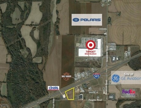
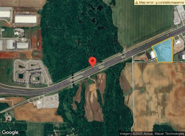
Property Record
15151 Al Highway 20, Madison, AL 35756

NEARBY LISTINGS FOR SALE OR LEASE
Property Detail
15151 Al Highway 20
Huntsville, AL
Mccrary Sd
18-02-04-0-000-002.004
MCCRARY SD PHASE A LOT 3
Vehiclerentalsvehiclesales
Limestone
X
Alabama
01083C0313G
3
2024
10.30 AC
2024
Outlying Limestone County
021203
Huntsville
48,304 SF
DEMOGRAPHICS near 15151 Al Highway 20
1 Mile
3 Mile
5 Mile
2024 Total Population
179
1,796
5,112
2029 Population
208
2,067
5,977
Pop Growth 2024-2029
+ 16.20%
+ 15.09%
+ 16.92%
Average Age
38
38
37
2024 Total Households
82
821
1,981
HH Growth 2024-2029
+ 15.85%
+ 15.59%
+ 17.11%
Median Household Inc
$88,461
$90,111
$107,555
Avg Household Size
2.20
2.20
2.60
2024 Avg HH Vehicles
2.00
2.00
2.00
Median Home Value
$254,166
$254,065
$273,634
Median Year Built
2010
2010
2010
Nearby Places
- Restaurants
- Banks
- Shops
- Fitness
- Groceries
PUBLIC TRANSPORTATION
AIRPORT
Huntsville International-Carl T Jones Field
DRIVE
WALK
Distance
Huntsville International-Carl T Jones Field
15 min
8.8 mi
Freight Ports
Port of Mobile
DRIVE
WALK
Distance
Port of Mobile
370 min
338.2 mi
SALE & LEASE HISTORY
LISTING DATE
SALE/LEASE

Sep 24, 2016
For Sale
Apr 10, 2017
For Sale
Nearby Properties
Address
Land Use
TOTAL SIZE
Lot Size
Zoning
Address
Land Use
TOTAL SIZE
Lot Size
Zoning
2,125 SF
Address
Land Use
TOTAL SIZE
Lot Size
Zoning
940,240 SF
352.30 AC
Address
Land Use
TOTAL SIZE
Lot Size
Zoning
1,084,811 SF
94.45 AC
Address
Land Use
TOTAL SIZE
Lot Size
Zoning
404,642 SF
Address
Land Use
TOTAL SIZE
Lot Size
Zoning
1,343,194 SF
152 AC
Address
Land Use
TOTAL SIZE
Lot Size
Zoning
31,028 SF
37.48 AC
Address
Land Use
TOTAL SIZE
Lot Size
Zoning
317,052 SF
46.29 AC
Address
Land Use
TOTAL SIZE
Lot Size
Zoning
314,250 SF
76.72 AC
Address
Land Use
TOTAL SIZE
Lot Size
Zoning
226,080 SF
98.18 AC
Address
Land Use
TOTAL SIZE
Lot Size
Zoning
395,770 SF
26.54 AC
Address
Land Use
TOTAL SIZE
Lot Size
Zoning
217,800 SF
Address
Land Use
TOTAL SIZE
Lot Size
Zoning
113,450 SF
Address
Land Use
TOTAL SIZE
Lot Size
Zoning
306,096 SF
25 AC
Address
Land Use
TOTAL SIZE
Lot Size
Zoning
234,000 SF
56.35 AC
Address
Land Use
TOTAL SIZE
Lot Size
Zoning
139,880 SF
25 AC
Address
Land Use
TOTAL SIZE
Lot Size
Zoning
385,020 SF
21.55 AC
Address
Land Use
TOTAL SIZE
Lot Size
Zoning
39,000 SF
Address
Land Use
TOTAL SIZE
Lot Size
Zoning
201,140 SF
20.12 AC
Address
Land Use
TOTAL SIZE
Lot Size
Zoning
229,670 SF
16.74 AC
Address
Land Use
TOTAL SIZE
Lot Size
Zoning
145,455 SF
14.42 AC
Address
Land Use
TOTAL SIZE
Lot Size
Zoning
252,691 SF
19.16 AC
Address
Land Use
TOTAL SIZE
Lot Size
Zoning
25,600 SF
32.12 AC
Address
Land Use
TOTAL SIZE
Lot Size
Zoning
227,410 SF
14.52 AC
Address
Land Use
TOTAL SIZE
Lot Size
Zoning
Address
Land Use
TOTAL SIZE
Lot Size
Zoning
204,328 SF
14.17 AC
Address
Land Use
TOTAL SIZE
Lot Size
Zoning
177,630 SF
12.37 AC
Address
Land Use
TOTAL SIZE
Lot Size
Zoning
60,000 SF
Address
Land Use
TOTAL SIZE
Lot Size
Zoning
68,420 SF
35.70 AC
Address
Land Use
TOTAL SIZE
Lot Size
Zoning
139,516 SF
14.47 AC
Address
Land Use
TOTAL SIZE
Lot Size
Zoning
42,648 SF
20 AC
The World's #1 Commercial Real Estate Marketplace
Connect with us
© 2025 CoStar Group
The information above has been obtained from sources believed reliable. While we do not doubt its accuracy we have not verified it and make no guarantee, warranty or representation about it. It is your responsibility to independently confirm its accuracy and completeness. Any projections, opinions, assumptions, or estimates used are for example only and do not represent the current or future performance of the property. The value of this transaction to you depends on tax and other factors which should be evaluated by your tax, financial, and legal advisors. You and your advisors should conduct a careful, independent investigation of the property to determine to your satisfaction the suitability of the property for your needs.