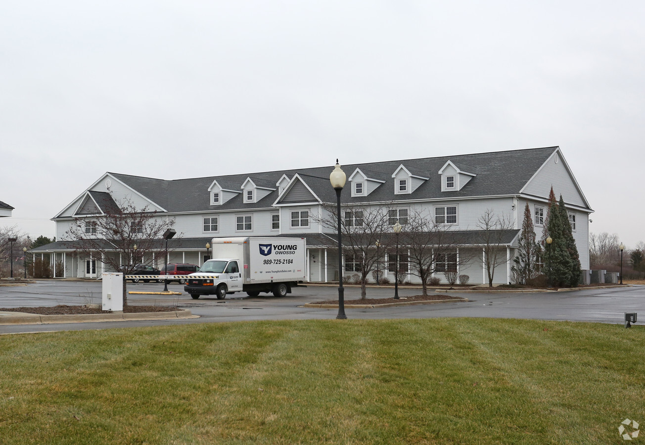
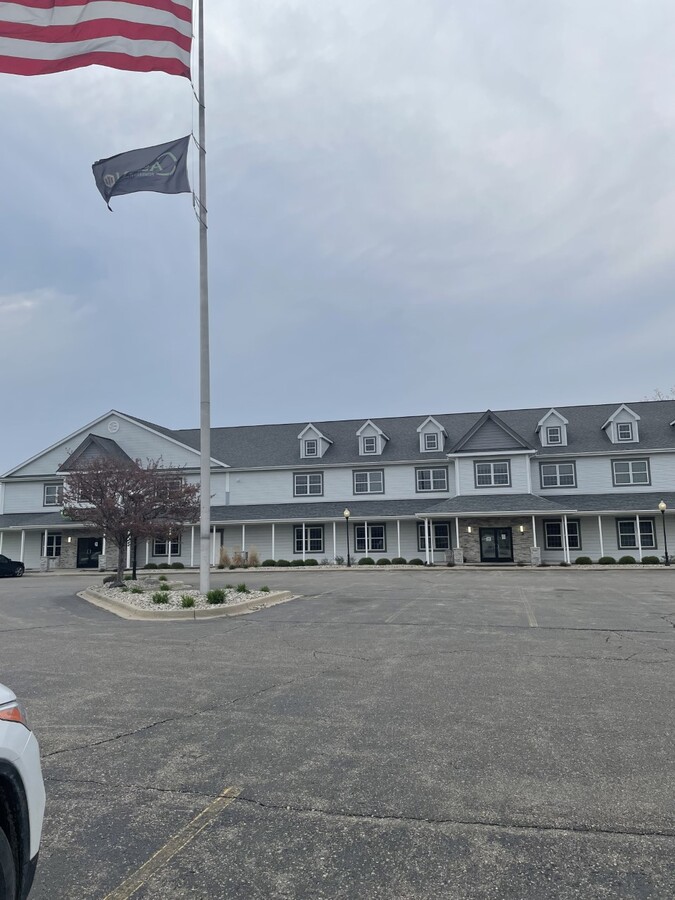
Property Record
15173 North Rd, Fenton, MI 48430
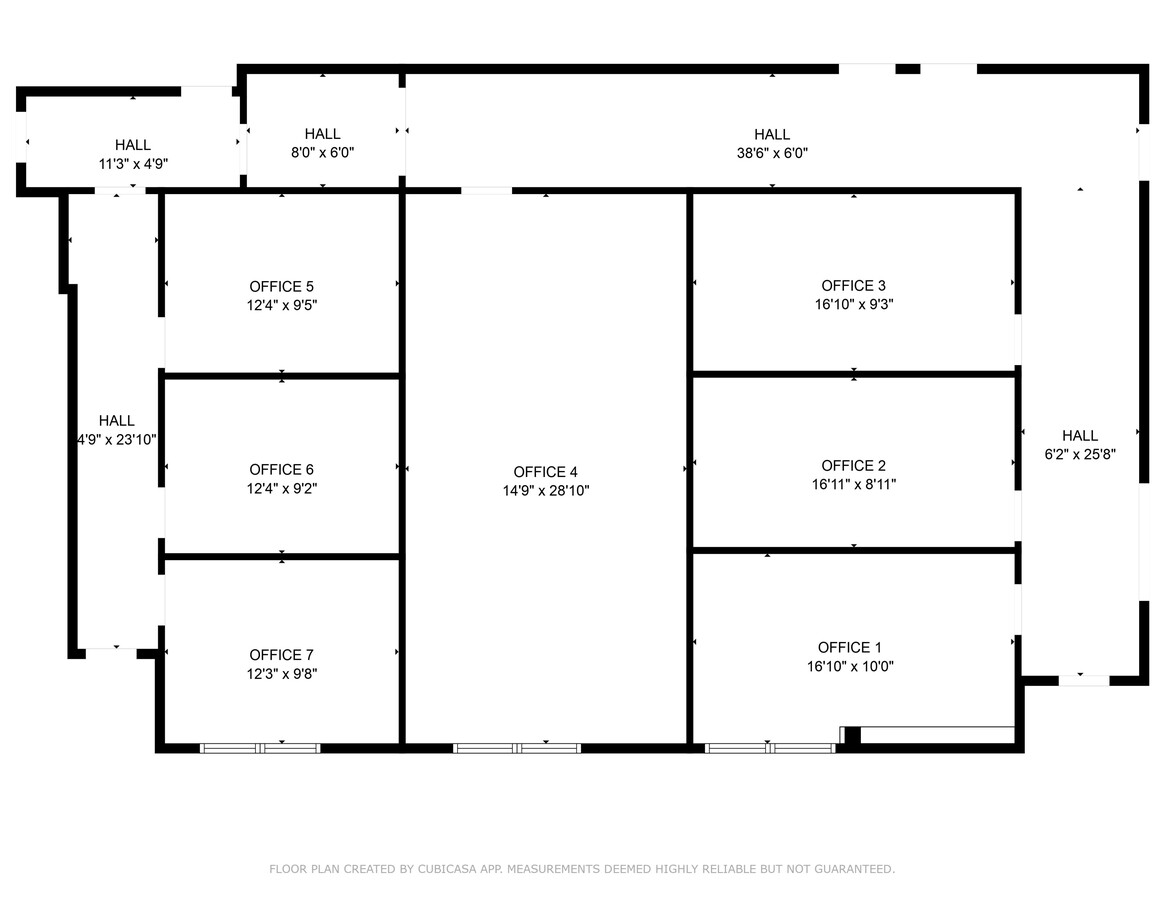
Current Lease Availabilities
NEARBY LISTINGS FOR SALE OR LEASE
Property Detail
15173 North Rd
06-27-200-016
A PARCEL OF BEG 775.5 FT N OF E 1/4 COR TH W 726 FT TH N 181.5 FT TH E 726 FT TH S 181.5 FT TO PL OF BEG EXC E 50 FT ALSO EXC 100 FT OF ROW OF NORTH RD EXTENSION & ALL THAT PART OF W 17 FT OF E 50 FT OF N 181.5 FT OF S 957 FT OF SE 1/4 OF NE 1/4 LYIN
Commercialnec
Genesee
X
Michigan
26049C0436D
2.66 AC
2024
Flint
2024
Detroit
013111
Flint, MI
15,340 SF
DEMOGRAPHICS near 15173 North Rd
1 Mile
3 Mile
5 Mile
2024 Total Population
5,241
27,024
45,339
2029 Population
5,172
26,599
44,836
Pop Growth 2024-2029
(1.32%)
(1.57%)
(1.11%)
Average Age
40
42
42
2024 Total Households
2,501
11,200
18,075
HH Growth 2024-2029
(1.36%)
(1.64%)
(1.24%)
Median Household Inc
$70,338
$85,501
$90,273
Avg Household Size
2.10
2.40
2.50
2024 Avg HH Vehicles
2.00
2.00
2.00
Median Home Value
$212,745
$270,971
$272,922
Median Year Built
1982
1986
1985
Nearby Places
- Restaurants
- Banks
- Shops
- Fitness
- Groceries
PUBLIC TRANSPORTATION
AIRPORT
Bishop International
DRIVE
WALK
Distance
Bishop International
25 min
13.8 mi
Freight Ports
Port of Toledo
DRIVE
WALK
Distance
Port of Toledo
116 min
98.0 mi
Nearby Properties
Address
Land Use
TOTAL SIZE
Lot Size
Zoning
Address
Land Use
TOTAL SIZE
Lot Size
Zoning
572,804 SF
39.61 AC
SEVERAL
Address
Land Use
TOTAL SIZE
Lot Size
Zoning
30,286 SF
3.29 AC
SEVERAL
Address
Land Use
TOTAL SIZE
Lot Size
Zoning
215,494 SF
25.02 AC
GBD
Address
Land Use
TOTAL SIZE
Lot Size
Zoning
167,681 SF
20.39 AC
HDR
Address
Land Use
TOTAL SIZE
Lot Size
Zoning
162,144 SF
8 AC
Address
Land Use
TOTAL SIZE
Lot Size
Zoning
92,006 SF
7.89 AC
R-3
Address
Land Use
TOTAL SIZE
Lot Size
Zoning
70,522 SF
23.58 AC
SEVERAL
Address
Land Use
TOTAL SIZE
Lot Size
Zoning
148,951 SF
10.02 AC
HDR
Address
Land Use
TOTAL SIZE
Lot Size
Zoning
82,447 SF
8.96 AC
GBD
Address
Land Use
TOTAL SIZE
Lot Size
Zoning
204,956 SF
44 SF
R-M
Address
Land Use
TOTAL SIZE
Lot Size
Zoning
114,408 SF
13.53 AC
GBD
Address
Land Use
TOTAL SIZE
Lot Size
Zoning
87,925 SF
13.49 AC
GBD
Address
Land Use
TOTAL SIZE
Lot Size
Zoning
87,847 SF
12.71 AC
GBD
Address
Land Use
TOTAL SIZE
Lot Size
Zoning
63,504 SF
8.26 AC
Address
Land Use
TOTAL SIZE
Lot Size
Zoning
126,064 SF
10.80 AC
GBD
Address
Land Use
TOTAL SIZE
Lot Size
Zoning
13,220 SF
7.90 AC
GBD
Address
Land Use
TOTAL SIZE
Lot Size
Zoning
145,076 SF
11.95 AC
HDR
Address
Land Use
TOTAL SIZE
Lot Size
Zoning
1.97 AC
R-3
Address
Land Use
TOTAL SIZE
Lot Size
Zoning
97,830 SF
12.16 AC
GBD
Address
Land Use
TOTAL SIZE
Lot Size
Zoning
112,330 SF
11.82 AC
IND
Address
Land Use
TOTAL SIZE
Lot Size
Zoning
89,453 SF
7.87 AC
C-3
Address
Land Use
TOTAL SIZE
Lot Size
Zoning
46,732 SF
10.50 AC
SEVERAL
Address
Land Use
TOTAL SIZE
Lot Size
Zoning
72,624 SF
8.18 AC
MHR
Address
Land Use
TOTAL SIZE
Lot Size
Zoning
41,427 SF
0.40 AC
CBD
Address
Land Use
TOTAL SIZE
Lot Size
Zoning
44,343 SF
3.94 AC
NO DATA TO
Address
Land Use
TOTAL SIZE
Lot Size
Zoning
48,096 SF
6.39 AC
GBD
Address
Land Use
TOTAL SIZE
Lot Size
Zoning
92,600 SF
13.34 AC
Address
Land Use
TOTAL SIZE
Lot Size
Zoning
103,896 SF
7.30 AC
IND
Address
Land Use
TOTAL SIZE
Lot Size
Zoning
26,719 SF
4.07 AC
GBD
Address
Land Use
TOTAL SIZE
Lot Size
Zoning
94,597 SF
9.10 AC
NO DATA TO
The World's #1 Commercial Real Estate Marketplace
Connect with us
© 2025 CoStar Group
The information above has been obtained from sources believed reliable. While we do not doubt its accuracy we have not verified it and make no guarantee, warranty or representation about it. It is your responsibility to independently confirm its accuracy and completeness. Any projections, opinions, assumptions, or estimates used are for example only and do not represent the current or future performance of the property. The value of this transaction to you depends on tax and other factors which should be evaluated by your tax, financial, and legal advisors. You and your advisors should conduct a careful, independent investigation of the property to determine to your satisfaction the suitability of the property for your needs.