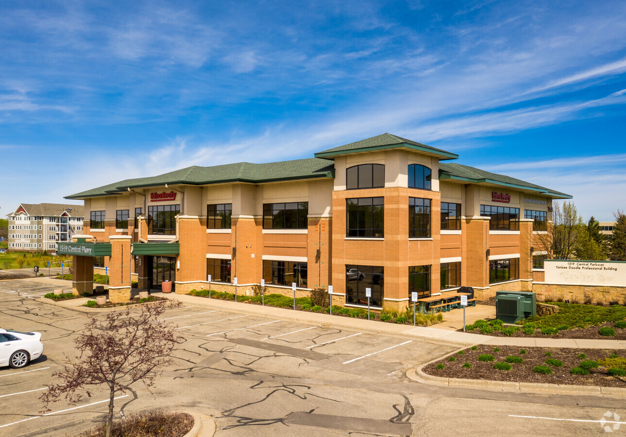
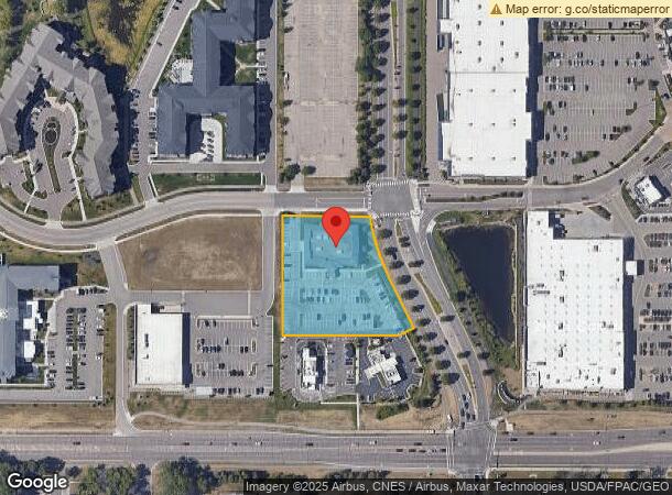
Property Record
1519 Central Pkwy, Saint Paul, MN 55121

NEARBY LISTINGS FOR SALE OR LEASE
Property Detail
1519 Central Pkwy
Minneapolis-St. Paul-Bloomington, MN-WI
Yankee Doodle Professional Building
10-87375-01-010
YANKEE DOODLE PROFESSIONAL BUILDING 1 1
Commercialnec
Dakota
X
Minnesota
27053C0500F
10
2023
1.87 AC
2023
Burnsville/Eagan/Apple Vy
060725
Minneapolis/St Paul
25,656 SF
DEMOGRAPHICS near 1519 Central Pkwy
1 Mile
3 Mile
5 Mile
2024 Total Population
9,100
49,420
135,646
2029 Population
9,322
50,589
137,206
Pop Growth 2024-2029
+ 2.44%
+ 2.37%
+ 1.15%
Average Age
39
40
40
2024 Total Households
4,183
21,282
54,690
HH Growth 2024-2029
+ 2.65%
+ 2.48%
+ 1.14%
Median Household Inc
$74,448
$88,385
$91,312
Avg Household Size
2.10
2.30
2.40
2024 Avg HH Vehicles
2.00
2.00
2.00
Median Home Value
$311,432
$342,841
$344,109
Median Year Built
1984
1987
1983
Nearby Places
- Restaurants
- Banks
- Shops
- Fitness
- Groceries
PUBLIC TRANSPORTATION
AIRPORT
Minneapolis-St Paul International/Wold-Chamberlain
DRIVE
WALK
Distance
Minneapolis-St Paul International/Wold-Chamberlain
13 min
6.6 mi
Freight Ports
Port Milwaukee
DRIVE
WALK
Distance
Port Milwaukee
374 min
337.8 mi
SALE & LEASE HISTORY
LISTING DATE
SALE/LEASE

Mar 01, 2022
For Sale
Jun 13, 2017
For Lease
Dec 15, 2016
For Lease
Aug 04, 2017
For Lease
Nearby Properties
Address
Land Use
TOTAL SIZE
Lot Size
Zoning
Address
Land Use
TOTAL SIZE
Lot Size
Zoning
1,341.19 AC
Address
Land Use
TOTAL SIZE
Lot Size
Zoning
4.26 AC
Address
Land Use
TOTAL SIZE
Lot Size
Zoning
3.86 AC
Address
Land Use
TOTAL SIZE
Lot Size
Zoning
587,427 SF
87.26 AC
Address
Land Use
TOTAL SIZE
Lot Size
Zoning
300,663 SF
4.81 AC
Address
Land Use
TOTAL SIZE
Lot Size
Zoning
657,358 SF
17.12 AC
Address
Land Use
TOTAL SIZE
Lot Size
Zoning
168,729 SF
19.02 AC
Address
Land Use
TOTAL SIZE
Lot Size
Zoning
264,370 SF
36.39 AC
Address
Land Use
TOTAL SIZE
Lot Size
Zoning
282,095 SF
2.71 AC
Address
Land Use
TOTAL SIZE
Lot Size
Zoning
291,589 SF
6.77 AC
Address
Land Use
TOTAL SIZE
Lot Size
Zoning
192,843 SF
13.32 AC
Address
Land Use
TOTAL SIZE
Lot Size
Zoning
9,344 SF
61.71 AC
Address
Land Use
TOTAL SIZE
Lot Size
Zoning
1,049,150 SF
87.81 AC
Address
Land Use
TOTAL SIZE
Lot Size
Zoning
300,000 SF
18.44 AC
Address
Land Use
TOTAL SIZE
Lot Size
Zoning
201,481 SF
6.69 AC
Address
Land Use
TOTAL SIZE
Lot Size
Zoning
2.49 AC
Address
Land Use
TOTAL SIZE
Lot Size
Zoning
47,397 SF
6.78 AC
Address
Land Use
TOTAL SIZE
Lot Size
Zoning
247,451 SF
9.57 AC
Address
Land Use
TOTAL SIZE
Lot Size
Zoning
34,152 SF
6.11 AC
Address
Land Use
TOTAL SIZE
Lot Size
Zoning
45,360 SF
5.72 AC
Address
Land Use
TOTAL SIZE
Lot Size
Zoning
159,341 SF
2.82 AC
Address
Land Use
TOTAL SIZE
Lot Size
Zoning
41,300 SF
20.74 AC
Address
Land Use
TOTAL SIZE
Lot Size
Zoning
26,838 SF
1.30 AC
Address
Land Use
TOTAL SIZE
Lot Size
Zoning
278,025 SF
9.12 AC
Address
Land Use
TOTAL SIZE
Lot Size
Zoning
436,701 SF
19.58 AC
Address
Land Use
TOTAL SIZE
Lot Size
Zoning
227,200 SF
14.78 AC
Address
Land Use
TOTAL SIZE
Lot Size
Zoning
191,307 SF
2.31 AC
Address
Land Use
TOTAL SIZE
Lot Size
Zoning
168,846 SF
7.30 AC
Address
Land Use
TOTAL SIZE
Lot Size
Zoning
217,832 SF
15.13 AC
Address
Land Use
TOTAL SIZE
Lot Size
Zoning
205,920 SF
16.68 AC
The World's #1 Commercial Real Estate Marketplace
Connect with us
© 2025 CoStar Group
The information above has been obtained from sources believed reliable. While we do not doubt its accuracy we have not verified it and make no guarantee, warranty or representation about it. It is your responsibility to independently confirm its accuracy and completeness. Any projections, opinions, assumptions, or estimates used are for example only and do not represent the current or future performance of the property. The value of this transaction to you depends on tax and other factors which should be evaluated by your tax, financial, and legal advisors. You and your advisors should conduct a careful, independent investigation of the property to determine to your satisfaction the suitability of the property for your needs.