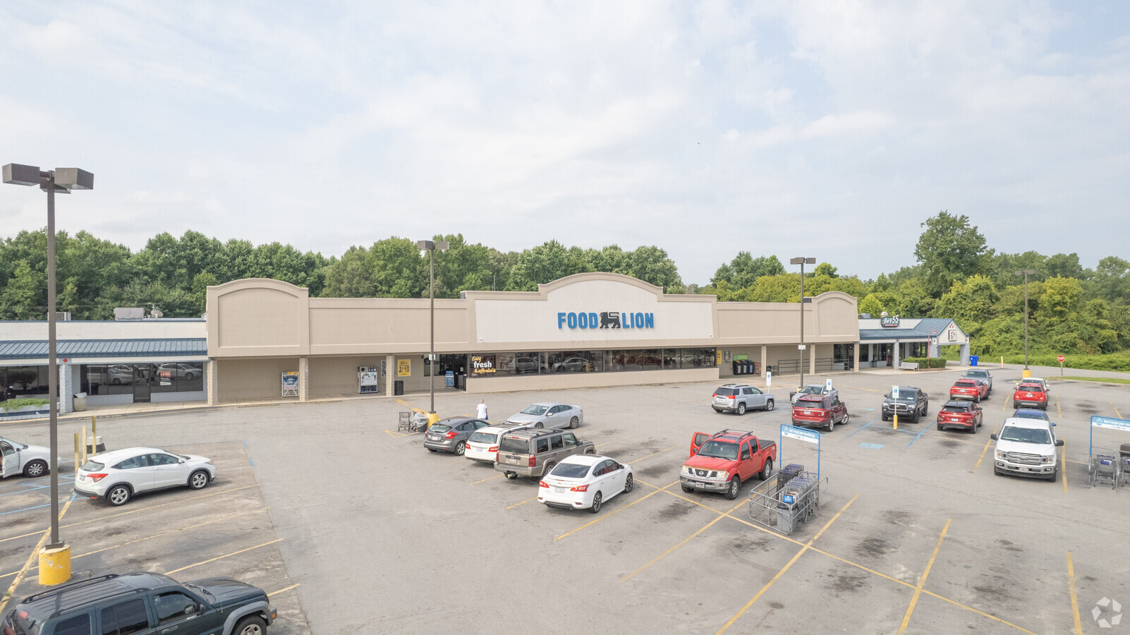
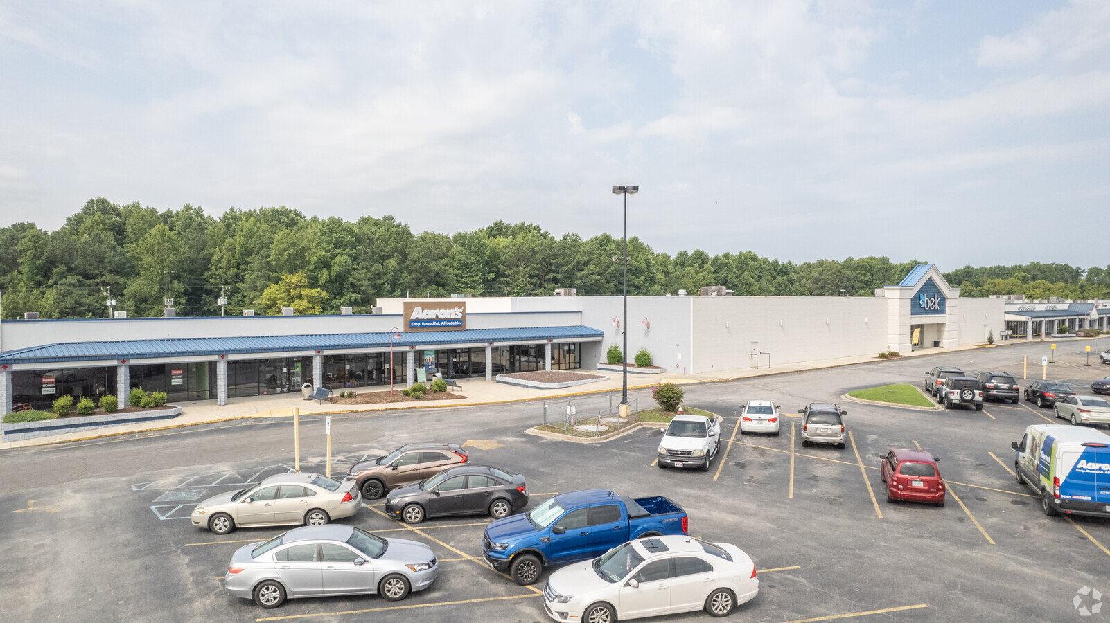
Property Record
1520 Memorial Dr E, Ahoskie, NC 27910
NEARBY LISTINGS FOR SALE OR LEASE
Property Detail
1520 Memorial Dr E
Communitycenter
WAL-MART ANDERSON/AHOSKIE MKT PL SHP CNTR
X
Hertford
3720599200J
North Carolina
2024
0.53 AC
2024
North Carolina Northeast Area
950401
Other Market Areas
11,200 SF
5992-73-5776
DEMOGRAPHICS near 1520 Memorial Dr E
1 Mile
3 Mile
5 Mile
2024 Total Population
1,312
6,477
8,622
2029 Population
1,276
6,290
8,333
Pop Growth 2024-2029
(2.74%)
(2.89%)
(3.35%)
Average Age
42
43
44
2024 Total Households
558
2,725
3,655
HH Growth 2024-2029
(2.87%)
(2.90%)
(3.39%)
Median Household Inc
$34,196
$38,896
$39,776
Avg Household Size
2.20
2.20
2.20
2024 Avg HH Vehicles
2.00
2.00
2.00
Median Home Value
$124,257
$118,928
$109,769
Median Year Built
1975
1972
1974
Nearby Places
- Restaurants
- Banks
- Shops
- Fitness
- Groceries
SALE & LEASE HISTORY
LISTING DATE
SALE/LEASE

Sep 25, 2016
For Lease
May 31, 2017
For Lease
Feb 16, 2017
For Lease
Nearby Properties
Address
Land Use
TOTAL SIZE
Lot Size
Zoning
Address
Land Use
TOTAL SIZE
Lot Size
Zoning
121,466 SF
17.40 AC
A
Address
Land Use
TOTAL SIZE
Lot Size
Zoning
1,284 SF
39.02 AC
C3
Address
Land Use
TOTAL SIZE
Lot Size
Zoning
42,960 SF
16.13 AC
B-3
Address
Land Use
TOTAL SIZE
Lot Size
Zoning
74,560 SF
10.30 AC
B-3
Address
Land Use
TOTAL SIZE
Lot Size
Zoning
12,480 SF
1.59 AC
B-2
Address
Land Use
TOTAL SIZE
Lot Size
Zoning
10.19 AC
C
Address
Land Use
TOTAL SIZE
Lot Size
Zoning
6,921 SF
4.36 AC
O-I
Address
Land Use
TOTAL SIZE
Lot Size
Zoning
151,138 SF
35.21 AC
IL
Address
Land Use
TOTAL SIZE
Lot Size
Zoning
10,306 SF
5.56 AC
O-I
Address
Land Use
TOTAL SIZE
Lot Size
Zoning
26,646 SF
3.37 AC
B-2
Address
Land Use
TOTAL SIZE
Lot Size
Zoning
11,320 SF
1.07 AC
B-2
Address
Land Use
TOTAL SIZE
Lot Size
Zoning
10,004 SF
1.11 AC
I-L
Address
Land Use
TOTAL SIZE
Lot Size
Zoning
1,993 SF
12.90 AC
I
Address
Land Use
TOTAL SIZE
Lot Size
Zoning
3,086 SF
0.99 AC
B-3
Address
Land Use
TOTAL SIZE
Lot Size
Zoning
3,195 SF
0.80 AC
B-3
Address
Land Use
TOTAL SIZE
Lot Size
Zoning
3,430 SF
0.98 AC
B-3
Address
Land Use
TOTAL SIZE
Lot Size
Zoning
3,164 SF
2.80 AC
B-2
Address
Land Use
TOTAL SIZE
Lot Size
Zoning
3,888 SF
1.67 AC
C2
Address
Land Use
TOTAL SIZE
Lot Size
Zoning
2,916 SF
1.03 AC
B-2
Address
Land Use
TOTAL SIZE
Lot Size
Zoning
7,751 SF
2.97 AC
O
Address
Land Use
TOTAL SIZE
Lot Size
Zoning
8,448 SF
0.91 AC
B-2
Address
Land Use
TOTAL SIZE
Lot Size
Zoning
1,215 SF
1.06 AC
B-2
Address
Land Use
TOTAL SIZE
Lot Size
Zoning
384 SF
670.61 AC
Address
Land Use
TOTAL SIZE
Lot Size
Zoning
13,245 SF
2.58 AC
B-2
Address
Land Use
TOTAL SIZE
Lot Size
Zoning
640 SF
4.86 AC
R
Address
Land Use
TOTAL SIZE
Lot Size
Zoning
784.52 AC
Address
Land Use
TOTAL SIZE
Lot Size
Zoning
3,578 SF
1.01 AC
B-1
Address
Land Use
TOTAL SIZE
Lot Size
Zoning
360.77 AC
RA-30
Address
Land Use
TOTAL SIZE
Lot Size
Zoning
9,440 SF
1.02 AC
B-1
Address
Land Use
TOTAL SIZE
Lot Size
Zoning
9,000 SF
11.62 AC
RA-30
The World's #1 Commercial Real Estate Marketplace
Connect with us
© 2025 CoStar Group
The information above has been obtained from sources believed reliable. While we do not doubt its accuracy we have not verified it and make no guarantee, warranty or representation about it. It is your responsibility to independently confirm its accuracy and completeness. Any projections, opinions, assumptions, or estimates used are for example only and do not represent the current or future performance of the property. The value of this transaction to you depends on tax and other factors which should be evaluated by your tax, financial, and legal advisors. You and your advisors should conduct a careful, independent investigation of the property to determine to your satisfaction the suitability of the property for your needs.