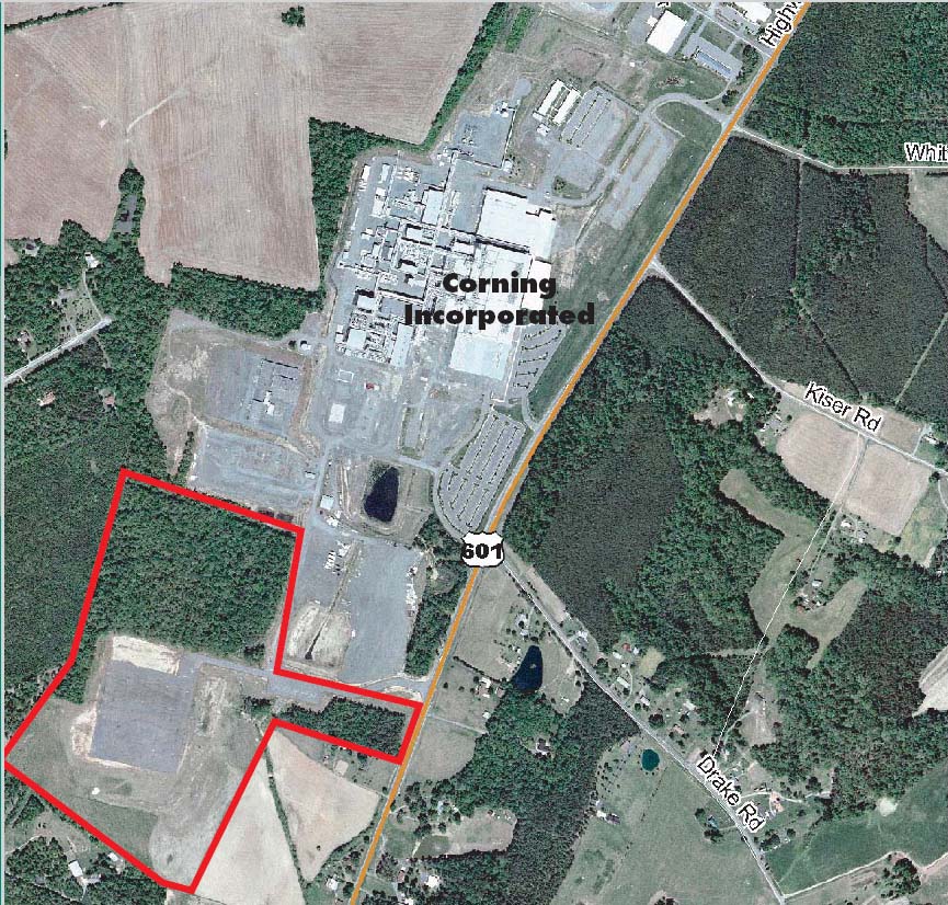
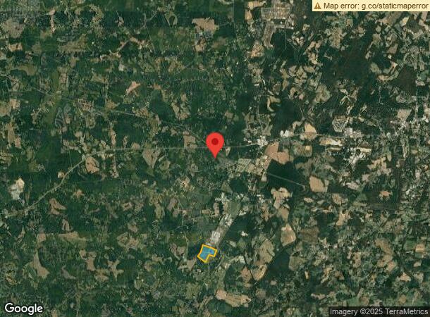
Property Record
15200 Highway 601, Midland, NC 28107
NEARBY LISTINGS FOR SALE OR LEASE
Property Detail
15200 Highway 601
Charlotte-Concord-Gastonia, NC-SC
Midland Commercial
5543-44-1315-0000
W/S HWY 601 & TRACT 4 NETTIE BEAVER
Industrialgeneral
Cabarrus
X
North Carolina
3710554300L
82.14 AC
2024
Cabarrus County
2024
Charlotte
041603
DEMOGRAPHICS near 15200 Highway 601
1 Mile
3 Mile
5 Mile
2024 Total Population
366
6,503
17,254
2029 Population
413
7,332
19,094
Pop Growth 2024-2029
+ 12.84%
+ 12.75%
+ 10.66%
Average Age
40
39
41
2024 Total Households
132
2,366
6,268
HH Growth 2024-2029
+ 12.12%
+ 11.75%
+ 10.00%
Median Household Inc
$87,500
$86,409
$91,448
Avg Household Size
2.70
2.70
2.70
2024 Avg HH Vehicles
2.00
2.00
2.00
Median Home Value
$310,000
$298,426
$308,208
Median Year Built
1996
1999
1994
Nearby Places
- Restaurants
- Banks
- Shops
- Fitness
- Groceries
PUBLIC TRANSPORTATION
AIRPORT
Concord-Padgett Regional
DRIVE
WALK
Distance
Concord-Padgett Regional
31 min
22.9 mi
Charlotte/Douglas International
DRIVE
WALK
Distance
Charlotte/Douglas International
46 min
27.8 mi
Freight Ports
Port of Wilmington
DRIVE
WALK
Distance
Port of Wilmington
236 min
186.5 mi
Nearby Properties
Address
Land Use
TOTAL SIZE
Lot Size
Zoning
Address
Land Use
TOTAL SIZE
Lot Size
Zoning
483,414 SF
154.89 AC
GI
Address
Land Use
TOTAL SIZE
Lot Size
Zoning
114,972 SF
40.59 AC
GI
Address
Land Use
TOTAL SIZE
Lot Size
Zoning
112,514 SF
35.77 AC
CIV
Address
Land Use
TOTAL SIZE
Lot Size
Zoning
27,500 SF
13.57 AC
C 24/27
Address
Land Use
TOTAL SIZE
Lot Size
Zoning
92.46 AC
OM
Address
Land Use
TOTAL SIZE
Lot Size
Zoning
47,890 SF
28.03 AC
GI
Address
Land Use
TOTAL SIZE
Lot Size
Zoning
2,850 SF
15.05 AC
CIV
Address
Land Use
TOTAL SIZE
Lot Size
Zoning
33,510 SF
2.60 AC
C 24/27
Address
Land Use
TOTAL SIZE
Lot Size
Zoning
51,686 SF
30.01 AC
IND
Address
Land Use
TOTAL SIZE
Lot Size
Zoning
111.80 AC
GI
Address
Land Use
TOTAL SIZE
Lot Size
Zoning
22,807 SF
4.28 AC
C 24/27
Address
Land Use
TOTAL SIZE
Lot Size
Zoning
1,512 SF
97.39 AC
IND
Address
Land Use
TOTAL SIZE
Lot Size
Zoning
4,961 SF
12.62 AC
GI
Address
Land Use
TOTAL SIZE
Lot Size
Zoning
17,910 SF
10 AC
IND
Address
Land Use
TOTAL SIZE
Lot Size
Zoning
31,391 SF
11.27 AC
IND
Address
Land Use
TOTAL SIZE
Lot Size
Zoning
6,510 SF
17.57 AC
C 24/27
Address
Land Use
TOTAL SIZE
Lot Size
Zoning
36,776 SF
5.95 AC
GI
Address
Land Use
TOTAL SIZE
Lot Size
Zoning
14,580 SF
6.08 AC
OM
Address
Land Use
TOTAL SIZE
Lot Size
Zoning
16,439 SF
4.52 AC
C 601
Address
Land Use
TOTAL SIZE
Lot Size
Zoning
89.72 AC
CR
Address
Land Use
TOTAL SIZE
Lot Size
Zoning
167.89 AC
CR
Address
Land Use
TOTAL SIZE
Lot Size
Zoning
51,512 SF
7.54 AC
GI
Address
Land Use
TOTAL SIZE
Lot Size
Zoning
31,647 SF
3.51 AC
GI
Address
Land Use
TOTAL SIZE
Lot Size
Zoning
7,300 SF
14.95 AC
OI
Address
Land Use
TOTAL SIZE
Lot Size
Zoning
76 AC
SFR
Address
Land Use
TOTAL SIZE
Lot Size
Zoning
15.42 AC
OPS
Address
Land Use
TOTAL SIZE
Lot Size
Zoning
26.56 AC
GI
Address
Land Use
TOTAL SIZE
Lot Size
Zoning
248.97 AC
OI
Address
Land Use
TOTAL SIZE
Lot Size
Zoning
31,500 SF
3.35 AC
GI
The World's #1 Commercial Real Estate Marketplace
Connect with us
© 2025 CoStar Group
The information above has been obtained from sources believed reliable. While we do not doubt its accuracy we have not verified it and make no guarantee, warranty or representation about it. It is your responsibility to independently confirm its accuracy and completeness. Any projections, opinions, assumptions, or estimates used are for example only and do not represent the current or future performance of the property. The value of this transaction to you depends on tax and other factors which should be evaluated by your tax, financial, and legal advisors. You and your advisors should conduct a careful, independent investigation of the property to determine to your satisfaction the suitability of the property for your needs.