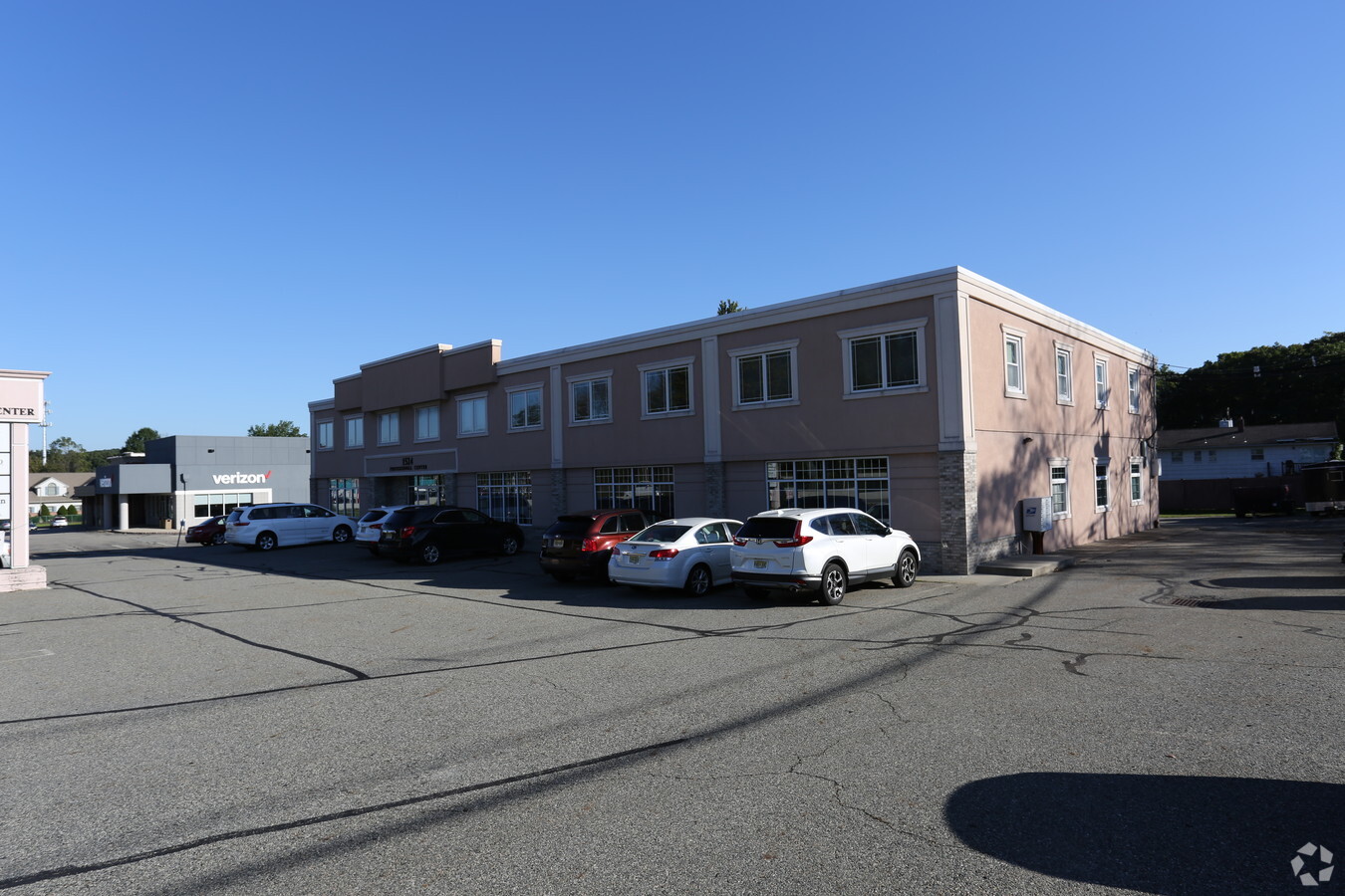
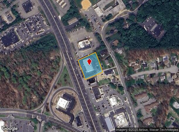
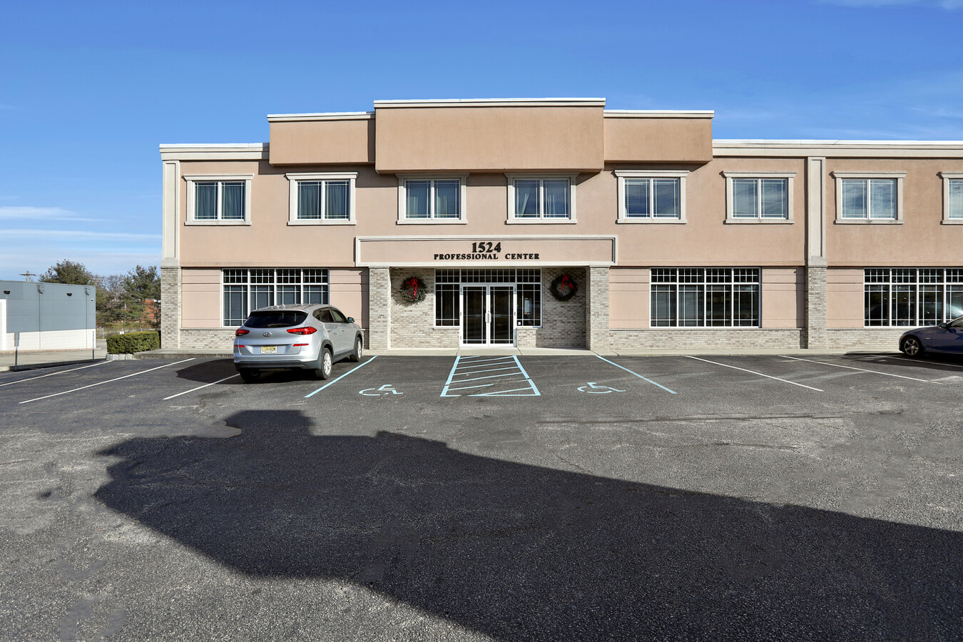
Property Record
1524 Route 23, Butler, NJ 07405
NEARBY LISTINGS FOR SALE OR LEASE
Property Detail
1524 Route 23
Newark, NJ-PA
Morris
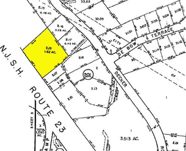
03-00201-0000-00002-19
New Jersey
Retailwithmorethanonenonretailuse
2.19
2023
0.92 AC
2024
Eastern Morris
040600
Northern New Jersey
11,730 SF
DEMOGRAPHICS near 1524 Route 23
1 Mile
3 Mile
5 Mile
2024 Total Population
8,320
30,893
73,981
2029 Population
8,206
30,609
73,659
Pop Growth 2024-2029
(1.37%)
(0.92%)
(0.44%)
Average Age
42
45
44
2024 Total Households
3,439
12,620
28,590
HH Growth 2024-2029
(1.54%)
(1.16%)
(0.59%)
Median Household Inc
$99,518
$107,431
$112,314
Avg Household Size
2.40
2.40
2.50
2024 Avg HH Vehicles
2.00
2.00
2.00
Median Home Value
$366,113
$421,200
$409,217
Median Year Built
1964
1969
1966
Nearby Places
- Restaurants
- Banks
- Shops
- Fitness
- Groceries
PUBLIC TRANSPORTATION
COMMUTER RAIL
Lincoln Park (Montclair-Boonton Line - NJ Transit Commuter Rail (NJ Transit))
DRIVE
WALK
Distance
Lincoln Park (Montclair-Boonton Line - NJ Transit Commuter Rail (NJ Transit))
13 min
8.8 mi
AIRPORT
Newark Liberty International
DRIVE
WALK
Distance
Newark Liberty International
38 min
32.6 mi
Laguardia
DRIVE
WALK
Distance
Laguardia
54 min
40.6 mi
Freight Ports
Port Newark Container Terminal
DRIVE
WALK
Distance
Port Newark Container Terminal
44 min
31.9 mi
SALE & LEASE HISTORY
LISTING DATE
SALE/LEASE

Dec 27, 2023
For Lease
Nearby Properties
Address
Land Use
TOTAL SIZE
Lot Size
Zoning
Address
Land Use
TOTAL SIZE
Lot Size
Zoning
143.16 AC
PUD
Address
Land Use
TOTAL SIZE
Lot Size
Zoning
264,080 SF
44.44 AC
HB
Address
Land Use
TOTAL SIZE
Lot Size
Zoning
15.36 AC
AH
Address
Land Use
TOTAL SIZE
Lot Size
Zoning
49,925 SF
4.08 AC
R-4
Address
Land Use
TOTAL SIZE
Lot Size
Zoning
41,791 SF
4.82 AC
HC
Address
Land Use
TOTAL SIZE
Lot Size
Zoning
9,360 SF
13.58 AC
R-7
Address
Land Use
TOTAL SIZE
Lot Size
Zoning
31.46 AC
R
Address
Land Use
TOTAL SIZE
Lot Size
Zoning
25,064 SF
14.53 AC
HB
Address
Land Use
TOTAL SIZE
Lot Size
Zoning
131,306 SF
14.40 AC
HB
Address
Land Use
TOTAL SIZE
Lot Size
Zoning
82,022 SF
6.09 AC
RC
Address
Land Use
TOTAL SIZE
Lot Size
Zoning
103,603 SF
12.12 AC
LI
Address
Land Use
TOTAL SIZE
Lot Size
Zoning
Address
Land Use
TOTAL SIZE
Lot Size
Zoning
109,848 SF
14.01 AC
HB
Address
Land Use
TOTAL SIZE
Lot Size
Zoning
9.13 AC
R-G
Address
Land Use
TOTAL SIZE
Lot Size
Zoning
13.72 AC
RO
Address
Land Use
TOTAL SIZE
Lot Size
Zoning
8,978 SF
7.04 AC
R-4
Address
Land Use
TOTAL SIZE
Lot Size
Zoning
2.93 AC
B-5
Address
Land Use
TOTAL SIZE
Lot Size
Zoning
23.15 AC
R
Address
Land Use
TOTAL SIZE
Lot Size
Zoning
105,263 SF
15.60 AC
RC
Address
Land Use
TOTAL SIZE
Lot Size
Zoning
67,570 SF
3.02 AC
SC
Address
Land Use
TOTAL SIZE
Lot Size
Zoning
434 SF
53.04 AC
I-3
Address
Land Use
TOTAL SIZE
Lot Size
Zoning
70,398 SF
6.14 AC
HB
Address
Land Use
TOTAL SIZE
Lot Size
Zoning
54,176 SF
21.48 AC
R-4
Address
Land Use
TOTAL SIZE
Lot Size
Zoning
Address
Land Use
TOTAL SIZE
Lot Size
Zoning
112,860 SF
2.39 AC
HB
Address
Land Use
TOTAL SIZE
Lot Size
Zoning
44.65 AC
I-3
Address
Land Use
TOTAL SIZE
Lot Size
Zoning
11.51 AC
R
Address
Land Use
TOTAL SIZE
Lot Size
Zoning
493.70 AC
R
Address
Land Use
TOTAL SIZE
Lot Size
Zoning
395.63 AC
SC
Address
Land Use
TOTAL SIZE
Lot Size
Zoning
35,111 SF
1.48 AC
HC
The World's #1 Commercial Real Estate Marketplace
Connect with us
© 2025 CoStar Group
The information above has been obtained from sources believed reliable. While we do not doubt its accuracy we have not verified it and make no guarantee, warranty or representation about it. It is your responsibility to independently confirm its accuracy and completeness. Any projections, opinions, assumptions, or estimates used are for example only and do not represent the current or future performance of the property. The value of this transaction to you depends on tax and other factors which should be evaluated by your tax, financial, and legal advisors. You and your advisors should conduct a careful, independent investigation of the property to determine to your satisfaction the suitability of the property for your needs.