Property Record
1525 Francisco Blvd E, San Rafael, CA 94901
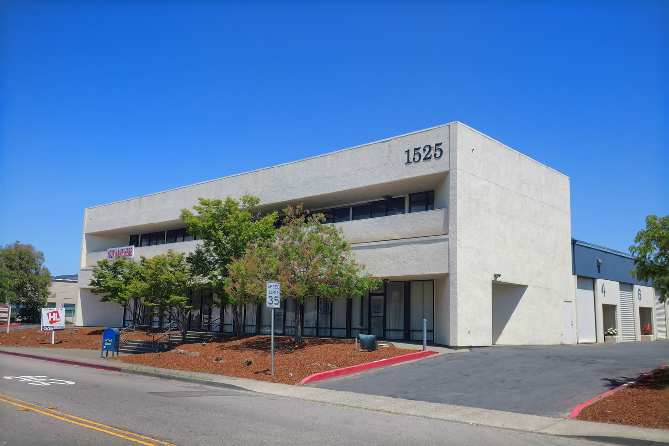
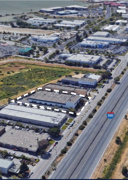
This Property Is For Sale
NEARBY LISTINGS FOR SALE OR LEASE
Property Detail
1525 Francisco Blvd E
San Rafael, CA
1525 Francisco Blvd Condo
009-310-08
L72&L73 /B18P26 M BAHIA DE RAFAEL IND
Commercialnec
Marin
AE
California
06041C0478E
72,73
2024
0.02 AC
2024
San Rafael/Larkspur
112202
North Bay/Santa Rosa
675 SF
DEMOGRAPHICS near 1525 Francisco Blvd E
1 Mile
3 Mile
5 Mile
2024 Total Population
8,133
65,859
131,259
2029 Population
7,846
64,012
127,626
Pop Growth 2024-2029
(3.53%)
(2.80%)
(2.77%)
Average Age
38
43
44
2024 Total Households
2,407
25,404
52,246
HH Growth 2024-2029
(3.57%)
(2.76%)
(2.75%)
Median Household Inc
$94,953
$117,235
$128,869
Avg Household Size
3.10
2.50
2.40
2024 Avg HH Vehicles
2.00
2.00
2.00
Median Home Value
$896,551
$1,109,289
$1,106,610
Median Year Built
1974
1964
1964
Nearby Places
- Restaurants
- Banks
- Shops
- Fitness
- Groceries
PUBLIC TRANSPORTATION
COMMUTER RAIL
San Rafael Smart (Main Line - Sonoma Marin Area Rail Transit)
DRIVE
WALK
Distance
San Rafael Smart (Main Line - Sonoma Marin Area Rail Transit)
5 min
2.3 mi
Larkspur Smart (Main Line - Sonoma Marin Area Rail Transit)
DRIVE
WALK
Distance
Larkspur Smart (Main Line - Sonoma Marin Area Rail Transit)
7 min
3.0 mi
AIRPORT
Metro Oakland International
DRIVE
WALK
Distance
Metro Oakland International
40 min
29.0 mi
San Francisco International
DRIVE
WALK
Distance
San Francisco International
51 min
31.4 mi
Freight Ports
Port of Richmond
DRIVE
WALK
Distance
Port of Richmond
18 min
9.6 mi
Nearby Properties
Address
Land Use
TOTAL SIZE
Lot Size
Zoning
Address
Land Use
TOTAL SIZE
Lot Size
Zoning
271,212 SF
15.87 AC
Address
Land Use
TOTAL SIZE
Lot Size
Zoning
217,791 SF
4.50 AC
Address
Land Use
TOTAL SIZE
Lot Size
Zoning
87,058 SF
1.33 AC
Address
Land Use
TOTAL SIZE
Lot Size
Zoning
91,151 SF
3.15 AC
Address
Land Use
TOTAL SIZE
Lot Size
Zoning
180,000 SF
15.92 AC
Address
Land Use
TOTAL SIZE
Lot Size
Zoning
132,969 SF
9.09 AC
Address
Land Use
TOTAL SIZE
Lot Size
Zoning
119,185 SF
4.31 AC
Address
Land Use
TOTAL SIZE
Lot Size
Zoning
109,944 SF
5.73 AC
Address
Land Use
TOTAL SIZE
Lot Size
Zoning
147,502 SF
1.02 AC
Address
Land Use
TOTAL SIZE
Lot Size
Zoning
218,521 SF
26.79 AC
Address
Land Use
TOTAL SIZE
Lot Size
Zoning
127,504 SF
8.49 AC
Address
Land Use
TOTAL SIZE
Lot Size
Zoning
91,158 SF
1.89 AC
Address
Land Use
TOTAL SIZE
Lot Size
Zoning
12.57 AC
Address
Land Use
TOTAL SIZE
Lot Size
Zoning
79,995 SF
3.15 AC
Address
Land Use
TOTAL SIZE
Lot Size
Zoning
119,061 SF
5.90 AC
Address
Land Use
TOTAL SIZE
Lot Size
Zoning
72,870 SF
3.51 AC
Address
Land Use
TOTAL SIZE
Lot Size
Zoning
94,745 SF
1.46 AC
Address
Land Use
TOTAL SIZE
Lot Size
Zoning
81,894 SF
5.91 AC
Address
Land Use
TOTAL SIZE
Lot Size
Zoning
234,922 SF
6 AC
Address
Land Use
TOTAL SIZE
Lot Size
Zoning
71,527 SF
1.86 AC
Address
Land Use
TOTAL SIZE
Lot Size
Zoning
177,460 SF
13 AC
Address
Land Use
TOTAL SIZE
Lot Size
Zoning
97,410 SF
5.97 AC
Address
Land Use
TOTAL SIZE
Lot Size
Zoning
11,830 SF
0.65 AC
Address
Land Use
TOTAL SIZE
Lot Size
Zoning
138,861 SF
15.82 AC
Address
Land Use
TOTAL SIZE
Lot Size
Zoning
100,900 SF
4.32 AC
Address
Land Use
TOTAL SIZE
Lot Size
Zoning
82,206 SF
3.67 AC
Address
Land Use
TOTAL SIZE
Lot Size
Zoning
87,840 SF
1.19 AC
Address
Land Use
TOTAL SIZE
Lot Size
Zoning
54,189 SF
4.80 AC
Address
Land Use
TOTAL SIZE
Lot Size
Zoning
75,629 SF
2.80 AC
Address
Land Use
TOTAL SIZE
Lot Size
Zoning
66,700 SF
0.99 AC
The World's #1 Commercial Real Estate Marketplace
Connect with us
© 2025 CoStar Group
The information above has been obtained from sources believed reliable. While we do not doubt its accuracy we have not verified it and make no guarantee, warranty or representation about it. It is your responsibility to independently confirm its accuracy and completeness. Any projections, opinions, assumptions, or estimates used are for example only and do not represent the current or future performance of the property. The value of this transaction to you depends on tax and other factors which should be evaluated by your tax, financial, and legal advisors. You and your advisors should conduct a careful, independent investigation of the property to determine to your satisfaction the suitability of the property for your needs.