No Photo
Property Record
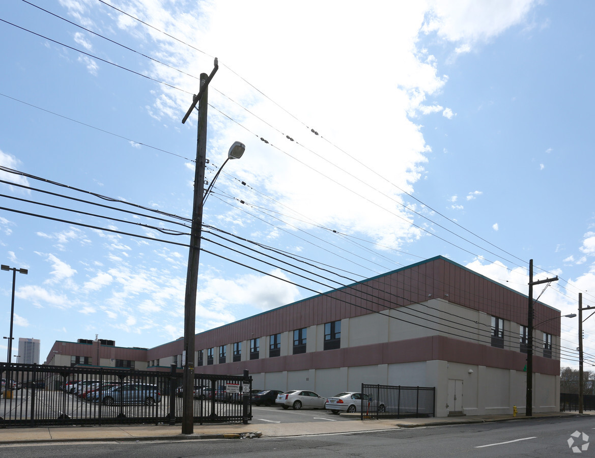
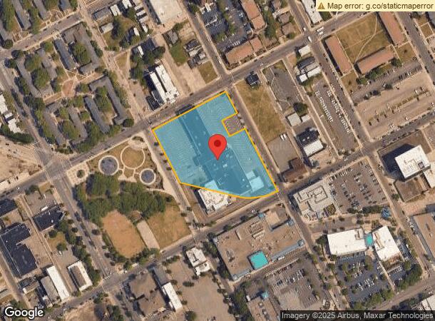
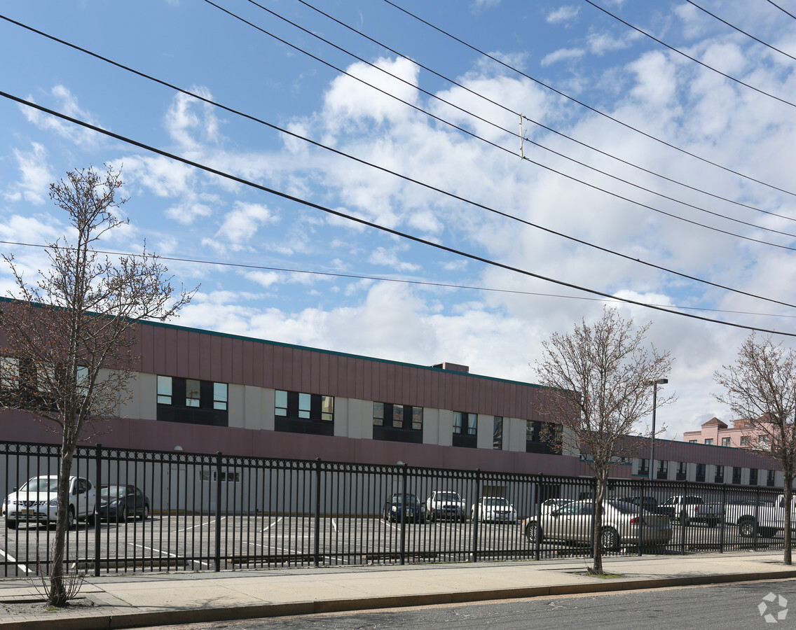
1535 Bacharach Blvd, Atlantic City, NJ 08401
NEARBY LISTINGS FOR SALE OR LEASE
-
-
View all Atlantic City listings for sale on LoopNet.com
Property Detail
1535 Bacharach Blvd
02-00323-0000-00001
FACILITY NAME: COLLEGE
Publicschool
Atlantic
ARE
New Jersey
34001C0456F
1
0
2.04 AC
2024
Atlantic City/Hammonton
002400
Philadelphia
14,072 SF
Atlantic City-Hammonton, NJ
DEMOGRAPHICS near 1535 Bacharach Blvd
1 Mile
3 Mile
5 Mile
2024 Total Population
21,535
52,620
76,182
2029 Population
21,483
53,836
79,028
Pop Growth 2024-2029
(0.24%)
+ 2.31%
+ 3.74%
Average Age
39
41
44
2024 Total Households
9,053
22,418
33,377
HH Growth 2024-2029
(0.46%)
+ 2.48%
+ 3.99%
Median Household Inc
$26,231
$37,464
$50,034
Avg Household Size
2.20
2.20
2.20
2024 Avg HH Vehicles
1.00
1.00
1.00
Median Home Value
$139,439
$246,788
$327,069
Median Year Built
1964
1965
1965
Nearby Places
- Restaurants
- Banks
- Shops
- Fitness
- Groceries
PUBLIC TRANSPORTATION
COMMUTER RAIL
Atlantic City (Atlantic City Line - NJ Transit Commuter Rail (NJ Transit))
DRIVE
WALK
Distance
Atlantic City (Atlantic City Line - NJ Transit Commuter Rail (NJ Transit))
4 min
12 min
0.6 mi
Absecon (Atlantic City Line - NJ Transit Commuter Rail (NJ Transit))
DRIVE
WALK
Distance
Absecon (Atlantic City Line - NJ Transit Commuter Rail (NJ Transit))
12 min
6.7 mi
AIRPORT
Atlantic City International
DRIVE
WALK
Distance
Atlantic City International
40 min
16.1 mi
Freight Ports
Broadway Terminal - Pier 5
DRIVE
WALK
Distance
Broadway Terminal - Pier 5
71 min
56.5 mi
Nearby Properties
Address
Land Use
TOTAL SIZE
Lot Size
Zoning
Address
Land Use
TOTAL SIZE
Lot Size
Zoning
25.97 AC
HNRA
Address
Land Use
TOTAL SIZE
Lot Size
Zoning
5,364 SF
142.55 AC
BFRA
Address
Land Use
TOTAL SIZE
Lot Size
Zoning
14.71 AC
RS-C
Address
Land Use
TOTAL SIZE
Lot Size
Zoning
69.16 AC
HNRA
Address
Land Use
TOTAL SIZE
Lot Size
Zoning
398,702 SF
4.05 AC
RS-C
Address
Land Use
TOTAL SIZE
Lot Size
Zoning
9.90 AC
RS-C
Address
Land Use
TOTAL SIZE
Lot Size
Zoning
6,552 SF
3.60 AC
RS
Address
Land Use
TOTAL SIZE
Lot Size
Zoning
3.54 AC
HNRA
Address
Land Use
TOTAL SIZE
Lot Size
Zoning
387,249 SF
49.56 AC
HW-C
Address
Land Use
TOTAL SIZE
Lot Size
Zoning
4.33 AC
RS-C
Address
Land Use
TOTAL SIZE
Lot Size
Zoning
Address
Land Use
TOTAL SIZE
Lot Size
Zoning
1.98 AC
RS-C
Address
Land Use
TOTAL SIZE
Lot Size
Zoning
2.44 AC
RS-C
Address
Land Use
TOTAL SIZE
Lot Size
Zoning
7.62 AC
RS-C
Address
Land Use
TOTAL SIZE
Lot Size
Zoning
3.01 AC
RS-C
Address
Land Use
TOTAL SIZE
Lot Size
Zoning
192,602 SF
5.80 AC
RS-C
Address
Land Use
TOTAL SIZE
Lot Size
Zoning
277,716 SF
5.45 AC
RS-C
Address
Land Use
TOTAL SIZE
Lot Size
Zoning
1.09 AC
RS-C
Address
Land Use
TOTAL SIZE
Lot Size
Zoning
28,520 SF
47.40 AC
M-C
Address
Land Use
TOTAL SIZE
Lot Size
Zoning
2.13 AC
RS-C
Address
Land Use
TOTAL SIZE
Lot Size
Zoning
2.75 AC
Address
Land Use
TOTAL SIZE
Lot Size
Zoning
2.91 AC
RS-C
Address
Land Use
TOTAL SIZE
Lot Size
Zoning
43,980 SF
1.80 AC
R-3
Address
Land Use
TOTAL SIZE
Lot Size
Zoning
8.35 AC
HNRA
Address
Land Use
TOTAL SIZE
Lot Size
Zoning
4.22 AC
RS-C
Address
Land Use
TOTAL SIZE
Lot Size
Zoning
1.66 AC
RS-C
Address
Land Use
TOTAL SIZE
Lot Size
Zoning
Address
Land Use
TOTAL SIZE
Lot Size
Zoning
2.67 AC
R-1
Address
Land Use
TOTAL SIZE
Lot Size
Zoning
2.04 AC
HNRA
Address
Land Use
TOTAL SIZE
Lot Size
Zoning
The World's #1 Commercial Real Estate Marketplace
Connect with us
© 2025 CoStar Group
The information above has been obtained from sources believed reliable. While we do not doubt its accuracy we have not verified it and make no guarantee, warranty or representation about it. It is your responsibility to independently confirm its accuracy and completeness. Any projections, opinions, assumptions, or estimates used are for example only and do not represent the current or future performance of the property. The value of this transaction to you depends on tax and other factors which should be evaluated by your tax, financial, and legal advisors. You and your advisors should conduct a careful, independent investigation of the property to determine to your satisfaction the suitability of the property for your needs.