Property Record
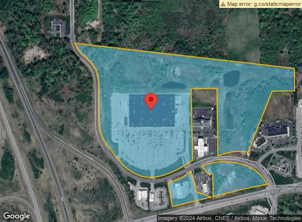
15400 Waldron Way, Big Rapids, MI 49307

NEARBY LISTINGS FOR SALE OR LEASE
Property Detail
15400 Waldron Way
05 016 014 301
SEC 16 T15N R10W COM AT S 1/4 POST SEC 16 TH N 0 DEG 22 M W 1075.17 FT TO INT OF NLY R/W LINE HIGHWAY M-20 AND N & S 1/4 LINE
Commercialnec
Mecosta
X
Michigan
26123C0250D
56.64 AC
0
Michigan North Central Area
2024
Other Market Areas
960600
Big Rapids, MI
DEMOGRAPHICS near 15400 Waldron Way
1 Mile
3 Mile
5 Mile
2024 Total Population
858
11,456
15,591
2029 Population
912
12,182
16,553
Pop Growth 2024-2029
+ 6.29%
+ 6.34%
+ 6.17%
Average Age
35
34
36
2024 Total Households
382
4,631
6,259
HH Growth 2024-2029
+ 6.54%
+ 6.85%
+ 6.52%
Median Household Inc
$34,210
$31,879
$41,094
Avg Household Size
2.10
2.10
2.20
2024 Avg HH Vehicles
2.00
2.00
2.00
Median Home Value
$174,073
$158,685
$160,218
Median Year Built
1978
1977
1978
Nearby Places
- Restaurants
- Banks
- Shops
- Fitness
- Groceries
SALE & LEASE HISTORY
LISTING DATE
SALE/LEASE

Mar 16, 2023
For Lease
Nearby Properties
Address
Land Use
TOTAL SIZE
Lot Size
Zoning
Address
Land Use
TOTAL SIZE
Lot Size
Zoning
270869
19.75 AC
Address
Land Use
TOTAL SIZE
Lot Size
Zoning
205711
30.37 AC
Address
Land Use
TOTAL SIZE
Lot Size
Zoning
20760
36.80 AC
Address
Land Use
TOTAL SIZE
Lot Size
Zoning
16.08 AC
Address
Land Use
TOTAL SIZE
Lot Size
Zoning
Address
Land Use
TOTAL SIZE
Lot Size
Zoning
9.65 AC
Address
Land Use
TOTAL SIZE
Lot Size
Zoning
95044
12.16 AC
Address
Land Use
TOTAL SIZE
Lot Size
Zoning
10080
18.85 AC
Address
Land Use
TOTAL SIZE
Lot Size
Zoning
Address
Land Use
TOTAL SIZE
Lot Size
Zoning
14.05 AC
Address
Land Use
TOTAL SIZE
Lot Size
Zoning
23240
7.41 AC
Address
Land Use
TOTAL SIZE
Lot Size
Zoning
18387
6.20 AC
Address
Land Use
TOTAL SIZE
Lot Size
Zoning
60416
5.40 AC
Address
Land Use
TOTAL SIZE
Lot Size
Zoning
35.44 AC
Address
Land Use
TOTAL SIZE
Lot Size
Zoning
14094
9.43 AC
Address
Land Use
TOTAL SIZE
Lot Size
Zoning
Address
Land Use
TOTAL SIZE
Lot Size
Zoning
103416
23.68 AC
Address
Land Use
TOTAL SIZE
Lot Size
Zoning
263.37 AC
Address
Land Use
TOTAL SIZE
Lot Size
Zoning
263.37 AC
Address
Land Use
TOTAL SIZE
Lot Size
Zoning
89079
6.90 AC
Address
Land Use
TOTAL SIZE
Lot Size
Zoning
Address
Land Use
TOTAL SIZE
Lot Size
Zoning
11319
3.40 AC
Address
Land Use
TOTAL SIZE
Lot Size
Zoning
12.54 AC
Address
Land Use
TOTAL SIZE
Lot Size
Zoning
131210
6.11 AC
Address
Land Use
TOTAL SIZE
Lot Size
Zoning
10443
5.81 AC
Address
Land Use
TOTAL SIZE
Lot Size
Zoning
20300
6.36 AC
Address
Land Use
TOTAL SIZE
Lot Size
Zoning
25434
4.39 AC
Address
Land Use
TOTAL SIZE
Lot Size
Zoning
36322
3.22 AC
Address
Land Use
TOTAL SIZE
Lot Size
Zoning
12960
6.14 AC
Start a new search to find other properties for sale or lease
Connect with us
© 2024 CoStar Group
The information above has been obtained from sources believed reliable. While we do not doubt its accuracy we have not verified it and make no guarantee, warranty or representation about it. It is your responsibility to independently confirm its accuracy and completeness. Any projections, opinions, assumptions, or estimates used are for example only and do not represent the current or future performance of the property. The value of this transaction to you depends on tax and other factors which should be evaluated by your tax, financial, and legal advisors. You and your advisors should conduct a careful, independent investigation of the property to determine to your satisfaction the suitability of the property for your needs.