Property Record
15410 John Marshall Hwy, Haymarket, VA 20169
NEARBY LISTINGS FOR SALE OR LEASE
Property Detail
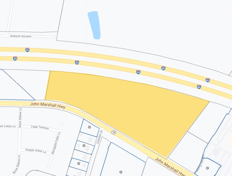
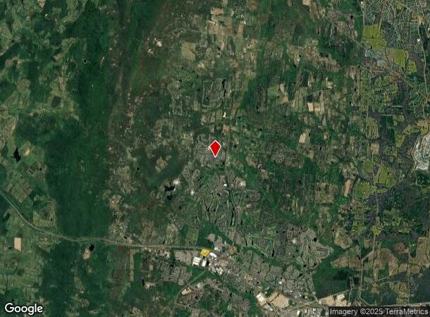
15410 John Marshall Hwy
7298-52-5158
Plat Showing Subdivision Street Dedicati
Storebuilding
PCL C2
X
Prince William
51061C0250D
Virginia
2024
10.84 AC
2024
Route 29/I-66 Corridor
901511
Washington, DC
136,000 SF
Washington-Arlington-Alexandria, DC-VA-MD-WV
DEMOGRAPHICS near 15410 John Marshall Hwy
1 Mile
3 Mile
5 Mile
2024 Total Population
6,950
46,081
70,828
2029 Population
7,267
47,611
73,035
Pop Growth 2024-2029
+ 4.56%
+ 3.32%
+ 3.12%
Average Age
36
40
40
2024 Total Households
2,244
15,472
23,126
HH Growth 2024-2029
+ 4.55%
+ 3.30%
+ 3.17%
Median Household Inc
$148,914
$145,679
$146,384
Avg Household Size
3.10
2.90
3.00
2024 Avg HH Vehicles
2.00
2.00
2.00
Median Home Value
$610,145
$636,385
$643,561
Median Year Built
2009
2006
2004
Nearby Places
- Restaurants
- Banks
- Shops
- Fitness
- Groceries
PUBLIC TRANSPORTATION
AIRPORT
Washington Dulles International
DRIVE
WALK
Distance
Washington Dulles International
44 min
24.2 mi
Freight Ports
Port of Baltimore
DRIVE
WALK
Distance
Port of Baltimore
103 min
78.6 mi
SALE & LEASE HISTORY
LISTING DATE
SALE/LEASE

Jun 16, 2022
For Lease
Nearby Properties
Address
Land Use
TOTAL SIZE
Lot Size
Zoning
Address
Land Use
TOTAL SIZE
Lot Size
Zoning
453,174 SF
38.50 AC
PBD
Address
Land Use
TOTAL SIZE
Lot Size
Zoning
220,552 SF
30.95 AC
PMD
Address
Land Use
TOTAL SIZE
Lot Size
Zoning
236,082 SF
28.27 AC
M2
Address
Land Use
TOTAL SIZE
Lot Size
Zoning
280,221 SF
78.34 AC
RPC
Address
Land Use
TOTAL SIZE
Lot Size
Zoning
140,285 SF
20.50 AC
RPC
Address
Land Use
TOTAL SIZE
Lot Size
Zoning
144,869 SF
40.78 AC
A1
Address
Land Use
TOTAL SIZE
Lot Size
Zoning
95,846 SF
17.99 AC
RPC
Address
Land Use
TOTAL SIZE
Lot Size
Zoning
133,296 SF
6.24 AC
M2
Address
Land Use
TOTAL SIZE
Lot Size
Zoning
81,462 SF
PMD
Address
Land Use
TOTAL SIZE
Lot Size
Zoning
91.94 AC
MIXED
Address
Land Use
TOTAL SIZE
Lot Size
Zoning
160,480 SF
12.75 AC
PMD
Address
Land Use
TOTAL SIZE
Lot Size
Zoning
81,015 SF
20.17 AC
RPC
Address
Land Use
TOTAL SIZE
Lot Size
Zoning
75,483 SF
17.65 AC
A1
Address
Land Use
TOTAL SIZE
Lot Size
Zoning
72,366 SF
28.18 AC
A1
Address
Land Use
TOTAL SIZE
Lot Size
Zoning
75,184 SF
2.05 AC
B1
Address
Land Use
TOTAL SIZE
Lot Size
Zoning
135,297 SF
39.35 AC
R2
Address
Land Use
TOTAL SIZE
Lot Size
Zoning
36,554 SF
7.18 AC
PBD
Address
Land Use
TOTAL SIZE
Lot Size
Zoning
39,927 SF
9.32 AC
PMD
Address
Land Use
TOTAL SIZE
Lot Size
Zoning
65,035 SF
4.94 AC
M1
Address
Land Use
TOTAL SIZE
Lot Size
Zoning
36,293 SF
214.59 AC
A1
Address
Land Use
TOTAL SIZE
Lot Size
Zoning
21,739 SF
4.08 AC
B2
Address
Land Use
TOTAL SIZE
Lot Size
Zoning
64,728 SF
4.32 AC
PMD
Address
Land Use
TOTAL SIZE
Lot Size
Zoning
41,190 SF
3.13 AC
M1
Address
Land Use
TOTAL SIZE
Lot Size
Zoning
22,400 SF
2.68 AC
M1
Address
Land Use
TOTAL SIZE
Lot Size
Zoning
18,523 SF
4.25 AC
RPC
Address
Land Use
TOTAL SIZE
Lot Size
Zoning
53,961 SF
3.74 AC
M1
Address
Land Use
TOTAL SIZE
Lot Size
Zoning
45,120 SF
3.45 AC
M1
Address
Land Use
TOTAL SIZE
Lot Size
Zoning
27,720 SF
2.27 AC
B2
Address
Land Use
TOTAL SIZE
Lot Size
Zoning
2,522 SF
231.89 AC
A1
The World's #1 Commercial Real Estate Marketplace
Connect with us
© 2025 CoStar Group
The information above has been obtained from sources believed reliable. While we do not doubt its accuracy we have not verified it and make no guarantee, warranty or representation about it. It is your responsibility to independently confirm its accuracy and completeness. Any projections, opinions, assumptions, or estimates used are for example only and do not represent the current or future performance of the property. The value of this transaction to you depends on tax and other factors which should be evaluated by your tax, financial, and legal advisors. You and your advisors should conduct a careful, independent investigation of the property to determine to your satisfaction the suitability of the property for your needs.