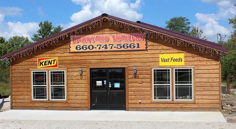
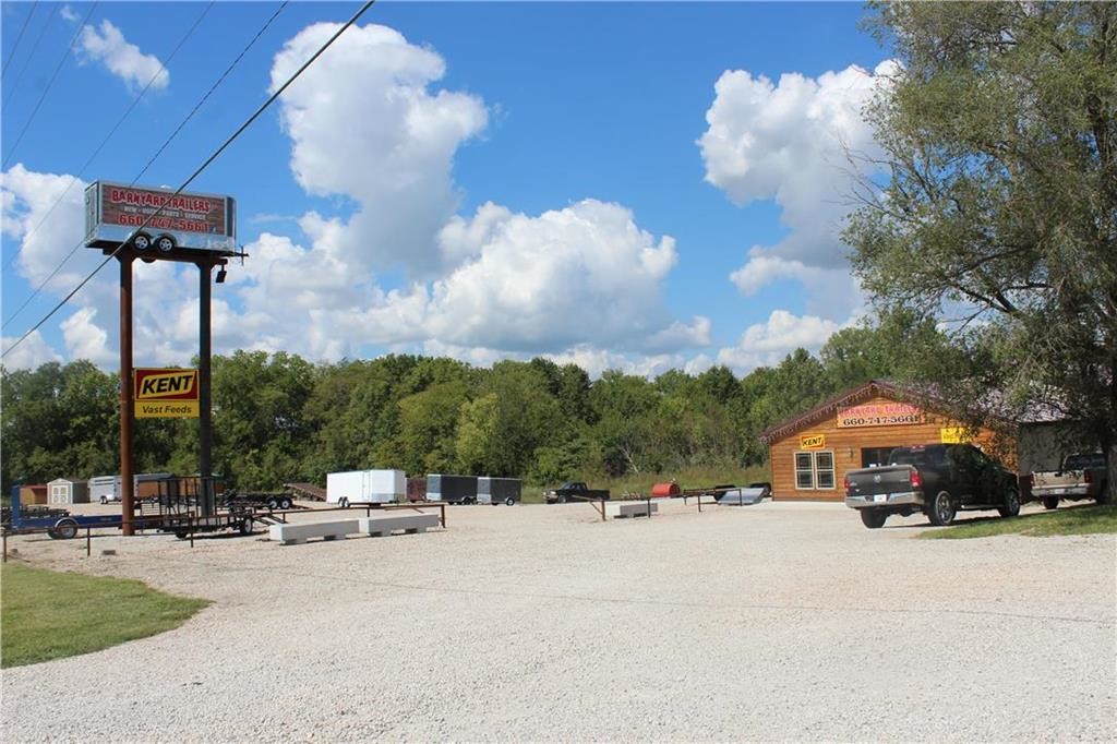
Property Record
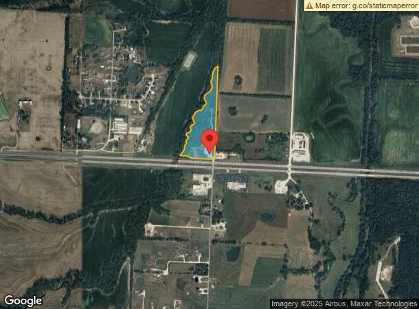
155 Nw Us Highway 50, Warrensburg, MO 64093
NEARBY LISTINGS FOR SALE OR LEASE
-
-
View all Warrensburg listings for sale on LoopNet.com
Property Detail
155 Nw Us Highway 50
12501500000000401
Highway Indust Park
Commercialnec
15 46 26 PT E . S OF CRK E SW
A
Johnson
29101C0220E
Missouri
2024
11.86 AC
2024
Johnson County MO
960301
Kansas City
1,008 SF
Warrensburg, MO
DEMOGRAPHICS near 155 Nw Us Highway 50
1 Mile
3 Mile
5 Mile
2024 Total Population
198
15,734
25,853
2029 Population
204
16,144
26,400
Pop Growth 2024-2029
+ 3.03%
+ 2.61%
+ 2.12%
Average Age
38
33
34
2024 Total Households
80
5,785
9,624
HH Growth 2024-2029
+ 2.50%
+ 2.94%
+ 2.34%
Median Household Inc
$63,214
$47,761
$57,551
Avg Household Size
2.50
2.20
2.30
2024 Avg HH Vehicles
2.00
2.00
2.00
Median Home Value
$257,142
$201,660
$192,702
Median Year Built
2001
1987
1989
Nearby Places
- Restaurants
- Banks
- Shops
- Fitness
- Groceries
PUBLIC TRANSPORTATION
COMMUTER RAIL
Warrensburg Amtrak Station (Lincoln Service Missouri River Runner - Amtrak, Missouri River Runner - Amtrak)
DRIVE
WALK
Distance
Warrensburg Amtrak Station (Lincoln Service Missouri River Runner - Amtrak, Missouri River Runner - Amtrak)
4 min
2.5 mi
Freight Ports
Tulsa Port Of Catoosa
DRIVE
WALK
Distance
Tulsa Port Of Catoosa
299 min
264.5 mi
SALE & LEASE HISTORY
LISTING DATE
SALE/LEASE

Jan 23, 2019
For Sale
Nearby Properties
Address
Land Use
TOTAL SIZE
Lot Size
Zoning
Address
Land Use
TOTAL SIZE
Lot Size
Zoning
205,785 SF
24.20 AC
Address
Land Use
TOTAL SIZE
Lot Size
Zoning
112,082 SF
10.79 AC
Address
Land Use
TOTAL SIZE
Lot Size
Zoning
Address
Land Use
TOTAL SIZE
Lot Size
Zoning
4,552 SF
8.01 AC
Address
Land Use
TOTAL SIZE
Lot Size
Zoning
43,053 SF
2.79 AC
Address
Land Use
TOTAL SIZE
Lot Size
Zoning
52,925 SF
5.53 AC
Address
Land Use
TOTAL SIZE
Lot Size
Zoning
27,306 SF
2.69 AC
Address
Land Use
TOTAL SIZE
Lot Size
Zoning
27,022 SF
1.75 AC
Address
Land Use
TOTAL SIZE
Lot Size
Zoning
44,818 SF
2.24 AC
Address
Land Use
TOTAL SIZE
Lot Size
Zoning
32,828 SF
2.40 AC
Address
Land Use
TOTAL SIZE
Lot Size
Zoning
3,914 SF
5.92 AC
Address
Land Use
TOTAL SIZE
Lot Size
Zoning
12,212 SF
1.45 AC
Address
Land Use
TOTAL SIZE
Lot Size
Zoning
53,692 SF
9.83 AC
Address
Land Use
TOTAL SIZE
Lot Size
Zoning
75,899 SF
5.25 AC
Address
Land Use
TOTAL SIZE
Lot Size
Zoning
Address
Land Use
TOTAL SIZE
Lot Size
Zoning
21,290 SF
4.70 AC
Address
Land Use
TOTAL SIZE
Lot Size
Zoning
3,622 SF
4.83 AC
Address
Land Use
TOTAL SIZE
Lot Size
Zoning
Address
Land Use
TOTAL SIZE
Lot Size
Zoning
16,102 SF
4.06 AC
Address
Land Use
TOTAL SIZE
Lot Size
Zoning
17,193 SF
2.74 AC
Address
Land Use
TOTAL SIZE
Lot Size
Zoning
13,002 SF
0.27 AC
Address
Land Use
TOTAL SIZE
Lot Size
Zoning
6,365 SF
Address
Land Use
TOTAL SIZE
Lot Size
Zoning
23,937 SF
7.34 AC
Address
Land Use
TOTAL SIZE
Lot Size
Zoning
36,186 SF
3.45 AC
Address
Land Use
TOTAL SIZE
Lot Size
Zoning
2,450 SF
7.17 AC
Address
Land Use
TOTAL SIZE
Lot Size
Zoning
8,811 SF
3.68 AC
Address
Land Use
TOTAL SIZE
Lot Size
Zoning
6,678 SF
3 AC
Address
Land Use
TOTAL SIZE
Lot Size
Zoning
2,850 SF
1 AC
Address
Land Use
TOTAL SIZE
Lot Size
Zoning
2,400 SF
12.02 AC
Address
Land Use
TOTAL SIZE
Lot Size
Zoning
14,490 SF
1.41 AC
The World's #1 Commercial Real Estate Marketplace
Connect with us
© 2025 CoStar Group
The information above has been obtained from sources believed reliable. While we do not doubt its accuracy we have not verified it and make no guarantee, warranty or representation about it. It is your responsibility to independently confirm its accuracy and completeness. Any projections, opinions, assumptions, or estimates used are for example only and do not represent the current or future performance of the property. The value of this transaction to you depends on tax and other factors which should be evaluated by your tax, financial, and legal advisors. You and your advisors should conduct a careful, independent investigation of the property to determine to your satisfaction the suitability of the property for your needs.