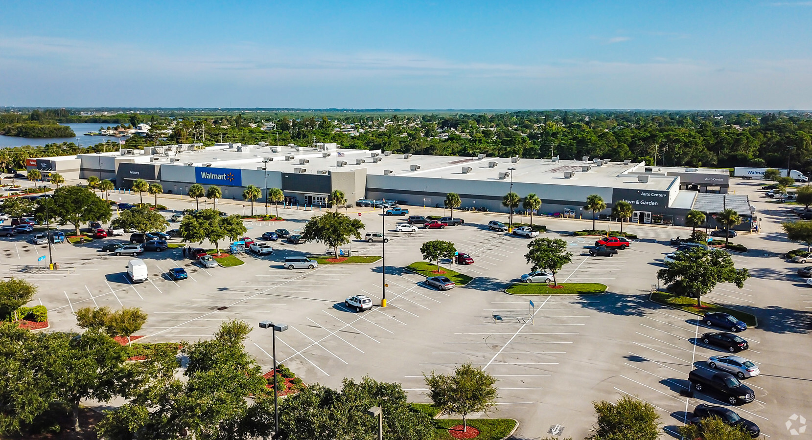
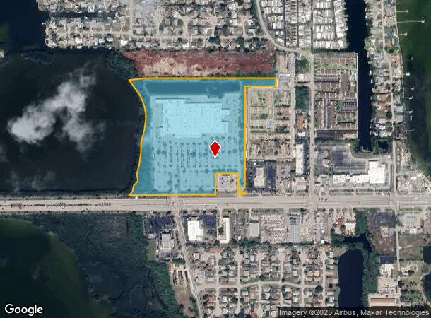
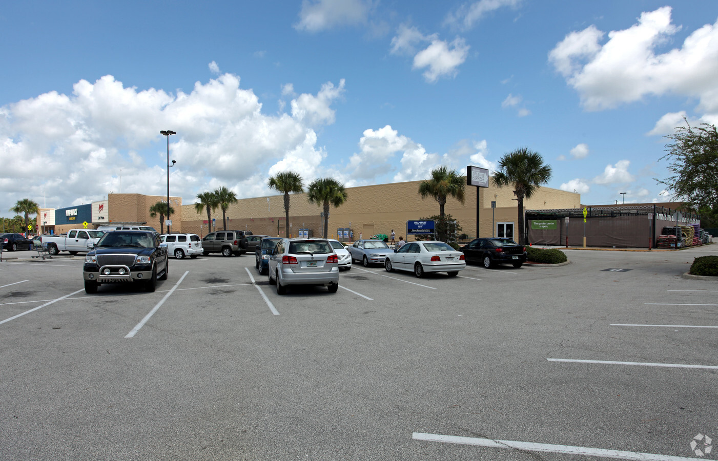
Property Record
1550 E Merritt Island Cswy, Merritt Island, FL 32952

NEARBY LISTINGS FOR SALE OR LEASE
Property Detail
1550 E Merritt Island Cswy
24-37-31-00-00010.0-0000.00
PART OF GOVT LOTS 1, 2, 3, 4 AS DESC IN DB 356 PG 229, 393 PG 532; ORB 3326 PG 1797 EXC ORB 3367 PG 679, 3687 PG 1633 PARS 251, 252 & 253
Departmentstore
Brevard
AE
Florida
12009C0435H
1-4
2023
26.18 AC
2023
Brevard County
069200
Orlando
198,201 SF
Palm Bay-Melbourne-Titusville, FL
DEMOGRAPHICS near 1550 E Merritt Island Cswy
1 Mile
3 Mile
5 Mile
2024 Total Population
5,318
26,654
85,111
2029 Population
5,931
29,011
94,106
Pop Growth 2024-2029
+ 11.53%
+ 8.84%
+ 10.57%
Average Age
50
46
48
2024 Total Households
2,753
12,002
40,039
HH Growth 2024-2029
+ 11.99%
+ 8.88%
+ 10.81%
Median Household Inc
$61,752
$70,112
$68,155
Avg Household Size
1.90
2.20
2.10
2024 Avg HH Vehicles
2.00
2.00
2.00
Median Home Value
$326,508
$335,845
$331,579
Median Year Built
1972
1969
1976
Nearby Places
- Restaurants
- Banks
- Shops
- Fitness
- Groceries
PUBLIC TRANSPORTATION
AIRPORT
Melbourne Orlando International
DRIVE
WALK
Distance
Melbourne Orlando International
46 min
28.1 mi
Freight Ports
Port Canaveral
DRIVE
WALK
Distance
Port Canaveral
15 min
7.2 mi
Nearby Properties
Address
Land Use
TOTAL SIZE
Lot Size
Zoning
Address
Land Use
TOTAL SIZE
Lot Size
Zoning
320,279 SF
51.92 AC
PS1
Address
Land Use
TOTAL SIZE
Lot Size
Zoning
256,094 SF
37.37 AC
BU1
Address
Land Use
TOTAL SIZE
Lot Size
Zoning
263,066 SF
13.36 AC
PUD
Address
Land Use
TOTAL SIZE
Lot Size
Zoning
666,224 SF
55.06 AC
BU1
Address
Land Use
TOTAL SIZE
Lot Size
Zoning
211,483 SF
14.46 AC
BU2
Address
Land Use
TOTAL SIZE
Lot Size
Zoning
313,612 SF
11.91 AC
BU1
Address
Land Use
TOTAL SIZE
Lot Size
Zoning
153,136 SF
8.65 AC
RU215
Address
Land Use
TOTAL SIZE
Lot Size
Zoning
122,116 SF
28.56 AC
AU
Address
Land Use
TOTAL SIZE
Lot Size
Zoning
140,113 SF
25 AC
GU
Address
Land Use
TOTAL SIZE
Lot Size
Zoning
249,080 SF
106.95 AC
GML
Address
Land Use
TOTAL SIZE
Lot Size
Zoning
212,232 SF
20.80 AC
RU215
Address
Land Use
TOTAL SIZE
Lot Size
Zoning
89,408 SF
18.50 AC
GU
Address
Land Use
TOTAL SIZE
Lot Size
Zoning
98,877 SF
7.86 AC
BU2
Address
Land Use
TOTAL SIZE
Lot Size
Zoning
120,495 SF
3.86 AC
PUD
Address
Land Use
TOTAL SIZE
Lot Size
Zoning
7,992 SF
22.36 AC
AU
Address
Land Use
TOTAL SIZE
Lot Size
Zoning
79,845 SF
8.47 AC
RU230
Address
Land Use
TOTAL SIZE
Lot Size
Zoning
83,650 SF
25.65 AC
AU
Address
Land Use
TOTAL SIZE
Lot Size
Zoning
61,207 SF
16.03 AC
GU
Address
Land Use
TOTAL SIZE
Lot Size
Zoning
130,361 SF
12.77 AC
BU1
Address
Land Use
TOTAL SIZE
Lot Size
Zoning
73,708 SF
8.60 AC
GMLI
Address
Land Use
TOTAL SIZE
Lot Size
Zoning
112,440 SF
22.08 AC
BU1
Address
Land Use
TOTAL SIZE
Lot Size
Zoning
68,218 SF
9.07 AC
BU1
Address
Land Use
TOTAL SIZE
Lot Size
Zoning
94,046 SF
12 AC
GU
Address
Land Use
TOTAL SIZE
Lot Size
Zoning
84,747 SF
8.57 AC
BU2
Address
Land Use
TOTAL SIZE
Lot Size
Zoning
103,870 SF
15.67 AC
BU1
Address
Land Use
TOTAL SIZE
Lot Size
Zoning
97,920 SF
6.08 AC
RU215
Address
Land Use
TOTAL SIZE
Lot Size
Zoning
39,228 SF
1.74 AC
BU1
Address
Land Use
TOTAL SIZE
Lot Size
Zoning
36,560 SF
2.84 AC
BU1
Address
Land Use
TOTAL SIZE
Lot Size
Zoning
66,318 SF
6.92 AC
BU-2
The World's #1 Commercial Real Estate Marketplace
Connect with us
© 2025 CoStar Group
The information above has been obtained from sources believed reliable. While we do not doubt its accuracy we have not verified it and make no guarantee, warranty or representation about it. It is your responsibility to independently confirm its accuracy and completeness. Any projections, opinions, assumptions, or estimates used are for example only and do not represent the current or future performance of the property. The value of this transaction to you depends on tax and other factors which should be evaluated by your tax, financial, and legal advisors. You and your advisors should conduct a careful, independent investigation of the property to determine to your satisfaction the suitability of the property for your needs.