Property Record
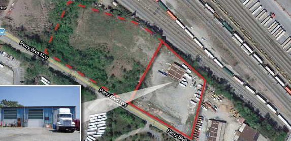
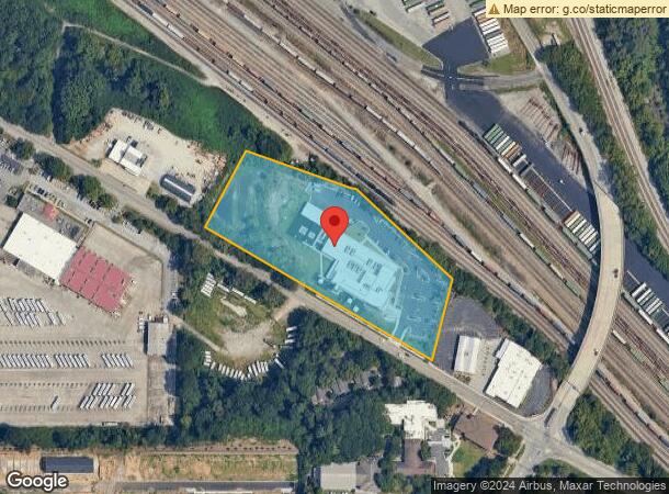
1551 Perry Blvd Nw, Atlanta, GA 30318
NEARBY LISTINGS FOR SALE OR LEASE
Property Detail
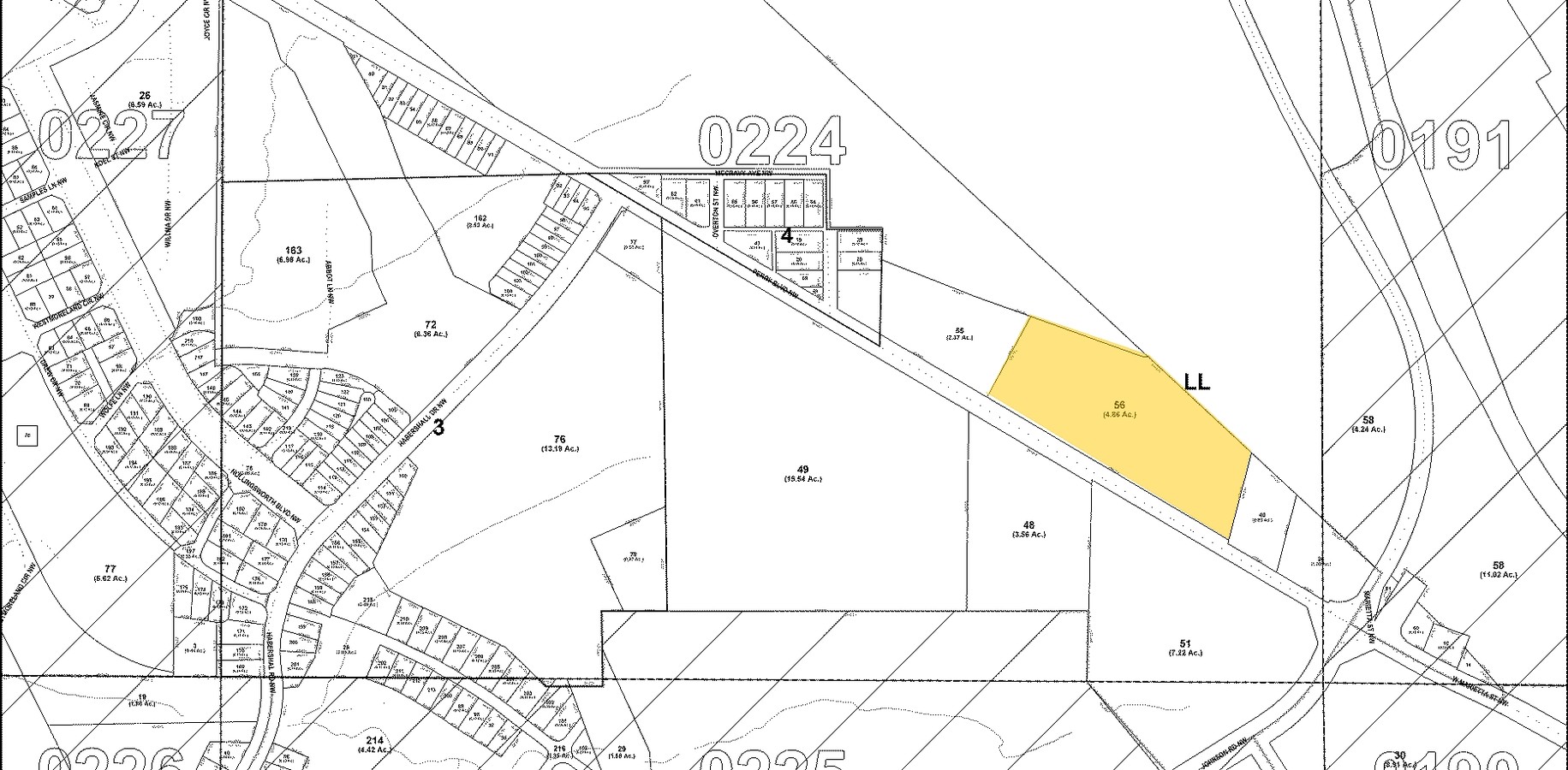
1551 Perry Blvd Nw
17-0224-LL-056-7
Atlanta
Charitableorganization
KA ATLANTA HUMANE SOCIETY ** UPDATE PARCEL SEE NOTES
X
Fulton
13121C0237F
Georgia
2023
5.07 AC
2023
Chattahoochee
008702
Atlanta
40,153 SF
Atlanta-Sandy Springs-Roswell, GA
DEMOGRAPHICS near 1551 Perry Blvd Nw
1 Mile
3 Mile
5 Mile
2024 Total Population
8,340
118,021
331,919
2029 Population
8,677
123,500
345,924
Pop Growth 2024-2029
+ 4.04%
+ 4.64%
+ 4.22%
Average Age
35
35
37
2024 Total Households
2,853
50,816
156,741
HH Growth 2024-2029
+ 5.50%
+ 4.94%
+ 4.45%
Median Household Inc
$83,662
$67,581
$77,847
Avg Household Size
2.00
2.00
1.90
2024 Avg HH Vehicles
1.00
1.00
1.00
Median Home Value
$420,393
$362,551
$425,745
Median Year Built
2004
1998
1994
Nearby Places
- Restaurants
- Banks
- Shops
- Fitness
- Groceries
PUBLIC TRANSPORTATION
COMMUTER RAIL
Atlanta (Crescent - Amtrak)
DRIVE
WALK
Distance
Atlanta (Crescent - Amtrak)
11 min
4.1 mi
AIRPORT
Hartsfield - Jackson Atlanta International
DRIVE
WALK
Distance
Hartsfield - Jackson Atlanta International
25 min
14.4 mi
Freight Ports
Georgia Ports - Savannah
DRIVE
WALK
Distance
Georgia Ports - Savannah
288 min
253.7 mi
Nearby Properties
Address
Land Use
TOTAL SIZE
Lot Size
Zoning
Address
Land Use
TOTAL SIZE
Lot Size
Zoning
1,227,912 SF
2.15 AC
SPI4
Address
Land Use
TOTAL SIZE
Lot Size
Zoning
1,467,469 SF
0.06 AC
C4
Address
Land Use
TOTAL SIZE
Lot Size
Zoning
903,671 SF
1 AC
C3
Address
Land Use
TOTAL SIZE
Lot Size
Zoning
903,732 SF
0.34 AC
SPI1
Address
Land Use
TOTAL SIZE
Lot Size
Zoning
3,651,623 SF
28.88 AC
C3
Address
Land Use
TOTAL SIZE
Lot Size
Zoning
630,471 SF
0.70 AC
I2
Address
Land Use
TOTAL SIZE
Lot Size
Zoning
1,639,996 SF
9.16 AC
C3
Address
Land Use
TOTAL SIZE
Lot Size
Zoning
742,537 SF
1.56 AC
C4
Address
Land Use
TOTAL SIZE
Lot Size
Zoning
883,867 SF
2.71 AC
C1
Address
Land Use
TOTAL SIZE
Lot Size
Zoning
872,588 SF
1.77 AC
SPI4
Address
Land Use
TOTAL SIZE
Lot Size
Zoning
411,890 SF
0.02 AC
SPI1
Address
Land Use
TOTAL SIZE
Lot Size
Zoning
899,982 SF
2.91 AC
C4
Address
Land Use
TOTAL SIZE
Lot Size
Zoning
632,402 SF
0.68 AC
C4C
Address
Land Use
TOTAL SIZE
Lot Size
Zoning
770,093 SF
11.08 AC
RG3
Address
Land Use
TOTAL SIZE
Lot Size
Zoning
549,564 SF
0.60 AC
SPI4
Address
Land Use
TOTAL SIZE
Lot Size
Zoning
939,972 SF
0.82 AC
SPI16
Address
Land Use
TOTAL SIZE
Lot Size
Zoning
589,167 SF
1.27 AC
C4
Address
Land Use
TOTAL SIZE
Lot Size
Zoning
746,498 SF
0.72 AC
C1
Address
Land Use
TOTAL SIZE
Lot Size
Zoning
12.97 AC
C3
Address
Land Use
TOTAL SIZE
Lot Size
Zoning
578,521 SF
1.40 AC
C4
Address
Land Use
TOTAL SIZE
Lot Size
Zoning
568,976 SF
1.09 AC
C4
Address
Land Use
TOTAL SIZE
Lot Size
Zoning
621,668 SF
2.32 AC
SPI3
Address
Land Use
TOTAL SIZE
Lot Size
Zoning
695,481 SF
11.66 AC
RG3
Address
Land Use
TOTAL SIZE
Lot Size
Zoning
735,480 SF
1.49 AC
C4
Address
Land Use
TOTAL SIZE
Lot Size
Zoning
448,258 SF
0.54 AC
C4C
Address
Land Use
TOTAL SIZE
Lot Size
Zoning
961,817 SF
25.44 AC
I2
Address
Land Use
TOTAL SIZE
Lot Size
Zoning
474,681 SF
2.07 AC
I1
Address
Land Use
TOTAL SIZE
Lot Size
Zoning
418,252 SF
3.48 AC
I2
Address
Land Use
TOTAL SIZE
Lot Size
Zoning
628,608 SF
0.38 AC
SPI4
Address
Land Use
TOTAL SIZE
Lot Size
Zoning
638,721 SF
3.31 AC
I1
The World's #1 Commercial Real Estate Marketplace
Connect with us
© 2025 CoStar Group
The information above has been obtained from sources believed reliable. While we do not doubt its accuracy we have not verified it and make no guarantee, warranty or representation about it. It is your responsibility to independently confirm its accuracy and completeness. Any projections, opinions, assumptions, or estimates used are for example only and do not represent the current or future performance of the property. The value of this transaction to you depends on tax and other factors which should be evaluated by your tax, financial, and legal advisors. You and your advisors should conduct a careful, independent investigation of the property to determine to your satisfaction the suitability of the property for your needs.