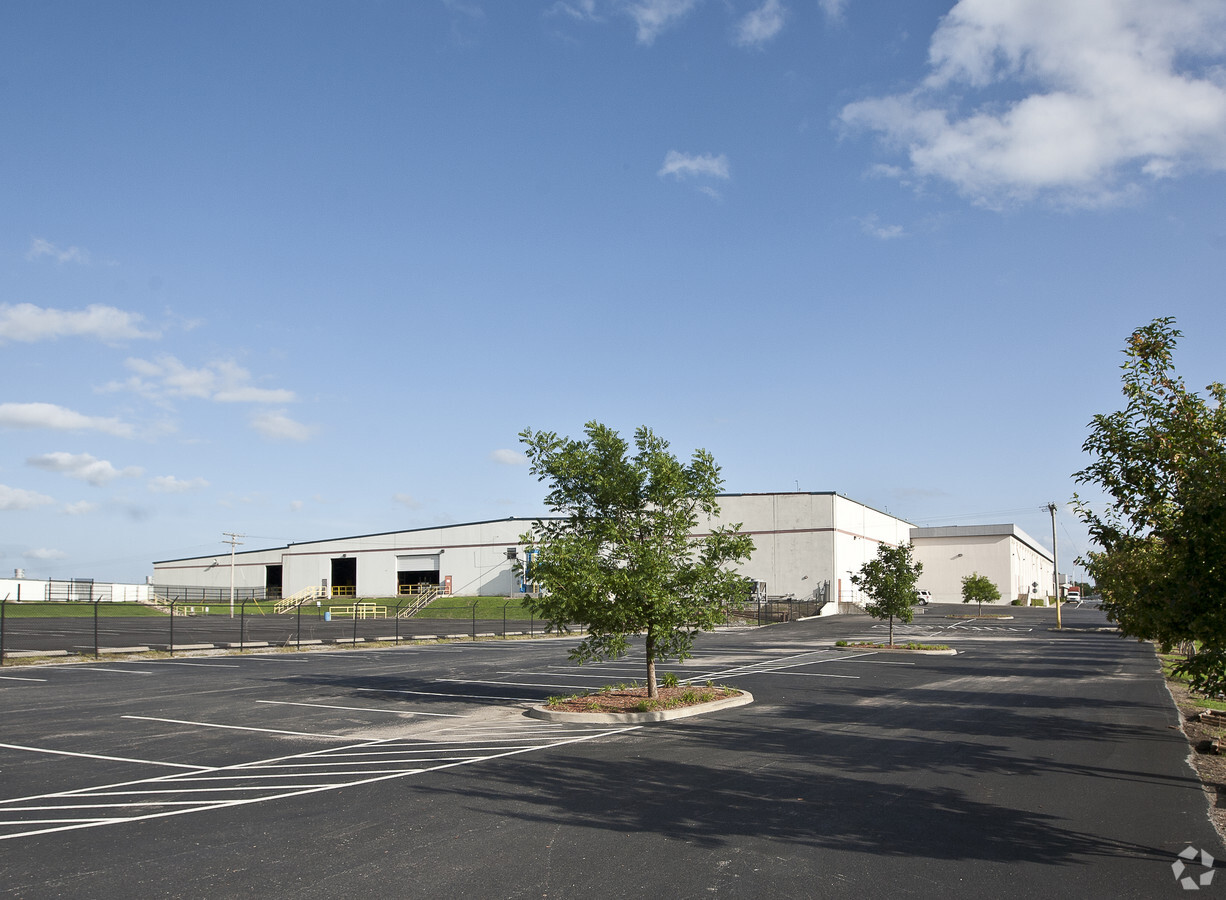
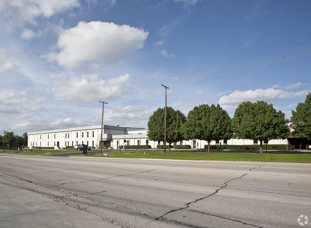
Property Record
1555 N Mingo Rd, Tulsa, OK 74116
NEARBY LISTINGS FOR SALE OR LEASE
Property Detail
1555 N Mingo Rd
90430-04-30-06760
Unplatted
Lightindustrial
PRT NE SW BEG NWC SE SW TH E659.59 N926.07 NW362.71 TO RR TH W ON RR TO WL NE SW TH S TO POB LESS BEG SECR THEREOF TH NLY1288.78 TO RR W ON RR 164SLY TO PT ON SL TH E TO POB & LESS BEG 1147.19NE TO PT WHERE ELY ROW OF N MINGO RD INTERSECTS SLY ROW OF
AE
Tulsa
40131C0350J
Oklahoma
2023
46.72 AC
2024
Northeast Tulsa
005900
Tulsa
272,404 SF
Tulsa, OK
DEMOGRAPHICS near 1555 N Mingo Rd
1 Mile
3 Mile
5 Mile
2024 Total Population
2,407
34,872
122,706
2029 Population
2,483
36,205
127,097
Pop Growth 2024-2029
+ 3.16%
+ 3.82%
+ 3.58%
Average Age
35
35
36
2024 Total Households
846
12,610
46,308
HH Growth 2024-2029
+ 3.31%
+ 3.90%
+ 3.67%
Median Household Inc
$49,208
$41,795
$45,645
Avg Household Size
2.70
2.60
2.50
2024 Avg HH Vehicles
2.00
2.00
2.00
Median Home Value
$64,048
$74,331
$113,538
Median Year Built
1961
1961
1963
Nearby Places
- Restaurants
- Banks
- Shops
- Fitness
- Groceries
PUBLIC TRANSPORTATION
AIRPORT
Tulsa International
DRIVE
WALK
Distance
Tulsa International
10 min
5.6 mi
Freight Ports
Tulsa Port Of Catoosa
DRIVE
WALK
Distance
Tulsa Port Of Catoosa
15 min
10.2 mi
Nearby Properties
Address
Land Use
TOTAL SIZE
Lot Size
Zoning
Address
Land Use
TOTAL SIZE
Lot Size
Zoning
353.75 AC
IL
Address
Land Use
TOTAL SIZE
Lot Size
Zoning
349,823 SF
203.39 AC
IL
Address
Land Use
TOTAL SIZE
Lot Size
Zoning
2,689,602 SF
93.55 AC
IH
Address
Land Use
TOTAL SIZE
Lot Size
Zoning
2,689,602 SF
81.80 AC
IH
Address
Land Use
TOTAL SIZE
Lot Size
Zoning
1 SF
207.77 AC
IM
Address
Land Use
TOTAL SIZE
Lot Size
Zoning
246.16 AC
IM
Address
Land Use
TOTAL SIZE
Lot Size
Zoning
228.59 AC
IL
Address
Land Use
TOTAL SIZE
Lot Size
Zoning
674,500 SF
122.30 AC
IM
Address
Land Use
TOTAL SIZE
Lot Size
Zoning
112,556 SF
11.07 AC
CH
Address
Land Use
TOTAL SIZE
Lot Size
Zoning
110.77 AC
IL
Address
Land Use
TOTAL SIZE
Lot Size
Zoning
103,248 SF
8.87 AC
IL
Address
Land Use
TOTAL SIZE
Lot Size
Zoning
97.68 AC
CH
Address
Land Use
TOTAL SIZE
Lot Size
Zoning
124,648 SF
21.23 AC
IL
Address
Land Use
TOTAL SIZE
Lot Size
Zoning
275,768 SF
49.62 AC
IM
Address
Land Use
TOTAL SIZE
Lot Size
Zoning
106,270 SF
9.47 AC
RM0
Address
Land Use
TOTAL SIZE
Lot Size
Zoning
19,708 SF
21.04 AC
IL
Address
Land Use
TOTAL SIZE
Lot Size
Zoning
101,090 SF
1.70 AC
RS2
Address
Land Use
TOTAL SIZE
Lot Size
Zoning
185,649 SF
56.23 AC
IL
Address
Land Use
TOTAL SIZE
Lot Size
Zoning
55,425 SF
2.96 AC
IL
Address
Land Use
TOTAL SIZE
Lot Size
Zoning
56,531 SF
7.79 AC
RS3
Address
Land Use
TOTAL SIZE
Lot Size
Zoning
49,953 SF
2.36 AC
OL
Address
Land Use
TOTAL SIZE
Lot Size
Zoning
147,683 SF
9.18 AC
IL
Address
Land Use
TOTAL SIZE
Lot Size
Zoning
53.24 AC
IM
Address
Land Use
TOTAL SIZE
Lot Size
Zoning
36,425 SF
5.90 AC
RS3
Address
Land Use
TOTAL SIZE
Lot Size
Zoning
18,325 SF
3.05 AC
CS
Address
Land Use
TOTAL SIZE
Lot Size
Zoning
35,000 SF
14.10 AC
RS3
Address
Land Use
TOTAL SIZE
Lot Size
Zoning
673,050 SF
52.77 AC
IM
The World's #1 Commercial Real Estate Marketplace
Connect with us
© 2025 CoStar Group
The information above has been obtained from sources believed reliable. While we do not doubt its accuracy we have not verified it and make no guarantee, warranty or representation about it. It is your responsibility to independently confirm its accuracy and completeness. Any projections, opinions, assumptions, or estimates used are for example only and do not represent the current or future performance of the property. The value of this transaction to you depends on tax and other factors which should be evaluated by your tax, financial, and legal advisors. You and your advisors should conduct a careful, independent investigation of the property to determine to your satisfaction the suitability of the property for your needs.