Property Record
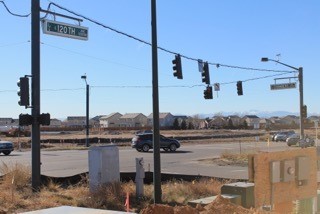
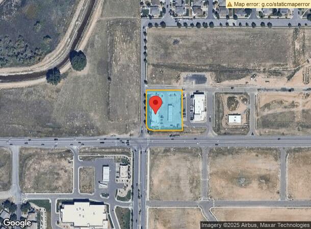
15330 E 120Th Pl, Commerce City, CO 80603
NEARBY LISTINGS FOR SALE OR LEASE
Property Detail
15330 E 120Th Pl
Denver-Aurora-Lakewood, CO
The Village Commercial Subdivision
1569-32-3-19-017
THE VILLAGE COMMERCIAL SUBD FLG NO 3 BLK 1 LOT 1
Storebuilding
Adams
X
Colorado
08001C0341H
1
2023
1.14 AC
2024
Northeast Denver
008553
Denver
5,705 SF
DEMOGRAPHICS near 15330 E 120Th Pl
1 Mile
3 Mile
5 Mile
2024 Total Population
6,071
40,611
76,350
2029 Population
6,430
43,117
80,806
Pop Growth 2024-2029
+ 5.91%
+ 6.17%
+ 5.84%
Average Age
37
34
35
2024 Total Households
1,966
12,526
24,846
HH Growth 2024-2029
+ 6.00%
+ 6.26%
+ 5.94%
Median Household Inc
$126,163
$123,196
$108,993
Avg Household Size
3.10
3.20
3.00
2024 Avg HH Vehicles
2.00
2.00
2.00
Median Home Value
$603,083
$473,378
$469,282
Median Year Built
2007
2008
2006
Nearby Places
- Restaurants
- Banks
- Shops
- Fitness
- Groceries
PUBLIC TRANSPORTATION
COMMUTER RAIL
Thornton Crossroads - 104Th Station Track 1 (Union Station to Eastlake & 124th Station - Regional Transportation District)
DRIVE
WALK
Distance
Thornton Crossroads - 104Th Station Track 1 (Union Station to Eastlake & 124th Station - Regional Transportation District)
14 min
8.7 mi
AIRPORT
Denver International
DRIVE
WALK
Distance
Denver International
18 min
13.5 mi
Freight Ports
Tulsa Port Of Catoosa
DRIVE
WALK
Distance
Tulsa Port Of Catoosa
725 min
707.6 mi
SALE & LEASE HISTORY
LISTING DATE
SALE/LEASE

Dec 15, 2017
For Lease
Dec 14, 2017
For Sale
Nearby Properties
Address
Land Use
TOTAL SIZE
Lot Size
Zoning
Address
Land Use
TOTAL SIZE
Lot Size
Zoning
358,386 SF
76.08 AC
Address
Land Use
TOTAL SIZE
Lot Size
Zoning
231,205 SF
10.46 AC
Address
Land Use
TOTAL SIZE
Lot Size
Zoning
Address
Land Use
TOTAL SIZE
Lot Size
Zoning
64,715 SF
10.38 AC
Address
Land Use
TOTAL SIZE
Lot Size
Zoning
279,946 SF
11.55 AC
Address
Land Use
TOTAL SIZE
Lot Size
Zoning
121,103 SF
13.46 AC
Address
Land Use
TOTAL SIZE
Lot Size
Zoning
122,399 SF
14.29 AC
Address
Land Use
TOTAL SIZE
Lot Size
Zoning
70,573 SF
6.42 AC
Address
Land Use
TOTAL SIZE
Lot Size
Zoning
19,341 SF
74.46 AC
Address
Land Use
TOTAL SIZE
Lot Size
Zoning
104,395 SF
10.43 AC
Address
Land Use
TOTAL SIZE
Lot Size
Zoning
75,398 SF
8.82 AC
I2
Address
Land Use
TOTAL SIZE
Lot Size
Zoning
70,573 SF
14.73 AC
Address
Land Use
TOTAL SIZE
Lot Size
Zoning
44,077 SF
13.02 AC
Address
Land Use
TOTAL SIZE
Lot Size
Zoning
28.95 AC
A3
Address
Land Use
TOTAL SIZE
Lot Size
Zoning
90,208 SF
7.19 AC
Address
Land Use
TOTAL SIZE
Lot Size
Zoning
61,793 SF
9.28 AC
Address
Land Use
TOTAL SIZE
Lot Size
Zoning
55,810 SF
14.52 AC
Address
Land Use
TOTAL SIZE
Lot Size
Zoning
24.92 AC
I2
Address
Land Use
TOTAL SIZE
Lot Size
Zoning
26,010 SF
8.68 AC
Address
Land Use
TOTAL SIZE
Lot Size
Zoning
42,177 SF
17.73 AC
A3
Address
Land Use
TOTAL SIZE
Lot Size
Zoning
2,185 SF
49.80 AC
Address
Land Use
TOTAL SIZE
Lot Size
Zoning
54,712 SF
2.93 AC
Address
Land Use
TOTAL SIZE
Lot Size
Zoning
17,160 SF
2.05 AC
Address
Land Use
TOTAL SIZE
Lot Size
Zoning
25,527 SF
3.63 AC
Address
Land Use
TOTAL SIZE
Lot Size
Zoning
11,424 SF
1.49 AC
Address
Land Use
TOTAL SIZE
Lot Size
Zoning
102,069 SF
3.26 AC
Address
Land Use
TOTAL SIZE
Lot Size
Zoning
21,533 SF
11.50 AC
I2
Address
Land Use
TOTAL SIZE
Lot Size
Zoning
14,569 SF
7.94 AC
I3
Address
Land Use
TOTAL SIZE
Lot Size
Zoning
13,768 SF
1.35 AC
Address
Land Use
TOTAL SIZE
Lot Size
Zoning
1,138 SF
13.81 AC
The World's #1 Commercial Real Estate Marketplace
Connect with us
© 2025 CoStar Group
The information above has been obtained from sources believed reliable. While we do not doubt its accuracy we have not verified it and make no guarantee, warranty or representation about it. It is your responsibility to independently confirm its accuracy and completeness. Any projections, opinions, assumptions, or estimates used are for example only and do not represent the current or future performance of the property. The value of this transaction to you depends on tax and other factors which should be evaluated by your tax, financial, and legal advisors. You and your advisors should conduct a careful, independent investigation of the property to determine to your satisfaction the suitability of the property for your needs.