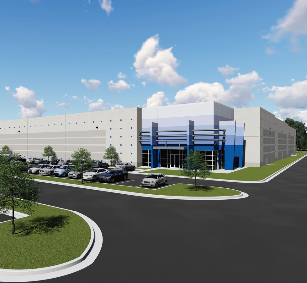
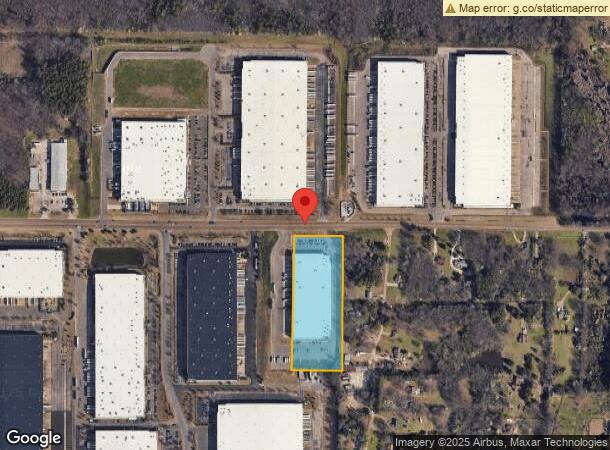
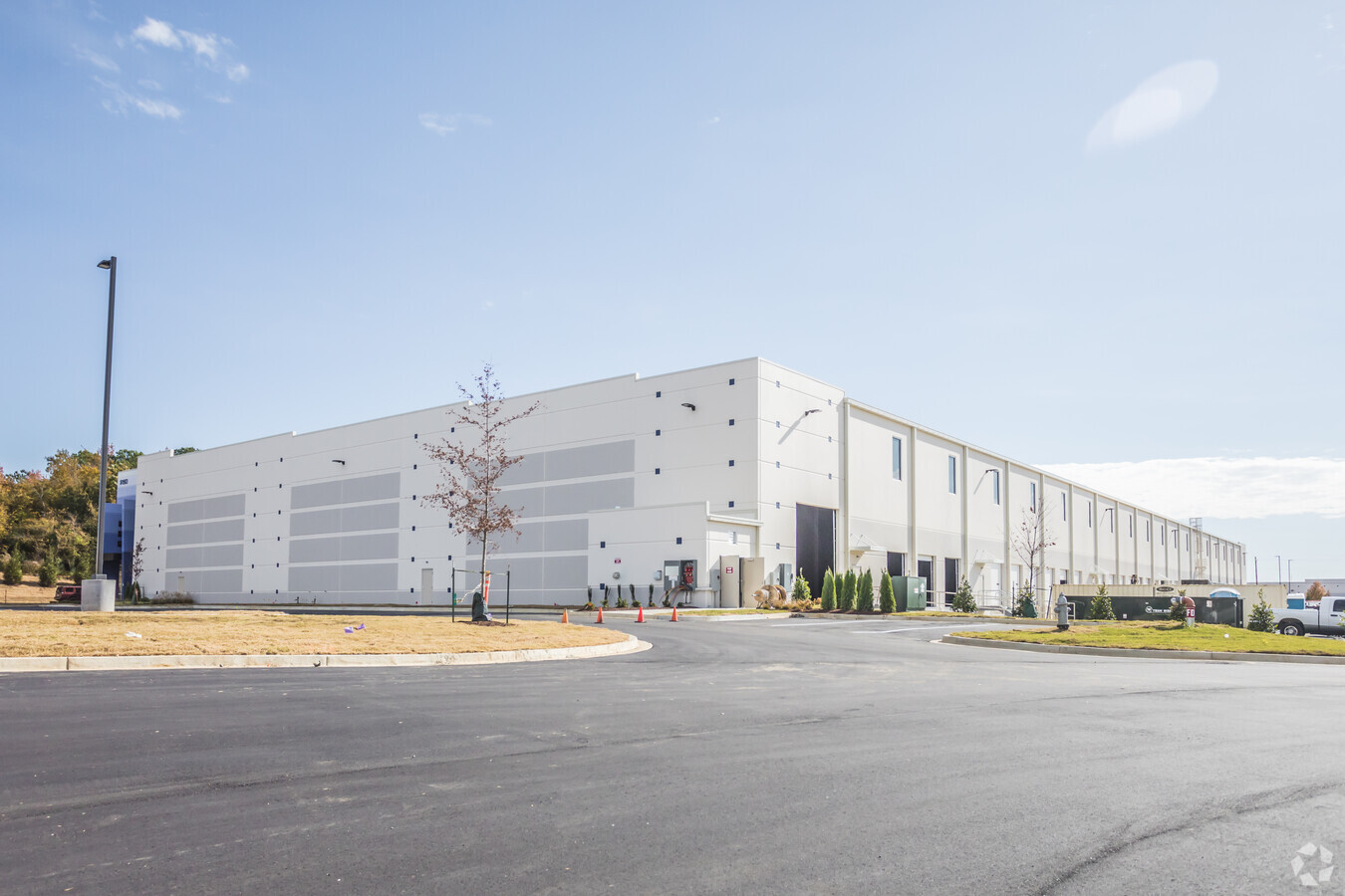
Property Record
1563 Stateline Rd E, Southaven, MS 38671
NEARBY LISTINGS FOR SALE OR LEASE
Property Detail
1563 Stateline Rd E
Memphis
Stateline Business Park Ph 7
Memphis, TN-MS-AR
STATELINE BUSINESS PARK PH 7 LOT 7
1074202700000700
DeSoto
Warehouse
Mississippi
2024
7
2024
9.51 AC
070523
DeSoto
133,880 SF
DEMOGRAPHICS near 1563 Stateline Rd E
1 Mile
3 Mile
5 Mile
2024 Total Population
4,206
38,653
111,781
2029 Population
4,647
40,693
117,795
Pop Growth 2024-2029
+ 10.49%
+ 5.28%
+ 5.38%
Average Age
37
38
37
2024 Total Households
1,534
14,556
42,296
HH Growth 2024-2029
+ 10.43%
+ 5.27%
+ 5.41%
Median Household Inc
$66,159
$54,761
$50,587
Avg Household Size
2.80
2.60
2.60
2024 Avg HH Vehicles
2.00
2.00
2.00
Median Home Value
$189,194
$167,465
$170,162
Median Year Built
2001
1981
1979
Nearby Places
- Restaurants
- Banks
- Shops
- Fitness
- Groceries
PUBLIC TRANSPORTATION
AIRPORT
Memphis International
DRIVE
WALK
Distance
Memphis International
11 min
6.8 mi
Freight Ports
Port of Shreveport
DRIVE
WALK
Distance
Port of Shreveport
415 min
381.7 mi
SALE & LEASE HISTORY
LISTING DATE
SALE/LEASE

Sep 25, 2016
For Lease
Apr 22, 2021
For Lease
Nearby Properties
Address
Land Use
TOTAL SIZE
Lot Size
Zoning
Address
Land Use
TOTAL SIZE
Lot Size
Zoning
986,374 SF
68.79 AC
CA
Address
Land Use
TOTAL SIZE
Lot Size
Zoning
969,150 SF
64.49 AC
EMP
Address
Land Use
TOTAL SIZE
Lot Size
Zoning
717,155 SF
83.34 AC
CA
Address
Land Use
TOTAL SIZE
Lot Size
Zoning
897,076 SF
47.32 AC
CA
Address
Land Use
TOTAL SIZE
Lot Size
Zoning
865,065 SF
51.05 AC
CA
Address
Land Use
TOTAL SIZE
Lot Size
Zoning
739,205 SF
31.51 AC
AG
Address
Land Use
TOTAL SIZE
Lot Size
Zoning
586,847 SF
37 AC
CA
Address
Land Use
TOTAL SIZE
Lot Size
Zoning
1,013,319 SF
38.86 AC
EMP
Address
Land Use
TOTAL SIZE
Lot Size
Zoning
1,034,433 SF
53.32 AC
EMP
Address
Land Use
TOTAL SIZE
Lot Size
Zoning
861,322 SF
72.92 AC
CA
Address
Land Use
TOTAL SIZE
Lot Size
Zoning
352,000 SF
16.82 AC
AG
Address
Land Use
TOTAL SIZE
Lot Size
Zoning
328,300 SF
33.78 AC
CA
Address
Land Use
TOTAL SIZE
Lot Size
Zoning
853,440 SF
39.22 AC
EMP
Address
Land Use
TOTAL SIZE
Lot Size
Zoning
265,600 SF
22.03 AC
CA
Address
Land Use
TOTAL SIZE
Lot Size
Zoning
61,164 SF
36.95 AC
RU-3
Address
Land Use
TOTAL SIZE
Lot Size
Zoning
432,700 SF
28.16 AC
EMP
Address
Land Use
TOTAL SIZE
Lot Size
Zoning
63,842 SF
11 AC
R-6
Address
Land Use
TOTAL SIZE
Lot Size
Zoning
344,016 SF
16.50 AC
R-8
Address
Land Use
TOTAL SIZE
Lot Size
Zoning
338,368 SF
15.70 AC
R-8
Address
Land Use
TOTAL SIZE
Lot Size
Zoning
316,573 SF
30.77 AC
CA
Address
Land Use
TOTAL SIZE
Lot Size
Zoning
811,203 SF
47.71 AC
M-1
Address
Land Use
TOTAL SIZE
Lot Size
Zoning
298,852 SF
18.75 AC
RU-2
Address
Land Use
TOTAL SIZE
Lot Size
Zoning
226,438 SF
19.52 AC
C-1
Address
Land Use
TOTAL SIZE
Lot Size
Zoning
321.59 AC
R-8
Address
Land Use
TOTAL SIZE
Lot Size
Zoning
741,634 SF
34.89 AC
PBP
Address
Land Use
TOTAL SIZE
Lot Size
Zoning
779,780 SF
46.22 AC
PBP
Address
Land Use
TOTAL SIZE
Lot Size
Zoning
245,848 SF
12.06 AC
CA
Address
Land Use
TOTAL SIZE
Lot Size
Zoning
111,541 SF
8.88 AC
R-8
Address
Land Use
TOTAL SIZE
Lot Size
Zoning
131,329 SF
34.64 AC
EMP
Address
Land Use
TOTAL SIZE
Lot Size
Zoning
611,307 SF
29.51 AC
PBP
The World's #1 Commercial Real Estate Marketplace
Connect with us
© 2025 CoStar Group
The information above has been obtained from sources believed reliable. While we do not doubt its accuracy we have not verified it and make no guarantee, warranty or representation about it. It is your responsibility to independently confirm its accuracy and completeness. Any projections, opinions, assumptions, or estimates used are for example only and do not represent the current or future performance of the property. The value of this transaction to you depends on tax and other factors which should be evaluated by your tax, financial, and legal advisors. You and your advisors should conduct a careful, independent investigation of the property to determine to your satisfaction the suitability of the property for your needs.