Property Record
15648 N 35Th Ave, Phoenix, AZ 85053
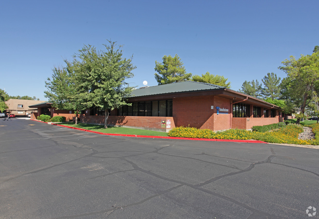
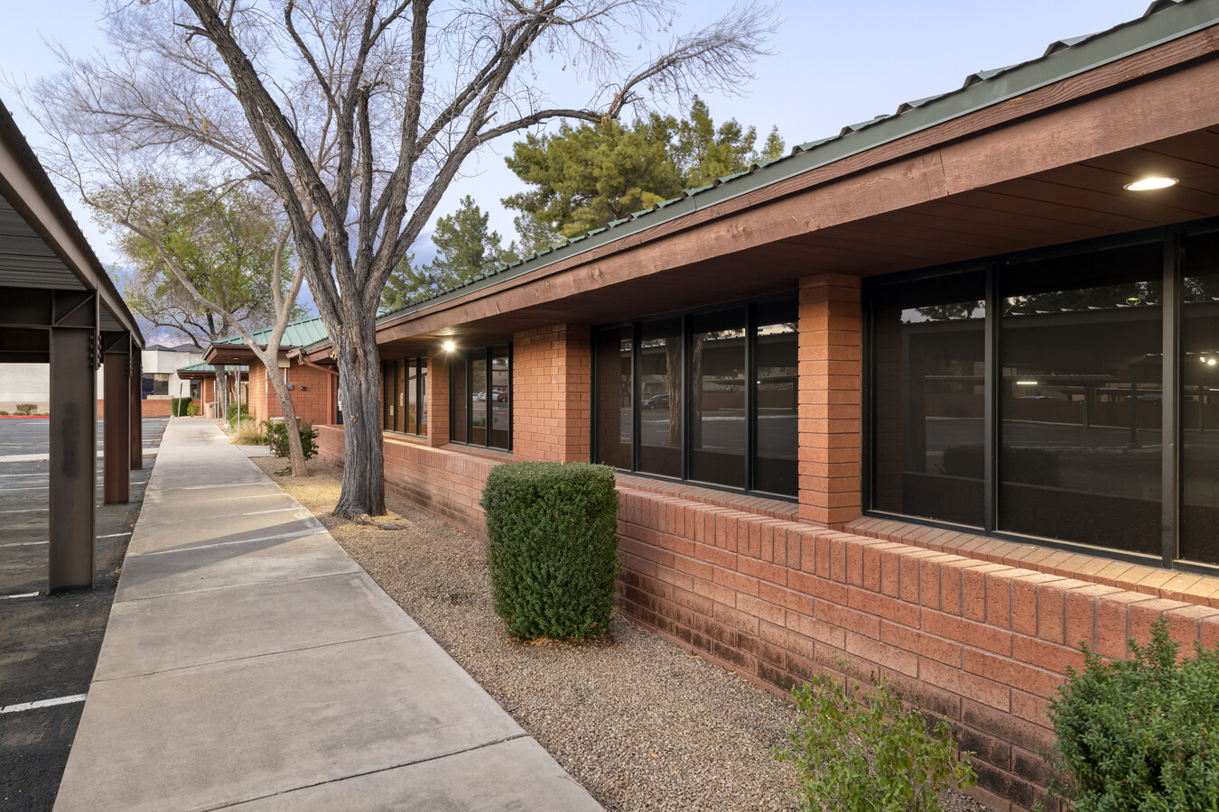

This Property Is For Sale
NEARBY LISTINGS FOR SALE OR LEASE
Property Detail
15648 N 35Th Ave
Phoenix-Mesa-Scottsdale, AZ
S 155F OF N 330F OF LOT 21 OR S 155F OF N 330F OF E2 NE4 SE4 SE4 EX E 40F TH/OF & EX E 15F TH/OF P/D 15991-31
207-15-028C
Maricopa
Commercialnec
Arizona
X
21
04013C1270M
0.98 AC
2024
Deer Valley/Airport
2025
Phoenix
104226
DEMOGRAPHICS near 15648 N 35Th Ave
1 Mile
3 Mile
5 Mile
2024 Total Population
17,000
151,802
361,180
2029 Population
18,174
163,870
389,394
Pop Growth 2024-2029
+ 6.91%
+ 7.95%
+ 7.81%
Average Age
38
38
38
2024 Total Households
6,482
57,490
137,884
HH Growth 2024-2029
+ 6.94%
+ 8.16%
+ 7.99%
Median Household Inc
$57,013
$63,074
$65,632
Avg Household Size
2.50
2.50
2.50
2024 Avg HH Vehicles
2.00
2.00
2.00
Median Home Value
$328,347
$292,100
$310,558
Median Year Built
1978
1980
1982
Nearby Places
- Restaurants
- Banks
- Shops
- Fitness
- Groceries
PUBLIC TRANSPORTATION
AIRPORT
Phoenix Sky Harbor International
DRIVE
WALK
Distance
Phoenix Sky Harbor International
30 min
20.7 mi
Freight Ports
Port of San Diego
DRIVE
WALK
Distance
Port of San Diego
408 min
361.9 mi
Nearby Properties
Address
Land Use
TOTAL SIZE
Lot Size
Zoning
Address
Land Use
TOTAL SIZE
Lot Size
Zoning
1,019,640 SF
32.10 AC
GO
Address
Land Use
TOTAL SIZE
Lot Size
Zoning
742,601 SF
295.89 AC
R-8
Address
Land Use
TOTAL SIZE
Lot Size
Zoning
526,912 SF
55.64 AC
Address
Land Use
TOTAL SIZE
Lot Size
Zoning
704,521 SF
15.12 AC
C-C
Address
Land Use
TOTAL SIZE
Lot Size
Zoning
625,318 SF
15.79 AC
Address
Land Use
TOTAL SIZE
Lot Size
Zoning
360,026 SF
74.94 AC
R-6
Address
Land Use
TOTAL SIZE
Lot Size
Zoning
361,228 SF
24.60 AC
I-P
Address
Land Use
TOTAL SIZE
Lot Size
Zoning
401,879 SF
67.89 AC
Address
Land Use
TOTAL SIZE
Lot Size
Zoning
296,753 SF
9.53 AC
CPBP
Address
Land Use
TOTAL SIZE
Lot Size
Zoning
314,839 SF
39 AC
R-18
Address
Land Use
TOTAL SIZE
Lot Size
Zoning
290,321 SF
37.97 AC
R-8
Address
Land Use
TOTAL SIZE
Lot Size
Zoning
268,958 SF
38.42 AC
R-6
Address
Land Use
TOTAL SIZE
Lot Size
Zoning
469,322 SF
22.40 AC
M-H
Address
Land Use
TOTAL SIZE
Lot Size
Zoning
241,669 SF
12.78 AC
PAD
Address
Land Use
TOTAL SIZE
Lot Size
Zoning
228,085 SF
7.84 AC
I-P
Address
Land Use
TOTAL SIZE
Lot Size
Zoning
229,000 SF
18.99 AC
I-P
Address
Land Use
TOTAL SIZE
Lot Size
Zoning
268,353 SF
20.45 AC
I-P
Address
Land Use
TOTAL SIZE
Lot Size
Zoning
378,106 SF
19.18 AC
R-3
Address
Land Use
TOTAL SIZE
Lot Size
Zoning
430,038 SF
26.71 AC
M-H
Address
Land Use
TOTAL SIZE
Lot Size
Zoning
145,956 SF
10.30 AC
CP/GCP
Address
Land Use
TOTAL SIZE
Lot Size
Zoning
200,658 SF
23.14 AC
C-BP
Address
Land Use
TOTAL SIZE
Lot Size
Zoning
358,005 SF
8.54 AC
M-H
Address
Land Use
TOTAL SIZE
Lot Size
Zoning
221,641 SF
21.60 AC
C-2
Address
Land Use
TOTAL SIZE
Lot Size
Zoning
171,751 SF
8.61 AC
C-2
Address
Land Use
TOTAL SIZE
Lot Size
Zoning
267,747 SF
8.91 AC
M-H
Address
Land Use
TOTAL SIZE
Lot Size
Zoning
153,980 SF
20.11 AC
R-8
Address
Land Use
TOTAL SIZE
Lot Size
Zoning
277,659 SF
23.52 AC
Address
Land Use
TOTAL SIZE
Lot Size
Zoning
147,184 SF
15.02 AC
C-C
Address
Land Use
TOTAL SIZE
Lot Size
Zoning
387,832 SF
20.25 AC
M-H
Address
Land Use
TOTAL SIZE
Lot Size
Zoning
336,264 SF
158.78 AC
R-43AG
The World's #1 Commercial Real Estate Marketplace
Connect with us
© 2025 CoStar Group
The information above has been obtained from sources believed reliable. While we do not doubt its accuracy we have not verified it and make no guarantee, warranty or representation about it. It is your responsibility to independently confirm its accuracy and completeness. Any projections, opinions, assumptions, or estimates used are for example only and do not represent the current or future performance of the property. The value of this transaction to you depends on tax and other factors which should be evaluated by your tax, financial, and legal advisors. You and your advisors should conduct a careful, independent investigation of the property to determine to your satisfaction the suitability of the property for your needs.