Property Record
15664 Highway 231 431 N, Hazel Green, AL 35750
NEARBY LISTINGS FOR SALE OR LEASE
-
-
View all Hazel Green listings for sale on LoopNet.com
Property Detail
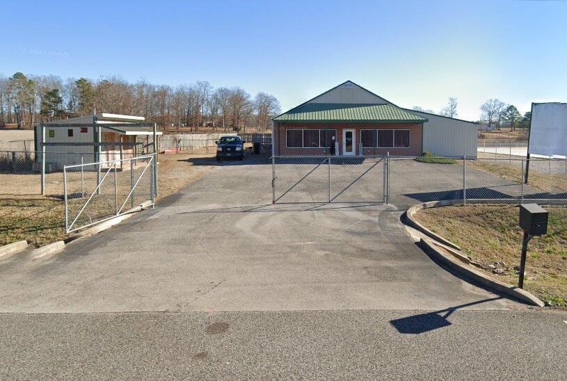
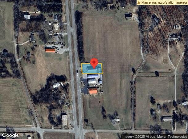
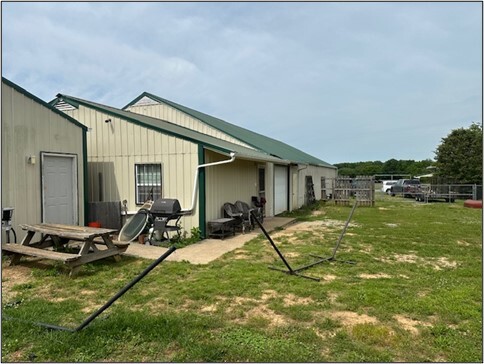
15664 Highway 231 431 N
03-03-06-0-002-011.001
SEC 6 T1S R1E PT OF THE SW1/4 OF SEC 6 DESC AS BEG E 722.28 FT N 6 DEG W 592.55 FT FR THE SW COR OF SEC 6 TO THE P/O/T/B TH E
Storebuilding
Madison
X
Alabama
47103C0425E
0.50 AC
2024
North Madison County
2024
Huntsville
010303
Huntsville, AL
5,508 SF
DEMOGRAPHICS near 15664 Highway 231 431 N
1 Mile
3 Mile
5 Mile
2024 Total Population
926
6,126
15,726
2029 Population
1,020
6,620
17,068
Pop Growth 2024-2029
+ 10.15%
+ 8.06%
+ 8.53%
Average Age
40
41
41
2024 Total Households
350
2,368
6,105
HH Growth 2024-2029
+ 10.86%
+ 8.32%
+ 8.80%
Median Household Inc
$62,500
$69,563
$69,068
Avg Household Size
2.50
2.50
2.50
2024 Avg HH Vehicles
2.00
2.00
2.00
Median Home Value
$214,583
$198,192
$189,413
Median Year Built
1994
1992
1992
Nearby Places
- Restaurants
- Banks
- Shops
- Fitness
- Groceries
PUBLIC TRANSPORTATION
AIRPORT
Huntsville International-Carl T Jones Field
DRIVE
WALK
Distance
Huntsville International-Carl T Jones Field
42 min
31.4 mi
Freight Ports
Port of Mobile
DRIVE
WALK
Distance
Port of Mobile
410 min
372.6 mi
SALE & LEASE HISTORY
LISTING DATE
SALE/LEASE

Jun 17, 2024
For Sale
Nearby Properties
Address
Land Use
TOTAL SIZE
Lot Size
Zoning
Address
Land Use
TOTAL SIZE
Lot Size
Zoning
156,342 SF
16.36 AC
Address
Land Use
TOTAL SIZE
Lot Size
Zoning
Address
Land Use
TOTAL SIZE
Lot Size
Zoning
25,848 SF
6.21 AC
Address
Land Use
TOTAL SIZE
Lot Size
Zoning
30,440 SF
4.52 AC
Address
Land Use
TOTAL SIZE
Lot Size
Zoning
Address
Land Use
TOTAL SIZE
Lot Size
Zoning
570 SF
1.37 AC
Address
Land Use
TOTAL SIZE
Lot Size
Zoning
Address
Land Use
TOTAL SIZE
Lot Size
Zoning
Address
Land Use
TOTAL SIZE
Lot Size
Zoning
4,890 SF
3.47 AC
Address
Land Use
TOTAL SIZE
Lot Size
Zoning
12,400 SF
1.66 AC
Address
Land Use
TOTAL SIZE
Lot Size
Zoning
3,630 SF
1.20 AC
Address
Land Use
TOTAL SIZE
Lot Size
Zoning
3.03 AC
Address
Land Use
TOTAL SIZE
Lot Size
Zoning
Address
Land Use
TOTAL SIZE
Lot Size
Zoning
13,960 SF
2.90 AC
Address
Land Use
TOTAL SIZE
Lot Size
Zoning
6,150 SF
0.98 AC
Address
Land Use
TOTAL SIZE
Lot Size
Zoning
2,993 SF
0.53 AC
Address
Land Use
TOTAL SIZE
Lot Size
Zoning
16,400 SF
7.34 AC
Address
Land Use
TOTAL SIZE
Lot Size
Zoning
Address
Land Use
TOTAL SIZE
Lot Size
Zoning
Address
Land Use
TOTAL SIZE
Lot Size
Zoning
Address
Land Use
TOTAL SIZE
Lot Size
Zoning
Address
Land Use
TOTAL SIZE
Lot Size
Zoning
3,700 SF
0.96 AC
Address
Land Use
TOTAL SIZE
Lot Size
Zoning
1,392 SF
2.05 AC
Address
Land Use
TOTAL SIZE
Lot Size
Zoning
Address
Land Use
TOTAL SIZE
Lot Size
Zoning
4,812 SF
2.07 AC
Address
Land Use
TOTAL SIZE
Lot Size
Zoning
3,115 SF
0.97 AC
Address
Land Use
TOTAL SIZE
Lot Size
Zoning
15,168 SF
2.07 AC
Address
Land Use
TOTAL SIZE
Lot Size
Zoning
Address
Land Use
TOTAL SIZE
Lot Size
Zoning
Address
Land Use
TOTAL SIZE
Lot Size
Zoning
2,790 SF
0.99 AC
The World's #1 Commercial Real Estate Marketplace
Connect with us
© 2025 CoStar Group
The information above has been obtained from sources believed reliable. While we do not doubt its accuracy we have not verified it and make no guarantee, warranty or representation about it. It is your responsibility to independently confirm its accuracy and completeness. Any projections, opinions, assumptions, or estimates used are for example only and do not represent the current or future performance of the property. The value of this transaction to you depends on tax and other factors which should be evaluated by your tax, financial, and legal advisors. You and your advisors should conduct a careful, independent investigation of the property to determine to your satisfaction the suitability of the property for your needs.