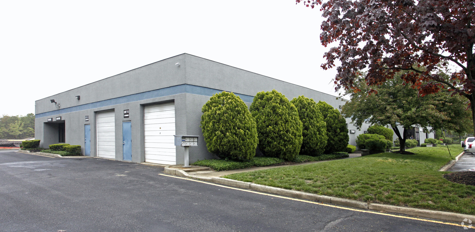
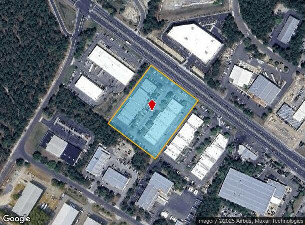
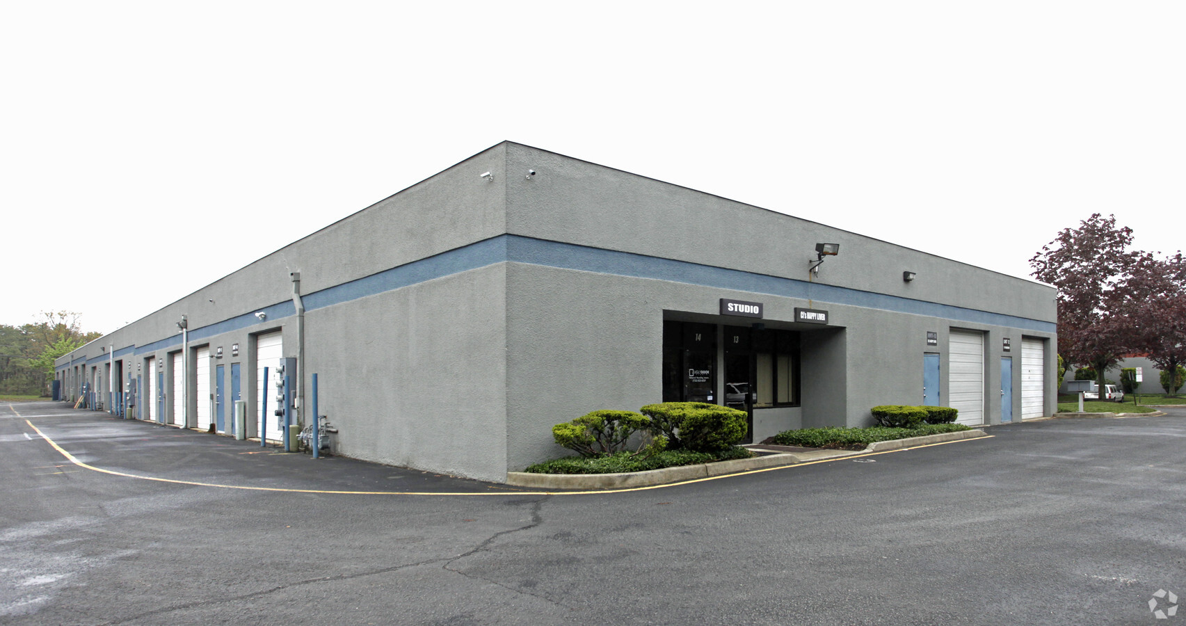
Property Record
1575 Route 37 W, Toms River, NJ 08755
NEARBY LISTINGS FOR SALE OR LEASE
Property Detail
1575 Route 37 W
New York-Jersey City-White Plains, NY-NJ
Map/Toms River Indust Park
08-00504-0000-00002
3.41AC
Industrialgeneral
Ocean
X
New Jersey
34029C0282F
2
2023
3.41 AC
2024
Ocean County
723000
Northern New Jersey
3,442 SF
DEMOGRAPHICS near 1575 Route 37 W
1 Mile
3 Mile
5 Mile
2024 Total Population
7,563
44,004
105,914
2029 Population
7,998
46,230
111,390
Pop Growth 2024-2029
+ 5.75%
+ 5.06%
+ 5.17%
Average Age
51
55
48
2024 Total Households
3,464
21,694
45,682
HH Growth 2024-2029
+ 5.34%
+ 4.58%
+ 4.44%
Median Household Inc
$54,804
$53,445
$58,509
Avg Household Size
2.10
1.90
2.20
2024 Avg HH Vehicles
2.00
2.00
2.00
Median Home Value
$227,099
$218,698
$248,557
Median Year Built
1979
1979
1981
Nearby Places
- Restaurants
- Banks
- Shops
- Fitness
- Groceries
SALE & LEASE HISTORY
LISTING DATE
SALE/LEASE

Sep 24, 2016
For Lease
Nearby Properties
Address
Land Use
TOTAL SIZE
Lot Size
Zoning
Address
Land Use
TOTAL SIZE
Lot Size
Zoning
75,558 SF
43.30 AC
R15
Address
Land Use
TOTAL SIZE
Lot Size
Zoning
2,250 SF
326.26 AC
SPLT
Address
Land Use
TOTAL SIZE
Lot Size
Zoning
3,881 SF
93.73 AC
FAAF
Address
Land Use
TOTAL SIZE
Lot Size
Zoning
8.66 AC
RHB
Address
Land Use
TOTAL SIZE
Lot Size
Zoning
7,550 SF
39.07 AC
HD-3
Address
Land Use
TOTAL SIZE
Lot Size
Zoning
9,730 SF
98.31 AC
RC
Address
Land Use
TOTAL SIZE
Lot Size
Zoning
5,600 SF
24.53 AC
RHB
Address
Land Use
TOTAL SIZE
Lot Size
Zoning
2,056 SF
15.74 AC
RUR
Address
Land Use
TOTAL SIZE
Lot Size
Zoning
5,112 SF
15.69 AC
RHB
Address
Land Use
TOTAL SIZE
Lot Size
Zoning
2,934 SF
16.83 AC
RHB
Address
Land Use
TOTAL SIZE
Lot Size
Zoning
23.53 AC
R40
Address
Land Use
TOTAL SIZE
Lot Size
Zoning
52.06 AC
TC
Address
Land Use
TOTAL SIZE
Lot Size
Zoning
11.26 AC
RHB
Address
Land Use
TOTAL SIZE
Lot Size
Zoning
3,628 SF
17.59 AC
SPLT
Address
Land Use
TOTAL SIZE
Lot Size
Zoning
11,106 SF
38.39 AC
RUR
Address
Land Use
TOTAL SIZE
Lot Size
Zoning
38,688 SF
9.60 AC
TC
Address
Land Use
TOTAL SIZE
Lot Size
Zoning
4,296 SF
45.24 AC
400C
Address
Land Use
TOTAL SIZE
Lot Size
Zoning
0.47 AC
RC
Address
Land Use
TOTAL SIZE
Lot Size
Zoning
77,730 SF
4.88 AC
R40
Address
Land Use
TOTAL SIZE
Lot Size
Zoning
5.73 AC
PRRC
Address
Land Use
TOTAL SIZE
Lot Size
Zoning
7,656 SF
5.69 AC
RHB
Address
Land Use
TOTAL SIZE
Lot Size
Zoning
38,172 SF
7.36 AC
MF
Address
Land Use
TOTAL SIZE
Lot Size
Zoning
8,032 SF
23.57 AC
R400
Address
Land Use
TOTAL SIZE
Lot Size
Zoning
3,109 SF
12.76 AC
SPLT
Address
Land Use
TOTAL SIZE
Lot Size
Zoning
968.71 AC
I
Address
Land Use
TOTAL SIZE
Lot Size
Zoning
7,006 SF
167.85 AC
SPLT
Address
Land Use
TOTAL SIZE
Lot Size
Zoning
15,020 SF
7.38 AC
RHB
Address
Land Use
TOTAL SIZE
Lot Size
Zoning
34,900 SF
2 AC
RHB
Address
Land Use
TOTAL SIZE
Lot Size
Zoning
38,172 SF
10.61 AC
MF
Address
Land Use
TOTAL SIZE
Lot Size
Zoning
18,024 SF
5.94 AC
MF
The World's #1 Commercial Real Estate Marketplace
Connect with us
© 2025 CoStar Group
The information above has been obtained from sources believed reliable. While we do not doubt its accuracy we have not verified it and make no guarantee, warranty or representation about it. It is your responsibility to independently confirm its accuracy and completeness. Any projections, opinions, assumptions, or estimates used are for example only and do not represent the current or future performance of the property. The value of this transaction to you depends on tax and other factors which should be evaluated by your tax, financial, and legal advisors. You and your advisors should conduct a careful, independent investigation of the property to determine to your satisfaction the suitability of the property for your needs.